
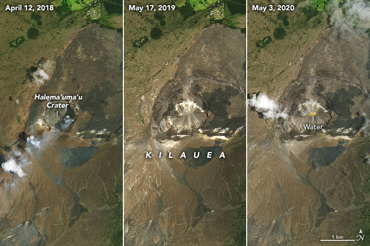
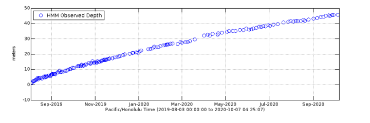
In May 2020, we published a story about a new lake growing in the summit caldera of Hawaii’s Kīlauea volcano. Six months later, the heated lake continues to rise. The water level now tops 40 meters (130 feet), according to U.S Geological Survey (USGS) measurements made with a laser rangefinder.
Though gentle “effusive” eruptions have been the norm at Kīlauea across the past two centuries, the geologic record shows plenty of evidence that the volcano has had periods when violent, explosive eruptions were common. The presence of water in magma is a key factor contributing to explosive eruptions, so USGS scientists have been carefully monitoring the volcano for signs that it may be entering a more explosive and dangerous phase.
As detailed in a September 2020 EOS article, that monitoring has included sending unoccupied aircraft systems (UAS)—drones—deep into the crater to get a closer look at the lake. Scientists have also been conducting regular helicopter flights over the lake and monitoring a suite of ground-based sensors (seismometers, GPS sites, thermal cameras, and others) that measure the motion of the ground, gaseous emissions, and the appearance and temperature of the lake.
Meanwhile, satellites provide the big-picture view. Landsat satellites periodically collect multi-spectral imagery of the lake; the images at the top of this page provide a natural-color perspective. Other satellites with Interferometric Aperture Radar (InSAR) complement the ground-based GPS sites by offering a crucial, large-scale view of land deformation.
“The chance to monitor an incipient volcanic lake is not unprecedented, but it is rare,” a group of USGS geologists wrote in EOS. “Kīlauea’s crater lake provides an opportunity to improve the scientific community’s understanding of how such lakes evolve and interact with magmatic systems below.”
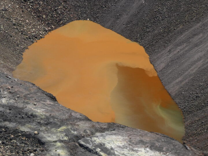
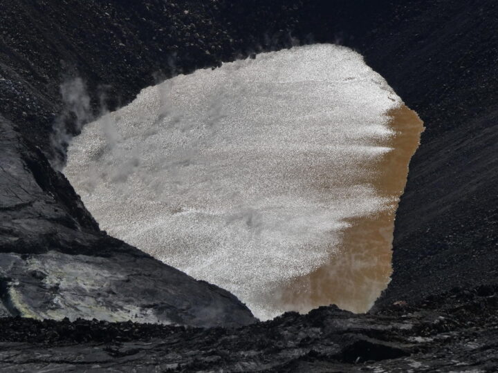
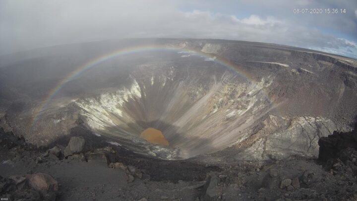
One byproduct of all the scientific monitoring is a steady stream of lake imagery that is visually striking as well as scientifically interesting. In July, for instance, morning sunglint transformed the muddy brown water to something that glittered and shimmered (see photo above). Influxes of new water often set up gradients of color that range from green to rusty orange (also above). And on a day when a light mist moved across the caldera, a webcam at the summit acquired a striking image of a rainbow framing the lake (below). You can find more images in Hawaii Volcano Observatory’s photo and video chronology.
Its Pleasure to realize your blog.The above articles is relatively extraordinary, and I extremely enjoyed reading your blog and points that you expressed. I incredibly like to glimpse back on a typical basis,post additional during the topic.Thanks for sharingkeep writing!!!