

Who knew that being a scientist could be as easy as pointing your phone at the sky? This month, NASA and the GLOBE Program are asking citizen scientists to take out their phones and report what kinds of clouds they see above them.
From October 15 to November 15 citizen scientists young, old, and in-between can submit up to ten cloud observations per day using the GLOBE Observer app or one of GLOBE’s other data entry options (for trained members). Participants with the most observations will receive a personalized thank you from a NASA scientist.
“What excites researchers about GLOBE observations is the ability to see what’s up in the sky from volunteers’ perspectives all over the world,” said Marilé Colón Robles, lead for the GLOBE Clouds Team at NASA’s Langley Research Center. “What our eyes can see is difficult to fully duplicate with instruments. Merging these views is what makes a complete and impactful story.”
“We want to do a data challenge in the fall and see if there are any differences from what was observed during the spring data challenge of 2018,” said Colón Robles. “From thin, high clouds that are hard for satellites to detect to dust storms that impact our daily lives, these observations play an important role in better understanding our atmosphere.”
At NASA, scientists work with a suite of satellite instruments known as the Clouds and the Earth’s Radiant Energy System (CERES). Though they have these highly sensitive instruments, it can sometimes be difficult for scientists to distinguish features such as cirrus clouds from snow cover in their imagery because both are cold and bright from a satellite perspective. By comparing satellite images from a particular area with data submitted by citizen scientists, researchers can differentiate between the two.
Lucky GLOBE observers might make an observation while the Cloud-Aerosol Lidar and Infrared Pathfinder Satellite Observation (CALIPSO) is overhead. CALIPSO is a joint mission between NASA and the French space agency (CNES) that uses laser pulses to measure clouds and atmospheric aerosols. Citizen scientists who make observations at the same time and place as CALIPSO will receive an emailed satellite comparison of CALIPSO’s measurements showing features such as high clouds, dust, and smoke. Scientists are especially interested in these observations in order to improve their understanding of dust storms. During the challenge, make sure you turn on daily satellite notifications in the app or use this satellite overpass website to see the schedule for your location.
“Last year’s challenge gave researchers special glimpses into cloud types around the world,” said Colón Robles. “Photographs provided by observers gave insight into events such as dust storms and wildfires. Our hope is to once again learn from the community and together study our atmosphere.”
The 2018 data challenge, which took place in the spring, received more than 56,000 cloud observations from more than 15,000 locations in 99 countries and Antarctica.
NASA is a sponsor of GLOBE, an international science and education program that provides students and the public with the opportunity to participate in data collection and the scientific process. NASA GLOBE Observer is a free smartphone app that lets anyone make citizen science observations from the palm of their hand.
Cloud Identification Resources and Tips
Data collection and data entry help

What do you get when you mix science with sugary marshmallow candy? Peepola Tesla, the candy bunny that invented the transmitter. Or Neanderpeeps, the group of sweet marshmallows that created fire. Or Dmitri Mendelpeep, the father of the peepiodic table.
For the first time possibly ever, science writers, school children, and enthusiastic science fans participated in “The World’s Finest Science-Themed Peeps Diorama Contest.” Participants were asked to recreate scenes of scientific discoveries, field work, moments in history, and model organisms— all made with the spring marshmallow treats. With nearly 50 entries to choose from, you now get to vote on which diorama deserves the coveted “Peeple’s Choice Award.”
Of course here at NASA Earth Observatory, we are partial to the space- and Earth-themed dioramas. Take a peep at some of the entries below. Make sure to vote for your favorite here before April 14, 2019.
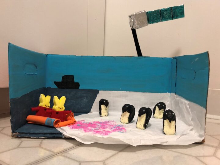
Antarctic peep-searchers use Landsat images of peep-guin peep (er, poop) to measure the health of colonies. Penguin peep (er, poop) is bright pink and bright blue, depending on if they’re eating shrimp or sardines. What they’re eating and how much peep (er, poop) is on the ice is an important indicator of peep-guin health. In this diorama, intrepid peep-searchers are bundled up in their cozy Arctic gear, visiting the peep-guin colony from a peep-search ship to ground-truth the colony counts they’re getting with satellite data. Reminder to all peep-searchers: Don’t eat the pink snow!
Read about the original research on NASA Earth Observatory.
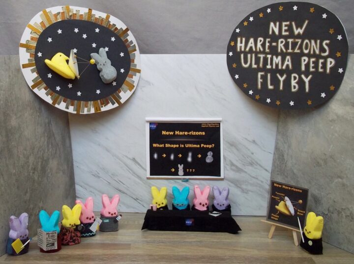
Peep scientists are investigating an unusual object at the far reaches of the solar system, known as Ultima Peep. The spacecraft New Hare-rizons is closing in, and images of Ultima Peep are becoming clearer. At first, Ultima Peep appeared to be shaped like a bowling pin, but now, some are beginning to suspect that Ultima Peep is shaped like a peep. (Perhaps it is a lonely space peep?) The peeple demand information! Scientists have called a press conference to weigh in, and journalists are peepering them with questions.
The scientific inspiration for this diorama is, of course, NASA’s New Horizons spacecraft and its investigation of the Kuiper Belt object Ultima Thule, the shape of which became clearer as the spacecraft got closer. Unfortunately, in our world, bunny ears never materialized. The diorama also includes a title and a close-up of the encounter between New Hare-rizons and Ultima Peep.
Read about the Ultimate Thule flyby.
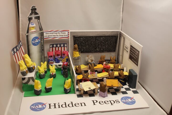
Hidden Peeps is an artistic rendering of the Black women who made essential contributions to the U.S. scientific space program at NASA. The right side of the diorama depicts the women, known as computers, whose work enabled US spaceflights but went largely unsung. The details include Dorothy Vaughan programming an early computer, Katherine Johnson and Mary Jackson writing their official technical reports, other women doing math on the chalkboard, calculating trajectories, verifying fight patterns. Be sure to check out the ‘colored’ bathroom sign (NASA’s facilities in Virginia were segregated), the Mary Jackson quote, the women’s glasses, typewriter, pencils, coffee mugs and family peeps photo.
The other side of the diorama depicts the men receiving attention and accolades for the space program complete with astronaut John Glenn in the rocket, military band, NBC photographer, and medals. Check out the NASA logo and the Neil Armstrong-inspired banner, “One small hop for Peeps….”
Learn more about NASA’s Hidden Figures and Modern Figures.
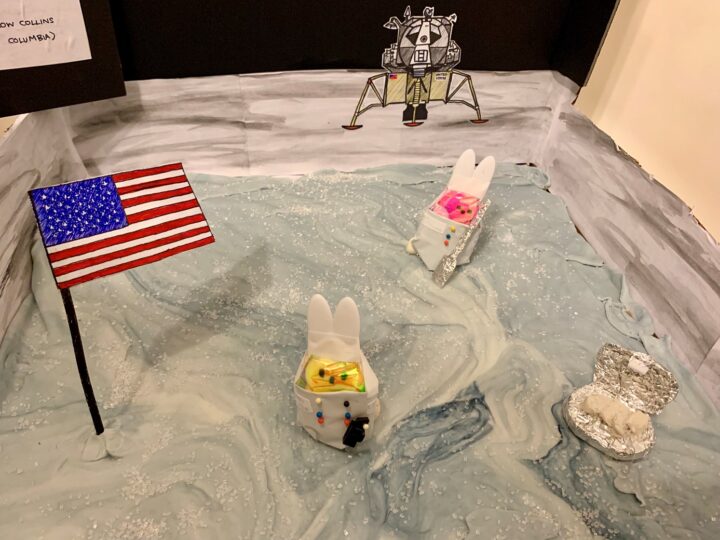
Astropeeps Bunny Aldrin and Neil Peepstrong explore Tranquilipeep Base — making history as the first sentient marshmallows to step on the moon. Marshmallow Collins drew the short straw and is orbiting up high in the Columbia capsule.
Meanwhile, Bunny is collecting rock samples with his shovel and sample box, and Neil takes pictures with his hand-held camera. The two astropeeps have already planted the American flag, and their ride — the Eagle lander — waits in the distance. They keep their spacesuits on, because bad things happen to Peeps in a vacuum…
See the photograph taken by Neil Armstrong of the Lunar Module at Tranquility Base.
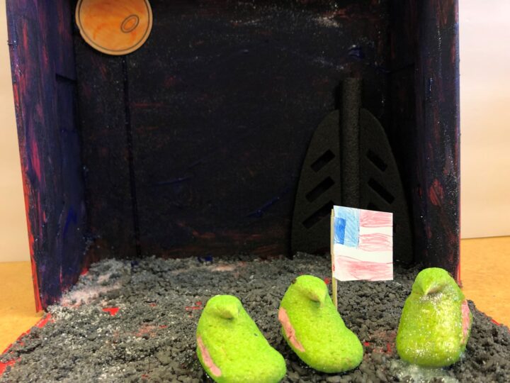
Peepil Armstrong takes his first hop on the moon.
View the original video of Neil Armstrong walking on the moon.
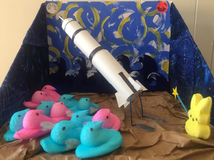
Wernher Von Braun’s V2 rockets ultimately powered the Saturn V and took the United States to the moon, but von Braun always saw Mars as the true destination. Today, we are proving him right. So while the crowds have their eyes on the moon, von Braun points the way to Mars.
Learn about NASA’s mission to Mars.
The contest is hosted by The Open Notebook, a non-profit publication aimed to help science journalists sharpen their skills by providing useful tools, articles, and career advice. The contest is the brainchild of volunteers Joanna Church, Helen Fields, and Kate Ramsayer, an award-winning trio of peep diorama makers from the Washington, DC, area.
Last week, an Earth Observatory Image of the Day featured a sediment plume from the Fraser River where it enters the Strait of Georgia. That photograph was taken by an astronaut on the International Space Station on September 6, 2014. After we posted the image on Facebook, researcher Ed Wiebe responded by sharing some close-up views of the plume.
The photo above was taken by Kevin Bartlett of Ocean Networks Canada on May 4, 2013, from the deck of the Canadian Coast Guard research ship John P. Tully during an expedition in the Strait. According to Bartlett, the photo was taken during operations with a remotely operated vehicle (ROV), so the location would have been over the central or east node of the VENUS undersea network.
Wiebe, who works at the University of Victoria, shot the second photo from the deck of a ferry in May 2007. According to Wiebe’s Facebook post: “The spring flood brings very intense loading of the surface water with sharp boundaries. The ferry between Vancouver Island and Vancouver crosses this boundary, providing a great opportunity to observe the river outflow floating on top of the saline water in the Strait of Georgia.”
Thanks to Ed and Kevin for sharing these terrific images!
Most years, the Swiss Air Force hosts an air show in the fall that sends planes roaring over the Axalp-Ebenfluh firing range near Brienz, Switzerland. Spectators often congregate at the Axalp, a resort area on a terrace that overlooks Brienz from an elevation of about 1,500 meters (4,900 feet). While waiting for the 2013 show on October 13, 2013, Luca Brüderlin captured this image of a cable car emerging from a layer of fog along a rock wall. Brüderlin was one of twelve winners of a precipitation-themed photography contest sponsored by the Global Precipitation Mission (GPM), a new Earth-observing satellite that is scheduled to launch from Tanegashima Space Center in Japan this week. The lower image was collected by the Moderate Resolution Imaging Spectroradiometer (MODIS) instrument on NASA’s Aqua satellite. It shows the clouds and fog in the area from above on the same day that Brüderlin took his photograph.
See more of the winning photographs at
http://pmm.nasa.gov/gpm-unique-perspectives-photo-contest-winners
Follow GPM’s launch blog at
http://earthobservatory.nasa.gov/blogs/fromthefield/category/gpm-road-to-launch/
http://www.nasa.gov/mission_pages/GPM/main/
Last week we shared an image of an 800-kilometer long bloom of marine protists off the coast of Brazil. In satellite imagery, the bloom appeared navy to black in color, even though the species—Myrionecta rubra—appears red when viewed close-up. The blooms tend to occur just below the water surface, so much red light that the protists reflect gets absorbed before it returns to the satellite. Here’s a look at the January bloom from a boat in the South Atlantic.

The photos were taken in the late afternoon on January 22, 2014. The boat was positioned at roughly 24° 08′ South and 45° 07′ West. The water temperature was 29°Celsius (84°Fahrenheit) and the depth was 70 meters (230 feet).

Thanks to Julio Cardoso, a boater and amateur scientist from Brazil who shared the photos with us. Thanks are due as well to Dr. Aurea Maria Ciotti of the Universidade de São Paulo, who helped us identify the species and the nature of the bloom.
As of February 5, 2014, the bloom appeared to be subsiding, though clouds and haze made it difficult to see clearly from satellites. You can continue to monitor the area by clicking here.
Halos have a long and rich history in religious art, usually symbolizing the presence of someone or something divine. In the physical sciences, the beautiful displays of light are a sign of something more ordinary—the presence of hexagonal, plate-shaped ice crystals that make up cirrus clouds. As gravity pulls the ice crystals downward, their faces become horizontal with the ground and they function as dispersive prisms, breaking sunlight into separate colors and leaving rainbow-like ice crystal halos in the sky.
Sundogs are one of the most common types of ice halo. They occur when light rays enter the side of an ice crystal and leave through another side inclined about 60 degrees to the first. (See Atmospheric Optics for a good diagram that illustrates the process.) Sundogs are most easily seen when the Sun is low in the sky; the halos occurring on either side of it at about 22 degrees. The part of a sundog closest to the Sun always forms a layer of red, while greens and blues form beyond that. Sundogs are visible all over the world and at any time of year, regardless of the temperature at the surface. For more imagery of sundogs and other optical phenomena (such as sun pillars, circumhorizonatal arcs, and parhelic circles), it’s worth checking out the archives of Earth Science Picture of the Day.
In the last few weeks, we’ve had a number of readers send us their photographs of sundogs. The image above was taken by Nina Garcia Jones; the image below comes from Isa DeSil. Thanks for sending the photos our way. To the rest of our readers: keep your interesting photos of atmospheric, meteorological, or geological phenomena coming. We’ll occasionally post the best images on this blog, and we’ll do what we can to help explain the science behind them.