The Earth Observatory has published its last Image of the Day on this website. Please join us on our new home at science.nasa.gov/earth/earth-observatory.
NASA satellites and sensors constantly take the pulse of our planet, measuring how Earth changes by the day, season, year, and decade. Researchers and resource managers analyze those measurements and apply them on local and regional scales to better manage things like our food and water supplies, health, safety, land use, and ecosystems. NASA data is also used by other government agencies to help with responses to natural disasters and emergencies around the country and the world.

As wildland fires raged in the American West, NASA airborne technology was there to image it in incredible detail.
Published Aug 15, 2025
Data provided by the water satellite are helping to improve tsunami forecast models.
Published Aug 14, 2025
That’s a key question for many farmers, and new research may make it easier to develop growing season plans.
Published Jul 28, 2025
NASA airborne technology revealed the progression of a controlled fire at Fort Stewart-Hunter Army Airfield.
Published Jul 16, 2025
A warm and dry spring in the Pacific Northwest quickly depleted the seasonal snowpack, raising concern over summer water supplies and wildland fire risk.
Published Jun 27, 2025Image of the Day Atmosphere Heat Snow and Ice Temperature Extremes
Scientists used Landsat satellite images to detect both abrupt and gradual changes and to examine how phenomena, from storms to sea level rise, have reshaped coastal ecosystems.
Published May 19, 2025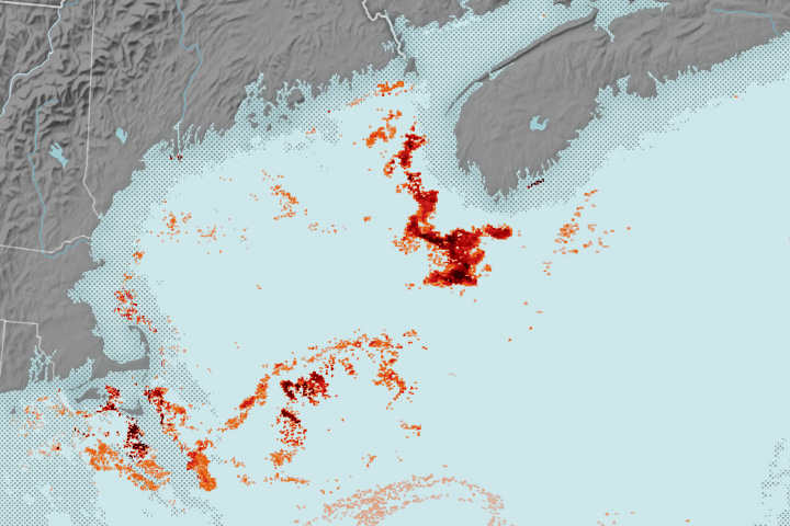
Researchers used NASA satellite data to detect swarms of red-tinged copepods, a key food source for the endangered marine mammals, in the Gulf of Maine.
Published May 12, 2025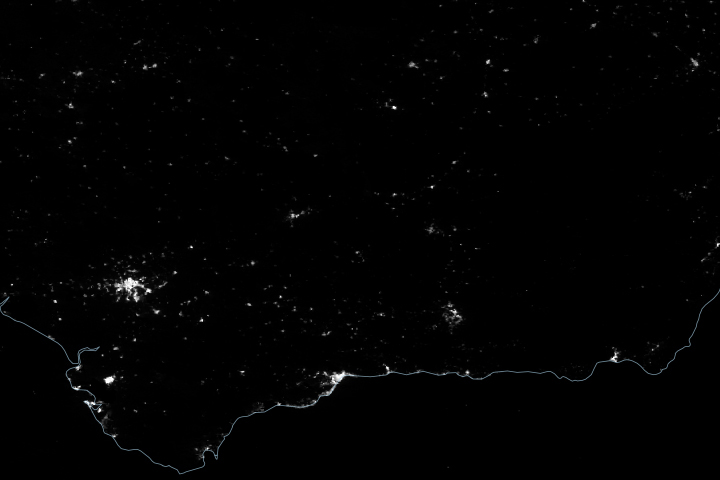
Satellite-derived maps of nighttime lights in southern Spain revealed power outages that persisted across rural areas as the region was recovering from a widespread blackout.
Published May 1, 2025
Detailed fire maps, produced in minutes with data from a NASA airborne sensor, enabled firefighters in Alabama to limit the spread of wildfires and save buildings.
Published Apr 29, 2025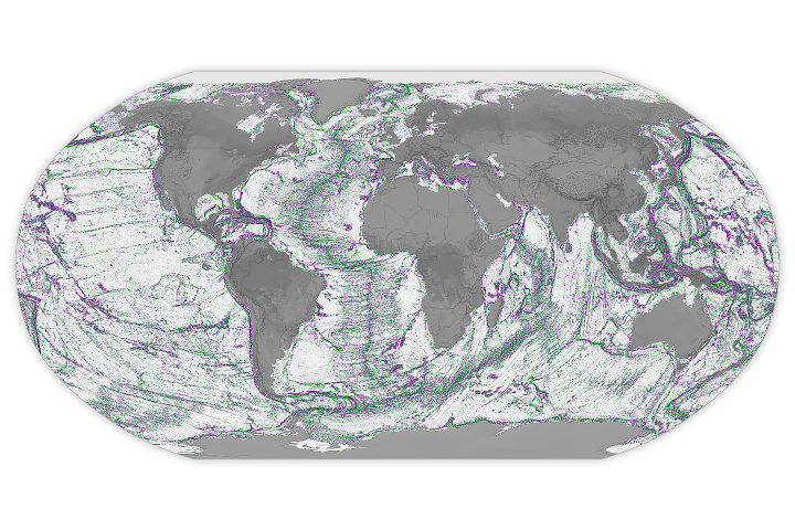
Depictions of the seafloor derived from satellite data can improve underwater navigation and increase knowledge of how heat and life move around the world’s ocean.
Published Apr 1, 2025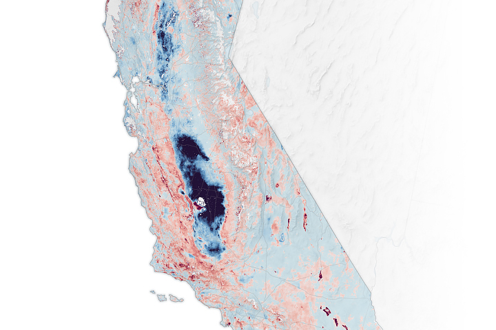
The elevation changes may seem small, amounting to fractions of inches per year, but they can increase or decrease local flood risk, wave exposure, and saltwater intrusion.
Published Feb 22, 2025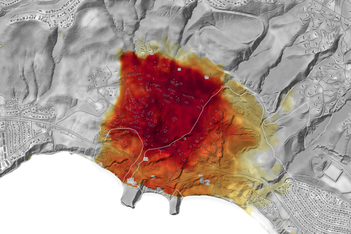
NASA radar imagery revealed that the active area of a decades-old landslide has grown following periods of heavy rainfall in 2023 and early 2024.
Published Feb 6, 2025Image of the Day Land Human Presence Remote Sensing Landslides
The buildup of vegetation and a rapid shift from wet to dry conditions played a role in the destructive blazes.
Published Jan 30, 2025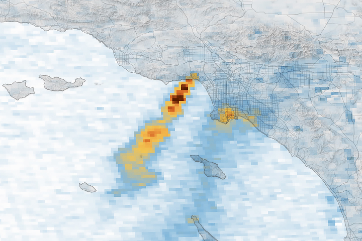
A series of images captured by NASA’s TEMPO sensor show the shifting location of nitrogen dioxide as destructive fires raged and smoke plumes streamed over the region.
Published Jan 17, 2025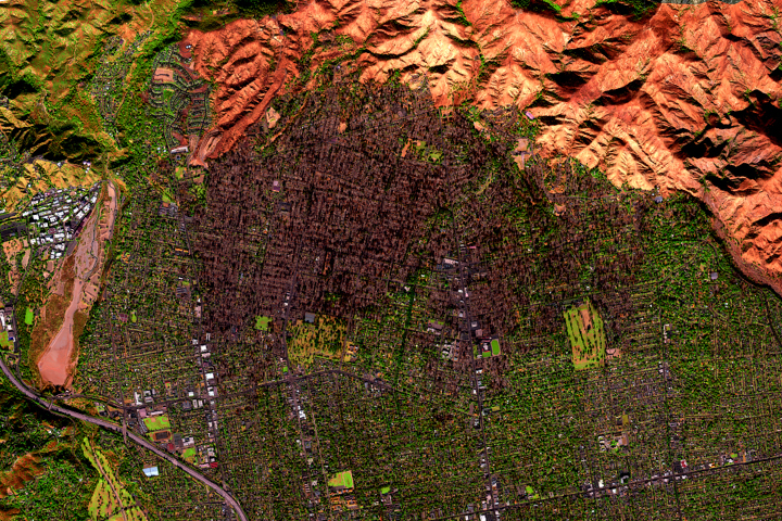
A NASA airborne instrument captured images of the fire’s aftermath in and around Altadena.
Published Jan 15, 2025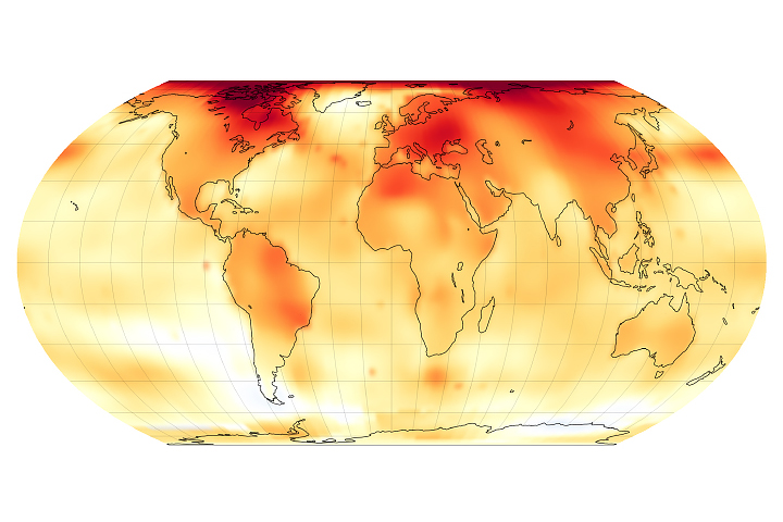
A NASA analysis shows that global temperatures in 2024 were 1.28 degrees Celsius (2.30 degrees Fahrenheit) above the agency’s 20th-century baseline.
Published Jan 10, 2025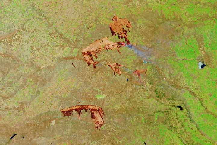
Two decades of satellite data show that the most destructive U.S. fires burn in grasslands and shrublands fanned by strong winds.
Published Dec 12, 2024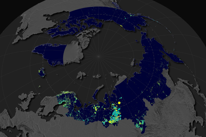
Satellite observations at night indicate that oil, gas, and mining have expanded across Earth’s northern latitudes.
Published Dec 9, 2024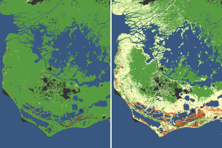
The iconic trees and shrubs of the Florida Everglades are under increased stress due to more frequent, intense hurricanes.
Published Dec 5, 2024
The amount of freshwater stored on land and underground has plummeted in the past decade, which might indicate that Earth’s continents have entered a persistently drier phase.
Published Nov 23, 2024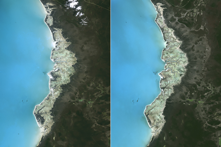
Rising seas have redistributed cyanobacterial mats blanketing part of Andros Island and restructured the island’s marshes and mudflats.
Published Nov 18, 2024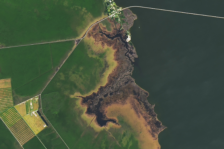
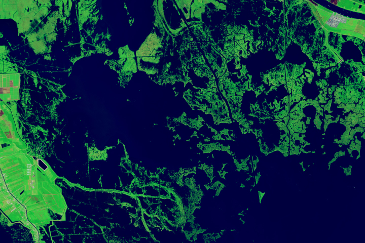
Bald cypress and other trees are becoming pale, leafless snags as storms, droughts, and sea level rise kill off coastal forests.
Published Oct 30, 2024
Insufficient rainfall in 2023-2024 has taken a toll on the region’s rivers and groundwater and upended daily life in several countries.
Published Oct 15, 2024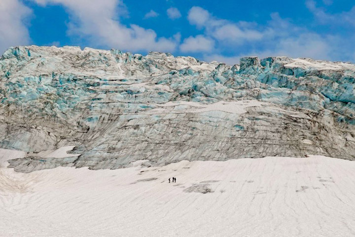
Scientists use satellites in orbit and boots on the ice to monitor glacial changes on the flanks of Mount Baker and elsewhere in Washington state.
Published Sep 19, 2024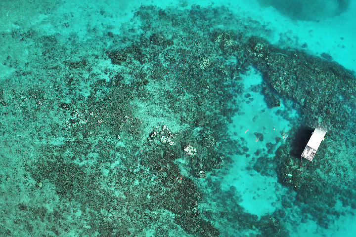
After a brutally hot summer in 2023 that caused widespread bleaching and coral death, summer 2024 was more favorable for the state’s vulnerable reefs.
Published Sep 17, 2024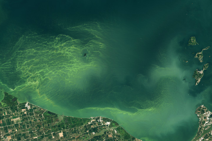
Algal communities flourish in Lake Erie’s western basin each summer. Scientists are looking to new NASA technology to better track them from space.
Published Sep 5, 2024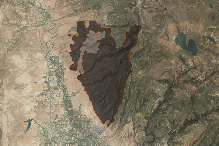
An array of satellite sensors observed the long-duration, episodic spread of the state’s historic fire.
Published Aug 31, 2024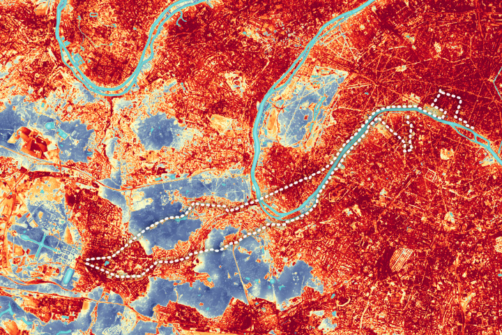
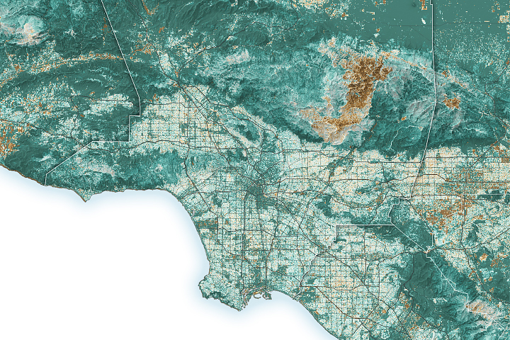
The city’s urban heat island could add to the challenge for Olympic marathoners.
Published Aug 10, 2024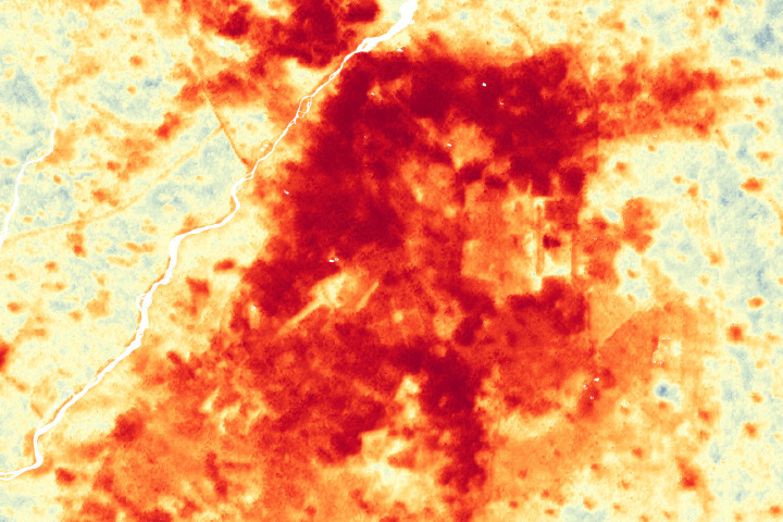
Greening projects in Lahore could help cool the city as climate change and rapid urbanization intensifies the urban heat island effect.
Published Jul 16, 2024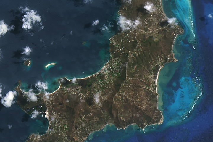
The Category 4 hurricane caused widespread damage to infrastructure and vegetation on the Grenadine island.
Published Jul 9, 2024