NASA satellites and sensors constantly take the pulse of our planet, measuring how Earth changes by the day, season, year, and decade. Researchers and resource managers analyze those measurements and apply them on local and regional scales to better manage things like our food and water supplies, health, safety, land use, and ecosystems. NASA data is also used by other government agencies to help with responses to natural disasters and emergencies around the country and the world.
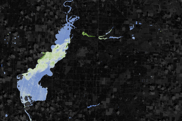
With limited resources to monitor often-unpredictable blooms, water managers are turning to new technologies to detect and keep track of hazards.
Published Jun 22, 2019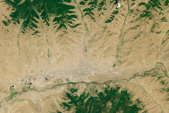
The Mongolian capital is spreading outward as migrants from the countryside fill neighborhoods on the fringes of the city.
Published Jun 4, 2019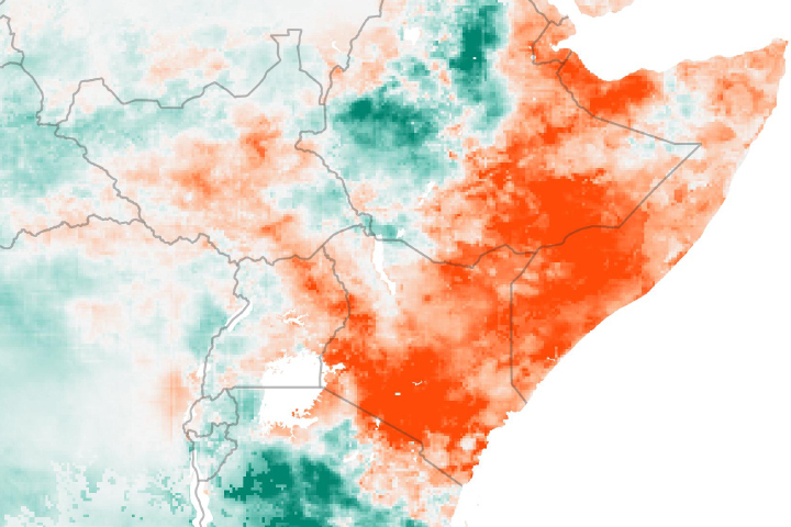
Drought is apparent across much of East Africa after seasonal rains failed to deliver much moisture to the region.
Published May 30, 2019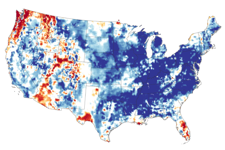
The continental United States recently finished its wettest twelve months in 124 years of modern recordkeeping.
Published May 24, 2019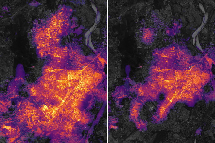
The powerful storm, one of the worst to hit India since 1999, knocked out electricity across the state of Odisha.
Published May 8, 2019Image of the Day Severe Storms Human Presence Remote Sensing
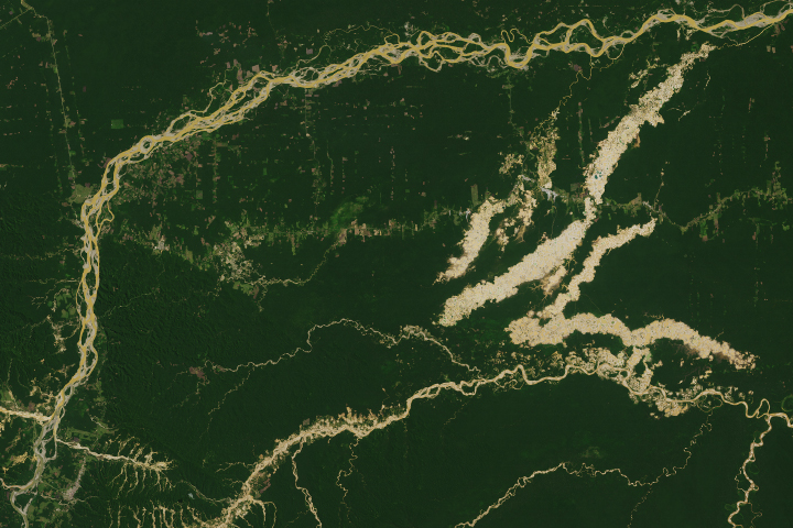
The Madre de Dios region has a rich concentration of endemic species, but their habitats are being threatened by human activity.
Published Apr 19, 2019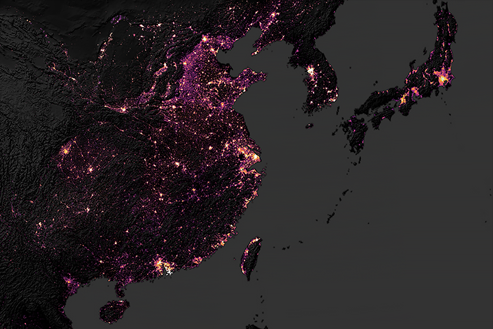
Large and wealthy cities have the biggest carbon footprints.
Published Apr 11, 2019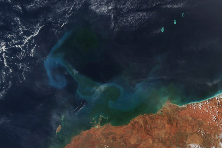
Tropical cyclone Veronica appears to have stirred up swirls of phytoplankton.
Published Apr 3, 2019
Researchers are using Facebook data to observe population movements during disasters.
Published Mar 29, 2019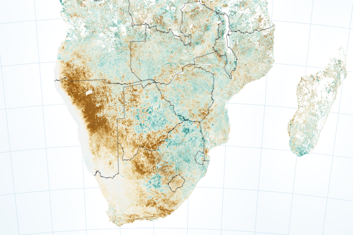
Dry conditions are bringing food insecurity to several countries.
Published Mar 20, 2019Image of the Day Land Life Water Drought Human Presence Remote Sensing
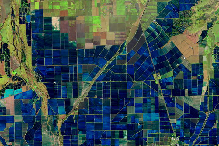
Flooded rice fields in the winter help farmers soften plant stubble for spring tilling. They also provide an oasis for migratory birds.
Published Mar 26, 2019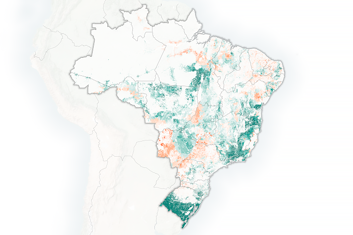
Brazilian researchers are using satellites to calculate how many cattle can be supported by the country's pasturelands.
Published Mar 12, 2019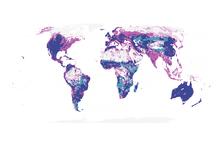
Fluctuations in rainfall are reducing the ability to sustain cattle on grazing lands.
Published Feb 22, 2019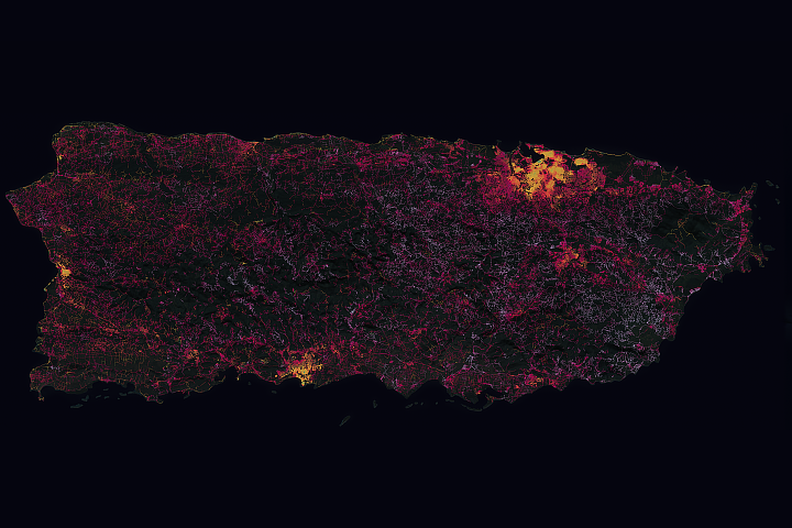
The hurricane took a disproportionate toll on power supplies in remote areas of Puerto Rico.
Published Dec 12, 2018Image of the Day Atmosphere Land Severe Storms Human Presence
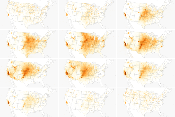
Farms and feedlots are a key source of the pollutant.
Published Dec 10, 2018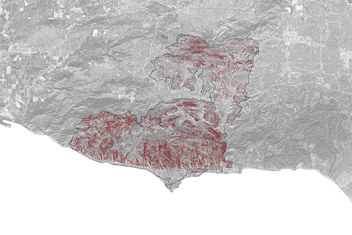
A NASA project is providing maps of satellite data to emergency response teams during the Woolsey Fire.
Published Nov 16, 2018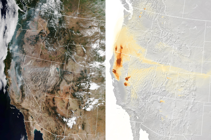
A new experimental model that relies on data from NOAA and NASA satellites has proven remarkably good at simulating the behavior of wildfire smoke.
Published Nov 6, 2018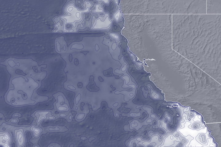
Environmental variables detected by satellites can help reduce collisions between ships and blue whales.
Published Nov 1, 2018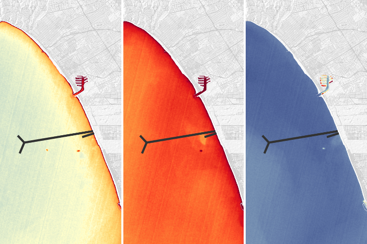
A NASA team was able to use satellite imagery to observe effects of a repair of Los Angeles' largest wastewater treatment plant.
Published Oct 30, 2018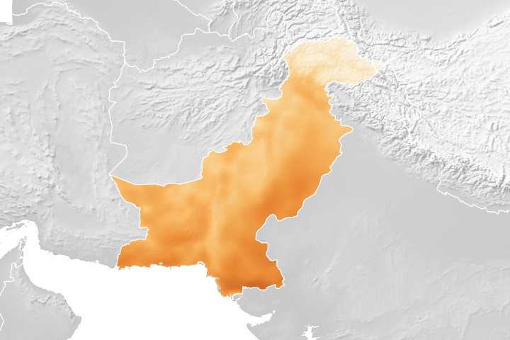
A project using NASA satellite data helps reduce overwatering and enhances crop yields for Pakistani farmers.
Published Oct 18, 2018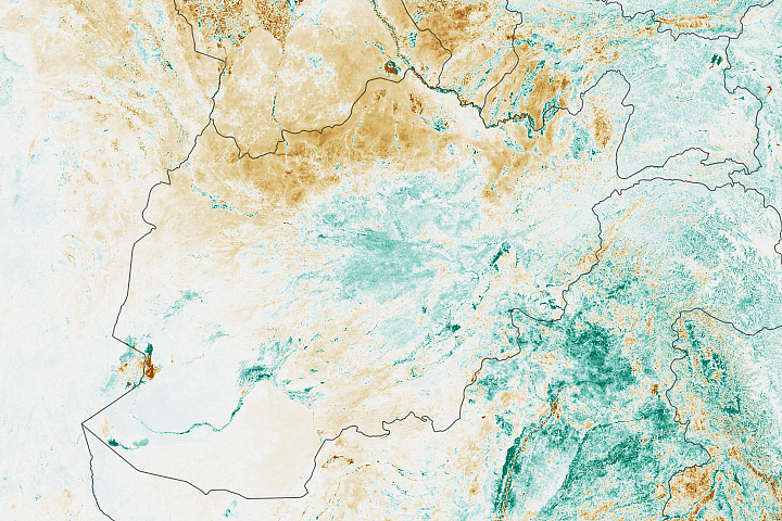
The GEOGLAM Crop Monitor for Early Warning provides science-driven alerts for countries that may be in danger of low crop yields.
Published Oct 5, 2018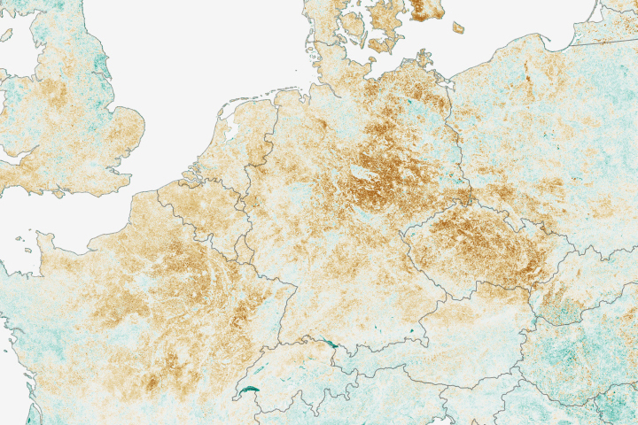
Economists are using satellite data to help make more accurate price predictions of important crops.
Published Sep 20, 2018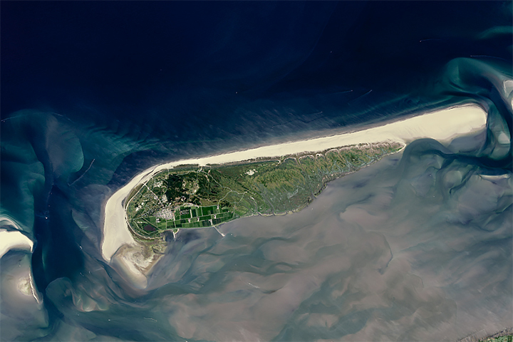
Sandy beaches are growing in some parts of the world and shrinking quickly in others, including one-third of marine protected areas.
Published Aug 2, 2018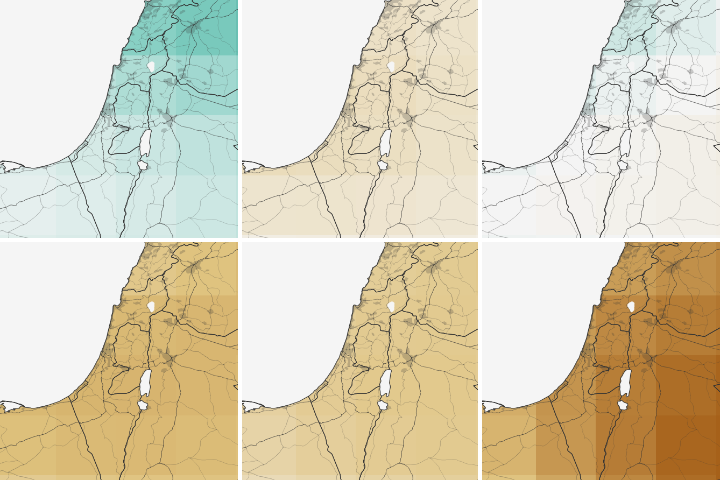
Water shortages in the Middle East lead to sanitation issues in schools, resulting in periodic school closures. NASA is working to change that.
Published Jul 27, 2018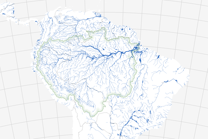
Long overlooked, it is increasingly clear that streams and rivers play a key role in the carbon cycle.
Published Jul 20, 2018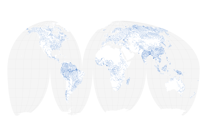
A new map of the world’s rivers and their widths shows that surface waterways are collectively wider and cover more area than previously thought.
Published Jul 18, 2018
Using Landsat to track patterns in irrigation may help water managers sketch out a more sustainable future for the Ogallala Aquifer in the central United States.
Published Jul 9, 2018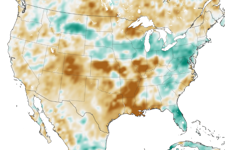
The amount of water contained in the top few centimeters of soil is small on a global scale, but it is critical for agriculture analysts trying to monitor commodity production and humanitarian need.
Published Jun 2, 2018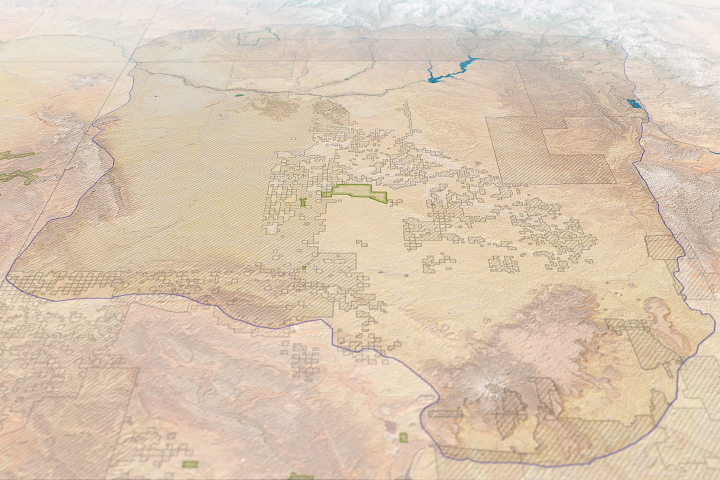
Risk maps can help land managers make more informed decisions about modern development in the vicinity of an ancient civilization.
Published Jun 1, 2018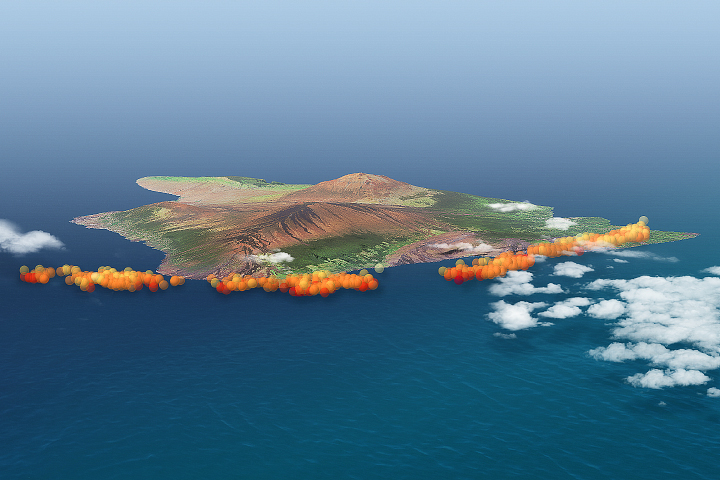
Volcanic plumes can pose health hazards and offer clues about a volcano’s geology.
Published May 15, 2018