NASA satellites and sensors constantly take the pulse of our planet, measuring how Earth changes by the day, season, year, and decade. Researchers and resource managers analyze those measurements and apply them on local and regional scales to better manage things like our food and water supplies, health, safety, land use, and ecosystems. NASA data is also used by other government agencies to help with responses to natural disasters and emergencies around the country and the world.
Satellite data show wetlands in Spain desiccated by demands on groundwater and persistent drought.
Published Jun 26, 2023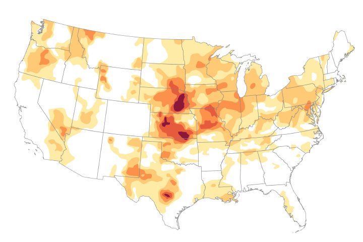
Prolonged drought in Kansas set the stage for what may be one of the state’s smallest wheat harvests in decades.
Published Jun 22, 2023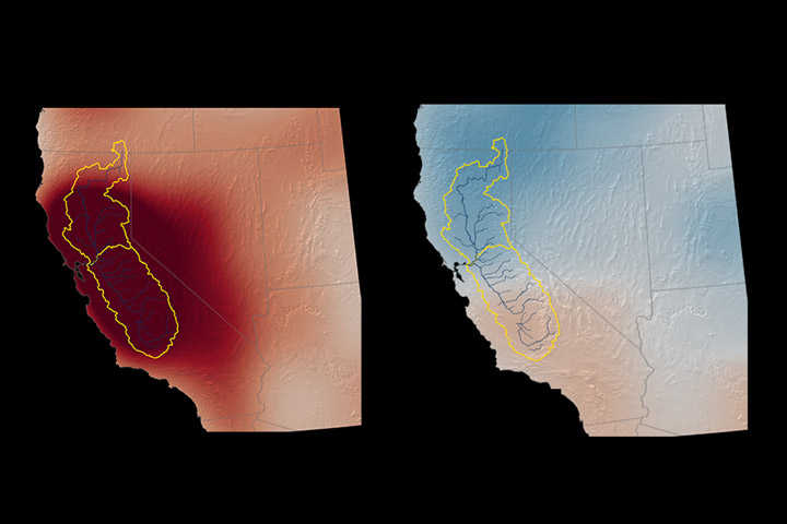
Data from winter 2022-2023 show the greatest net gain of water in nearly 22 years, but groundwater levels still suffer from years of drought.
Published Jun 10, 2023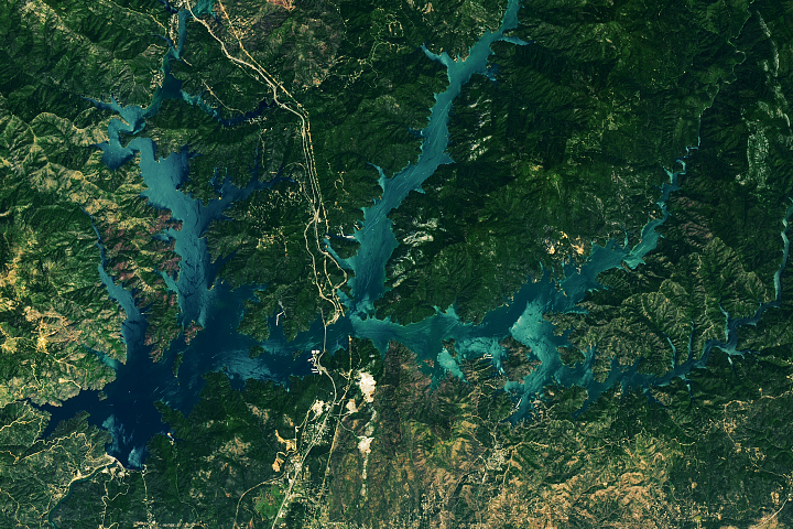
Shasta Lake refilled in spring 2023 after a season of heavy rain and snowmelt.
Published Jun 7, 2023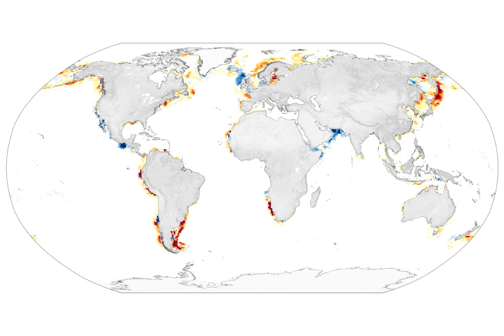
Blooms of the plant-like organisms near coastal areas have become more frequent in the 21st century.
Published May 30, 2023
Fieldwork in interior Alaska aimed to identify when evergreen trees resumed growth and started taking up carbon.
Published May 27, 2023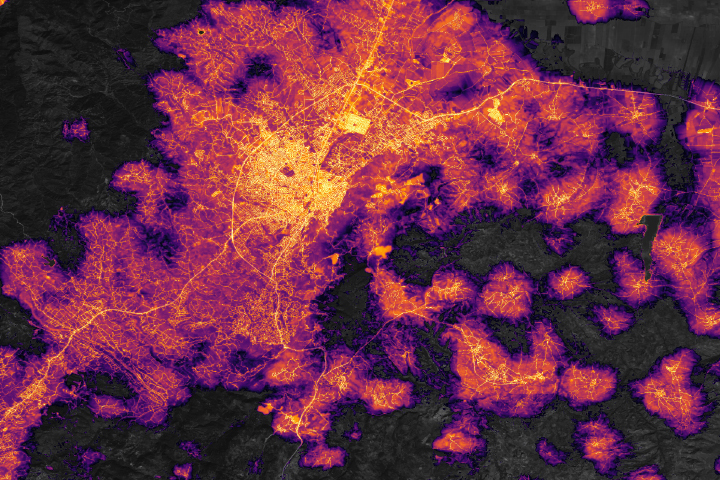
Lights have been steadily returning to southeast Türkiye after deadly earthquakes triggered power outages in February 2023.
Published May 15, 2023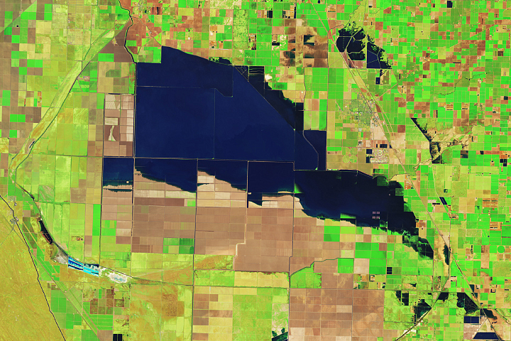
Flooding in the California lakebed continues to spread as spring brings snowmelt from the Sierras.
Published May 4, 2023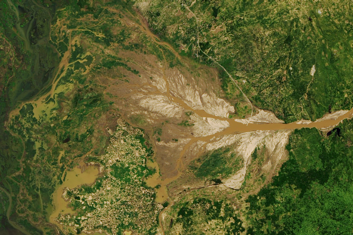
Hunger is on the rise in Malawi after the tropical cyclone devastated crops in the southern part of the country.
Published May 3, 2023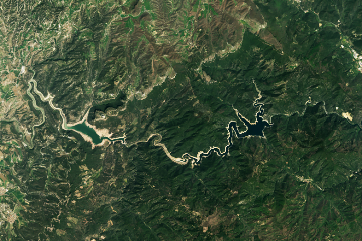
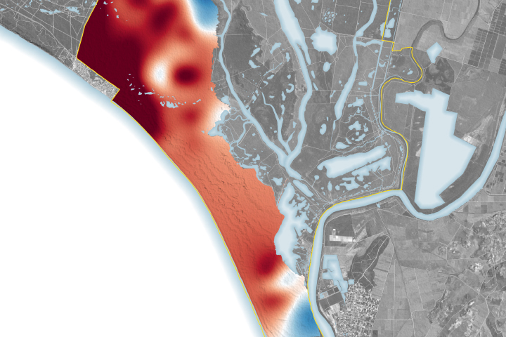
Heat and drought have parched reservoirs in northeastern Spain.
Published Apr 26, 2023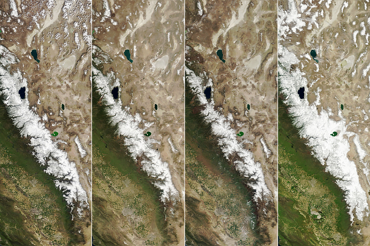
Atmospheric rivers delivered a huge amount of snow to the California mountain range.
Published Apr 19, 2023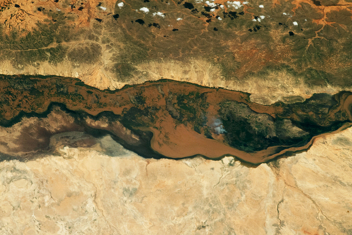
Water overtopped the banks of the Shabelle and Juba rivers, affecting hundreds of thousands of people in Ethiopia and Somalia.
Published Apr 14, 2023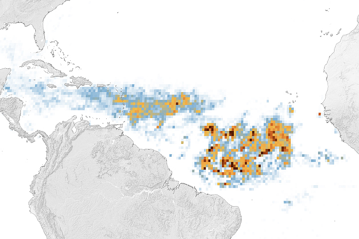
A belt of seaweed that stretches from the west coast of Africa to the Gulf of Mexico is the largest on record for March.
Published Apr 7, 2023
Heavy precipitation has flooded communities and agricultural fields in the former lakebed.
Published Apr 4, 2023
Satellites are helping farmers in the Rio Grande Valley take on the cotton-loving beetles.
Published Apr 3, 2023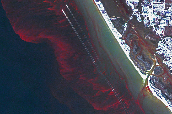
Scientists developed a way to detect the fine-scale features of harmful algae blooms that occur close to beaches and inside small bays.
Published Mar 29, 2023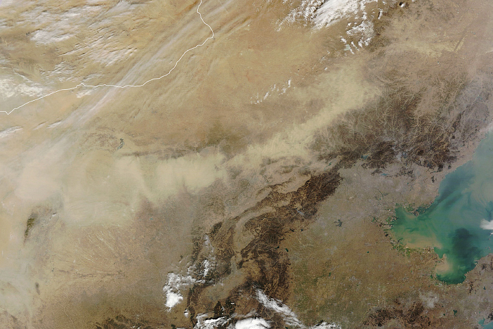
NASA research finds that a combination of windblown dust and human-caused particle pollution was associated with nearly 3 million premature deaths in 2019.
Published Mar 17, 2023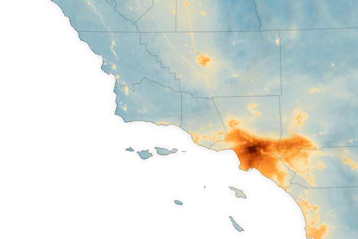
A team of scientists mapped nitrogen dioxide in California’s air at the neighborhood scale and found hotspots of the air pollutant near high-rise buildings and food processing facilities.
Published Mar 7, 2023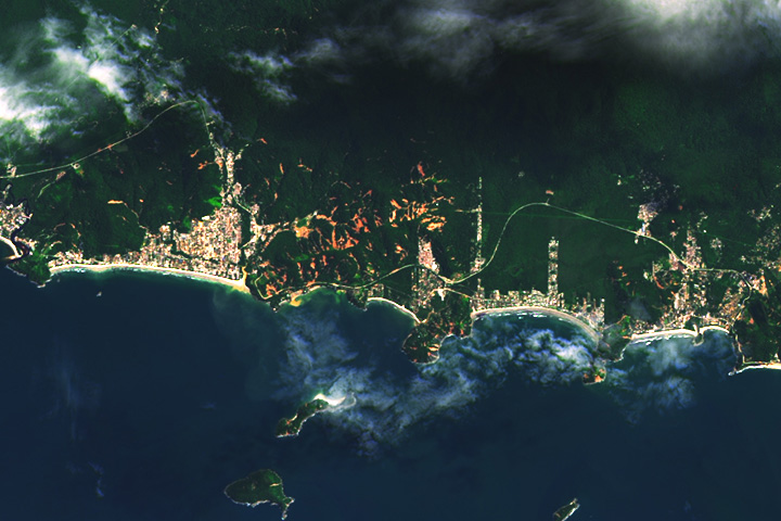
After torrential rains, satellite images revealed widespread landslides in the Brazilian state’s coastal municipality of São Sebastião.
Published Mar 4, 2023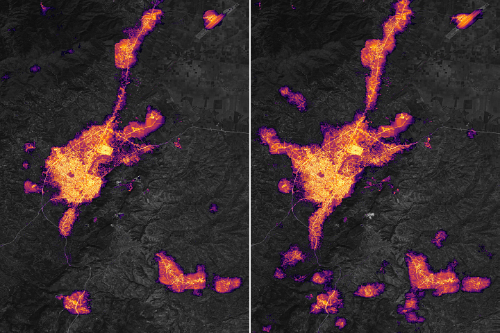
In the days after strong earthquakes struck Türkiye, significant destruction left many areas without electric power.
Published Feb 24, 2023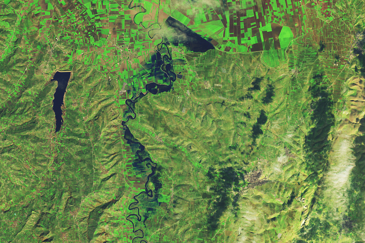
Some towns and farmland were flooded after powerful earthquakes and heavy rains struck areas of Türkiye and Syria.
Published Feb 23, 2023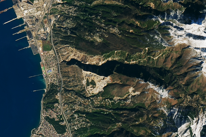
Scientists are using satellite images to locate landslides following the powerful earthquakes that struck in early February.
Published Feb 23, 2023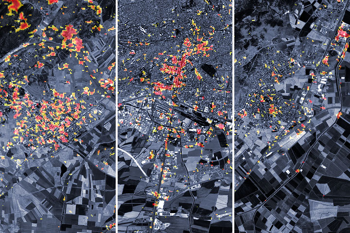
Scientists from NASA and other agencies are using satellites to map damage caused by the devastating earthquake.
Published Feb 9, 2023Image of the Day Land Human Presence Remote Sensing Earthquakes
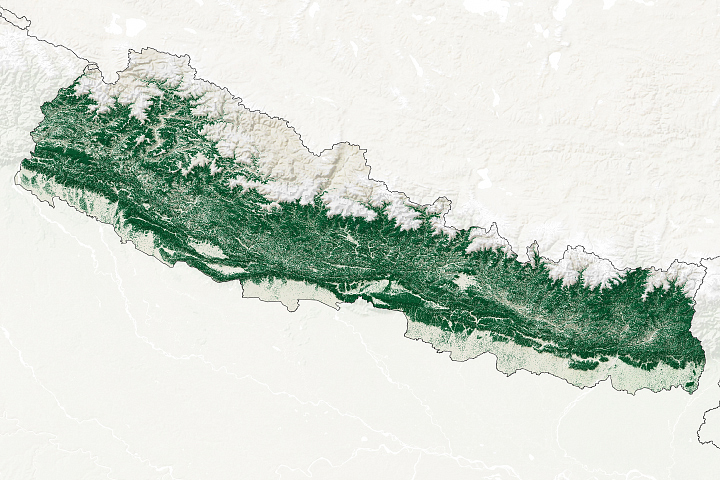
After relinquishing control of forests to the villages that depend on them, forest cover in this small mountainous country nearly doubled.
Published Feb 9, 2023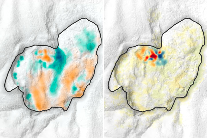
A large, slow-moving landslide is accelerating in eastern Congo, putting a community at risk.
Published Feb 6, 2023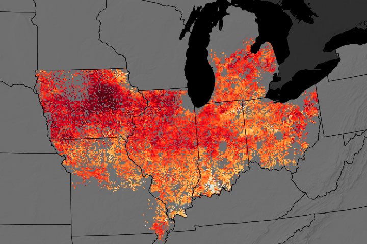
Although cover crops have significant environmental benefits, researchers found that they hinder yields on corn and soybean fields.
Published Jan 26, 2023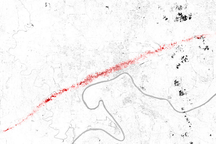
Thunderstorms swept across the U.S. Southeast in January 2023, spawning numerous twisters that left lengthy paths of damage.
Published Jan 19, 2023Image of the Day Atmosphere Land Severe Storms Human Presence Remote Sensing
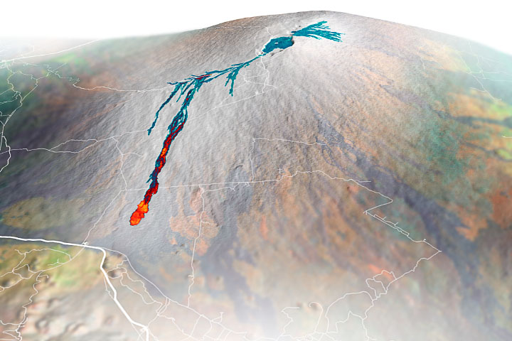
Airborne mapping of the thickness of the lava flows helped scientists calculate that 230 million cubic meters of molten rock poured from the volcano during the two-week eruption.
Published Dec 16, 2022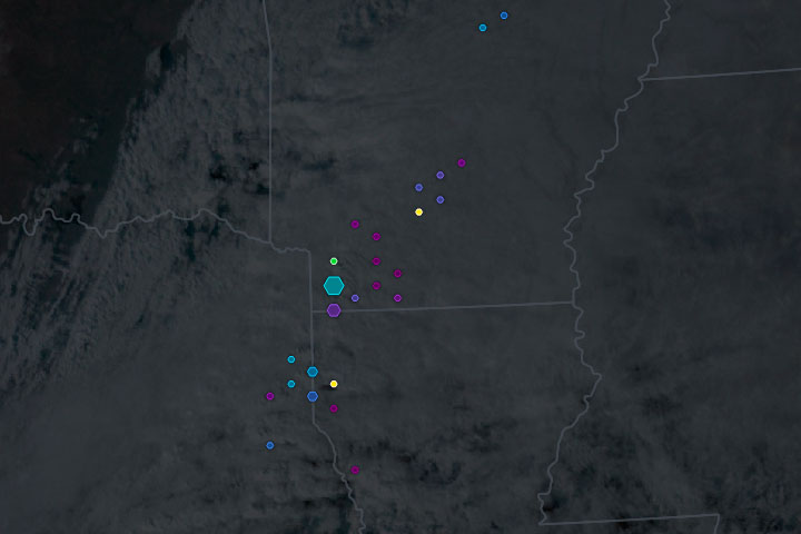
Dangerous thunderstorms and destructive tornadoes lashed the U.S. South amid a sprawling winter storm in December 2022.
Published Dec 16, 2022Image of the Day Atmosphere Land Human Presence Remote Sensing
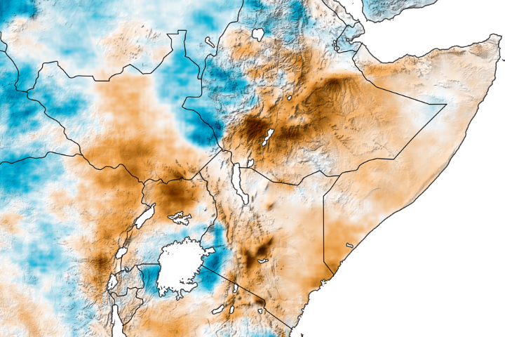
The most severe drought in 70 years of record keeping threatens the Horn of Africa with famine.
Published Dec 13, 2022