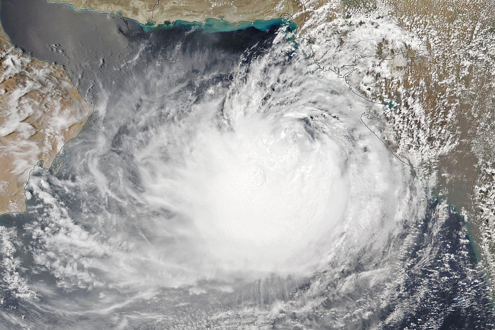
Before Tropical Cyclone Freddy hit Malawi, the landlocked country in southeastern Africa already faced serious food insecurity. By some estimates, one-third of the nation’s population was on the brink of extreme hunger, 37 percent of children under 5 were chronically malnourished, and 70 percent of people lived below the international poverty line.
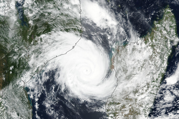
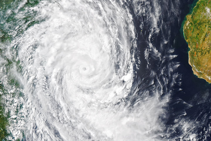
Then, starting on March 11, 2023, Freddy arrived and dropped six months’ worth of rain in six days. Rivers overflowed their banks, washed away homes and villages, and destroyed crops. In the aftermath of the storm, more than 1,000 people were reported killed or missing as of early April, according to the United Nations Office for the Coordination of Humanitarian Affairs.
“But that was just the first phase of the disaster,” said Christina Jade Justice, an agriculture and food security monitoring expert with NASA Harvest and lead of the GEOGLAM Crop Monitor for Early Warning initiative, which published a special report detailing conditions in southern Malawi in the aftermath of the storm. “Now we are in the midst of a slower-moving catastrophe that is affecting farmers. With many crops damaged or completely destroyed this season, food supply and access are a growing concern.”
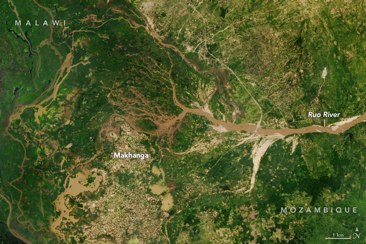
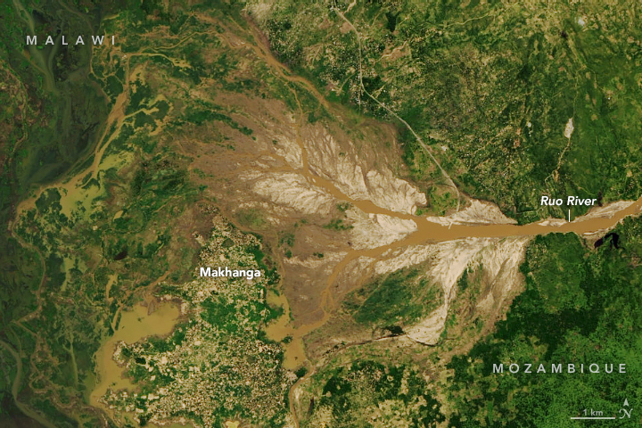
In the days after the storm, preliminary observatons based on an analysis using flood water extent from Canada’s RADARSAT constellation, overlaid on a national scale cropland map developed by NASA Harvest, revealed particularly extensive flooding in the Nsanje, Chikwawa, Mulanje, and Phalombe districts of southern Malawi.
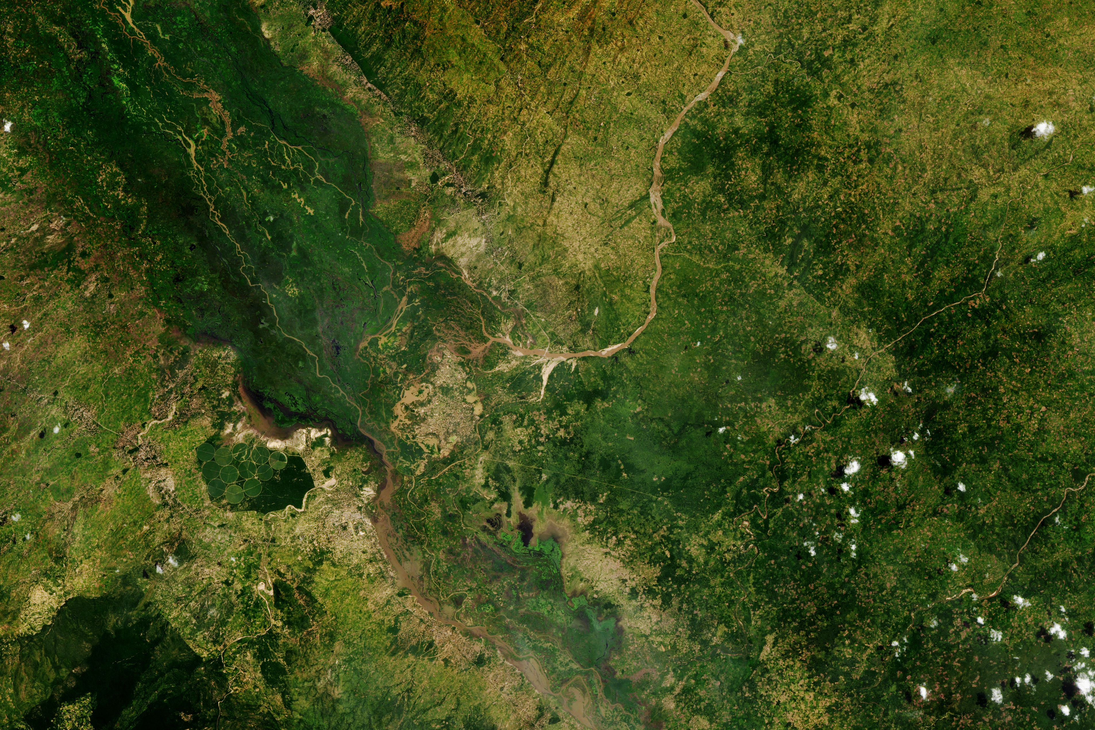
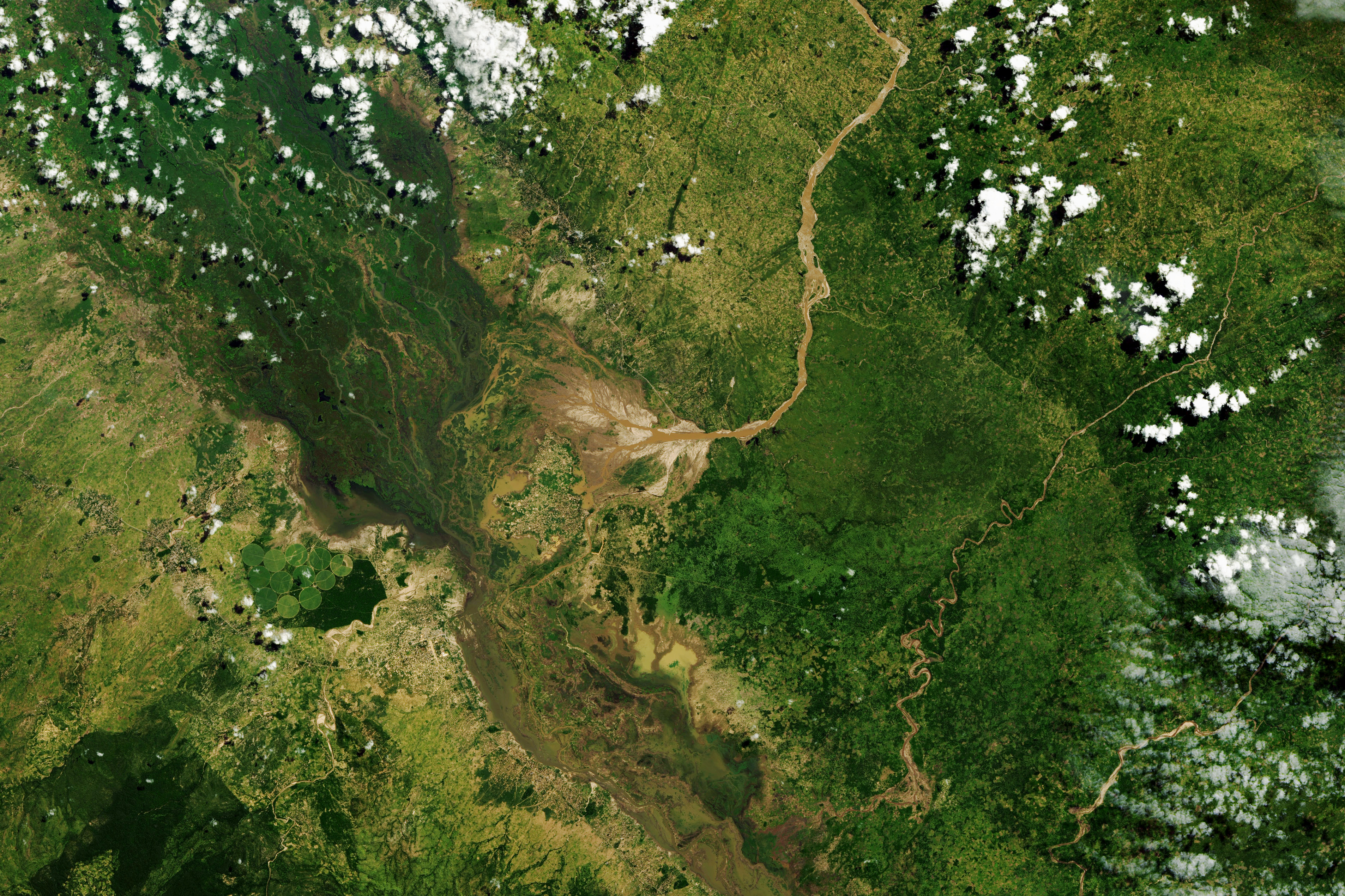
One month after the storm, damage to crops was still visible. This image (top-right), acquired with the Operational Land Imager (OLI) on the Landsat 8 satellite on April 10, 2023, shows damaged fields in southern Malawi along the Shire and Ruo rivers near Makhanga in the Nsanje district. The left image shows the same area on March 9, before the storm.
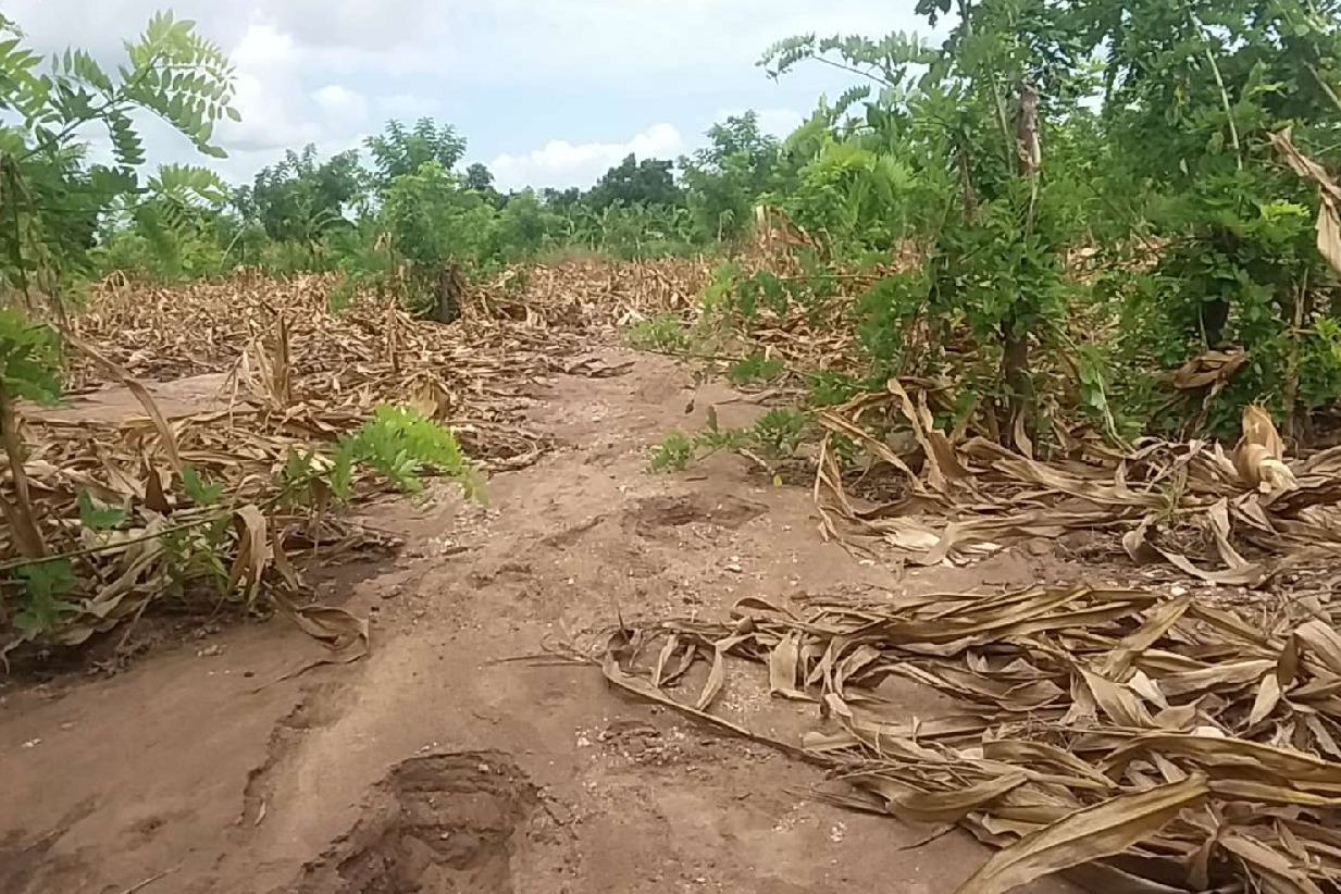
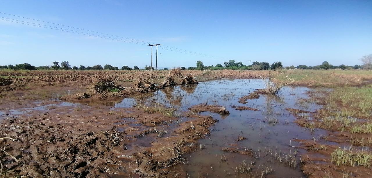
In some areas, floodwaters swept crops away and left bare, muddy fields behind. In others, the decomposing remains of plants killed or damaged by waterlogging remained rooted in the ground. The storm hit just before farmers were about to harvest the maize crop. The photographs show washed-out maize (above) and rice (below) fields in Makhanga.
Malawi’s Ministry of Agriculture in partnership with Food and Agriculture Organization and NASA Harvest conducted a flood assessment campaign in early April to survey farmers in order to better understand the impact of the floods on agriculture, livestock, and food security. Of the 2,095 farmers surveyed across 11 districts, 69 percent reported that flooding had damaged their crops. These farmers reported that fields stayed flooded for an average of eight days and damaged 76 percent of their fields. The largest average crop losses were reported in the Zomba and Mulanje (86 percent) districts, followed by Machinga (85 percent). Nearly 40 percent of farmers also reported the loss of livestock.
“One of the most worrisome things from the assessment was that 96 percent of farmers reported that the current season’s harvest will not be sufficient for their household’s food supply needs until the next harvest,” Justice said. In Malawi, about 80 percent of people are subsistence farmers, meaning they rely on the food they grow to feed themselves. Low food supply after the flooding has also led to increased prices for key staples. In March, the World Food Programme reported that the price of maize had soared 300 to 400 percent in southern Malawi due to the cyclone.
The Famine Early Warning Systems Network (FEWS NET) anticipates that southern Malawi will face crisis outcomes in the coming months—the equivalent of phase 3 on the integrated food phase classification scale for acute food insecurity. At that phase, households have food consumption gaps that are reflected by high or above-usual acute malnutrition.
“The results of the survey underscore the importance of rapid-response mobile-based surveys that can be implemented quickly and collect critical geolocated field verification of impacts,” said Blake Munshell, also with NASA Harvest. “The satellite data show us areas where flooding has affected cropland and that’s critical, but the field surveys and the interaction with farmers help us, the Malawian government, and the aid community understand more about what that means for people on the ground and how to get people the help they need most.”
NASA Earth Observatory images by Allison Nussbaum, using Landsat data from the U.S. Geological Survey. Photographs courtesy of MoA Malawi/FAO/NASA Harvest Rapid Flood. Story by Adam Voiland.
alert message