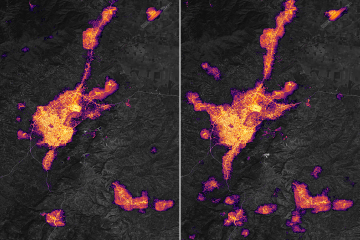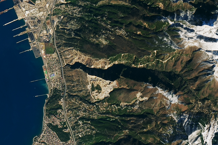
On February 6, 2023, magnitude 7.8 and 7.5 earthquakes hit southern Türkiye and northwestern Syria, causing significant losses of life and destruction to infrastructure. Antakya, the capital of Türkiye’s Hatay Province, was hit especially hard. Data from satellites show that after the quakes, much of the region lost electric power.
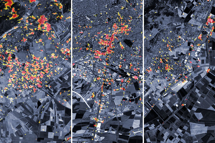
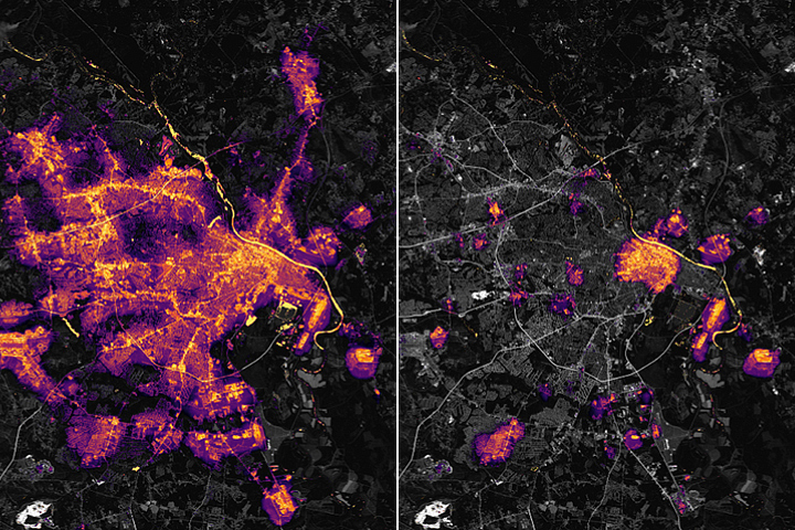
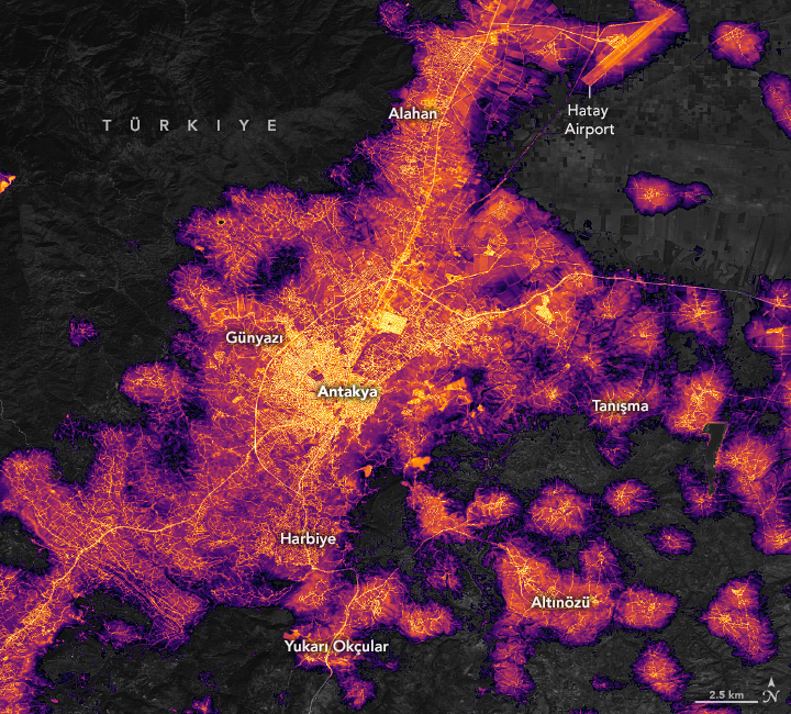
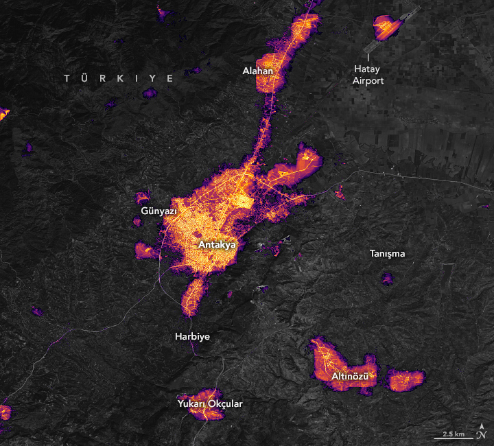
These maps show the amount of light emitted by Antakya’s city center and surrounding communities before and after the earthquake. The left map shows the area on February 4, 2023; the right map shows the same area on February 8.
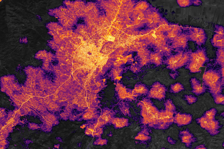
The maps come from the Black Marble HD product, provided by Eleanor Stokes and Ranjay Shrestha of the NASA/USRA Black Marble science team. The maps are based on data from the Visible Infrared Imaging Radiometer Suite (VIIRS) sensor on the NASA-NOAA Suomi NPP satellite. The basemap was built from data collected by the Landsat 9 satellite.
The maps show widespread outages beyond the central business district of Antakya in suburban and exurban communities. Some of the darkened communities include Dursunlu, Harbiye, and Samandağ to the southwest; Günyazı to the west; Ziyaret to the east; and Alazı to the north. A wider view of the region shows that other provinces, such as Kahramanmaraş and Adıyaman, also appear darker after the quake.
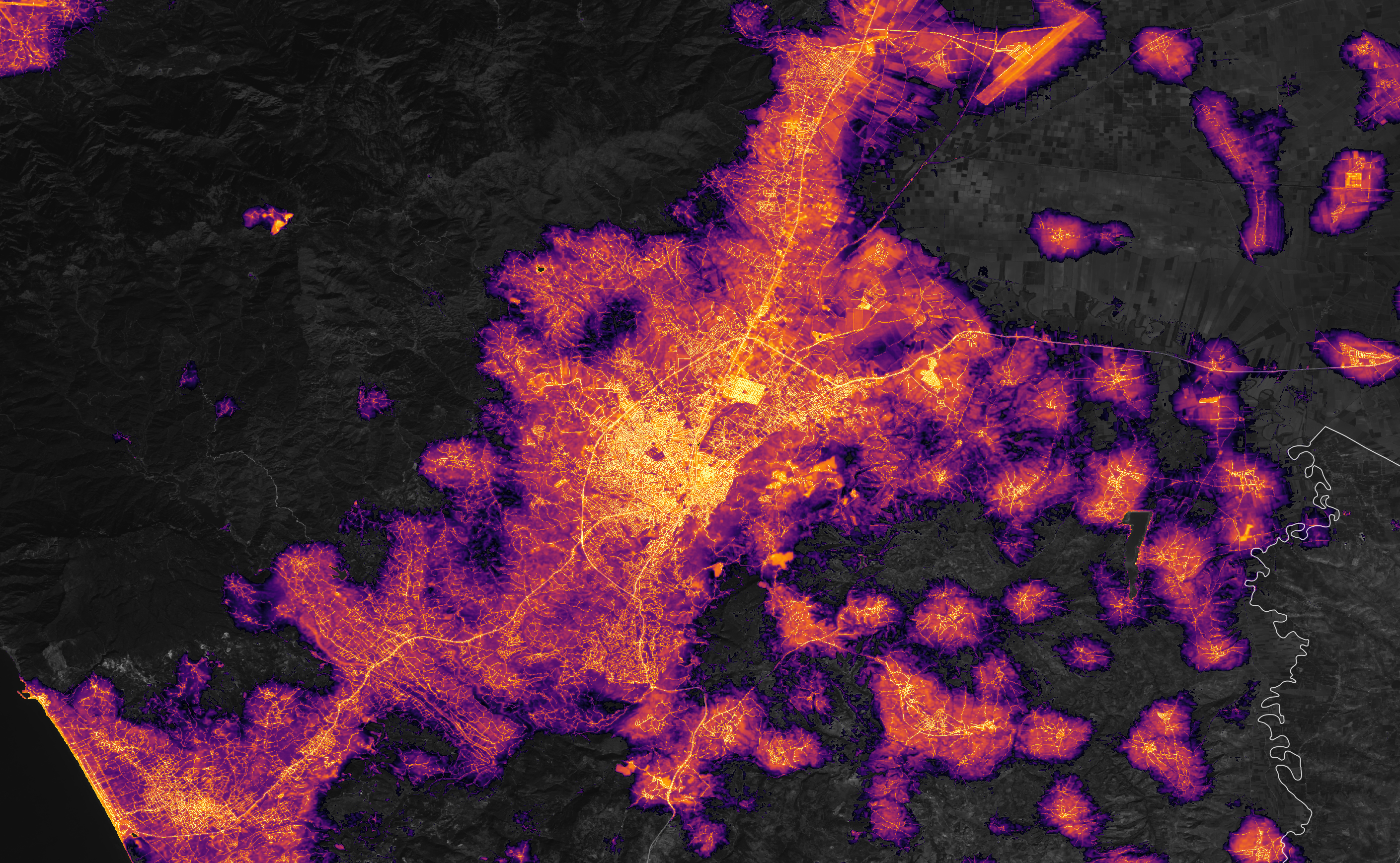
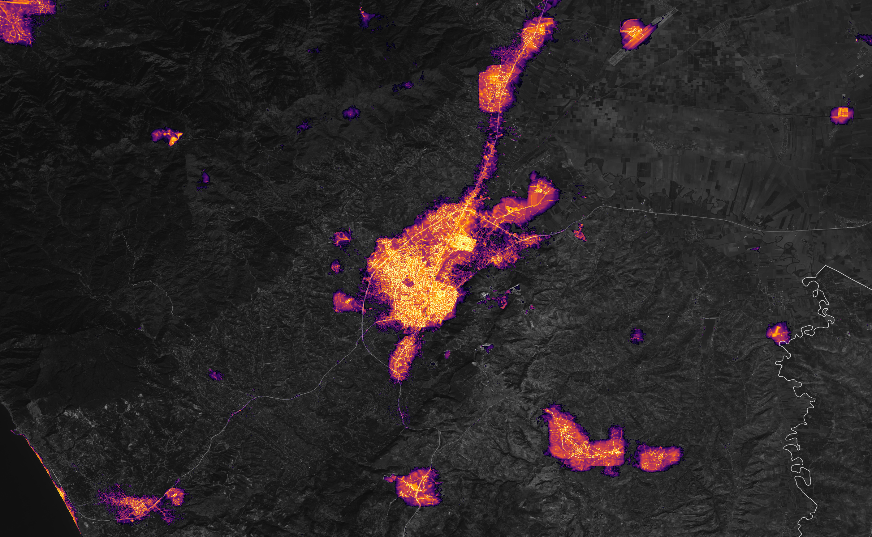
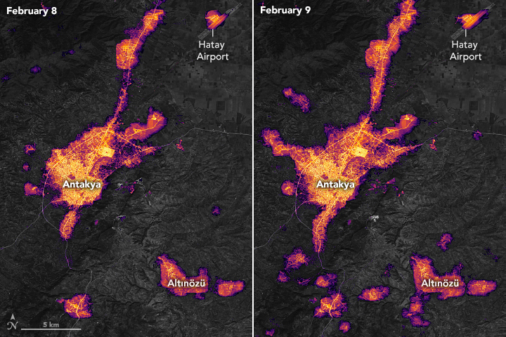
The second pair of maps (below) show that some lights returned between February 8 and 9, but widespread outages persisted in much of the region. Clouds on these days prevented the science team from assessing outages in the Antakya’s central business district.
Raw, unprocessed images of night lights can be misleading because moonlight, clouds, air pollution, snow cover, seasonal vegetation, and even the position of the satellite, can change how light is reflected. The Black Marble science team processes the data to account for these factors. They also apply a technique known as “downscaling,” in which data from Landsat and OpenStreetMap are used to create a high-definition version of the product, the Black Marble HD.
Nighttime imagery can help relief groups identify areas that are most in need of aid. The Black Marble product was one of several NASA datasets used by the United Nations Satellite Centre (UNOSAT) to make evidence-based decisions about disaster response during the Türkiye earthquake.
Note, however, that the maps on this page reflect conditions as of February 8 and 9, 2023, and conditions may have changed since then. The high-definition data visualization maps make it easier to monitor power outages on a neighborhood scale; they should not be used to monitor power outages in individual buildings, homes, or roads.
NASA’s Earth Applied Sciences Disasters program area is also tracking developments related to the earthquakes and their aftermath. They are sharing maps, data, and scientific expertise with multiple stakeholders to aid ongoing response efforts and risk assessments. As new information becomes available, the team is posting maps and data products related to the earthquake on its open access mapping portal.
NASA Earth Observatory images by Lauren Dauphin, using Black Marble data courtesy of Ranjay Shrestha/NASA Goddard Space Flight Center, Landsat data from the U.S. Geological Survey, and data from OpenStreetMap. Story by Kathryn Hansen with information from Eleanor Stokes (USRA/EfSI), Ranjay Shrestha (SSAI/NASA GSFC), and Zhuosen Wang (UMD/NASA GSFC).
alert message