NASA satellites and sensors constantly take the pulse of our planet, measuring how Earth changes by the day, season, year, and decade. Researchers and resource managers analyze those measurements and apply them on local and regional scales to better manage things like our food and water supplies, health, safety, land use, and ecosystems. NASA data is also used by other government agencies to help with responses to natural disasters and emergencies around the country and the world.
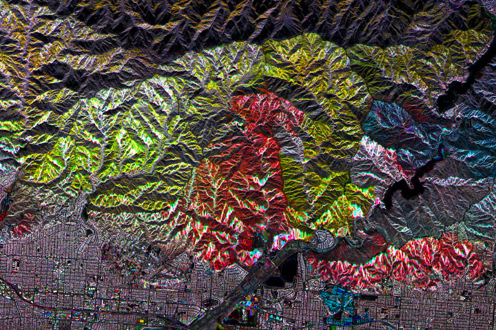
Scientists are using radar data to decipher where and how well landscapes recover in the years after major fires.
Published Feb 6, 2021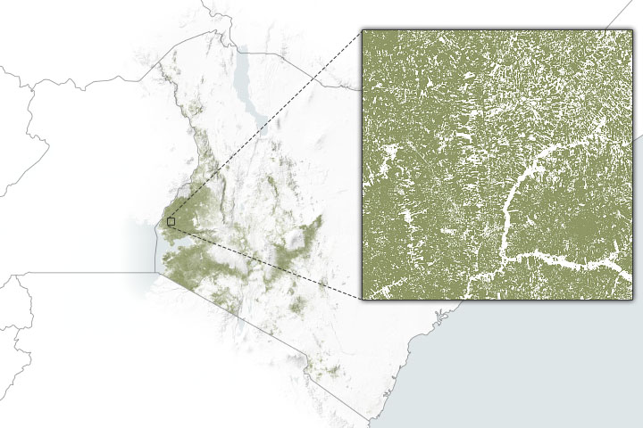
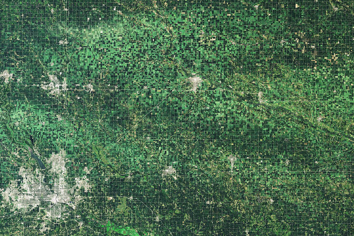
Cropland masks and other environmental data can help agriculture agencies pinpoint where support is most needed.
Published Jan 25, 2021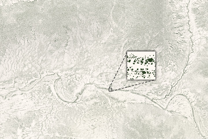
An international team of scientists has used artificial intelligence and commercial satellites to identify an unexpectedly large number of trees spread across arid and semi-arid areas.
Published Dec 7, 2020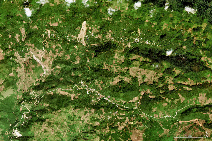
After severe hurricanes dropped torrential rain on Guatemala, Nicaragua, and other countries, NASA researchers worked to map potential landslide hazards.
Published Nov 18, 2020Image of the Day Land Severe Storms Human Presence Remote Sensing
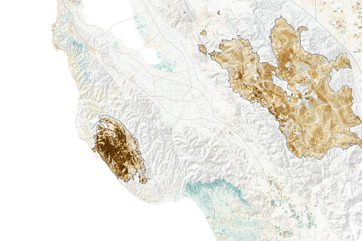
Analyzing subtle differences in near-infrared and shortwave-infrared light from the landscape, scientists can provide some measure of the severity of wildfire burns.
Published Oct 14, 2020Image of the Day Heat Land Fires Human Presence Remote Sensing
While the rate of losses has declined, the ecosystems are still threatened and are facing more environmental stress.
Published Aug 25, 2020Image of the Day Land Life Water Human Presence Remote Sensing
A line of thunderstorms with hurricane-force winds caused widespread damage to crops.
Published Aug 20, 2020Image of the Day Atmosphere Land Life Severe Storms Human Presence
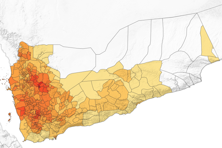
Researchers are using satellite and ground data to forecast the risk of cholera in the country, which has consistently experienced cases since 2017.
Published Aug 12, 2020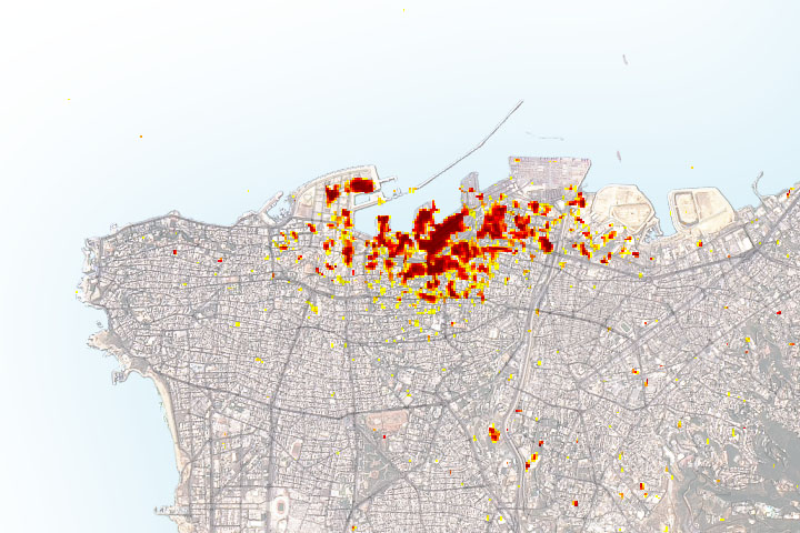
Radar imagery of ground surface changes could help with efforts at disaster relief and recovery after the explosion.
Published Aug 11, 2020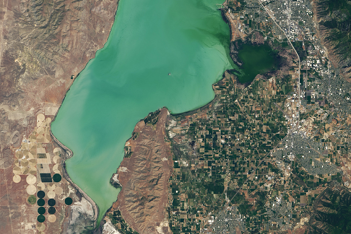
Satellites can spot some blooms earlier, resulting in significant savings on health care, lost work hours, and other economic costs.
Published Aug 4, 2020
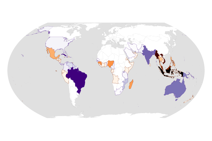
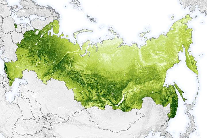
Rapid growth from 2008–2017 built upon the rise in the atmospheric concentration of the gas that has been happening for more than a century.
Published Jul 15, 2020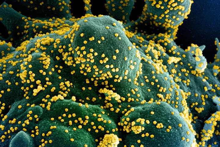
A race is on to figure out whether COVID-19 will wax and wane with the seasons. Atmospheric and hydrologic models produced by NASA and other institutions may be key to that research.
Published Jul 14, 2020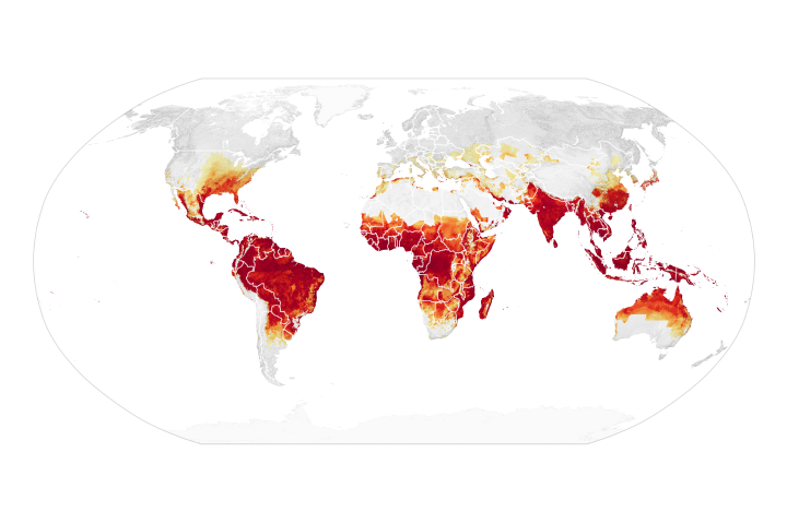
A few decades ago, the idea of predicting a disease outbreak via satellite was science fiction. But today, researchers can use environmental data to predict when and where some diseases are likely to spread.
Published Jul 9, 2020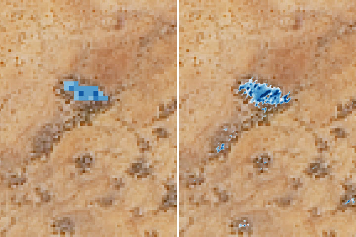
Satellites may make it easier for nomadic herders in Senegal to survive the lean season.
Published Jul 2, 2020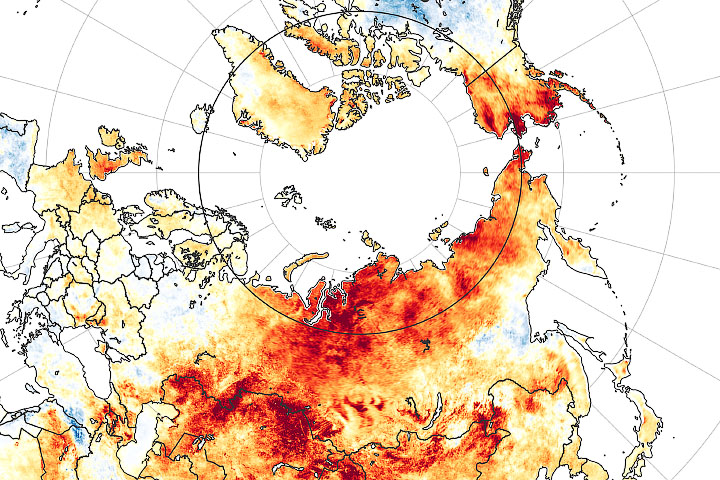
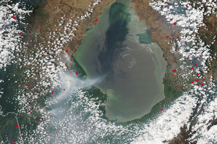
Fires are raging in eastern Siberia in the midst of an unusually long-lived heat wave.
Published Jun 23, 2020Image of the Day Atmosphere Heat Land Drought Fires Remote Sensing Temperature Extremes
Small birds prefer winter landscapes that have larger thermal differences, likely because they offer more opportunities to find refuge from the cold.
Published Jun 4, 2020Image of the Day Heat Land Life Human Presence Remote Sensing
After dry weather parched the soil and vegetation, large fires burned in the northwestern Venezuela state.
Published Apr 28, 2020
Powerful thunderstorms moving through eastern Texas and western Louisiana spawned several tornadoes, including some that caused major damage.
Published Apr 27, 2020Image of the Day Atmosphere Land Severe Storms Human Presence
Researchers using vegetation data to explain moose population dynamics run into a hidden variable and a possible signature of history.
Published Apr 27, 2020
A new web tool designed by NASA applied scientists could help the tribe anticipate and respond to drought.
Published Apr 20, 2020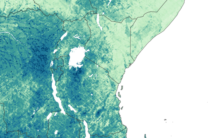
Researchers are using satellite data to understand where locusts may spread during the largest infestation in eastern Africa in decades.
Published Mar 30, 2020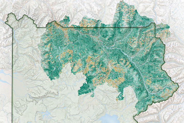
A new study has found a link between the effects of climate change, the productivity of grasslands, and the proliferation of bison in Yellowstone National Park.
Published Mar 12, 2020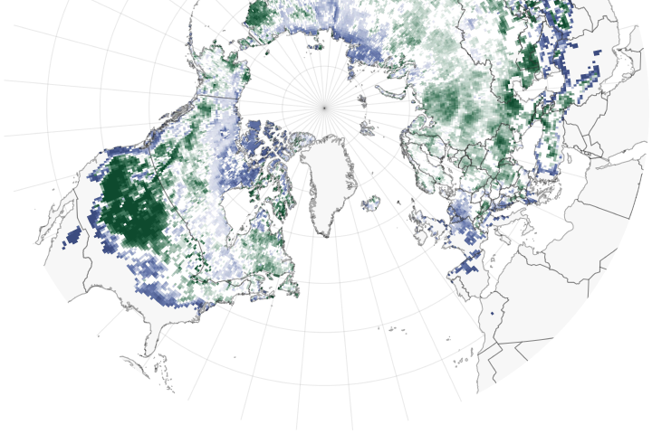
Some species will be exposed to more cold winter air without the insulating protection of snow cover.
Published Mar 6, 2020
The reality of science, statistics, and satellites is that a deep understanding of the causes, effects, and severity of a fire season takes time.
Published Mar 3, 2020
NO2 amounts have dropped with the coronavirus quarantine, Chinese New Year, and a related economic slowdown.
Published Feb 28, 2020Image of the Day Atmosphere Life Dust and Haze Human Presence Remote Sensing
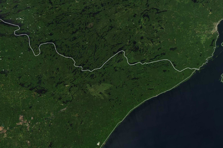
An instrument on the International Space Station observed vegetation beginning to stir on summer mornings near Lake Superior.
Published Feb 26, 2020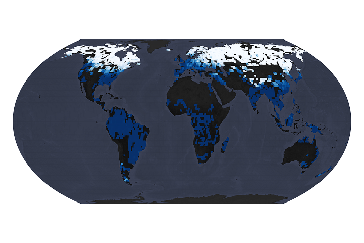
The window of time available to make and use ice roads is closing.
Published Feb 19, 2020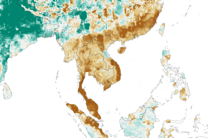
A severe drought in Thailand is affecting agriculture and drinking water in the region.
Published Feb 15, 2020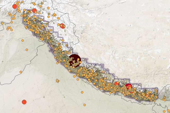
Warming temperatures will likely cause more intense rainfall, leading to increased landslide activity.
Published Feb 12, 2020Image of the Day Atmosphere Land Water Human Presence Snow and Ice Remote Sensing
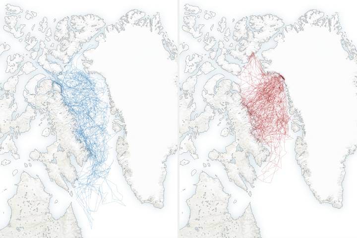
A new study shows that polar bears are spending less time on sea ice, leading them to fast longer, become thinner and have fewer cubs.
Published Feb 4, 2020