NASA satellites and sensors constantly take the pulse of our planet, measuring how Earth changes by the day, season, year, and decade. Researchers and resource managers analyze those measurements and apply them on local and regional scales to better manage things like our food and water supplies, health, safety, land use, and ecosystems. NASA data is also used by other government agencies to help with responses to natural disasters and emergencies around the country and the world.
Economists are using satellite data to help make more accurate price predictions of important crops.
Published Sep 20, 2018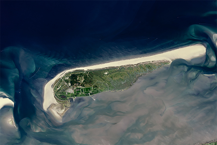
Sandy beaches are growing in some parts of the world and shrinking quickly in others, including one-third of marine protected areas.
Published Aug 2, 2018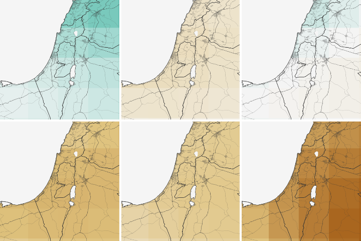
Water shortages in the Middle East lead to sanitation issues in schools, resulting in periodic school closures. NASA is working to change that.
Published Jul 27, 2018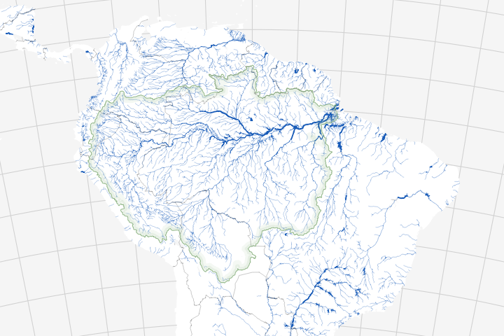
Long overlooked, it is increasingly clear that streams and rivers play a key role in the carbon cycle.
Published Jul 20, 2018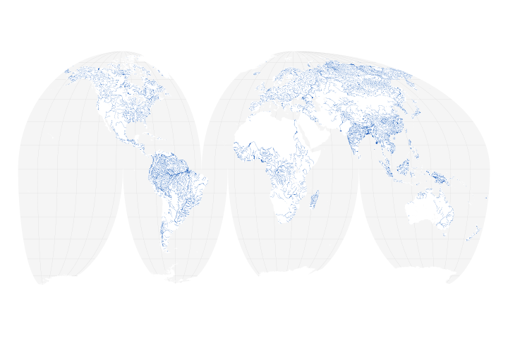
A new map of the world’s rivers and their widths shows that surface waterways are collectively wider and cover more area than previously thought.
Published Jul 18, 2018
Using Landsat to track patterns in irrigation may help water managers sketch out a more sustainable future for the Ogallala Aquifer in the central United States.
Published Jul 9, 2018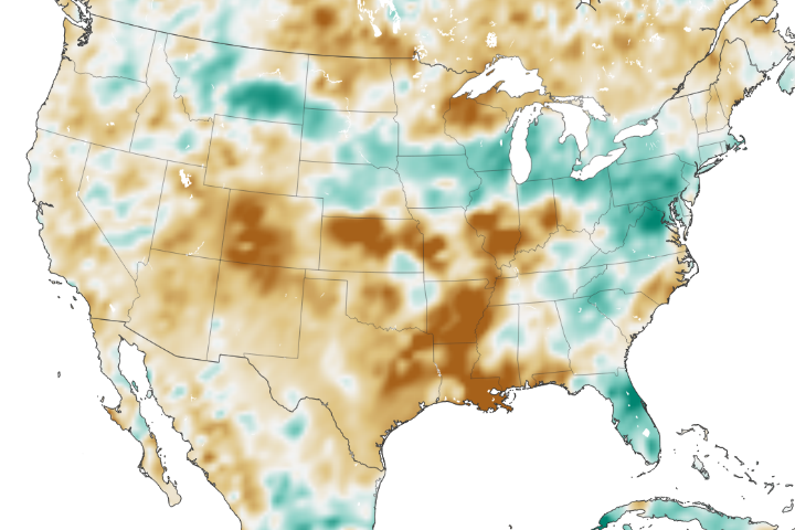
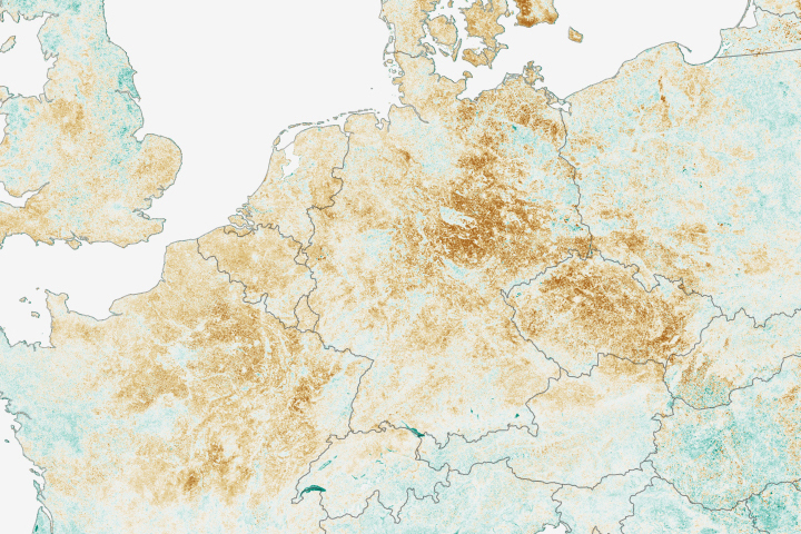
The amount of water contained in the top few centimeters of soil is small on a global scale, but it is critical for agriculture analysts trying to monitor commodity production and humanitarian need.
Published Jun 2, 2018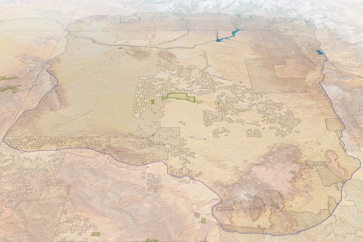
Risk maps can help land managers make more informed decisions about modern development in the vicinity of an ancient civilization.
Published Jun 1, 2018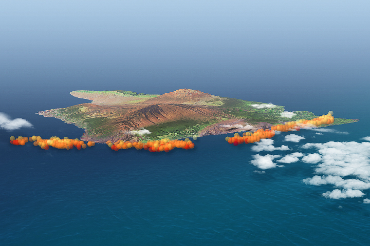
Volcanic plumes can pose health hazards and offer clues about a volcano’s geology.
Published May 15, 2018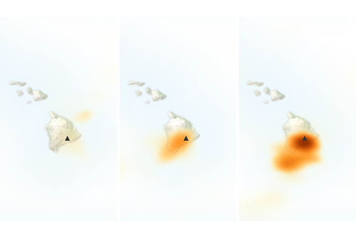
The eruption at one of Hawaii’s most active volcanoes has taken a turn for the worse.
Published May 8, 2018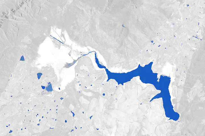
A multi-year drought, a growing population, and management choices have put the city’s water supply in a precarious position.
Published Jan 29, 2018
Satellites can help inform predictions of harmful algae blooms off California.
Published Jan 18, 2018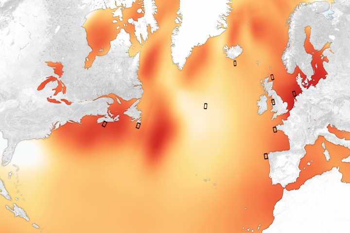
Increasing numbers of Vibrio infections could be a direct consequence of dramatic ocean warming over the past few decades.
Published Jan 17, 2018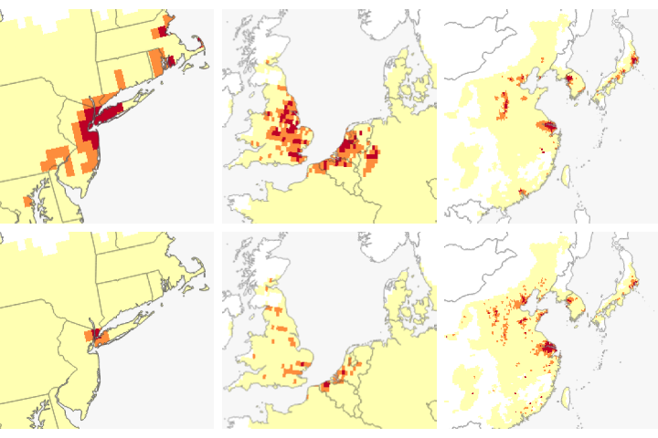
Understanding the chemical precursors of ground-level ozone may make it easier to prevent the pollutant from building up in the lower atmosphere.
Published Nov 7, 2017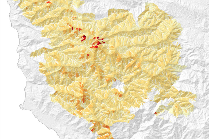
Hillslope-scale erosion maps helped response teams decide how and where to focus recovery efforts following the Soberanes fire in California.
Published Aug 18, 2017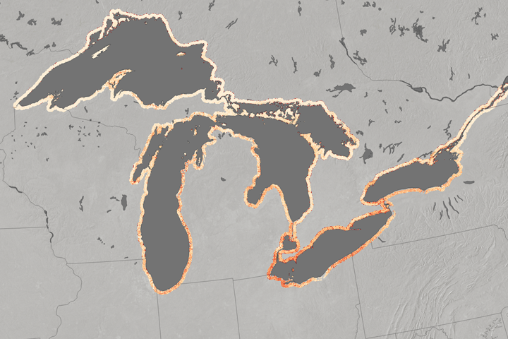
Aggressive phragmites can threaten native salt marsh vegetation.
Published Aug 2, 2017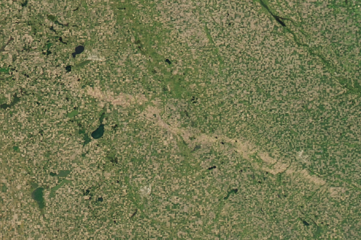
Hail pummeled a long stretch of crops in South Dakota in June.
Published Jul 19, 2017
Changing patterns of nighttime lights are of great interest to demographers, engineers, and humanitarian relief organizations.
Published May 16, 2017
By removing natural and stray light sources, researchers get a clearer picture of the human footprint on Earth.
Published Apr 13, 2017Image of the Day Fires Unique Imagery Human Presence Remote Sensing
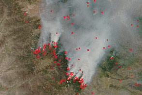
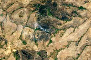
Peru’s intense fire season in 2016 saw burning extend into 11 of the country’s protected areas.
Published Feb 10, 2017
A new study suggests that health and climate benefits may come from unexpected parts of the world.
Published Feb 9, 2017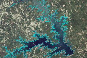
New maps could help managers control an invasive aquatic plant in the southeastern United States.
Published Jan 4, 2017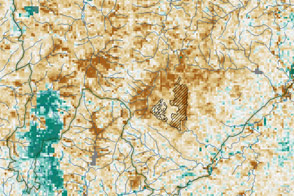
Tiny adelgids are killing off hemlock trees in the eastern United States.
Published Nov 15, 2016
A power plant fire left much of the island without electricity.
Published Sep 23, 2016Image of the Day Land Fires Unique Imagery Human Presence Remote Sensing
The Firecast project aims to bring current satellite data to fire managers as they manage forests in tropical nations. The hope is to improve the monitoring of wildfires and deforestation.
Published Aug 9, 2016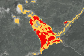
New open-source software called SLIP-DRIP uses satellite images and rainfall data to help identify otherwise overlooked landslides.
Published Jul 8, 2016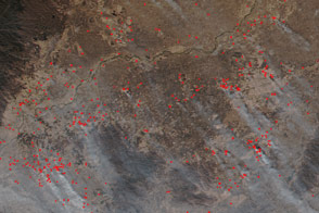
Scientists hope that higher-resolution data from VIIRS will lessen the pressure on firefighters.
Published Dec 8, 2015
As they prepare for a satellite that will measure the height and areal extent of rivers in unprecedented detail, hydrologists have released a better map of North American river widths.
Published Jul 9, 2015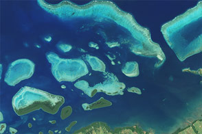
An image of Fiji’s coast shows how modern satellites can help study underwater corals even in the most remote regions.
Published Jul 4, 2015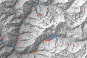
A multinational team is trying to map landslide hazards in Nepal before the summer monsoon adds to the region’s misery.
Published Jun 4, 2015