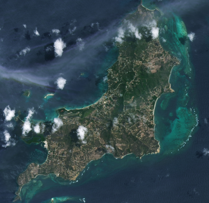
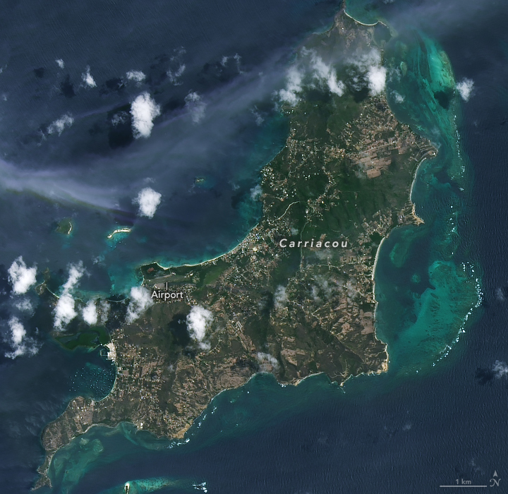
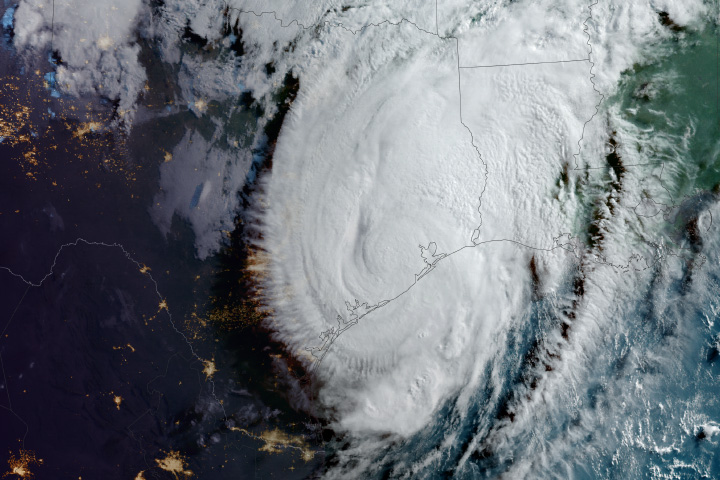
Hurricane Beryl first made landfall as a Category 4 storm on Carriacou Island on the morning of July 1, 2024. With maximum sustained winds of 150 miles (240 kilometers) per hour, the storm damaged practically all of the structures on the island, affecting its entire population, according to reports. Rough seas and air control tower outages hindered aid responses immediately after the storm.
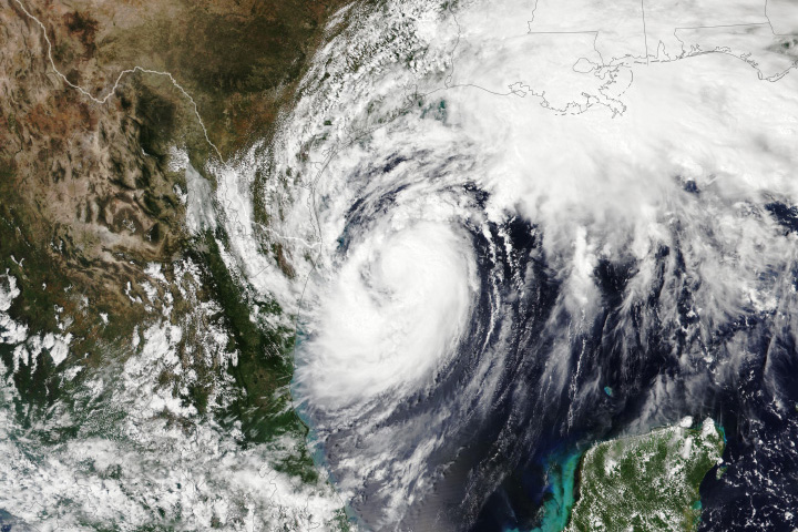
After crossing the Grenadine islands, the hurricane swept west across the Caribbean, where it brought strong winds and dangerous storm surge to Jamaica and Mexico’s Yucatan Peninsula before making landfall in Texas as a Category 1 storm. Beryl flooded streets, tore roofs off homes, and knocked out power and communications for millions of people along its path.
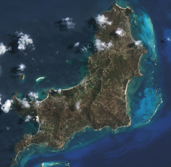
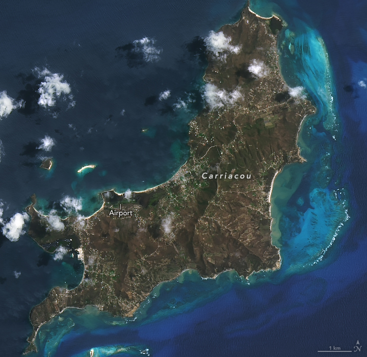
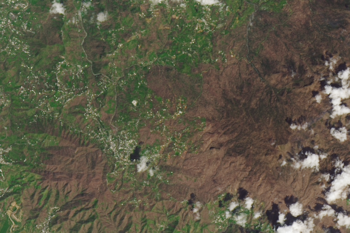
The powerful storm also devastated forests on Carriacou. In the image pair above, many areas that were dark green before the hurricane had turned brown in its aftermath. Note that built-up portions of the island appear less defined in the post-hurricane image, which may be due to flooding and scattered debris from damaged infrastructure. The images were acquired by the OLI (Operational Land Imager) on the Landsat 8 satellite on June 20, 2024 (left), and July 6, 2024 (right).
Hurricanes frequently disturb temperate and tropical forests in coastal regions of North and Central America. High winds blow leaves off trees and snap branches, and when combined with heavy rain, they more easily uproot trees from saturated soils.
Carriacou’s vegetation consists primarily of deciduous and dry thorn-scrub forests. Due to the island’s relatively low topographic relief, little of the plant life would likely have been spared from Beryl’s raging winds, said Jess Zimmerman, a professor of ecology at the University of Puerto Rico. Zimmerman has studied how tree composition changes after hurricanes. “All vegetation would have been defoliated,” he said. “Thus, the brown [seen in the image] is the exposed wood.”
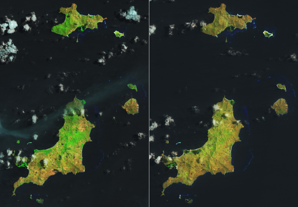
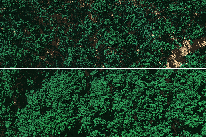
The comparison above offers a different way of viewing Beryl’s effects on vegetation on Carriacou and several smaller Grenadine islands. The images are false color, made up of shortwave infrared, near-infrared, and red light collected by Landsat 8 (bands 6, 5, 4) on the same days as the natural-color images at the top of the page. With this band combination, healthy plants appear bright green because they reflect near-infrared light. As on Carriacou, areas of vegetation on some surrounding islands have lost their bright-green signature, suggesting widespread harm.
Changes to mangrove stands on the coasts of Carriacou and Union islands are evident, if subtle, in the false-color imagery. Mangroves are networks of hardy trees and shrubs that help prevent coastal erosion, absorb carbon from the atmosphere, and provide habitat for fish and other marine animals. Extreme storms can defoliate and uproot mangrove trees, block drainage to the ocean, and cause flooding that affects soil oxygen concentrations and hinders photosynthesis.
The darker appearance of some mangrove areas in the July 6 image suggests they might have taken on water from the storm. (Some of the dark areas elsewhere on the islands are the shadows cast by clouds.) Previous studies have suggested that mangroves’ ability to drain may be linked to their resilience. According to a 2021 analysis incorporating airborne lidar and satellite imagery, Florida mangroves in well-drained areas began resprouting within one year of Hurricane Irma, whereas poorly drained sites saw diebacks.
NASA Earth Observatory images by Michala Garrison, using Landsat data from the U.S. Geological Survey. Story by Lindsey Doermann.
alert message


