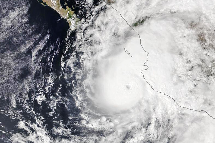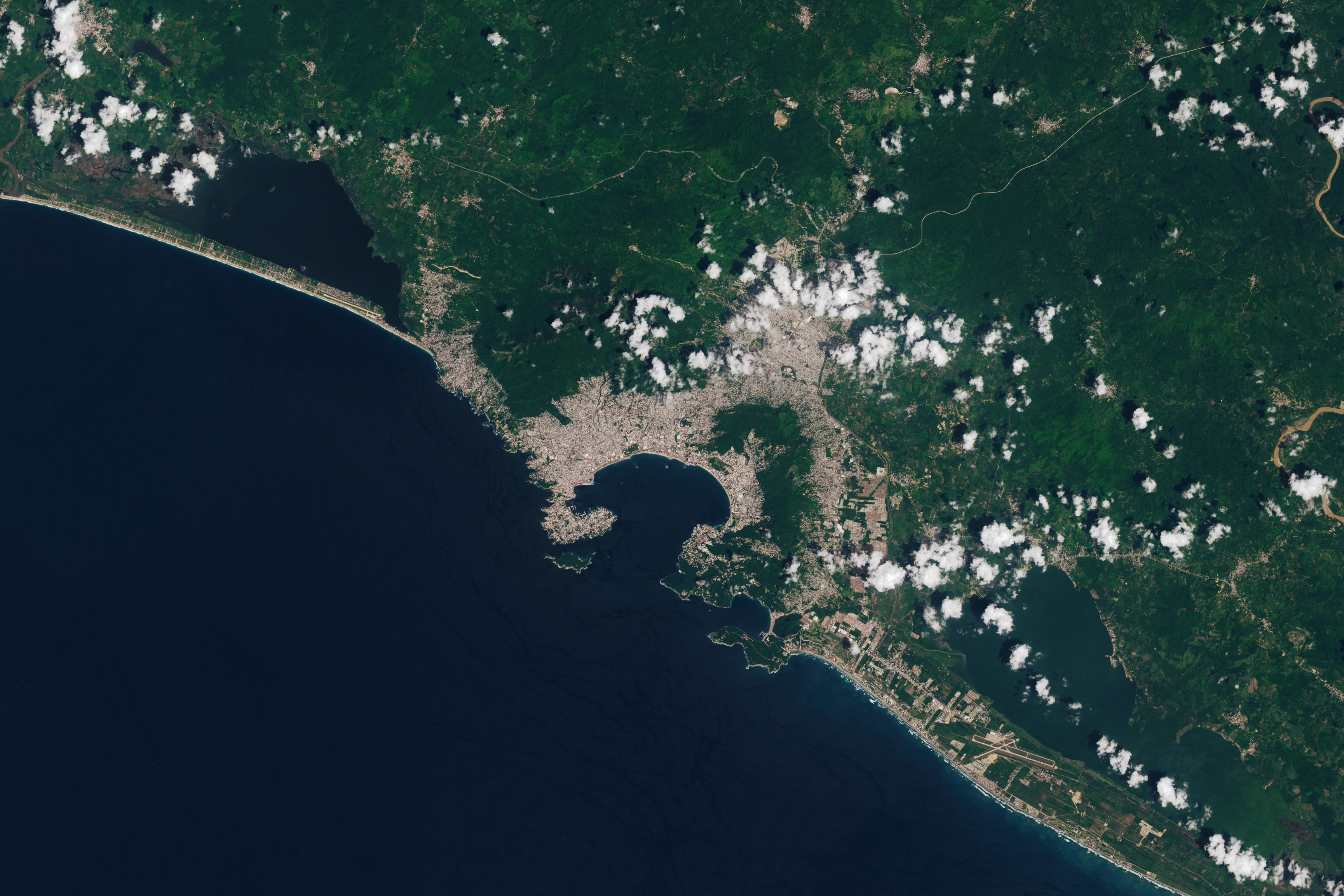

Hurricane Otis was one of the strongest storms in recorded history to hit the Pacific Coast of Mexico. Having strengthened from a tropical storm to a category 5 hurricane in just over 12 hours, the storm caught forecasters and the city of Acapulco off-guard when it made landfall on October 25, 2023. Otis knocked over power lines, uprooted trees, and unleashed torrential flooding and landslides. Beyond its devastating impact on human lives and property, the storm damaged the surrounding tropical forest.
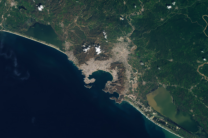
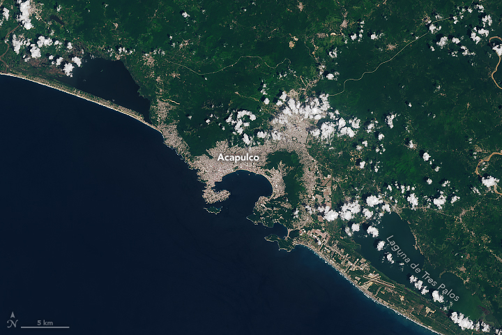
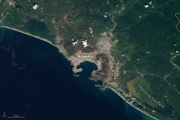
Acapulco—home to nearly 1 million people—is at the foot of steep mountains and encircled by dry tropical forests. These images show the city and surrounding area before and after Otis struck. Notice the landscape near the city changes from lush, green vegetation to brown. Sediment runoff from excess rainfall can still be seen in Laguna de Tres Palos almost a week after the storm. The OLI (Operational Land Imager) sensor on Landsat 8 acquired the left image on September 21, 2023, and the OLI-2 sensor on Landsat 9 acquired the right image on October 31.
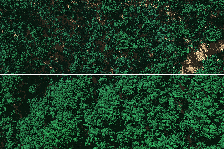
Hurricanes frequently disturb temperate and tropical forests in coastal regions of North and Central America. High winds blow leaves off trees and snap branches, and large amounts of rain combined with wind make it easier for trees to be uprooted from wet soils. Damage to vegetation on the mountains just outside of Acapulco is especially noticeable in these images. Trees at high elevations and on steep slopes are more likely to be damaged in storms because they are more exposed to high wind speeds.
Jess Zimmerman, a professor of ecology at the University of Puerto Rico, has studied how tree composition changes after hurricanes. After reviewing these images, he noted that the damage is “undoubtedly due to the hurricane.”
Past storms have caused similar damage, which scientists can examine using remote sensing. For example, Zimmerman co-authored research that used images from Sentinel-2 to estimate damage to forests from Hurricane Maria, a category 4 storm that hit Puerto Rico in September 2017. The researchers found that almost a quarter of forest biomass was lost in the storm and that areas of high rainfall experienced the most damage. They also noted that increases in the intensity and frequency of tropical cyclones may reduce the ability of tropical forests to sequester carbon.
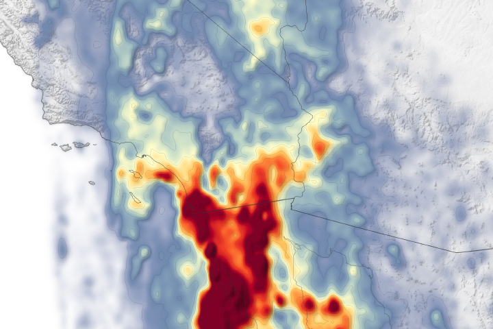
NASA’s Earth Applied Sciences Disasters program area has been activated in support of Hurricane Otis. As new information becomes available, the team will be posting maps and data products on its open-access mapping portal.
NASA Earth Observatory images by Michala Garrison, using Landsat data from the U.S. Geological Survey. Story by Emily Cassidy.