
For more than two months, lava has been pouring from part of Hawaii’s Kilauea volcano, destroying homes and remaking the land surface. More data and imagery of the eruption is flowing in from satellites, drones, and ground-based sensors than Earth Observatory can cover, but here are a few striking images that we would be remiss not to share.
By The Lava’s Early Light 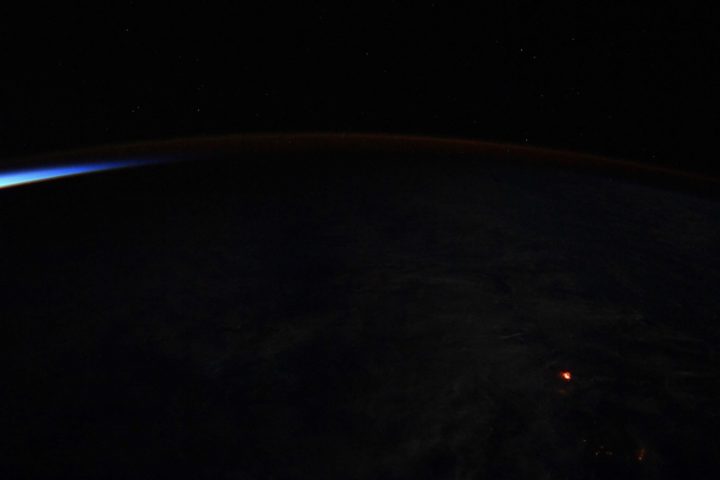
NASA Astronaut Ricky Arnold tweeted this nighttime photograph of lava on June 20, 2018. If the Star Spangled Banner had been composed in Hawaii rather than Baltimore, maybe “lava’s early light” would have made it into the lyrics. Credit: NASA
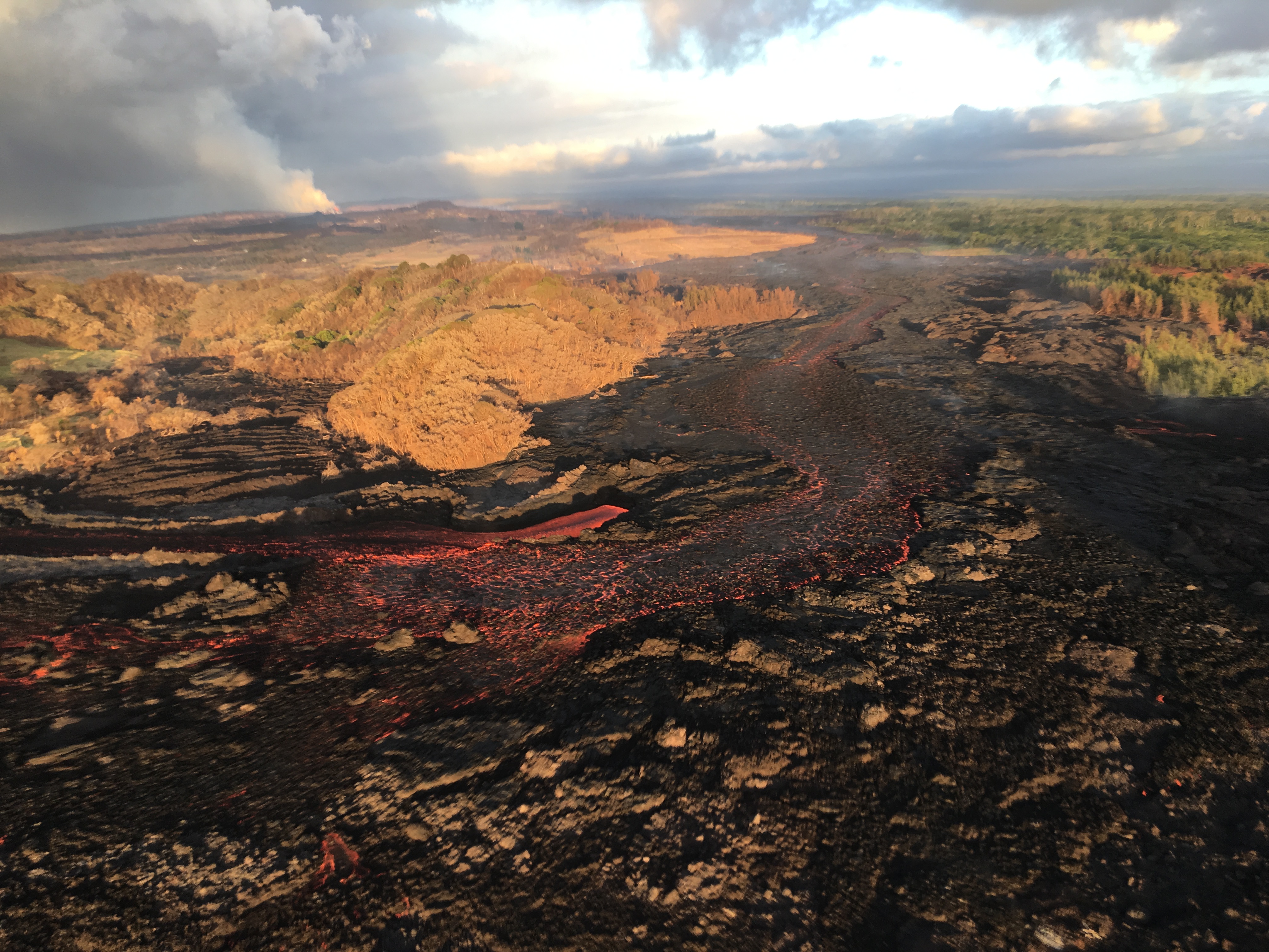
The Wrong Side of the Lava Flow
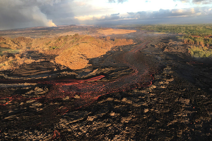
Notice the stark differences in landscapes on the northern and southern sides of the lava channel. With trade winds blowing heat and volcanic gases to the southwest, the north side remained green. Vegetation on the south side, yellowed and brown, took a battering. This aerial photograph was taken on July 10, 2018. Image Credit: USGS.
A Colorful Satellite Perspective on a Collapsing Caldera
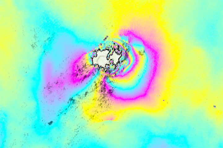
As lava flows from some parts of Kilauea, other parts of the volcano have been sinking. In the case of the summit caldera, the rate of subsidence has been dramatic. This interferometric synthetic aperature radar (InSAR) image, or interferogram, shows surface movement at the summit caldera between June 9 and June 23. Each cycle of yellow-blue-purple indicates approximately 5 inches (13 centimeters) of movement. Areas where the colorful lines are the closest have shifted the most. The data was collected by Advanced Land Observing Satellite-2 (ALOS-2), a Japanese Aerospace Exploration Agency (JAXA) mission. Read more about this image and type of data from NASA’s Disasters Program. Image Credit: NASA/JAXA.
The Same Caldera Collapse Seen from the Ground
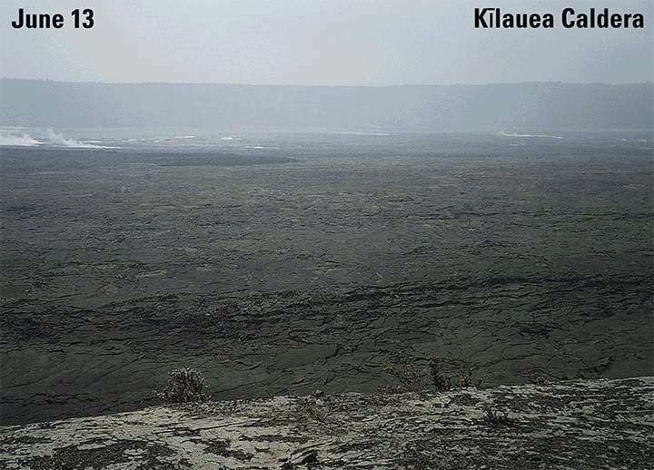
This sequence of images shows rapid subsidence of the caldera floor, along with the development of scarps. One photograph is shown per day between June 13 and 24. The photos were taken from the southern caldera rim, near Keanakāko‘i Crater, and face north. Image Credit: USGS.
Laze Billows into the Air as Lava Pours into the Sea
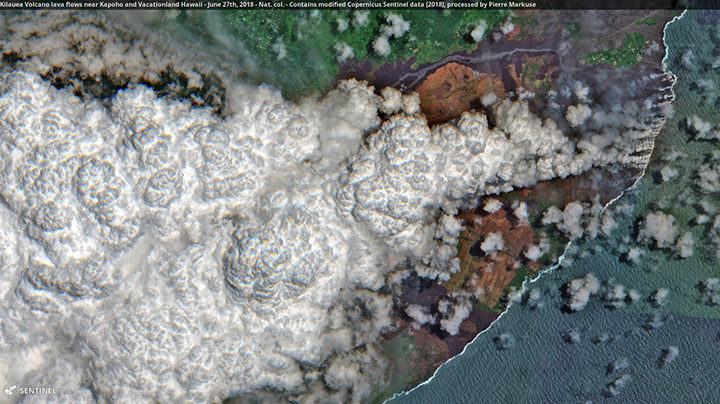
In this Sentinel-2 image, a large plume of laze—steam, volcanic gases, and shards of glass—blows west over Hawaii as lava poured into the sea on June 27, 2018. Pierre Markuse created this image using data from Sentinel-2, a satellite managed by the European Space Agency. He regularly downloads and processes Sentinel and Landsat satellite data and has posted dozens of Kilauea images on Flickr. Image Credit: ESA/Sentinel-2/Markuse