
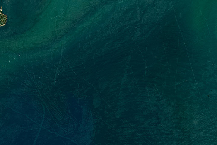
Every month on Earth Matters, we offer a puzzling satellite image. The July 2024 puzzler is shown above. Your challenge is to use the comments section to tell us where it is, what we are looking at, and why it is interesting.
How to answer. You can use a few words or several paragraphs. You might simply tell us the location, or you can dig deeper and offer details about what satellite and instrument produced the image, what spectral bands were used to create it, or what is compelling about some obscure feature. If you think something is interesting or noteworthy, tell us about it.
The prize. We cannot offer prize money or a trip on the International Space Station, but we can promise you credit and glory. Well, maybe just credit. Within a week after a puzzler image appears on this blog, we will post an annotated and captioned version as our Image of the Day. After we post the answer, we will acknowledge the first person to correctly identify the image at the bottom of this blog post. We also may recognize readers who offer the most interesting tidbits of information. Please include your preferred name or alias with your comment. If you work for or attend an institution that you would like to recognize, please mention that as well.
Recent winners. If you have won the puzzler in the past few months, or if you work in geospatial imaging, please hold your answer for at least a day to give less experienced readers a chance.
Releasing comments. Savvy readers have solved some puzzlers after a few minutes. To give more people a chance, we may wait 24 to 48 hours before posting comments. Good luck!
I believe this photo was taken in the Mediteranean Sea off the coast of Marseilles France.
In the Mediteranean Sea off the coast of Marseilles Franse. Specifically seeing the Island of Chateau d’If in upper left corner.
In the Mediterranean Sea off the coast of Marseilles France. Specifically seeing the Island of Chateau d’If in upper left corner.
It`s the nearby of Block island, we can see a wind farm and ship sediment plumes
The surface of Mars. Puzzling because it has small points of
moving objects?
Marianna Trench
The Mariana trench in the Pacific ocean. The deepest part of the world.
The shoreline of Block Island, NY from Mohegan Bluffs to the sandspit of New Shoreham is visible. The moving vessel and its wake provides scale and the regularly spaced wind turbines offshore nails it.
SAHARA INFRARED VIEW
This looks like submerged scour marks.
I don’t know where, but they mght be related to glacial activity or perhaps by rolling stones perhaps released by seismic activity.
Got it!!!
Block island – east side
turistic activities and lines of them… to east and south of them
41.17186131204349, -71.55839021523975
Boat’s trails
A punt but…….Ship trails in algal blooms across Lake Eire
It must be ship trails if not Lake Eire somewhere else
Goodevening and happy and safe symmer holidays to everyone.
I see many ship tracks, ship, olympic games time and i think its the straights between England and France.
Ελληνικά είναι το στενό της Μάγχης, αλλά στην αγγλική πώς;
Have a nice time
coast of japan in atlantic osean
sorry south pacific near japan.
south pacific near japan.