
Hindus are celebrating Diwali this week. That means cities and towns around the world—but particularly in South Asia—are ablaze with lamps, candles, and firecrackers. It’s also become a tradition (of sorts) to share a colorful image via social media that was supposedly taken by a satellite during Diwali. If that image turns up on your feed, be skeptical.
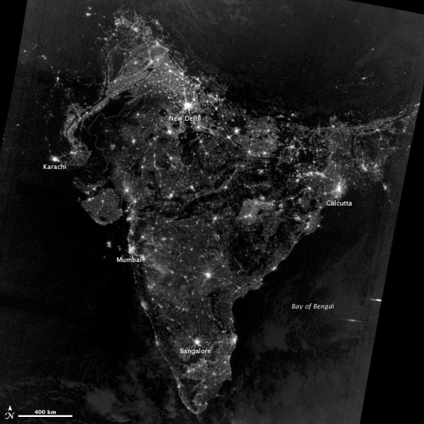
As we pointed out last year, that image is a composite created and colored back in 2003 by NOAA scientists to illustrate population growth over time. In reality, India during Diwali looks something more like the image you see at the bottom of this page. The fact is that any extra light produced during Diwali would be so subtle that it would be extremely difficult to detect from space.
The Visible Infrared Imaging Radiometer Suite (VIIRS) on the Suomi NPP satellite collected the data that was used to make the image below on November 12, 2012. Read more about the fake Diwali image from Earthsky or USA Today.
Thank you So Much NASA for This Colorful and Great Picture ,That’s Why reason i <3 NASA …
But the north INDIA in this pic is incomplete…..what the hell!!!
North India in this pic is incomplete because it is a satellite image and not a map showing political boundaries. Regions of Ladakh and Rajasthan are sparsely populated and hence there is lesser light coming out of these regions.
I LOVE MY INDIA…….
Thank U NASA
Amazing Photo. Thanks for sharing.