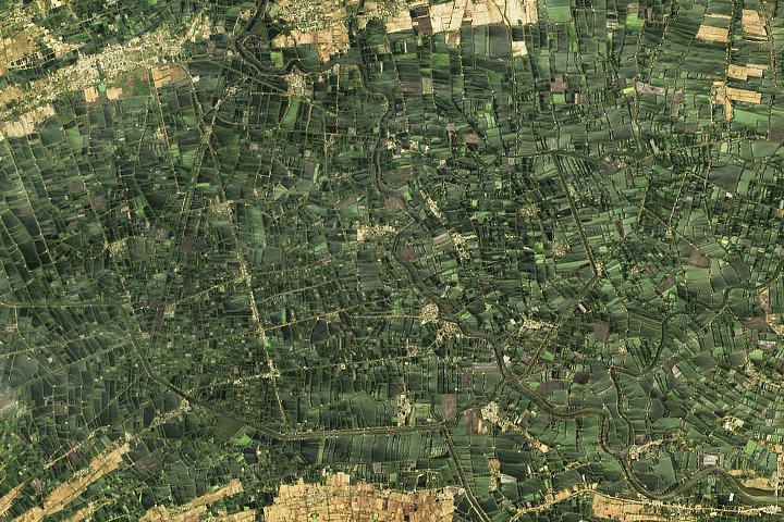
UPDATE — This puzzling image shows an abundance of agriculture in Andhra Pradesh. See the full image and story in our Image of the Day, published on July 17.
Every month on Earth Matters, we offer a puzzling satellite image. The July 2021 puzzler is above. Your challenge is to use the comments section to tell us what we are looking at, where it is, and why it is interesting.
How to answer. You can use a few words or several paragraphs. You might simply tell us the location, or you can dig deeper and explain what satellite and instrument produced the image, what spectral bands were used to create it, or what is compelling about some obscure feature. If you think something is interesting or noteworthy, tell us about it.
The prize. We cannot offer prize money or a trip to Mars, but we can promise you credit and glory. Well, maybe just credit. Roughly one week after a puzzler image appears on this blog, we will post an annotated and captioned version as our Image of the Day. After we post the answer, we will acknowledge the first person to correctly identify the image at the bottom of this blog post. We also may recognize readers who offer the most interesting tidbits of information about the geological, meteorological, or human processes that have shaped the landscape. Please include your preferred name or alias with your comment. If you work for or attend an institution that you would like to recognize, please mention that as well.
Recent winners. If you’ve won the puzzler in the past few months, or if you work in geospatial imaging, please hold your answer for at least a day to give less experienced readers a chance.
Releasing Comments. Savvy readers have solved some puzzlers after a few minutes. To give more people a chance, we may wait 24 to 48 hours before posting comments. Good luck!
Tags: puzzler


farmland on the Nile Delta in Egypt. It’s interesting, because it shows an intense level of cultivation.
A densely populated tropical area that has kept space for green, used for agriculture. Maybe in South east Asia. Couls also be encroached natural protected reserve.
Égypte
es canadá la cual son cultivos de principio a fin
está bien organizada se nota que es fácil distribuir los alimentos
Rural England? I see land enclosures everywhere.
Delta Egypt
Delta of Egypt
Egypt by luxor?
its in Vietnam
I see a river delta with tributaries and some man made channels used for irrigation. My gut instinct said Nile River Delta.
Kodoli. Rains everyday…..
Living roof tops in Denmark.
Looks like Ubud, Bali !! Stepped rice fields
This is Satalaj river’s area of Punjab state in India.
Between Majra n Chandpur . I thought bcz of *Y* shape of river’s n farms .
Se observa un ambiente muy antropizado y por ende modificado, con pequeñas parcelas cultivadas y orientadas en diferentes direcciones, probablemente para evitar la perdida de humus y abastecidas por canales de riego y acequias, rodeadas por pequeños poblados lo que garantiza que el agua este contaminada. Tambien se ve río que aparenta tener densa vegetacion en sus márgenes.
North California
I think, it’s a advanced hydrologic prediction service, somewhere situated in some river. I Saw this type of image once
Egypt´s Nyle Delta
What i can see is that there’s a long main river with meander and cannel is drawn-out for irrigation purpose and long side there linear settlement.
Looks like a green fertile narrow valley sorrounded by rocky hills. There are lots of crop fields.
There is a dense jungle ,it could be Laos.
north of France
it could be the north of Italy with continuous hills next to Austria.
Thinking of the date you posted this, my guess is that it is of the region where the Tour de France ?? travelled through?