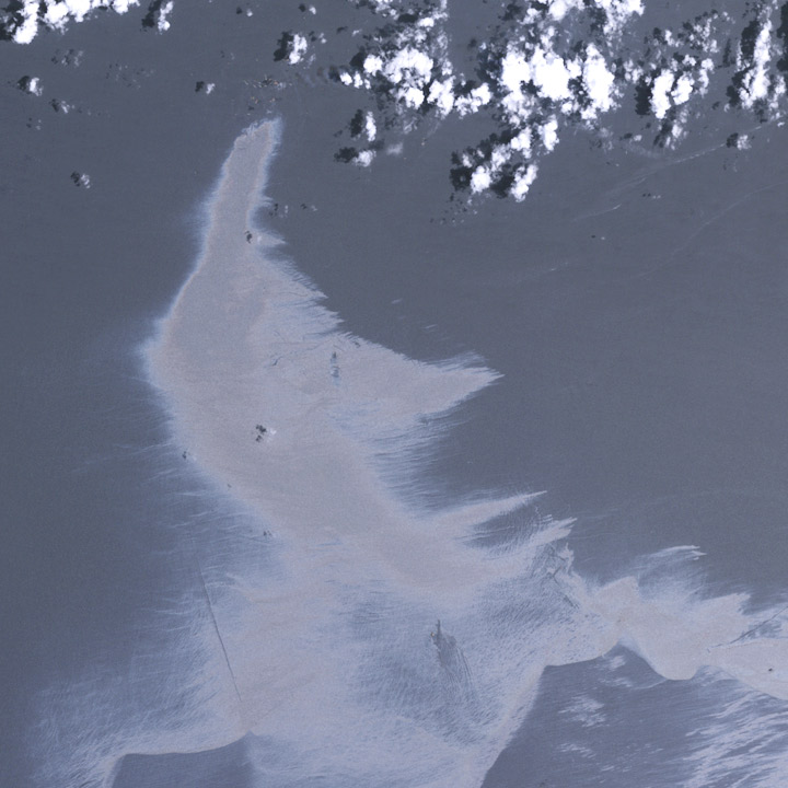
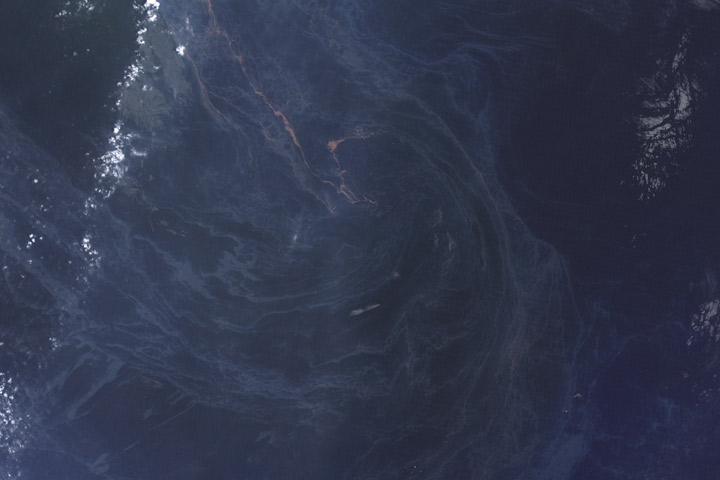
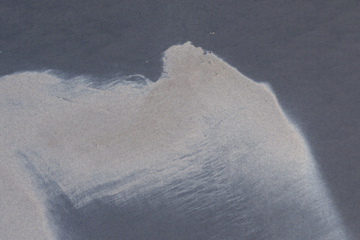
We sort through a lot of imagery at the Earth Observatory, and not all of it makes it onto the site. A picture might be cloudy, we might not be able to tell a good story about it, it’s not quite relevant, the quality might not be good enough, or—as in this case—we might find something after it’s no longer newsworthy. These three satellite images show oil slicks on the Gulf of Mexico after the Deepwater Horizon drilling rig explosion. All are from Landsat-5 in May and July. I found them earlier this month while looking for image ideas. (Click for large images.)


Greetings. The bog is quite interesting! Have a question somewhat off this particular subject.
Have a friend who was flooded nearly off her property during the BIG storm that romped across north America beginning in January 2009.
Is it possible to get a before and after image somehow? Latitude and longitude coordinates for BCC proper are 34.069722,-112.139444, however Trails End Ranch is due east 2 or 3 miles.
All images I can find are well before the damage.
Can you help? Many thanks!
Hey Robert,
Just found your blog, and I’m really impressed. It combines earth science and artistic sensibility in a useful and interesting way. Looking forward to reading future posts. Thanks for taking the time to share!
CB
Michele:
Unfortunately, there’s no way we can respond to individual requests for images and data processing. Fortunately, much of the raw data is available on-line if you want to explore for yourself. Twice-daily, relatively low resolution imagery of the Phoenix area is published by the MODIS rapid response system. Higher resolution Landsat 5 & 7 data collected every 8 days is available from the USGS Global Visualization Viewer.
At some point I’ll write a series of posts on how to create color imagery from the Landsat data, but it will take a while to do well.
Thank you MUCH for this information. I will continue to look for post-storm aftermath on the USGS website you have so kindly provided. Thanks! Hope I can find one that will allow a fairly close look at specific parcels. Thank you again!
I am a captive audience to USGS and Robert Simmon’s images – newsworthy or not, blurry, obscured, irrelevant….. I could be most entertained and interested in your discards / mistakes, no pic is a bad pic. Fantastic work, esp. Deepwater and forests, your fan – N.D. Fenton
Robert, interesting read, superb images!
I’m speechless. Thank you for sharing such great images with us!
The images are astounding.