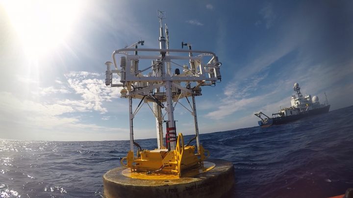
WHOI Mooring Buoy (credit Ray Graham).
One of the reasons our work requires a large research vessel is that we are dealing with large arrays of sensors moored in the deep ocean. That requires big buoys, lots of rope and wire, lots of floatation, and big anchors with very strong and steady human guidance.
Time series collected from moorings are among the most valuable data sets collected in oceanography. Anchoring sensors at one location and precisely placing them at pre-determined depths provides a view of the ocean that cannot be supplied by any other means.
SPURS-2 deployed three moorings in late summer of 2016 and recover the equipment now, in November 2017. Our “central mooring” from Woods Hole Oceanographic Institution is heavily instrumented with temperature, salinity, and velocity sensors (See Prior Blogs: Mooring Deployments and Mooring Deployment). Two additional moorings from NOAA PMEL (See Prior Blog: NOAA Contributions to SPURS) are instrumented with “Prawlers” (See prior blog: Prawlers, Engineers, and the Future of Oceanography at Sea) – a single sensor package that crawls up and down the mooring wire profiling the water column. In addition to ocean measurements, these moorings provide a year long record of the surface meteorological conditions.
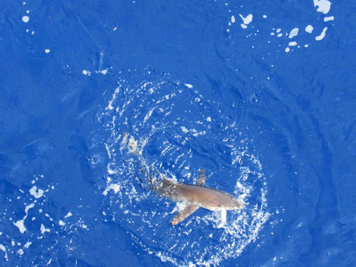
Silky Shark on the line at WHOI mooring.
One of the interesting thing about these moorings, that you seldom hear about, is the “buoy ride.” Several times during this voyage we have put men on the mooring buoy to complete assignments such as replace batteries, change out meteorological gear, and finally to remove all the meteorological equipment in preparation for recovery of the entire mooring. Ben Pietro and Ray Graham described the experience quite vividly – of clambering aboard the buoy from Revelle’s small boat and attempting to stay safe on a rocking, rolling, heaving, slippery, guano-encrusted, shark-surrounded, pillar of modern oceanography.
In the approach via small boat, we are told, one is impressed immediately by the number and variety of fish swimming around the buoy. There are also the menacing, shadowy figures of sharks among the fast-swimming tuna and mahimahi. That gives the short leap from the boat to the buoy the feeling of a do-or-die effort!
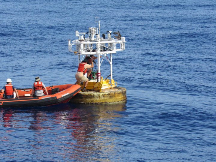
Once aboard the buoy the footing is slippery with seawater and guano, so the discipline of a rock climber is required. It may be only a short way down, but who wants to splash around with hungry sharks? One only has to recall the fishing, of days recently past, where on one cast all that was brought aboard was the lure and the head of the tuna; the sharks having won an easy and quick dinner. Best to hold on tight. Ben said his knees were sore from clamping down hard on the buoy while using both hands to get the meteorological gear free and stowed.
Serious profession this!
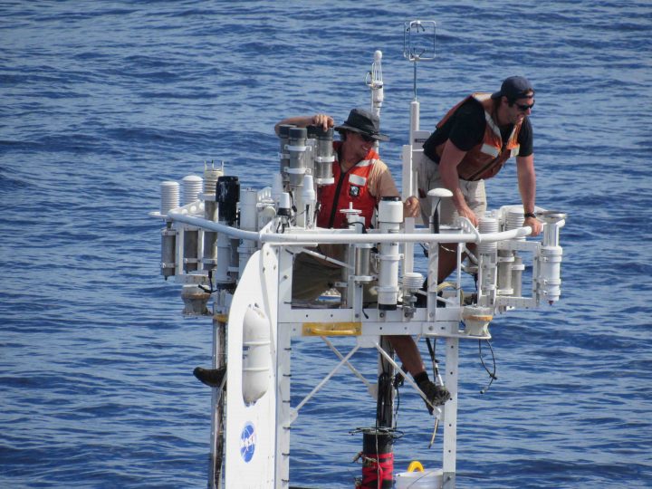
Ray and Ben riding the WHOI Buoy!
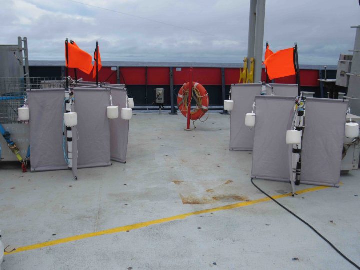
One of the fascinating projects to watch during the mooring recovery is the dismantling of the “hardhats” – the mass of floatation at the bottom of the mooring above the anchor that brings the bottom end to the surface. As deployed, it is a tall tidy assembly of glass balls in their protective hardhats, in bunches of four, connected with chains. As recovered (see photo), it is a confusing puzzle of twisted chain and shackles in an untidy pile. Amazingly, it took a dozen people only twenty minutes to untangle the puzzle and stow the hardhats four by four back in their shipping box (AKA, the snake pit). Honestly, it was an amazing operation to watch!
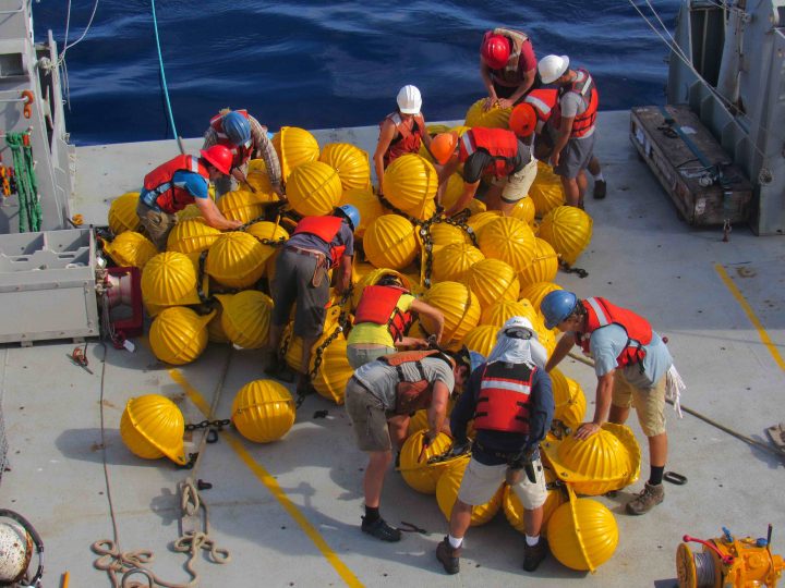
The Puzzle of Untangling the Hardhats.
While ocean moorings are often described as autonomous observing platforms, the human ingenuity required to deploy and recover them demands a steady human with a tight grip.
There is a bit of revolution going on in oceanography. Quite quietly, many new robust autonomous platforms are making ocean observations. The revolution has been growing for a decade and now feels like a fresh breeze. Taking humans and ships out of much of the ocean observation loop is enabling new science and pushing aside old ways. It is preparing us for observational challenges in places humans and ships cannot go.
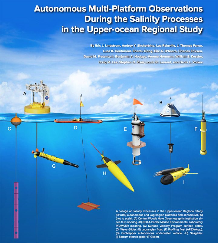
There was recently published a special issue of Oceanography (the Journal of The Oceanography Society) on Autonomous and Lagrangian Platforms and Sensors (ALPS). Here autonomous means “without humans aboard” and Lagrangian means “drifting.” Since ALPS are central to SPURS and the subject of a paper in the special issue, I thought I would give you the basics of the story. What motivations lie behind the use of ALPS in SPURS?
Satellite remote sensing enables observation of many surface properties of the ocean and their evolutions (temperature, salinity, and sea level being prime examples from physical oceanography). Because electromagnetic radiation (light) used for such remote sensing cannot penetrate water, measurements of subsurface properties still require the use of instruments in the water (such as ALPS), deployment mechanisms (such as ships), and oceanographers to design rational deployment strategies. From its origins, the SPURS program has focused on combining remote-sensing observations with autonomous multi-platform research (See prior blog: Measurements by long-term autonomous platforms in SPURS), continuing NASA’s long tradition of autonomous exploration in challenging remote environments with cutting-edge robotics.
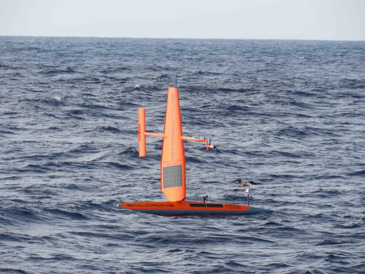
Saildrone with a bird landing.
Shipboard observations in the open ocean are too costly to sustain for than a few weeks; their use is impractical for studying some aspects of seasonal and longer-term evolution of ocean phenomena. Autonomous drifting (Lagrangian) instruments (See prior blog: Mathematicians from the 18th Century) have a niche in mapping the global ocean circulation and upper ocean properties (e.g. Global Drifter Program and Argo Program). The drifting assets in SPURS include deployments of drifters and Argo floats that initially contribute to SPURS but then stay on in the water for many years as part of their global arrays. Mobile autonomous instruments – underwater gliders (See prior blog: Seaglider #189 Away!) or self-propelled surface vehicles (wave, sail, or solar powered) can also provide the capability for sustained and controlled surveys of the upper ocean. The self-propelled vehicles in SPURS include Seagliders, Slocum Electric Gliders with microstructure, Wavegliders, Ecomappers, and Sail Drones. For SPURS-2 the focus on the upper few meters of the ocean has necessitated use of autonomous platforms that can sample the ocean well clear of the disturbances of a large ship.
It remains a central challenge of modern physical oceanography to sample the immense range of temporal and spatial scales relevant to determining and predicting the evolution of ocean properties. Ultimately we need to understand and model, for example, turbulence at microscopic scales, eddies and fronts at kilometer scale, and ocean-basin-spanning currents at 10,000 kilometer scale. The innovative use of a variety of measurement platforms in SPURS is one example of how different tools, each with its own strengths and weaknesses, can be used in a coordinated fashion to ensure broad-scale coverage while resolving important small-scale processes. We get the big picture with satellites but must fill in details with networks of ALPS and the occasional “intense look” by a research vessel acting as a mother ship for a concentrated ALPS fleet.
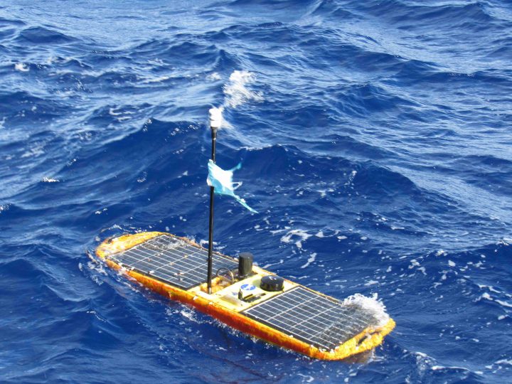
Waveglider ready for recovery after 14 months at sea.
The NASA Physical Oceanography Program is using SPURS to develop effective strategies for sustained ocean observations that use satellites and ALPS together to span the spatial and temporal scales required to address physical processes in the upper ocean – particularly those impacting climate and the water cycle. Ultimately NASA, in many realms, is working to perfect “smart networks” of disparate instruments – sensor webs you might call them – capable of interaction and self-coordination to achieve research and mission objectives. Hopefully we learn well how to explore and protect Earth’s ocean before we are called on to design and build an autonomous sensor web to explore another ocean world. Exploration of oceans on Enceladus, Europa, and others may only be decades away, so we better get moving!
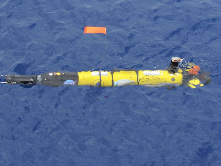
Ecomapper at the ocean surface.
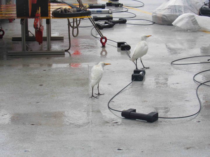
Our Egrets assist with drifter deployment.
We had imagined a grand drifter experiment for SPURS-2. Investigators from a number of institutions contributed drifters that would measure surface temperature and salinity and transmit position via satellite. Each was a different technology and would drift with currents at a different depth. Surface Velocity Program drifters (5), of which there is a global array of 1250 at any one time, are tailored to follow the currents at 15 m depth; CODE drifters (5) follow the currents at 2 m depth; French drifters (5), looking like miniature starships, follow the currents at 1 m depth; and new drifters (20) from Florida State University, looking like film cans from the cinema, follow the current within inches of the ocean surface. It was thought that if we could deploy all of them in about 1 square kilometer of ocean and watch them drift for a day, we could further understand the “shear” in currents near the surface (differences in speed and direction at different levels). With 35 drifters in all at 4 different levels, it seemed like an interesting experiment.
OK, so the immediate problem with this experiment was discovered before any drifters were deployed. Both France and FSU (25 of 35 drifters) use Globalstar positioning system. Although both groups had been assured that this system would work out here in the remote tropical Pacific Ocean, in fact no positioning information could be obtained once the drifters were turned on for testing. How this happened is surely the subject of much email between our investigators ashore and Globalstar. These 25 drifters return home unused. A huge part of the experiment went south without ever touching the water!
Surface Velocity Program drifers ready for deployment.
Now, we have 10 drifters at 2 levels. Not nearly so interesting. As planned we deployed them close together. The two kinds of drifters stayed together as like kinds and immediately headed off in slightly different directions (of south, funnily enough…). We recovered the CODE drifters after 24 hours and the SVP drifters remain in the water to join their brethren as part of the global array. What did we learn? It was hardly the “big” drifter we expected and the loss of diversity hurt pretty bad. We learned again that this kind of thing happens at sea, the technology of the lab and concept of an experiment runs afoul of reality and the sea. The battle between technology and the sea continues to rage.
Space-age looking drifters from France ready for deployment.
One person who is deeply disappointed by our drifter experience is Alexandre Supply. He is all set to begin his Ph.D. work and might have been in a good position to analyze the conceptualized drifter experiment. As it stands, he has worked out a new configuration of drifter material for deployment sometime in the next week (a mini-experiment). This will at least allow tests of some technology and some oceanographic data for his collaborators.
Alexandre Supply (at University of Pierre and Marie Curie in Paris) is one of those young scientists who gives us old folks hope for a bright future for our science of physical oceanography. We are lucky that he only thought briefly of studying law and quickly learned that natural science was much more to his liking. He describes being torn between careers in astronomy/space studies or climate – only to discover that he could have it both ways by working on oceanography from space. That is the kind of thinking that brings people into the world of the NASA Earth Science Division!
CODE drifters from Scripps ready for deployment.
Alexandre and his fiancé, Anastasia, will both be looking for work in the oceanography-from-space realm once all their academic credentials are completed. They will be a new kind of “power couple” in the field (both with Ph.D.) with deep experience in satellite data analysis and sea-going experience. Their language skills alone are awesome (French, English, and Russian)! I hope they are interested in working with NASA one day.
Alexandre Supply.
Life on an oceanographic research vessel is definitely different than daily life ashore. For the crew there are regular watches, to man the bridge, deck, and engineering. Keep them very busy are the operation and maintenance of the ship, sustenance and safety of all onboard, and fulfilling Revelle’s scientific mission. For the scientific party the work and watches are quite malleable depending on what the main occupation of the day might be. There are four primary activities of a day – working, sleeping, eating, and entertainment.
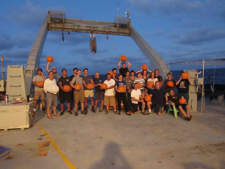
Pumpkin selection for carving contest completed.
Work: There is some work going on at every hour, around the clock. Shifts have been set up to manage the deployments and recoveries of the Surface Salinity Profiler and its associated laser/image experiment. There are three-person shifts around the clock to attend to the Underway CTD. Likewise there are volunteers for the balloon launches (atmospheric sounding) four times per day. The precipitation radar team also will manage 24 hour per day operations as we dedicate a couple weeks of work in the rainiest areas. Someone must always be awake to monitor “autonomous” systems processing water from the sea snake system (more on that during the last week of the voyage).
Sleep: Because of shift work, there may be people asleep at any hour of the day or night. The ship is a noisy place, so it is common to use ear plugs or noise suppressing ear gear. Noise arises from the constant drone of the engine, water slapping the hull of the ship, doors and hatches closing, grinding and sanding on deck, winches, and simply people in close quarters. The opportunity for true silence awaits ashore. It does not occur aboard ship.
Eating: Three meals per day are prepared by Jay and Mike. Breakfast 0730-0815. Lunch 1130-1215. Dinner 1700-1800. The food is plentiful and very well prepared. Sunday dinner is notable as “steak night.” There are options for the vegetarians! Unfortunately, there is inadequate space in the dining area for everyone to sit at once. Those on watch get to eat first, then others follow. The dining motto is “eat it and beat it.” Not very civilized, but necessary! We try hard to be finished and plates cleared by the end of the appointed meal time.
Entertainment: The ship has an extensive library, so there in no shortage of good reading material if one did not bring books from home. There is also a lounge for watching movies. It is quite common for a card game to get going after dinner. Some people bring craft work like knitting for entertainment. There are also opportunistic entertaining events – like the pumpkin carving contest on this expedition or fishing near moorings. There is gym equipment and a weight room for those wishing to work out.
Ben, who minds our flock of drifters.
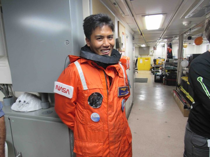
Clifford obviously wants a job at NASA.
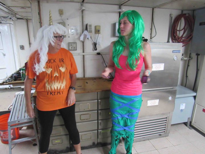
Janet and Elizabeth make a colorful duo.
For scientists at sea there is always the call of work back home. I know that people are reviewing the dissertations of students, preparing journal articles for submission, and preparing proposals to submit for new funding. Your blogger too has such duties – sending out emails to scientists about recently reviewed proposals, preparing for a large ocean conference in 2019, and writing a short article for Oceanography.
This voyage has been blessed with a small side-show by a couple of Egrets. They seemed near death when they joined the ship late last week. After taking on some food and freshwater, thanks to Trina from UW APL, they are taking ownership of the fantail of the ship and providing good entertainment. I will keep you apprised of their situation.
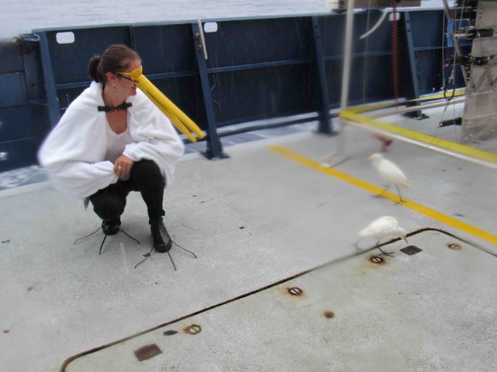
Trina in costume with the egrets.
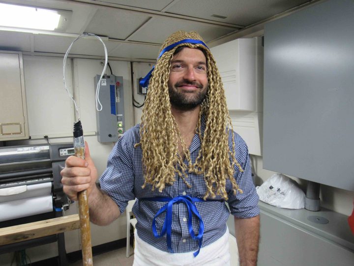
We had wonderful laughs and a few minutes of fun on Halloween. Costumes were called for while attending the daily science briefing. Photos throughout this blog post capture the moment much better than my words.
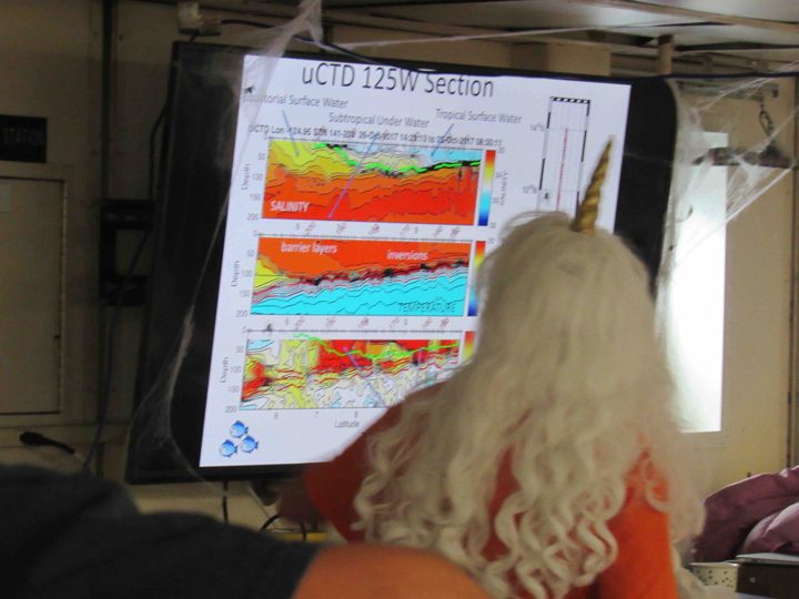
Science lecture for the Halloween party!
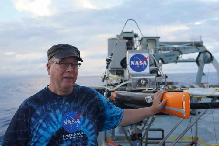
Eric Lindstrom with-Surface Salinity Profiler. Photo by David Ho.
In July 1969 I was watching Neil Armstrong take his first step on the moon at Tranquility Base like everyone else with a TV at the time. I spent that moment at the USC Wrigley Marine Center on Catalina Island as a 13 year old visiting my brother, who spent the summer studying there. If you had asked me then if I would wind up working for NASA, I would have said “No, I’d rather pursue oceanography!” Well, since 1997 I have been the Physical Oceanography Program Scientist at NASA Headquarters AND I am a dedicated sea-going oceanographer. It still feels kind of crazy what comes around in life. I write my short career biography here for students who may consider working in oceanography or for NASA or both.
After graduating from Huntington Beach High School in California in 1973, I took the train across the country to begin my college career at the Massachusetts Institute of Technology. After only one semester of MIT physics and mathematics problem sets, this boy gravitated to the Department of Earth and Planetary Sciences and asked them how I would train to be an oceanographer. There were no undergraduate oceanography courses, so I was told to take physics and math (ouch!) – and to get my degree in Earth Science I would have to take the required geology and geophysics courses too. I did all that, but rocks were not my first love. Luckily, a Professor of Physical Oceanography at MIT, John Bennett, allowed me to work with him under MIT’s Undergraduate Research Opportunities Program (UROP)and sit in on his graduate level physical oceanography courses. We worked together on an analysis of the coastal boundary layer in Lake Ontario and I co-authored a paper with him that appeared in Journal of Physical Oceanography in the summer of 1977. UROP and that research paper were a big boost for my applications to graduate school. I still donate money annually to MIT’s UROP to honor its impact.
For graduate school I sought out a diverse set of schools, UCSD Scripps Institution of Oceanography, University of Washington, Princeton, and University of Miami. I was told that since I was at MIT, I should NOT apply to the MIT/Woods Hole Oceanographic Institution joint program (that was weird). In the end I did have choices and settled at University of Washington working with Professor Bruce Taft. It was the era of Apollo-Soyuz and USA-USSR cooperation in space and oceanography, so I embarked on studying eddies in the North Atlantic with a diverse set of US and USSR scientists. The project was called POLYMODE. It was a fun project with time at sea, lots of workshops and meetings, including a month in Moscow doing a data exchange. The connection to the space program was remote and programmatic and I hardly noticed it at the time. I received my PhD in September 1983, the day the Australian’s won the America’s Cup sailing race. I celebrated, since I had signed up to move to Australia to do oceanography (and get married!) the very next month.
Australia was a hoot! We moved to Hobart in Tasmania where the government was building a new marine science laboratory and eventually a new oceanographic research vessel as well. It was a growing field because 200 mile Exclusive Economic Zones had just been declared and Australia wanted to know all about the waters around the continent. Good work for a newly minted oceanographer! The team in Hobart had me focus on the western tropical zone including the Coral Sea, Solomon Sea, Bismarck Sea, and the circulation around Australia’s neighbor Papua New Guinea. Hardly anything was known so I worked with some of my buddies back in the USA on developing the Western Equatorial Pacific Ocean Circulation Study (WEPOCS). Great success! We named some new ocean currents and replaced some old stale ideas with some fresh perspective on the role of the western tropical Pacific in climate.
While in Australia in the 1980’s I also became involved in the planning of a huge international experiment – the World Ocean Circulation Experiment (WOCE). My work on WOCE had the Australian government send me back to the USA to work at Texas A&M University, the U.S. WOCE Office. That certainly began returning my roots to US soil. After returning to Australia it was not long until headhunters from USA sought my return to work again in the USA at the project office in Boulder, CO of the Coupled Ocean Atmosphere Response Experiment (COARE; an experiment just off the coast of Papua New Guinea). The family decision was to make a return to USA permanent.
Boulder only lasted about 18 months and then I returned to WOCE work as U.S. WOCE Program Scientist in Washington D.C. in 1992, as an employee of Texan A&M University, but under the direction of five federal agencies (each providing 20% of my support). Gosh, the world is convoluted sometimes! That, for me, began “interagency cooperation” in oceanography for which I am still deeply involved. Broadly, the five agencies that fund global oceanography projects are the same now as they were then – NSF, NOAA, Navy, NASA, and Dept. of Energy. Eventually, after five years working on WOCE and the new Global Ocean Observing System, I got a call from Bruce Douglas at NASA Headquarters. He was serving a stint as Physical Oceanography Program Scientist and asked me to interview as his replacement. NASA told me they were looking for someone who could integrated their oceanography (from space) into the federal family of oceanography agencies. Certainly I had experience for that. However, I told them I had no particular experience with satellite oceanography. Their idea, and response at the time, was that they had plenty of satellite oceanographers at NASA but that it might be good for their leader to be someone who had “touched seawater” and was open to learning about the new tools for satellite oceanography. Wow, I said, you have found the right person!
Eric Lindstrom looks to NASA’s future!
So, here we are, after 20 years, I have learned my fair share of satellite oceanography and thoroughly enjoyed NASA. I have molded NASA Physical Oceanography into a community that fully supports its satellite missions with appropriate science at sea. I hope I have helped to make satellites an everyday tool for oceanographers. The positive feedback from the community has been most humbling. I am very lucky indeed to have landed on my own Tranquility Base.
