The airplanes went home in December. The radars pulled out in January. So what is going on with OLYMPEX in February and March? In our past blogs we stressed how during OLYMPEX we measured the structure of precipitation as winter cyclones passed from the Pacific Ocean across the Olympic Peninsula and the Olympic Mountains. And most of our focus was on measuring rain. But OLYMPEX is also tasked to measure snow, both the structure of falling snow crystals and the building of the snowpack throughout the entire winter season. Snow is one of the most difficult things to measure – both from space and on the ground. In this blog post I will highlight how it takes Olympic efforts to measure snow during this extended field phase of OLYMPEX.
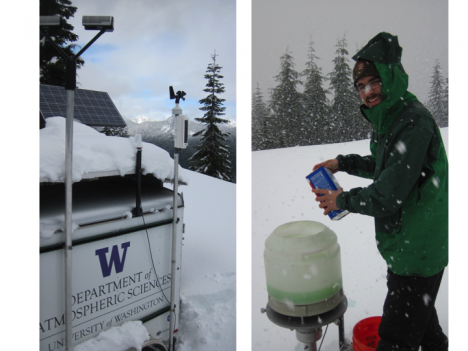
Some of the key quantities that we need to measure are the snow characteristics, i.e. the shapes, sizes and water content of falling snowflakes. In order to do that, instruments that measure these characteristics needed to be placed at elevations that frequently experience snow. The best location we found is on the north side of the Olympic Mountains at Hurricane Ridge within the Olympic National Park. We installed a Micro Rain Radar (MRR), a Parsivel Disdrometer and a Precipitation Imaging Package (PIP) which are shown below. The PIP works especially well in this environment as it can accurately collect data in strong winds, such as the 80mph winds that frequently accompany the winter storms as they assault the aptly named Hurricane Ridge.
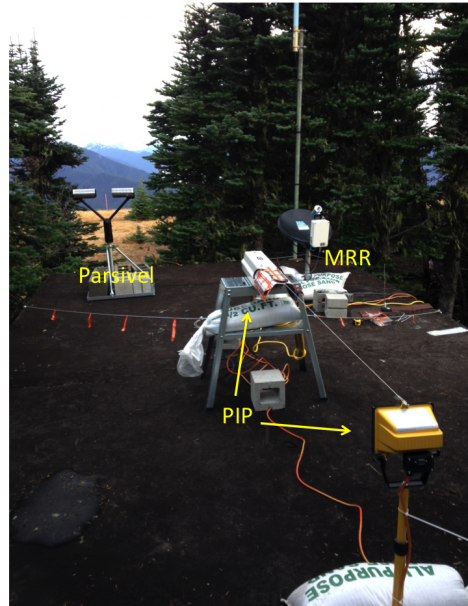
These instruments measure the characteristics of falling rain and snow. They include a Parsivel Disdrometer, and Micro Rain Radar (MRR) and a Precipitation Imaging Package (PIP). The MRR is a upwarding looking radar that measures fall velocity of rain and snow. The PIP is a high speed camera that takes pictures of the falling precipitation. Photo by Matt Wingo.
However, none of the instruments could quite handle the major snow dump we experienced in late December! Snow continues to accumulate and right now there is approximately 240 cm, or close to 8 feet of snow on the ground at Hurricane Ridge (luckily not covering our instruments!).
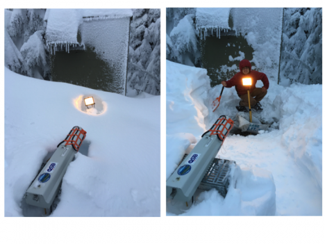
It’s hard to make measurements when your instruments are buried by 5 feet of snow. Thank you CJ Uhrnes of the Olympic National Park for digging out the PIP last January. Photo by Joe Zagrodnik.
Another way we are measuring snow and rain is with an instrumented trailer. The trailer is parked for the winter just outside the National Park at location at 3000’ elevation, where both rain and snow can fall any time throughout the winter.
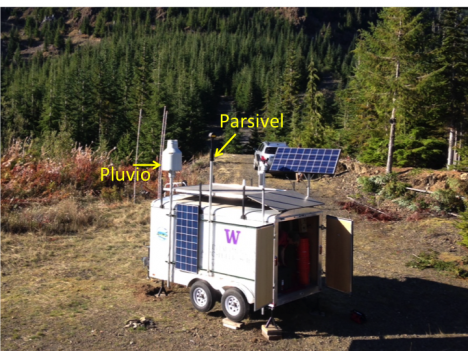
Instrumented trailer installed on the southern side of the Olympic Mountains. The Pluvio and Parsivel are mounted high on the trailer to keep them above the accumulating snowpack. Photo by Joe Zagrodnik.
The trailer has a Pluvio type of rain gauge and a Parsivel Disdrometer. The Pluvio is a very sensitive weighing type rain gauge that has a glycol mixture in it so falling precipitation, either liquid or frozen, will melt and the liquid equivalent is measured. The Parsivel Disdrometer measures the sizes of the falling drops or snowflakes and has a thermometer so we can tell if it is below freezing. Earlier in the project when the radars and airplanes were flying in storms, this trailer mostly experienced rain. However starting in mid December, the storms became colder and the trailer frequently experienced snow. Sometimes a bit too much snow.
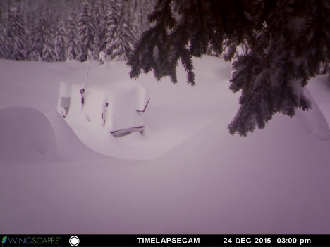
Photo taken December 24, 2015 by the remote camera monitoring the snow accumulation at the trailer. This snow came from the same series of storms that buried the PIP at Hurricane Ridge shown above.
A team of National Park rangers and our own graduate students often had to hike, ski or snowshoe to the trailer to dig it out, empty the Pluvio or recharge the batteries. In one 10 day period in early December, the trailer recorded over 40” of precipitation. That is more than the average annual precipitation in ‘rainy’ Seattle. So far, it has recorded over 200” of precipitation (liquid – Snow Water Equivalent, SWE) since October 1, and during the latest visit to the trailer around March 7, there was a foot of new snow.
Photos taken of the most recent trip to the trailer in early March. Our hero, CJ Urhnes is emptying the Pluvio. Photos by Bill Baccus.
Another important part of measuring snow is measuring the snowpack. Currently there are only 4 SNOw TELemetry or SNOTEL locations in the Olympic Mountains. These are permanent installations that make long term measurements of snow depth, total precipitation and other meteorological measurements (http://www.wcc.nrcs.usda.gov/snow/). In the Olympics Mountains, these are located mostly in the northeastern section. However, our focus was on the south and southwestern sides where there are no SNOTEL sites. In order to document the accumulating snowpack and the eventual melt-off, Dr. Jessica Lundquist of the Civil and Environmental Engineering Department at the University of Washington and her team of hardy graduate and undergraduate students installed snow stakes and remote cameras at 18 locations within the higher terrain on the southwestern side of the Olympic Mountains. Each site was installed in the summer in a series of backpacking trips deep into the wilderness areas.
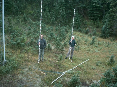
Bill Baccus of the Olympic National Park and Joel Massmann installing calibrated snow stakes in the Olympic National Park. Photo by Adam Massmann.
The cameras are installed in trees and take pictures of the stakes (with marks every 10 cm) several times a day. As the snow falls, the total on the ground is measured by the snow stake and photographed by the camera. Then the following summer the memory card from the camera is retrieved and analyzed.
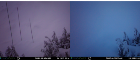
Photos taken by remote cameras during the 2014-15 snow season. The photo on the left shows three snow stakes measuring the snow depth. The photo on the right is taken after the snow stakes were obliterated by an avalanche. Now you see ’em, now you don’t. New snow stakes were installed for 2015-16 season in a different location that (hopefully) doesn’t experience avalanches.
Sometimes the students found that the stakes were mysteriously bent. They speculated that either wind or avalanches caused these problems. However at one site, the local inhabitants appeared to want to have a say in the new decorations of their meadow.
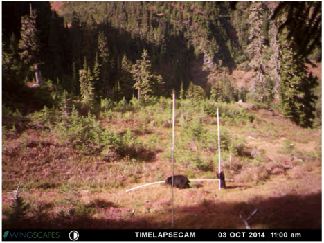
Mama Bear and Baby Bear trying to move the snow stakes to a ‘better’ location. Photo taken by the remote camera in October 2014.
A key component to interpreting the data from snow cameras is to have measurements of the density of the snow pack. That way the snow depth as photographed by the cameras can be converted to SWE, which tells how much water is stored as snow. That can only be done through direct measurements of the snowpack through snow surveys. For OLYMPEX, there will be two snow surveys, one in midwinter and one at the peak snowpack in April. The midwinter snow survey took place last February and is shown below. Here they are weighing the snow collected by the tube in order to calculate the density of the snowpack.
Making snow density measurements in the Olympic National Park. Photo by Bill Baccus.
Lastly, coincident with the snow survey, measurements of the snow depth over the entire Olympic Mountains were taken by Lidar instruments aboard the NASA Airborne Snow Observatory (ASO) plane of JPL (aso.jpl.nasa.gov). A second flight will take place in April coincident with the next snow survey.
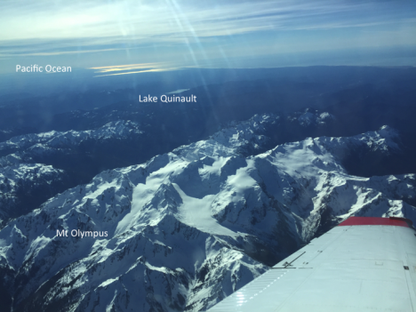
Photo taken from the ASO Lidar flight over the Olympic Mountains. Mt. Olympus, Lake Quinault and the Pacific Ocean are all visible in this image. Photo by Liz Duffy.
OLYMPEX– measuring rain and SNOW – over the Olympic Mountains.
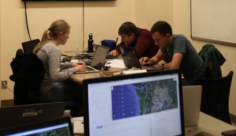
Today’s post will be a ‘guest’ post from Luke Madaus, expert weather forecaster, numerical modeler and graduate student from the University of Washington.
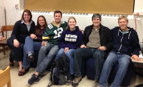
The OLYMPEX forecast team. From left: Sarah Bang, Leah Campbell, Nick Weber, Jen DeHart, Luke Madaus and Joe Zagrodnik. Not pictured: Peter Veals and Trey Alvey.
A Day in the life of an OLYMPEX forecaster by Luke Madaus.
When people think of field campaigns, they usually think of windblown scientists, struggling against the elements to get those critical observations of the fantastic weather surrounding them. Be it flying in planes, scanning with a radar or fixing a ground station, all these intrepid scientists would be nowhere unless they had some idea of what was coming at them, weatherwise.
That’s where we come in.
We are the forecasting team, the unsung (or, at least, the background chorus of) heroes that don’t actually get out into the field, who rarely leave the climate controlled operations center, but provide the critical guidance that’s needed to make sure the day goes smoothly. Here’s what a day in our life is like.
The time our day begins as a forecaster depends on what’s going on that day in the field operations. If there are aircraft involved, we may have to be ready to go in the middle of the night, as a 3 hour preflight forecast is needed to evaluate last minute changes and reaffirm the safety of the flight. But let’s say for now that today is a day where the planes are not taking off early in the morning. In that case, the lead (and helper) forecasters arrive around 7 AM to get a head start looking at the latest weather model runs. We work together to discuss the latest model forecasts and what they’re showing. Here at the OLYMPEX operations center we keep a running timeline of the next five days or so, updating it as new forecast models come in and our perception of the forecast changes.
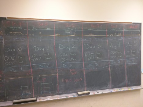
The timeline is updated every day and shows the timing of storm systems by various forecast models and timing of radar and aircraft operations.
The main goal for the first few hours of the morning is to become familiar with the current observations, latest model runs, and then prepare that information for the morning weather briefing. Our task for this briefing is to develop a narrative timeline for the next several days of what to expect over our study area. For instance…when is the next cold front due to arrive? How long will the frontal precipitation linger? Will there be any postfrontal showers? Interwoven with that are evaluations of potential hazards for the field campaign operations. For example, recently we’ve had lake flooding nearly drown the Doppler On Wheels radar and high winds have kept planes grounded when we wanted them to fly. Any possibility of hazards to operations needs to be voiced.
Forecasters getting ready for the morning briefing, Jen Dehart (left), Luke Madaus and Nick Weber (right).
We’re also challenged to present the uncertainty in the forecast. We look at multiple models, both deterministic and from ensembles, to assess confidence in the narrative timeline we are developing. Sometimes it’s easy, sometimes it’s a challenge. For instance, here are two model forecasts for sea-level pressure and 10m wind speeds along the western Washington coast. On the left is a 36 hour forecast for one afternoon, on the right is the forecast from the next model run. Surprise! A low pressure center with strong winds is now indicated! It’s our job as forecasters to assess the likelihood of these various scenarios and report on what we think will happen (and our confidence levels) to the mission scientists.
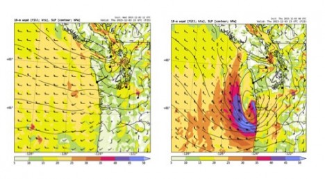
Two model forecasts valid at the same time. The one on the left shows light to moderate winds. The one on the right shows a developing low and strong coastal winds. Which one will be right?
That responsibility continues through the morning weather briefing, when the mission scientists review our forecast narrative and ask us questions. How certain is the forecast? What is the expected structure of the precipitation? Will it rain or snow in the mountains? Will the convection be deep or shallow? This is what we’ve been preparing for as a forecaster all morning so we are able to say, “Aha! I have the answer for you!” and impress the operations and flight directors.
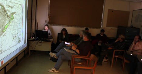
Jen DeHart gives the morning briefing while operations and flight directors and other scientists listen.
Following the morning weather briefing, if no aircraft are flying we linger with the scientists to answer questions as needed as they develop their plan of attack. But if planes are flying, we switch from forecasting to nowcasting. Our job is to sit with the flight director and respond to questions from the flight director, mission scientists, and the flight crews about what’s going on in the weather right now and where to direct the planes next. Keeping knowledge about the short term forecast is critical, as we are expected to evaluate many variables, such as how the melting level is going to evolve in the next few hours, where and when convection may develop and how the winds may change at the airport locations. The trick is to be straightforward, to the point, and anticipate what will be asked next. All of this ensures smooth operations and a successful mission.
Prof. Ed Zipser of University of Utah, Flight Director for OLYMPEX, watching a flight in progress. He communicates with flight scientists via x-chat and determines the locations the aircraft will fly.
There often is an evening briefing before expected flights the following day. These are shorter and more informal than the morning briefing. However, we are expected to update the forecast narrative based on new model forecasts and current observations. Since our region of operations is the west coast, we rely heavily on satellite data over the Pacific Ocean to really understand what is going on and heading our way, so satellite interpretation skills are essential.
Lead OLYMPEX scientists and operations directors Dr. Lynn McMurdie, Prof. Robert A. Houze, Jr., and Dr. Walter Petersen (left to right) discuss the current situation and operation plans during a morning briefing.
Once we’re done with briefings and flights, we’re home free! But wait, there may be an early flight the next day, so it’s time to order pizza, catch a nap and be ready at 1AM. But that’s all in a day’s work for an OLYMPEX forecaster at the operations center.
Ground-based weather radars are a critical component of the OLYMPEX project on the Olympic Peninsula. Situated near the coast, NASA’s NPOL radar records precipitation data over the ocean and toward the mountains. As with any scanning weather radar, the beam width and height above ground increases with distance from the radar. Therefore, even though NPOL is scanning toward the mountains, the lower portions of the Quinault Valley are being missed.
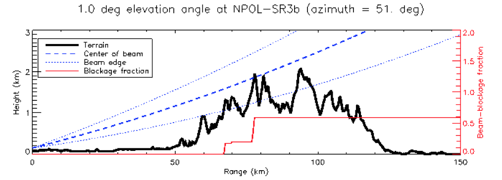
Figure showing the beam spread for a 1-degree elevation angle scan for NPOL. Terrain profile shown in black. Red line shows the percentage of the beam blocked by the terrain.
To fill in this low-level gap in data, a Doppler on Wheels (DOW) weather radar (funded through the National Science Foundation) is deployed at Lake Quinault. This mobile radar is commonly known for tracking tornadoes across the plains of the U.S., but for OLYMPEX, the radar is sitting still in a yard and scanning up the valley toward the mountains.
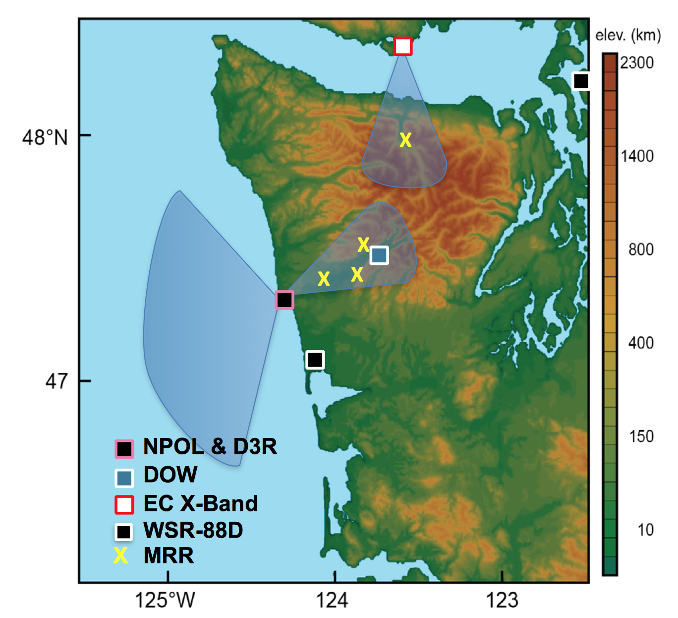
The OLYMPEX radar network showing the NPOL scanning region and the DOW location in the Quinault Valley. Environment Canada is also operating a weather for the project, scanning the northern side of the peninsula from Vancouver Island.

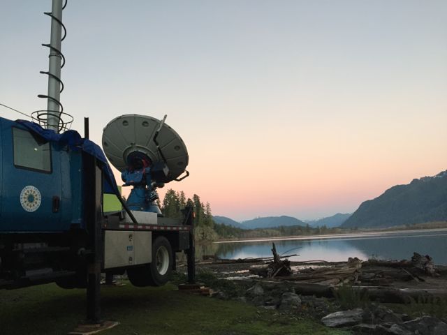
The Doppler on Wheels radar operating near Lake Quinault. (Photo credit: Hannah Barnes)
The DOW radar scans vertical slices through precipitation up the valley toward the mountains.
Inside the truck, surrounded by transmitters, antenna controls, and computers, the scientist on duty monitors the real-time data being collected, taking notes on interesting observations and making sure the quality of data is adequate. We also monitor internal and external data storage (the data is saved in several locations), make sure the radar is scanning the correct sequence, and check on other radar data to see the bigger picture beyond the valley.
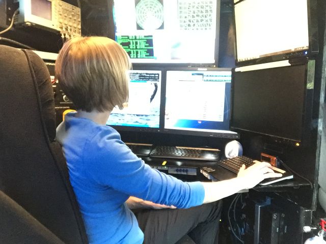
Dr. Angela Rowe (UW Research Scientist) monitoring data inside the DOW truck.
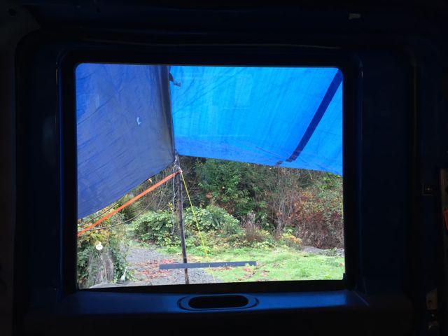
Our window to the rainforest from inside the DOW.
Here is an example of the type of data we can collect with the DOW. These images show several of the dual-polarization radar variables from a vertical slice through a precipitating storm toward the mountains. Reflectivity is the intensity that you typically associate with radar data seen on TV. In this case, weak intensities are generally observed due to the widespread light rain of this system. The higher intensity line near 2 km height is called a “brightband” and represents where the snow above is melting to form rain below. We monitor the intensity and height of this brightband scan-to-scan, storm-to-storm, and a how it changes between the radar and the mountains. The radial velocity is the Doppler portion of the radar, showing airflow towards (blues/greens) and away (reds/oranges) from the radar. In this example, most of the wind is coming from the southwest, flowing up the valley, but there’s a shallow area near the ground of down-valley flow toward the radar. This shallow down-valley flow would likely be missed by the NPOL radar near the coast, highlighting the value in having the DOW located further up the valley. The other variables shown in the bottom portion of this panel also help us understand the precipitation processes, where the brightband is seen clearly as enhanced differential reflectivity and reduced correlation coefficient.

Example of DOW radar data, showing a vertical slice through a precipitating system. Dashed arrows point to the brightband, where snow above is melting to rain below. Block arrows in the velocity image indicate the direction the air is moving.
This intriguing pattern of up- and down-valley flow has varied throughout the project, highlighting the complex influence of the local topography on the storms. We could regularly monitor this pattern on the radar, but at times, could also see the complex flow pattern by eye, as winds changing speed and direction throughout a shallow layer led to mesmerizing cloud patterns such as Kelvin-Helmholtz wave clouds.
Kelvin-Helmholtz wave clouds as viewed from the DOW site (Photo credit: Hannah Barnes)
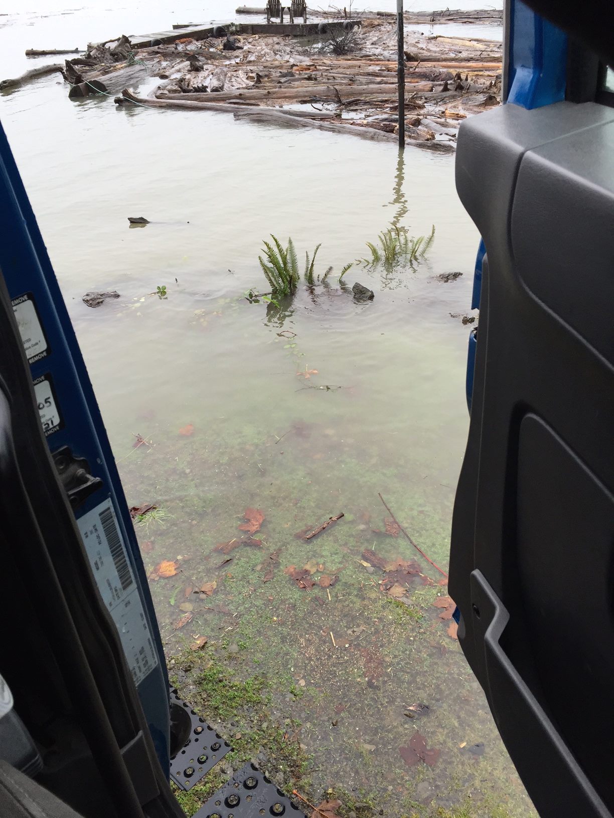
Early in the project, a series of storms led to enough rain and snowmelt to almost have to make use of the mobile ability of the DOW. Lake Quinault rapidly rose to 14 ft, spilling into the yard and causing concern for the DOW operations.

Lake Quinault spills into the DOW yard after a major precipitation event (Photo credit: Hannah Barnes)
Lake Quinault knocks on the DOW door. (Photo credit: Megan Chaplin)
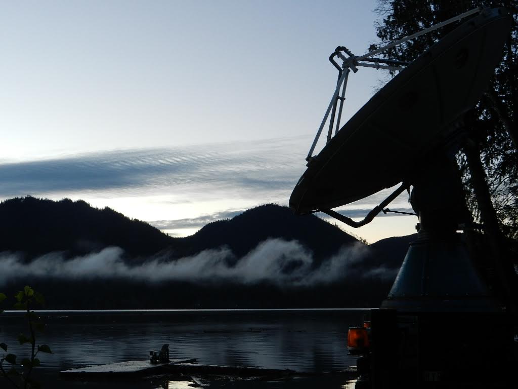
Thankfully, the precipitation stopped and the water receded before the DOW had to be moved. After this drenching start to the project, a strong high pressure system cleared the skies and halted DOW operations. The clear, calm skies led to fog formation over the relatively warmer lake, providing a beautiful view at the DOW house.
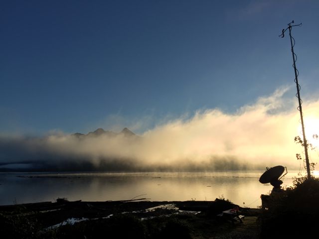
Fog over Lake Quinault as viewed from the DOW location (Photo credit: Angela Rowe)
This rain-free period allowed us to catch up on data analysis. We set up computers in the house where we could access all the data that has been collected thus far, providing us with an opportunity to dig deeper into the fascinating science of these exciting events. Plus, the view from our DOW house office isn’t so bad.
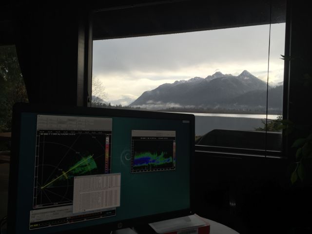
Analyzing DOW data from the DOW house office. (Photo credit: Angela Rowe)
We are so thankful for the wealth of data collected during the first few weeks of the project. And we are so thankful that the atmosphere decided to give us clear skies for Thanksgiving, allowing for the first full down day of the project. This provided many of the local participants at the UW operations center an opportunity to spend time at home with family on this holiday, while those of us at the DOW had the chance to explore the beautiful Quinault Valley.
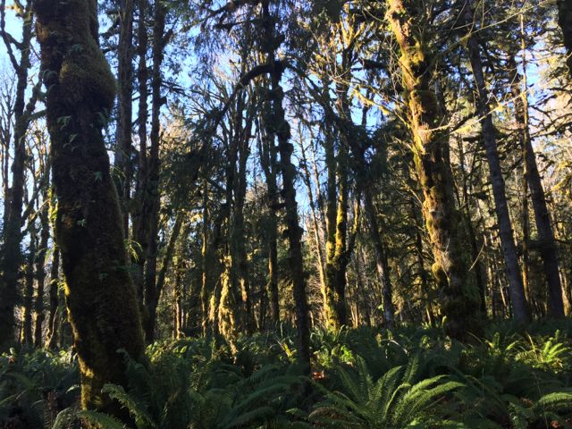
Known as the Valley of the Rainforest Giants for the record-holding sizes of many tree species, the Quinault Rainforest reminds us of the incredible impact the large amounts of precipitation has on the area. After spending several days staring intently at computer screens, it was refreshing to gaze in wonder at the giant trees, to feel their mossy coats, to smell the fresh air and wet ground, to listen to the river and streams flowing through the valley, and to give thanks for the rain and snow we are studying that allows this beautiful place to exist.
Quinault Rainforest on Thanksgiving Day (Photo credit: Angela Rowe)

Quinault Rainforest (Photo credit: Angela Rowe)
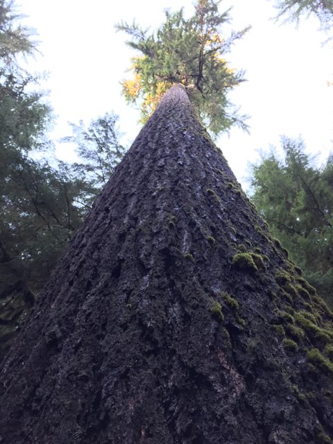
Large Douglas fir tree in the Quinault Rainforest (Photo credit: Angela Rowe)

Frosty fungus of the Quinault Rainforest (Photo credit: Angela Rowe)

Frosty fern in the Quinault Rainforest (Photo credit: Angela Rowe)
After this welcome break, the rain has thankfully returned. The DOW continues to collect fascinating data in the Quinault Valley and the forests of the valley continue to inspire awe.
Happy (belated) Thanksgiving from the DOW crew.
The western side of the Olympic Mountains is a sight to behold, with crashing waves along the rocky coast and mossy trees in the rain forest signifying the impressive amounts of precipitation that falls in this area. The ongoing Olympic Mountains Experiment (OLYMPEX) is set up to measure rain and snow over the ocean up to the highest mountain peaks using airborne and ground-based instruments. As part of this project, NASA’s ground-based weather radar, NPOL, sits atop a hill on the Quinault Indian Reservation, with clear views out over the ocean and up the Quinault valley toward the snowy mountains.
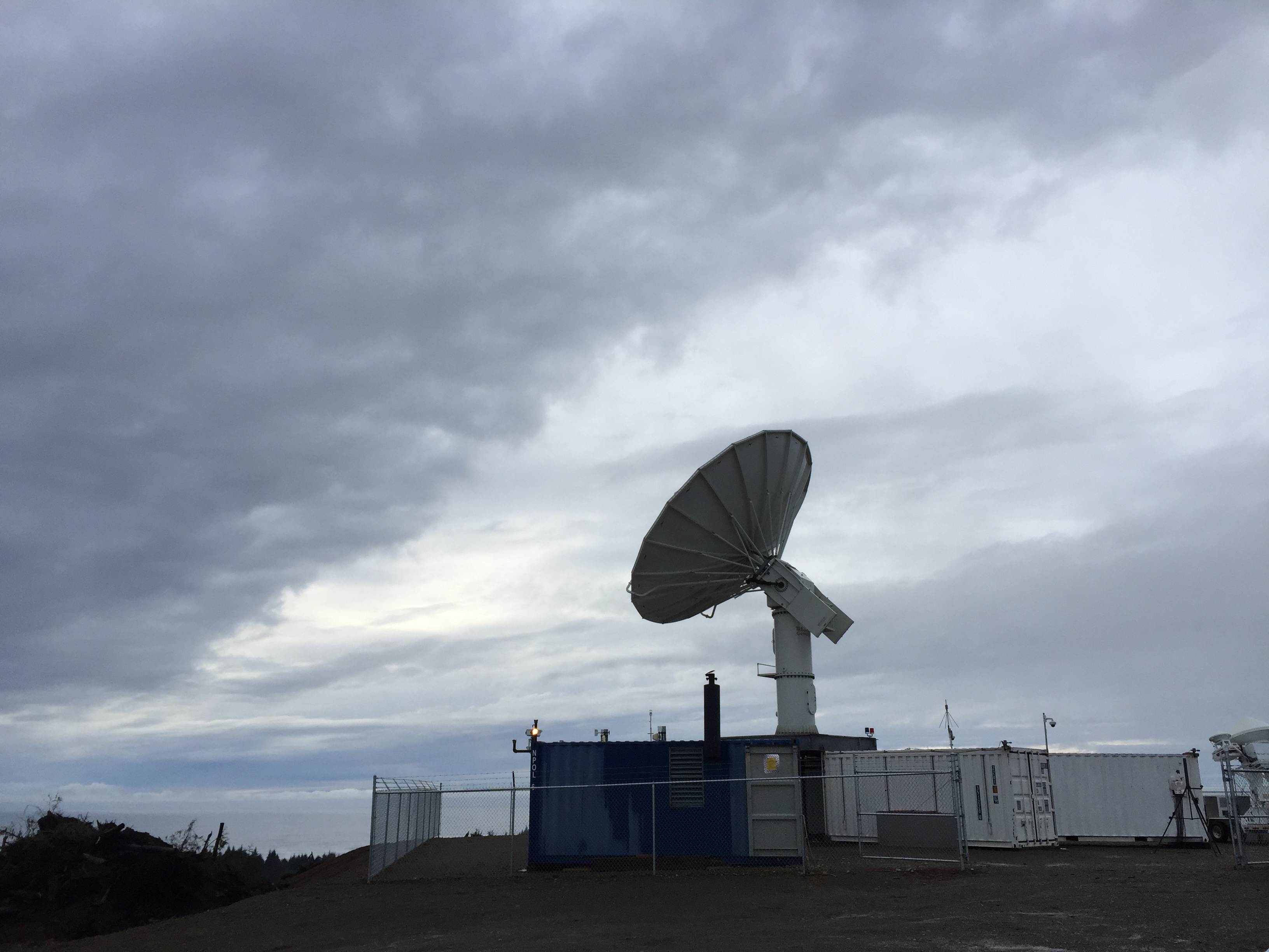
NASA’s weather radar (NPOL) on the Quinault Indian Reservation (Photo credit: Dr. Angela Rowe, UW)
As a Seattle resident, I, Dr. Angela Rowe, spend a lot of free time exploring the forests of the Olympic Peninsula. As a Research Scientist in the University of Washington’s Department of Atmospheric Sciences, I spend my work day (and honestly a good bit of my free time) using weather radar data to better understand storms around the world. To have the opportunity to combine both of my passions into one project seems too good to be true.
On a drizzly, foggy morning, I pack up my truck with supplies (water, canned soup, a warm blanket) and drive 20 minutes to the radar site. Half of this journey involves ascending a steep road prepared just for this project. It’s a slow-going trip as the creatures of the peninsula (deer, coyotes, rabbits, etc.) could jump out at any moment. It’s also worth driving a little slower to take in the eerily beautiful scene.
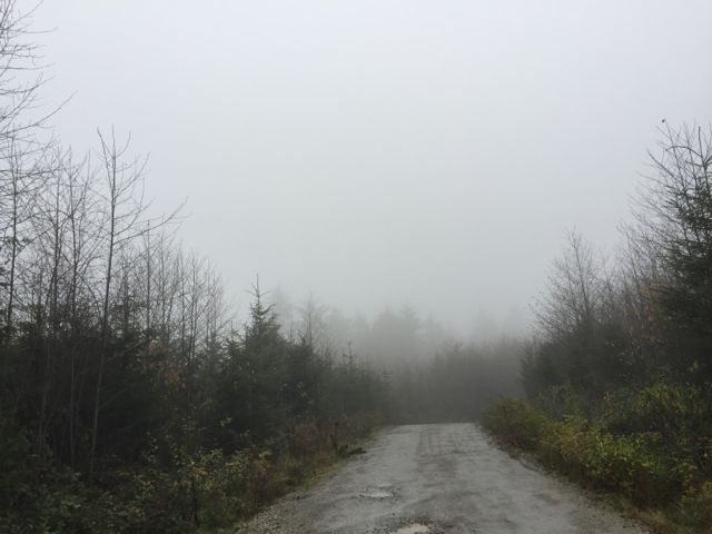
Foggy road to NPOL (Photo credit: Dr. Angela Rowe, UW)
I reach the radar to see the site blanketed in cloud. My view may be limited, but the NPOL radar can “see” out to nearly 135 km (> 80 miles).
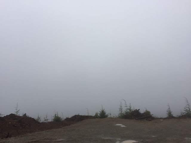
The “view” from the NPOL site on a rainy day.
The NASA NPOL and D3R weather radars scan the clouds. NPOL’s frequency is best for looking at precipitation, while the D3R’s dual frequencies are better suited for thin, nonprecipitating clouds than NPOL. (Photo credit: Dr. Angela Rowe, UW)

Example 360-degree low-level scan from NPOL, showing widespread precipitation.
NPOL sits atop 5 containers, which were used to ship the radar out to the site. One of these containers serves as the “office” for the radar scientists on duty. With 12-hour shifts (the radar operates 24/7), it’s important to find a way to get comfortable in this space, shared with several other scientists.
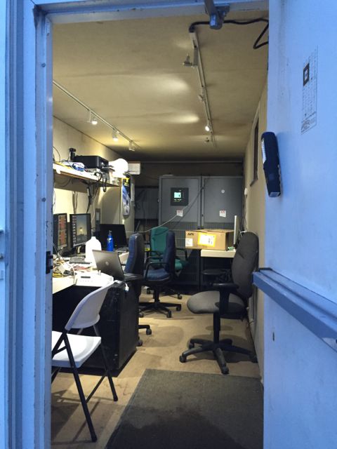
Peeking into the NPOL scientists’ trailer
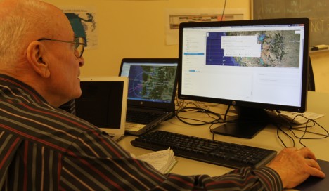
The NPOL radar scientist occupies the back left corner of the trailer, where we have a laptop set up to record and analyze data. Real-time displays of the data sit to my left so I can keep a watchful eye to make sure all is running smoothly. The radar engineer on duty is nearby in an adjacent trailer, waiting to help if things go awry.
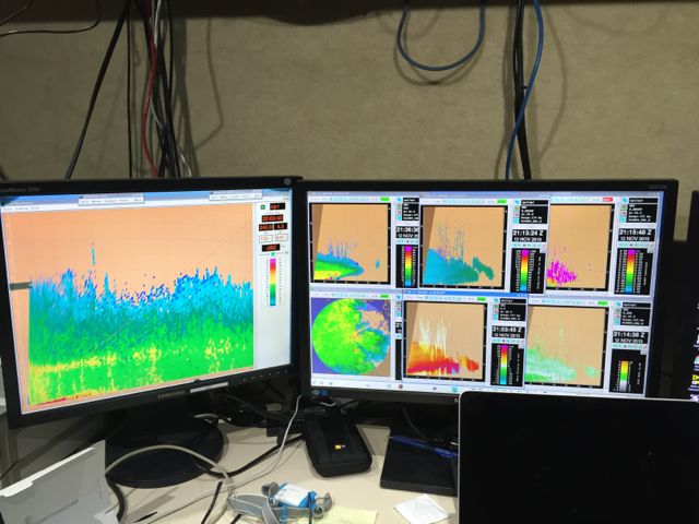
NPOL real-time display, showing a vertical slice through a precipitating storm.

Dr. Angela Rowe (UW), NPOL radar scientist on shift, monitors data
In addition to monitoring and analyzing radar data, the radar scientist on duty is also responsible for helping launch “soundings”. There is an instrument (called a radiosonde) that is attached to a large balloon which is then released into the atmosphere at a specified time. Data is transmitted back via an antenna located near the radar, providing us with vertical profiles of temperature, humidity, pressure, and winds throughout the atmosphere. This is a routine task under most circumstances, but on the stormy days we are studying for OLYMPEX, the wind and rain can add some obstacles. On this day, with over 30 mph winds out of the southwest and heavy rain at the site, it took four of us to launch the sounding, sliding along the muddy ground as the balloon pulled us toward the northeast.

The balloon is inflated with helium in another one of NPOL’s trailers, after which the instrument is attached and we head outside to launch the sounding. (Photo credit: Dr. Angela Rowe, UW)
After a successful launch, high fives seemed appropriate as we went back into the trailer, took off our rain gear, and began to watch the sounding data come in. This information serves as the environmental context for our radar observations. How is the wind profile affecting the storms? How are the storms feeding back on the temperature and moisture levels of the environment? At what level in the atmosphere is the snow turning to rain? Is that level the same across the area? How are the mountains playing a role? These are important questions we are trying to answer at the NPOL/sounding site.
In 3 hours, it’s time to put on our rain gear again (the OLYMPEX version of a scientist’s lab coat) and prepare to launch another balloon. It’s cold, wet, and windy,…and we wouldn’t want it any other way.
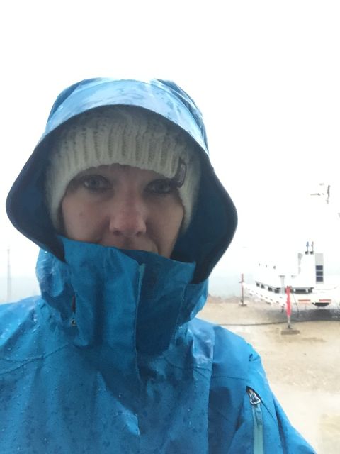
Dr. Angela Rowe (UW) heads out into the wind and rain to help launch another sounding.
At the end of the 12 hours, I head back out into the rain for the final time that day. It appears that I’m not the only one excited about the rainy day, as a northwestern salamander was sitting outside the trailer!
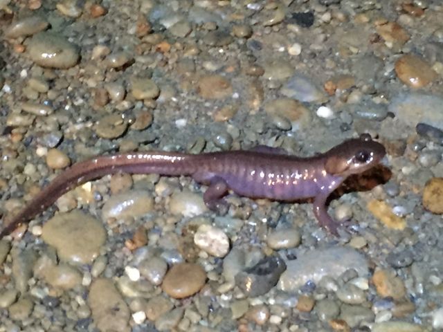
Northwestern salamander (Photo credit: Dr. Angela Rowe, UW)
I leave the residents of the NPOL site behind and slowly drive back down the dark, winding road, reflecting on the exciting day and ready to do it all again tomorrow.
It’s been a very busy week as OLYMPEX gears up for full operations. The last ground site was installed yesterday and the full network is collecting data. We have learned a lot from these sites alone and have already sampled some intense storm systems laden with rain. The four radars are installed, or being installed, with two of them already making measurements of the three dimensional structure of approaching storms. Two aircraft have arrived and will be ready to fly later this week. The third is performing test flights and will be ready to fly missions next week. All these preparations are just in time – the forecast is for a major, very wet 2-day storm system to impact the Olympic Peninsula at the end of the week with rainfall totals potentially as much as 200 – 250 mm (8 – 10 inches) of rain. Yikes – be careful what you ask for!
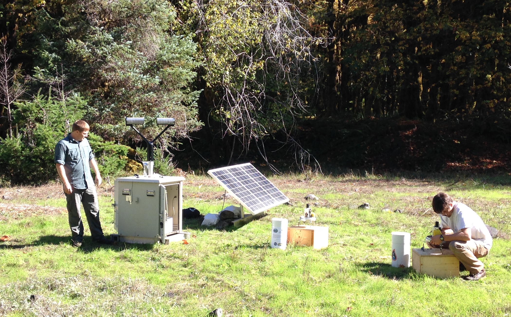
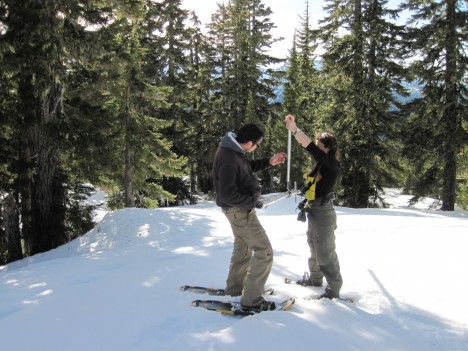
Matt Wingo (NASA) and CJ Urnes (Olympic National Park) install rain gauges and a Parsivel disdrometer (an instrument that measures sizes of falling precipitation) in the Olympic Mountains. (Photo by Joe Zagrodnik)
The photo above of one of our ground sites was taken in early October when it was still nice and sunny. Those were the days!

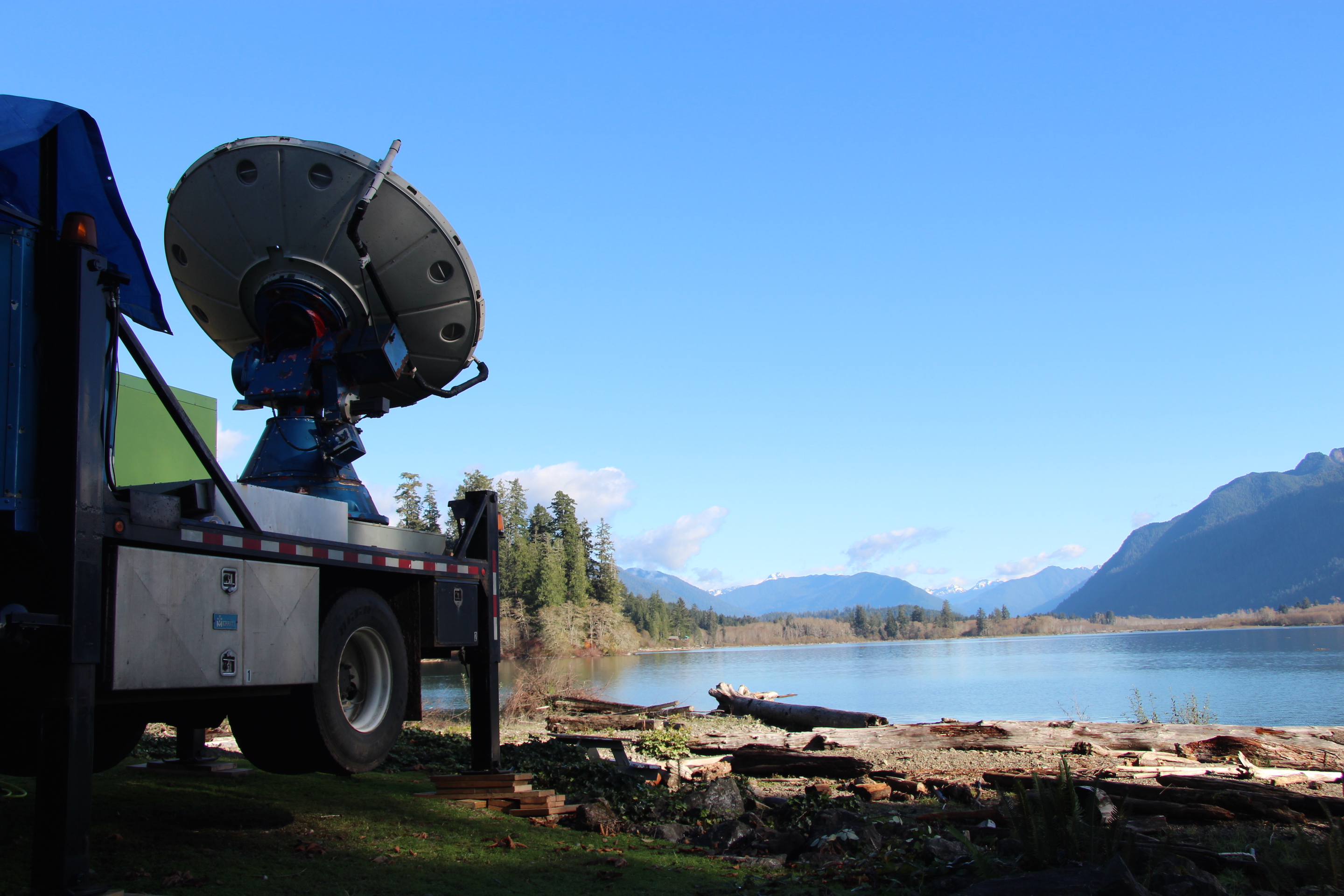
The S-band weather radar called NPOL and the Ku- Ka-band radar stand ready to sample storms. Photo by Dr. Angela Rowe
In the above picture, these two radars (NPOL, obvious in the middle, and the Ku- Ka-band radar called D3R, to right) are situated so they have a clear view to the ocean to sample oncoming storms and a clear view to the Olympic Mountains to sample the storms as they interact with the terrain.
The Doppler On Wheels situated to view precipitation systems as they approach the mountains. Photo by Joe Zagrodnik
The Doppler On Wheels (DOW) shown above has already been collecting fascinating data. We’ve found evidence that even minor terrain features can alter the cloud and precipitation structure above it producing small pockets of slightly enhanced precipitation.
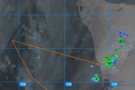
The DC-8 made its transit flight to McChord Airforce Base today (shown above in the screenshot made realtime during the flight) and they managed to fly over some light precipitation over the Olympic Peninsula. Precipitation won’t be light later this week, if the rain forecast verifies. We’ll be ready for it!
