A Powerful Landscape
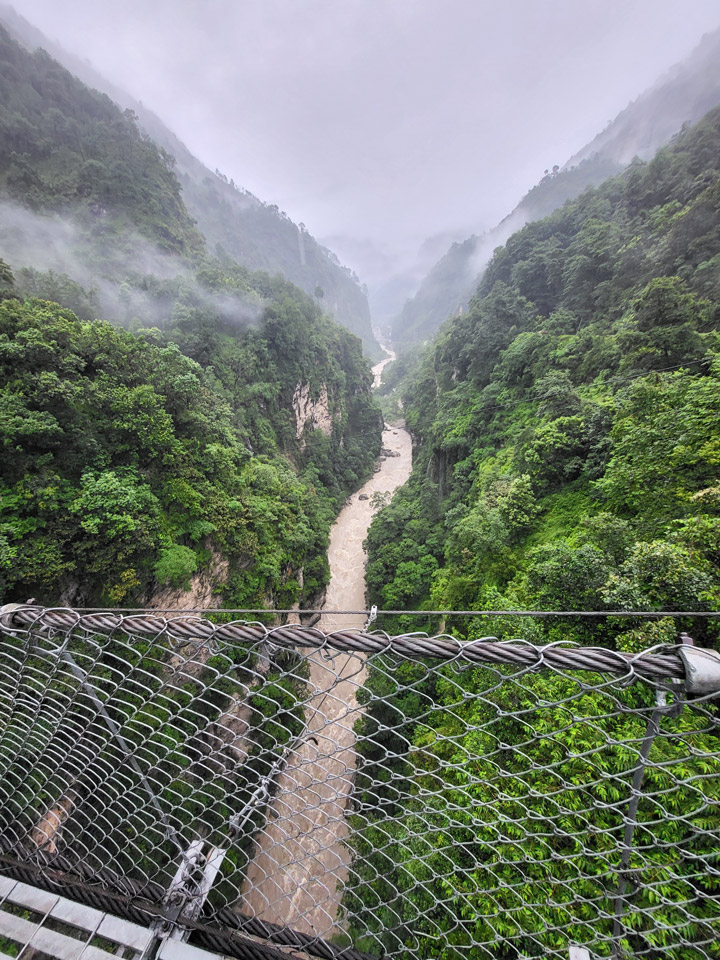
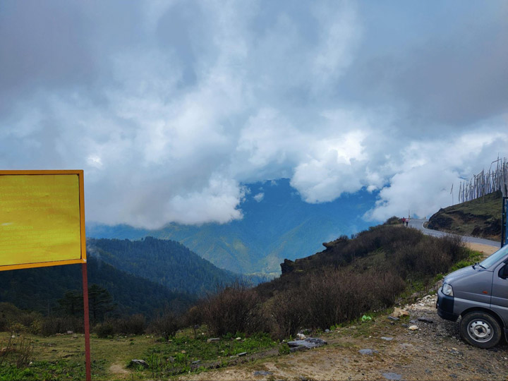
Umbrella in one hand, I gripped the metal cable of the suspension bridge as I looked down into the boiling Bhotekosi River coursing below me through a steep, verdant canyon. Due to the steep slopes, fragile geology, and frequent rainfall, Nepal is especially subject to natural disasters including landslides and flooding.
I found myself in this powerful landscape because I work for SERVIR, a joint NASA and USAID program that works with leading regional organizations to help countries worldwide use Earth observations and geospatial technologies to address environmental challenges. I joined a group of scientists and disaster risk reduction practitioners on a trip to view major landslide sites and better understand what satellite data can tell us about the landscape. Driving up from Kathmandu, we passed by small villages, hydropower plants, bulging retaining walls holding back hillsides, and the aftermath of past destructive landslides.
As an applied remote sensing scientist, I seek to understand the physical processes driving these hazards, how satellite data can capture these processes, and how the information from satellite data can complement the existing systems used for planning, early warning, and disaster response. While satellite data has the distinct advantage of consistently receiving data over large regions of the world, it is only a single perspective.
Visiting the field, talking to experts, and consulting with end users is critical to designing a product that is effective at reducing loss of lives and infrastructure due to natural hazards.
Cascading Hazards in Nepal
Cascading hazards (or ‘multi-hazards’) are events where one hazard triggers or increases vulnerability of a second hazard, such as a landslide that blocks a river and creates a flood. They pose a challenge to disaster managers since they can evolve quickly and the outcome can be difficult to predict. Nepal’s predominantly rural population is increasingly at risk as climate change drives extreme and erratic precipitation events that trigger cascading hazards.
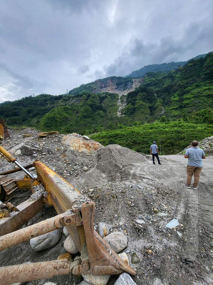
During our drive, we stopped to look at the site of the Jure landslide on the right bank of the Sunkoshi River. In 2014, the Jure landslide broke free from the steep valley walls, plummeting thousands of meters to the valley floor, blocking the river, and destroying over 100 homes and lives. The natural dam quickly caused water to back up, posing a serious flood risk to upstream towns and damaging hydropower infrastructure. The Nepal Army and Police force acted quickly to dynamite a section of the dam to release some of the water downstream, but even after this quick action the threat of catastrophic flood remained. Fortunately, a month later when the dam breached, no major damage was caused by the flood waters. In addition to loss of lives and homes, damage to the road interrupted necessary services, disrupted the primary trade route with China, and impacted the tourism trade.
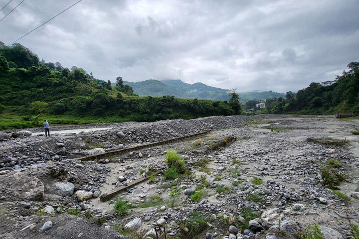
In addition to precipitation events, several factors increase the chance of cascading hazards in this region: glacial lakes, snowmelt, permafrost degradation, glacial deposits, high relief, and fragile topography. The Melamchi flood disaster that occurred June 15th of 2021 was triggered by heavy rainfall at higher elevations and snowmelt. This increased amount of drainage caused a glacial lake to breach. The consequent erosion of glacial deposits and natural dams downstream resulted in severe flooding that carried debris the size of boulders and triggered further landslides and riverbank erosion.
The communities here are familiar with the risk of natural hazards. They know that there is a higher risk of landslides when it rains. The current mechanisms for warning are primarily word of mouth, phone calls, text messages, and social media posts. Despite these warnings, many lives are lost during these disasters. There is still a need for an integrated multi-hazard early warning system.
The Satellite Perspective
Satellite data can be used to consistently monitor large areas for potential hazards, such as slopes at risk for landslides. Factors such as precipitation, soil moisture, slope, aspect, and even slow-motion movement can be measured via satellite and contribute to landslide hazard mapping.
NASA’s High Mountain Asia Team (HiMAT) is a group of scientists focusing on bringing the satellite perspective to these hazards. Thomas Stanley and Pukar Amatya from UMBC/NASA worked together with Sudan Bikash Maharjan from International Center for Integrated Mountain Development (ICIMOD) to develop a prototype landslide mapping and hazard awareness tool for the Karnali River Basin in Nepal. Collaborating with the National Disaster Risk Reduction and Management Authority (NDRRMA) and other government agencies, they are working to integrate the landslide hazard awareness tool into the planning and early warning process. In addition, a SERVIR applied science team is looking at how satellite radar systems can be used to monitor slowly moving slopes in the region.
The hazard awareness tool is known as Landslide Hazard Awareness for Karnali (LHASKarnali). It is a pilot project to adapt the global Landslide Hazard Assessment for Situational Awareness (LHASA) model for use in High Mountain Asia starting with the Karnali River Basin of Nepal. LHASA was previously regionalized for a SERVIR Applied Science Team project in the Lower Mekong region. It provides a one-day forecast of the hazard level for rainfall-triggered landslides by using precipitation forecasts. The LHASKarnali tool integrates forecasted precipitation from the High-Impact Weather Assessment Toolkit (HiWAT), which is managed by ICIMOD.
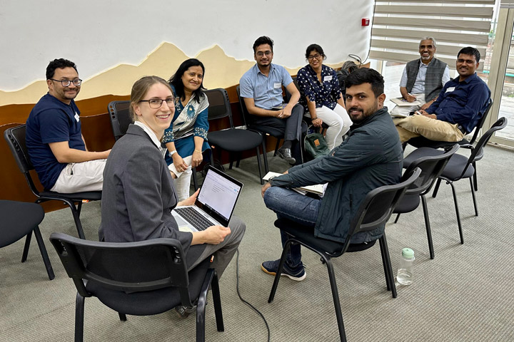
At a workshop prior to our field visit, we sought the insights of national stakeholders and academic experts, including the Department of Mines and Geology and the Department of Hydrology and Meteorology. Drawing from their experience assessing slope stability for high-risk communities, they felt that soil depth and soil moisture were among the most important factors controlling the occurrence of rain-triggered landslides. While satellite data can accurately provide data on slope, aspect, and rainfall, soil moisture is not well captured due to the steep slopes and high vegetation cover in Nepal. Although prior rainfall was used in LHASKarnali as a proxy for soil moisture, how this translates to soil moisture is unknown. These conversations helped end users think through the value of the tool and how their expertise could be used to enhance the end-product going forward.
The limitations of a 4-kilometer resolution product also stood out to participants. Response agencies like Practical Action emphasized the need to be able to identify vulnerable populations at a household or village level. Even smaller landslides can be highly destructive and more targeted warnings are important when evacuations and other high effort actions are required. Going forward, a partnership between the scientists and universities will contribute to an effort to increase the resolution of the landslide hazard forecast.
Looking Ahead
During my time in Nepal, I traversed steep river canyons, which showed me the challenge of capturing and interpreting the steep slopes and narrow rivers in satellite imagery. Talking with disaster management agencies like Practical Action and NDRRMA, I learned about the need for a joint system for multi-hazard assessment to understand the cumulative effects of landslides, floods, and other factors like the erosion of natural dams. Getting the opportunity to speak with communities and get feedback about satellite observations, such as concerns over the representation of soil moisture, help us get closer to achieving warning systems for these complex hazards.
With increasing extreme events due to climate change, being able to plan and react to these hazards is critical for resilience. It will take collective expertise and tools to tackle this complex challenge.
After five connecting flights—8,000+ miles and over 40 hours of traveling—our flight descended into the “Land of the Thunder Dragon.”
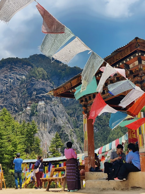
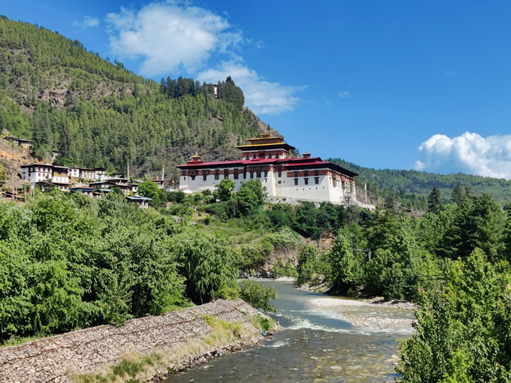
Our team from the SERVIR program made our way to the Himalayas to work with partners in Bhutan and demonstrate how NASA Earth observations and applied science approaches can align with the country’s unique environmental vision. Having grown up in the U.S., Bhutan certainly feels like a unique and rarified place. The legends of the towering snowy mountains, lush valleys, and unbelievably happy people are completely true. Also true are the legends of the harrowing descent into the country’s main airport. There is only one international airline that is allowed to fly into Bhutan, and I have heard tales that this measure is to ensure that only experienced Bhutanese pilots are guiding jets down through the narrow, twisting Himalayan valleys to reach the tarmac on the flat valley floor. Needless to say, I was very happy to have an experienced pilot at the yoke as we gracefully rolled and yawed down, cutting through the clouds and arriving in the amazing landscape of the Paro Valley.
The Kingdom of Bhutan is often known for its conservation and land management practices, and of course for its philosophy of “gross national happiness.” Bhutan is unique compared to other counties in that its constitution requires that 60% of the land remain forested to ensure social, economic, and environmental well-being for all. In addition, the country’s government famously follows a policy of measuring its progress not by its economic growth, but by the happiness of its citizens. This forward-leaning approach to both policy and the conservation of natural landscapes is just some of what makes Bhutan such a special place.
Since the 1970s, Bhutan has started to open its doors to foreign collaboration, and since the first democratic election in 2008, the Kingdom has made unbelievable strides to equip their next generation as regional leaders in science, technology, engineering and math (STEM), forestry, and sustainable agriculture—that’s where we align. SERVIR is a collaboration of NASA and the U.S. Agency for International Development. Our program assists communities in using geospatial science and Earth observing satellites to address and support their own environmental goals, collaborating with organizations to build tools that are demand-driven and tailored to local needs. The Department of State has been funding SERVIR to support STEM opportunities in Bhutan—but until now, that work has taken place entirely remotely through conference calls and webinars.
On paper, I was arriving halfway around the world to formally launch a new rice mapping tool and conduct capacity building trainings. But in the big picture, this visit really built the kind of connections with the Bhutanese community—university partners, NGOs, government agencies, as well as community members—that you just can’t achieve when combating an eleven-hour difference with a teleconference.

Back in early 2020, the Department of State and NASA Headquarters identified the opportunity to collaborate and support STEM opportunities in Bhutan through NASA’s Applied Sciences Program. Bhutan has never had diplomatic ties with the United States, but SERVIR and I took on the challenge to lead STEM initiatives and begin to collaborate with partners in the country to collaborate on geospatial solutions to environmental challenges. Through these efforts, we also had the opportunity to build ties between our two countries.
You know what they say about best laid plans. COVID presented a distinct challenge as we halted all in-person events, but we found ways to keep the project moving forward. In 2021, NASA’s DEVELOP program started special 10-week projects to help Bhutanese students living in the U.S. grow their geoscience and remote sensing skills while working with organizations in Bhutan (Bhutan Highlight). I was the lead science advisor on some of these projects, and it was a great opportunity to form meaningful connections with the brilliant Bhutanese students and the burgeoning geospatial community in Bhutan, even if we couldn’t yet meet face to face. NASA’s GLOBE program also got involved, helping to set up Earth science and geospatial workshops tailored to Bhutanese participants.
With SERVIR, I continued working intensively with our partners at Bhutan’s Department of Agriculture, as well as advising for more and more Bhutan DEVELOP projects connecting with over 30 Bhutanese scholars studying in the U.S.
Fast-forwarding, after two-plus years of extensive remote co-development of a geospatial crop mapping service and four virtual trainings focusing on remote sensing and applied Earth observation efforts, the conditions were finally just right for travel. SERVIR began to plot out our trip. Set for May 2023, we worked tirelessly with the State Department’s Bhutan Affairs Unit with partners from the Bhutan Foundation to plan the visit. The foundation was extraordinarily helpful, and they connected us with the Bhutan Ecological Society (BES), who aided us in designing a joint “training of trainers” workshop and did the unbelievably heavy lift of supporting our SERVIR team with logistics. Both the Bhutan Foundation and the BES not only made it possible for this trip to even be possible, but they also made us feel truly welcome.
A race against time, my entrance to Bhutan did not exactly proceed as originally planned. I was delayed a day en route, but my colleagues were thankfully able to arrive as scheduled. They met and became fast friends with our BES colleagues, starting off the journey with a tour. Twelve hours later, I got my connection in Kathmandu and when I touched down I was ready to run because our service launch was scheduled that same day. Floored by the sights, I ran to meet a representative from the BES who helped me hightail from Paro to Thimphu. After a two hour jaw-dropping road trip on a winding two-lane road, I made it just in time for our partners from the Ministry of Agriculture and Livestock and the Department of Agriculture to kick off the launch of the Agriculture Classification and Estimation Service (ACES).
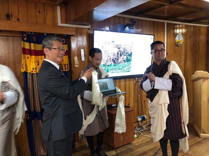
The launch of the ACES tool was a centerpiece of our visit to the capital of Thimphu. ACES was built in collaboration with the Bhutanese Department of Agriculture and provides the country with an automated system to map rice fields. At the launch event, we were lucky enough to be joined by several high-ranking members of the Department of Agriculture. I was thrilled to see the enthusiasm and excitement for what we had created together. The Department of Agriculture was so impressed that they invited other higher-ups from the local government to get involved, and our training planned for the next week hit max capacity.
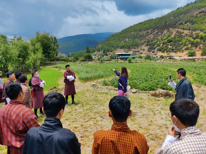
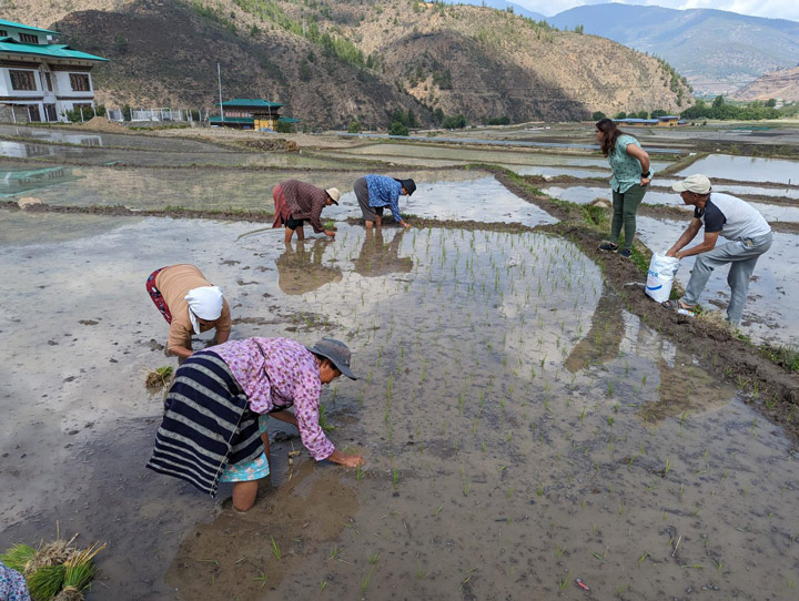
We then traveled back to the city of Paro to conduct a week-long training on using Earth observations and geospatial resources like ACES to manage agriculture. On the way, we crossed paths with a group of farmers as they were walking out to the rice fields, and they were kind enough to answer our questions. With the help of our interpreters, we were able to learn about the unique challenges of local cultivation, how communities cycle their crops, and the gender dynamics that influence local agriculture. We later were able to ask the same set of questions to the local Department of Agriculture, allowing us to understand these same topics from the perspective of the government. From these opportunities, we were able to come into our training with a deeper understanding and greater appreciation for what Bhutanese communities really want and need out of a rice-mapping tool.
With the help of the Bhutan Ecological Society, we had a full week to dive into the nuance and opportunities of using remote sensing, machine learning, and resources like Collect Earth Online. Thirty-one participants—20 men and 11 women—enrolled in the training, including regional land managers, economists, academics, and even some students. The training also included sections on field data collection using GeoFairy, a mobile application developed by Liping Di, a principal investigator with SERVIR’s Applied Sciences Team.
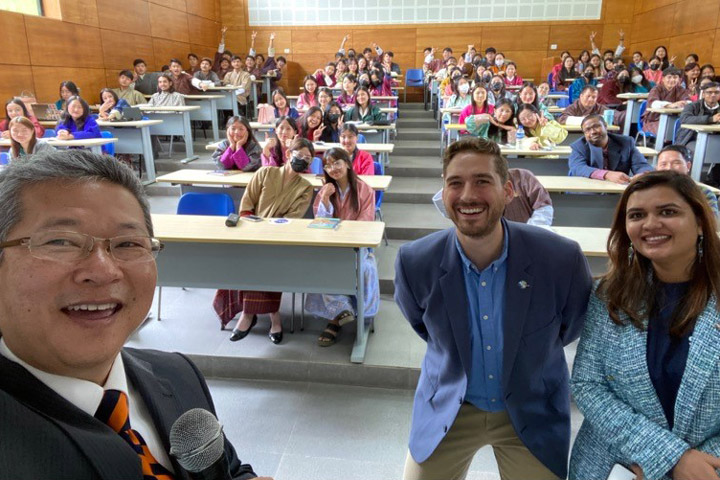
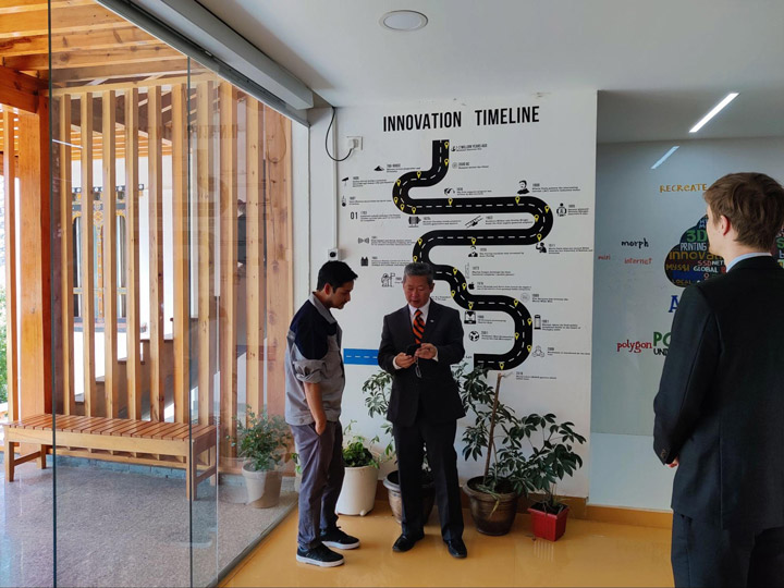
Throughout this process, participants from all of these different backgrounds shared their knowledge with our team so we could better understand the unique landscape and agricultural practices of Bhutan—knowledge we could take back with us to help SERVIR better serve the community with ACES and other resources. The opportunity to build ties between NASA and the Bhutanese STEM community was also incredibly rewarding. We were honored to meet over 100 students and faculty who attended a lecture we gave at the Royal Thimphu College. We visited the amazing Super FabLab, which provides STEM educational resources, including geospatial and Earth observations tools. Throughout our entire trip, we heard so much enthusiasm for NASA, and we were inspired by just how many people were excited to share ideas for future collaborations.
The trip—with the ACES launch, lectures to students, and amazing week-long joint training with the Bhutan Ecological Society—was even more successful than we could have anticipated. With the connections we had newly minted between NASA and the Bhutanese STEM community, our SERVIR team left in a great position to continue to collaborate.
Four connecting flights and over 48 hours of travel time and I closed the loop to arrive back in Alabama, literally flying all the way around the world. It was an absolute pleasure and an amazing opportunity to visit the Kingdom and see the spectacular architecture and scenery. The landscape reminded me of the Columbia River Gorge, close to where I grew up in the Pacific Northwest, but with looming Himalayan mountains and rice fields as far as the eye can see. I always appreciate how much we at SERVIR have been able to accomplish by connecting virtually, but our time in Bhutan was a great reminder of just how much more we can achieve when we get the opportunity to meet our international colleagues face to face, and get a sense of their community needs. I met some amazing people as part of the trip and I cannot wait to return, as it truly felt once in a lifetime.
Rockets, space, and planets! These are all things the group of 40 Bangladeshi students sitting before us think of when they hear “NASA.”
“But what about the Earth?” we asked.
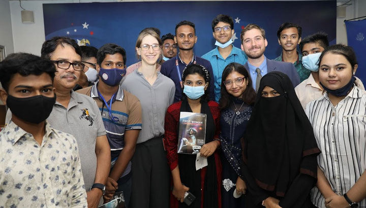
This past July, my colleague, Tim Mayer, and I were meeting with colleagues and collaborators in Bangladesh when we had the last minute opportunity to present NASA Earth science to a group of Bangladeshi students at the U.S. Embassy.
Amid weeks of meetings and stakeholder consultations, this felt like one of the most impactful and rewarding parts of the trip.
Dodging cars, pedal cabs, motorcycles, and scooters, we cross the street to where the red brick facade of the U.S. Embassy Annex is buffered from the bustle of the street by a line of tall bushes. We were in Bangladesh because we work for SERVIR, a joint NASA and USAID program that works with leading regional organizations to help countries worldwide use Earth observations and geospatial technologies to address environmental challenges. Tim and I work closely with the International Centre for Integrated Mountain Development (ICIMOD), a regional knowledge center based in Nepal that serves as a hub for SERVIR’s projects in several South Asian countries, including Bangladesh. Our role is to facilitate the use of NASA satellite data for applications like disaster management, weather forecasting, agriculture, and sustainable land use, but sometimes we get the opportunity to get out of the office and share Earth science with the community!
This presentation was a last minute addition to our crowded itinerary, but a welcome one. Our main purpose in Dhaka was to connect with Bangladeshi agencies, to meet and understand end user needs and catch up on project discussions after a long travel hiatus due to COVID. Through our travel planning process we got connected to USAID Bangladesh and the English Access Microscholarship Program, a program by the State Department. The program provides students aged 13 to 17 with the opportunity to learn about new topics and practice their English through invited speakers.
Entering the building, the rush of cool air provides relief from the heat and humidity of the monsoon season. We are greeted warmly by the spokesman for the U.S. Embassy as we are led into the auditorium. There’s a classroom-like vibe with the stage adorned with American and Bangladeshi flags and a State Department banner. As we set up our presentation, students begin to file in and take their seats in the rows of plastic chairs, while a buzz of excitement seems to fill the room. The spokesman introduces us to the audience and we’re off!
We ask our key question: “What do you think of when you think of NASA?” We get a flurry of answers on space and exploration, then open the door to our main point, “how about the Earth?”
As we introduce the basics of how to use satellite imagery to understand the Earth, the students are eager to answer questions with a dozen hands raised each time we pose a question. Wrapping up, we get a range of questions on scientific topics from why water boils at different temperatures at different elevations to the development of the Artemis mission. When asked about who was planning to pursue a career in science, most of the audience raised their hands!
A student asked us what event or person inspired us to pursue our current career path.
We both found our way to Earth science and remote sensing through encountering a professional who was passionate about their work. Tim got into field biology and ecology because a representative from the United States Forest Service brought an owl to his 5th grade classroom. He was fascinated by the animal and its role in the ecosystem motivated him to study the natural environment. As a lifelong outdoor enthusiast, my curiosity about the natural world around me led me to pursue an environmental career. While working as a park ranger in Yosemite I was introduced to remote sensing when I attended a presentation on the Airborne Snow Observatory, a plane that collects elevation data over snow covered peaks to predict snow volume. Learning about this technology inspired me to pivot my career path to work with geospatial information.
This question got me thinking.
Exposure to a new field that sparks your curiosity can change the course of someone’s life. Sometimes just being in the right place at the right time with someone who is passionate about what they do, can be enough fuel for your curiosity to turn into action. Career outreach helps introduce students to some of the paths available to them. After the event I had a girl invite me to speak at an environmental event she was putting on at an all women’s college. Though I was unable to attend, I was honored, and being asked made me feel like my presence and voice had made a difference.
As an engineer, scientist, mountain biker, and athlete, I have often found myself in male-dominated spaces. For me, the presence of someone who looks like me and who may communicate in a way that feels more familiar makes all the difference. It changes whether I feel comfortable asking questions, whether I feel understood and listened to, and ultimately, how much I am able to learn and engage. I will certainly take the time in future trips to meet and engage with women scientists and students.
As the presentation ended the room was buzzing with excitement, as we passed out flyers and were inundated with photo requests. We promised to connect sooner before our next trip so that they had time to organize a larger event.
If you are a scientist, or a communicator, or really anyone who is passionate about STEM I encourage you to share your passion with students. Take the time on your next trip to seek out an interested group. If you are going international connect with USAID and the local country mission. Look for English learners programs or universities or women’s groups. However you can make it happen, I assure you it is worth the effort.
In a quiet town on the border of Peru and Brazil, indigenous representatives from across the Amazon met with a team of NASA-funded geographers seeking to better understand how climate change is affecting the region–and trying to set an example for how the scientific community works with indigenous peoples.
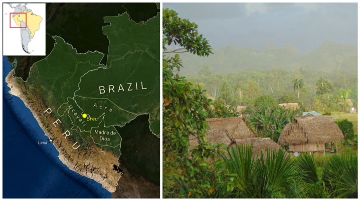
Puerto Breu, Peru (population: 600-ish) is not the town you might think of for an important work meeting. A holdover of the late 19th Century Amazonian rubber boom, this remote outpost is only accessible by charter flights or by long, winding journeys by river boat. In June 2022, Breu hosted an important summit between SERVIR Amazonia and indigenous communities from across the southwestern Amazon. The event allowed geographers with SERVIR, a joint program of NASA and the U.S. Agency for International Development, an opportunity to listen to members of the communities they study and learn how to better protect the region from climate change and other environmental challenges.
SERVIR collaborates with leading scientific and conservation organizations in the region, such as Conservación Amazónica (ACCA) and the Upper Amazon Conservancy, which make events like this possible. The program’s mission is to address climate and environmental challenges by helping communities around the world access and learn to use data from NASA’s Earth satellites. Many of its regional projects in Amazonia are designed to aid rainforest conservation and to prioritize the participation and leadership of local communities in the process.
“Much of this region is still forested and remote, but the pace of deforestation and other illegal activities has been intensifying in recent years,” said Katie Walker, a Regional Science Associate with the SERVIR Program who helped with the event. She notes that attention on the southwestern Amazon is a relatively recent development. Scientists and conservationists have historically been preoccupied with the southeastern Amazon, where greater proximity to major cities and highways catalyzed land development.
“In the Brazilian states of Rondonia and Mato Grosso, for example, most of the land area not occupied by indigenous groups has been either deforested and converted to cropland, or has been influenced by these activities,” Walker said. “But now attention is also turning to the southwestern Amazon, where similar patterns are emerging.”
In Peru’s Ucayali Department and the neighboring Brazilian state of Acre, the Upper Amazon is threatened by climate change and demand for luxury hardwoods. Informal roads, or carreteras, built by logging and mining ventures, cut through the jungle and often serve as stepping stones for further deforestation as further human development follows. In the intense equatorial sun, losing tree cover quickly dries out the ground, which can permanently diminish the soil quality and hinder new growth. To protect the world’s climate and help preserve the region’s human and ecological heritage, scientists need in-depth understanding of ecosystem services in the region. Especially for such a historically isolated region, the scientific community needs to consult the best experts it can find: the indigenous communities who live there.
The accelerating loss of forests in the southwestern Amazon creates a major threat to the region’s many indigenous communities, like the Ashéninka, Asháninka, and Yaminahua/Jaminahua. Historically, scientists and conservationists have often prescribed answers to these communities without acknowledging the generations of knowledge these communities have regarding their surroundings.
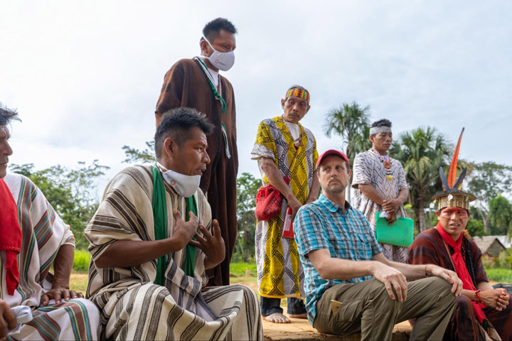
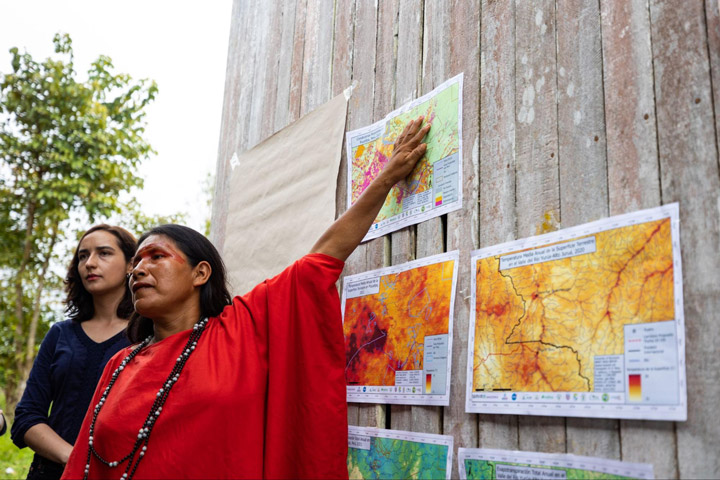
Dr. David Salisbury, a geographer from the University of Richmond’s Amazon Borderlands Spatial Analysis Team, led the NASA-funded visit to Breu in June to meet with more than 120 indigenous representatives from communities across the Southwest Amazon. The goal of the meeting was to seek community feedback about online tools that use NASA satellite data to monitor forest conditions in the region, but also to draw connections between the observations seen in satellite imagery and the daily observations of people on the ground.
“This was a historic workshop given that we had 120 Indigenous participants from 13 different ethnicities representing a transboundary area in Brazil and Peru the size of Michigan,” said Salisbury. “Our top goal was to give our Indigenous counterparts, who are local forest and climate experts, the opportunity to see if their lived experience and long-term observations of the forests, humidity, seasonality, and rainfall matched up with forest and climate trends our University of Richmond team was picking up in our satellite imagery analysis. Once the Indigenous participants became experts in our maps, they saw the benefits of our online tools that could show how ecosystem services could change in their homelands across space and time.”
Though Salisbury has almost 20 years of experience working in this part of the Amazon (he smoothly transitions between English, Spanish, and Portuguese mid-sentence), he emphasizes that his experience is relatively little in comparison to the lived experiences of local communities. In a packed one-room schoolhouse, the team spent two days talking with indigenous communities, inviting them to introduce their communities and explain how each is seeing the manifestations of climate change on a local and personal level.
“The quantity and quality of participation was amazing […] The key was then to take the first day slowly and focus on building community through the sharing of their own expert knowledge of forest and climate,” Salisbury said. “We mapped out how they were connected to each other through culture, watersheds, and landscape as they introduced themselves. Everyone had the opportunity to get to know each other across gender, age, and geography. Once they established their expertise, built a positive learning community, and shared similar concerns for their future, we introduced the science and technology to our receptive and empowered Indigenous collaborators.”
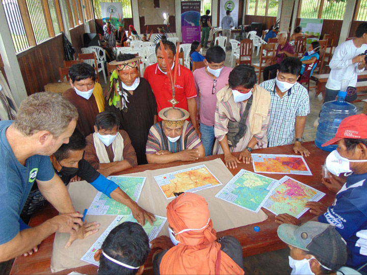
The event used discussion groups split by ethnic group, age, and gender to better understand how the effects of climate change and deforestation are experienced in different communities and by different demographics. These groups were asked for their opinions about climate change and for their interpretations of maps the team created using data from NASA Earth satellites.
“The studies they have done will help us a lot to do our monitoring of the community, and to involve more women,” Maria Elena Paredes said. Paredes is an Ashéninka activist and the coordinator of the Community Vigilance Committee for the Sawawo Hito 40 community in Peru, and was a vocal figure in both the women’s discussion groups and in the broader conversations.
“[The studies] involve more young people so that they learn how to take care of our forest and community,” Paredes said, noting the high representation of young indigenous participants. Her son Luis was a participant in the youth-focused discussion groups.
The team hopes that feedback from the event will not only help them better tailor their data and tools to the needs of local communities, but also to set a positive example for centering the expertise and experience of indigenous communities in Earth science research. Healthy dialogue between indigenous groups and the scientific community make for conservation efforts that are more effective and socially just.
The lessons learned in Puerto Breu can hopefully improve the efficacy of applied Earth sciences, and more importantly, set a positive example for the scientific community.
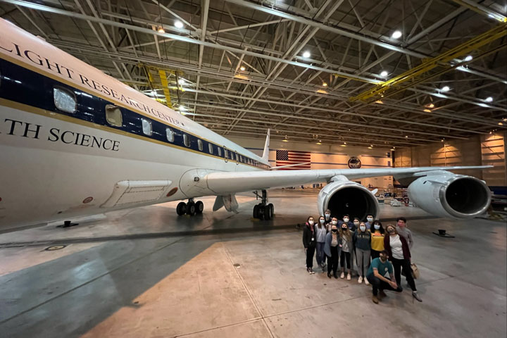
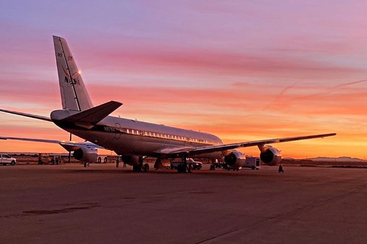
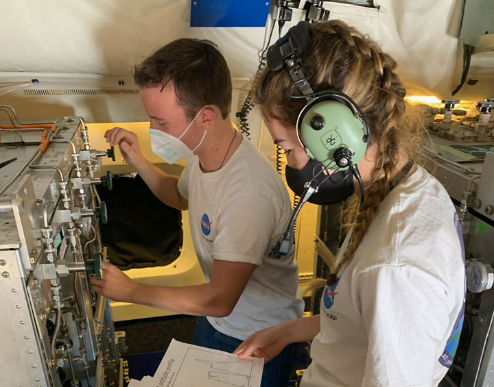
For students who want to take atmospheric science as literally as possible, it doesn’t get much better than flying in a NASA aircraft.
Each year, the Student Airborne Research Program (SARP) invites a team of rising college seniors to Armstrong Flight Research Center in Southern California to conduct research aboard NASA’s airborne science fleet. Each aircraft is equipped with instruments for land, ocean, and atmospheric research–enabling sample collection and imaging over the Earth’s surface. After operating the instruments in-flight, participants are then able to use the resulting data for their own individual research projects.
…as soon as they recover from the air sickness, of course.
Jacob Schenthal, who graduated from Vanderbilt University in 2021, was drawn to the NASA SARP program for its emphasis on independent, field-based research and multidisciplinary scientific teams. McKenna Price-Patak, a 2021 Tulane University grad, felt it was a rare opportunity for an undergraduate student to be responsible for an entire research project: from data collection to analysis and project development.
“I’ve always had interests in a variety of fields within Earth science, which is why I was excited about the multidisciplinary aspect of SARP,” Price-Patak said.
Both Schenthal and Price-Patak were placed with Dr. Donald Blake, conducting air sampling aboard the aircraft to study atmospheric pollution.
Dr. Blake is kind of a big deal in the atmospheric science community. An atmospheric chemist at UC Irvine, Blake is half of the eponymous Rowland-Blake Group: the research lab whose other namesake, the late Dr. F. Sherwood Rowland, won a Nobel Prize in chemistry for identifying compounds responsible for Earth’s ozone hole. Today, Blake continues the lab’s work as a leading expert on the impacts of atmospheric chemistry and air pollution on human health, and has conducted NASA-sponsored airborne research for over 30 years.
“Dr. Blake is a phenomenal mentor and really helped me find a newfound interest in air quality research–which intersects directly with climate change and environmental justice: two of my other passions,” Schenthal said. As Price-Patak put it, “Don takes a genuine interest in each member of his group and their success. When my project took a last minute detour and had to be redone days before final presentations, Don sat with me on Zoom for hours a day helping me recover and create a project I was proud of.”
Both Schenthal and Price-Patak were accepted into the SARP program in 2020. Unable to make the flights that year due to the COVID-19 pandemic, the program had to take a different approach. For the first time in SARP’s history, participants received air quality testing canisters in the mail to remotely collect initial data points.
“Although the program during summer 2020 was remote, it was exciting to take air samples to help measure emission impacts of the COVID-19 lockdowns,” Schenthal said.
“The way the program pivoted to a virtual environment was incredible,” Price-Patak said. “While we would’ve loved to be in person, we still had so much support from our research groups and mentors so we could successfully complete our projects in the short time frame.”
Schenthal’s project, titled Investigating Xylene and Toluene in Disadvantaged Communities Downwind of LAX, blended NASA’s airborne science data within an environmental justice framework. He examined how xylene and toluene–two airborne compounds that damage the nervous system with chronic exposure–are more common in disadvantaged communities near and around Los Angeles International Airport (LAX). Schenthal found that Inglewood, a predominantly Black and low-income community, experienced exposure levels for both compounds at 50 times the background level. Additionally, his project results indicated the compounds acted as tracers, meaning hundreds of other pollutants are also potentially travelling from LAX throughout these communities.
Price-Patak’s project, Dimethyl Sulfide (DMS) in the Imperial Valley and its impact on Sulfate Aerosol Loading, used data collected on SARP flights from 2014 to 2019 to locate sources of inland DMS. DMS is typically released from plankton in the ocean, and can turn into sulfate aerosols which can cause respiratory illness. Her research indicated there may be inland sources of DMS producing up to 10% of the sulfate aerosols in the Imperial Valley, an important agricultural region east of Los Angeles.
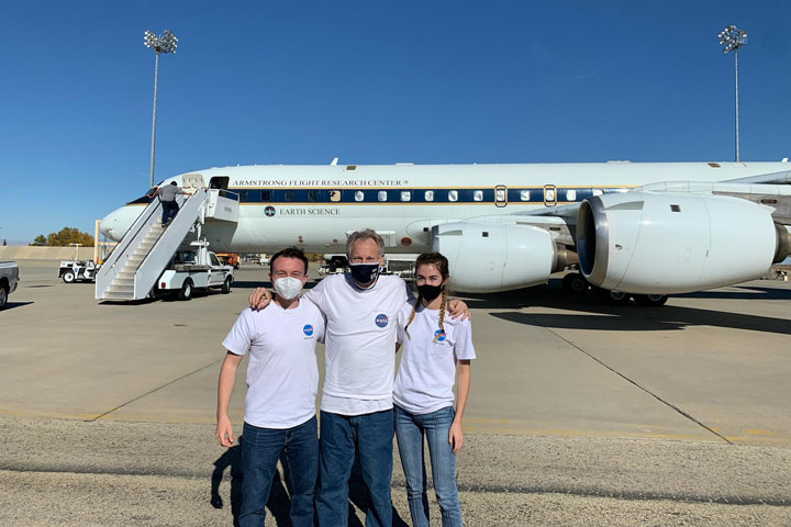
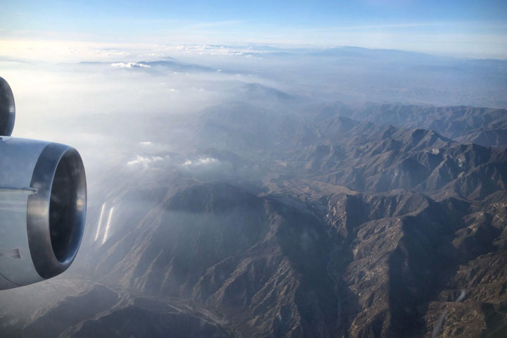
More than a year later, they got their chance to make the flight. In December 2021, fully-vaccinated participants from the 2020 and 2021 teams were finally able to take their projects airborne. Over the course of a week, the team participated in multiple flights over southern California aboard a DC-8 aircraft, taking samples adding to the program’s extensive record of air quality data.
By the end of the program, Price-Patak and Schenthal were able to rack up a combined 27 hours of flight time–and even experienced sitting in the cockpit for low approaches around Long Beach harbor!
According to Price-Patak, the value of the program comes not only from the work itself, but from the opportunity to connect with other early career scientists.
“Through SARP, I developed a new interest in atmospheric chemistry and connected with other students who have gone on to work as consultants with business firms, pursue PhDs, and everything else in between. Not only is the opportunity to conduct research through the program incredible, but the flights are truly a once in a lifetime experience. I would recommend any undergrad student with a STEM background to apply!”
“SARP has been an incredible experience, both personally and professionally. For me, it allowed me to explore my interest in air quality and environmental justice–all while engaging in field research and my independent research project,” Schenthal added.
Now, Schenthal and Price-Patak credit SARP in helping their careers take off–with both program alumni now working with NASA SERVIR at the University of Alabama in Huntsville (UAH).
A collaboration between NASA and USAID, SERVIR works with organizations around the world to design and implement satellite-based services supporting climate adaptation and natural resource management. Schenthal is the Regional Science Associate for SERVIR’s Mekong hub, while Price-Patak is a graduate research assistant for SERVIR-Hindu Kush-Himalaya while enrolled in UAH’s Master’s program in Earth science. And yes–both are still involved in air quality research. The application for SARP 2022 closes January 26th, and can be found here. Don’t hesitate to apply–and be prepared to pack your dramamine!