May 19, 2011
We are now well on our way back home again, with our GPS stations dutifully recording ice motion in our absence. Several of the stations will be visited again this summer, and all will have a visit this fall to freshen them up for winter. It was something of a whirlwind tour, but we managed to get it all done.
The next phase of the project begins in late June, when a new batch of ROGUE team members returns to Ilulissat and the ice sheet to conduct the hot-water drilling phase of the project. Thanks for following us this spring, and stay tuned to this stations for updates as the situation warrants.
Signing Off,
Tom and Matt
ROGUE: Real-time Observations of Greenland’s Under-ice Environment
The goal of the ROGUE project is to examine the nature and cause of short-term ice velocity changes near Swiss Camp, Greenland, by observing interactions between the ice sheet, the atmosphere and the bed.
May 18, 2011
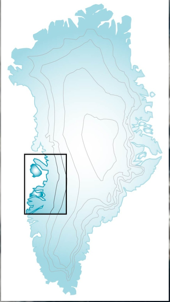
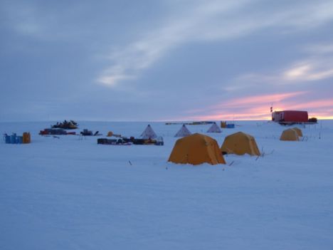
When working out on the ice sheet, it is useful to have a base of operations, so as to not have to move your whole camp every day you want to go to a new place. For our project, Swiss Camp served as our base of operations. Swiss Camp is one of just a handful of semi-permanent bases on the ice sheet (along with Raven, NEEM, and Summit camps). It has been around in various forms for the last 20 years, and has served as a home base for many many research projects.
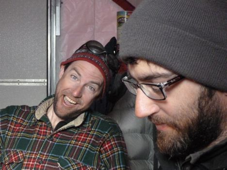
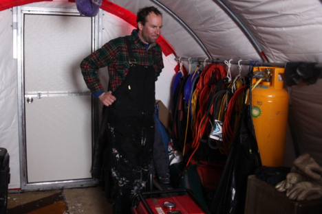
Swiss Camp tends to be occupied primarily during the month of May, when Koni and his students base their work out of the camp. This year, Matt and I have had the good fortune to work out of Swiss Camp as well. The camp consists of two insulated tents, each about 10 feet wide by 20 feet long, up on a plywood platform. Koni keeps a couple of snowmobiles at the camp (rather than flying them back and forth each season) as well as a supply of fuel and propane. The fuel is for the snowmobiles and generator, while the propane is used for heating and cooking.
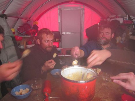
The tents consist of several layers of insulating material stretched over a frame of arched steel poles. A propane heater in each keeps the temperature inside comfortable, even when it is cold and snowy outside. One of the tents is set up as a kitchen and dining area, while the other serves as the workshop. Each season additional tents are pitched for each person to sleep in, and lines of cargo stretch out from camp, creating a small town radiating out from the main tents. The camp is typically powered by solar panels and a battery bank, though the storm this year knocked down the solar panels. Koni will no doubt have them up and running again shortly. Duties are shared, with everyone pitching in to help cook (yes, even me!), and keep the camp running. Snow is gathered from upwind of the camp for drinking water, while Koni brings the supply of food for the camp each year.
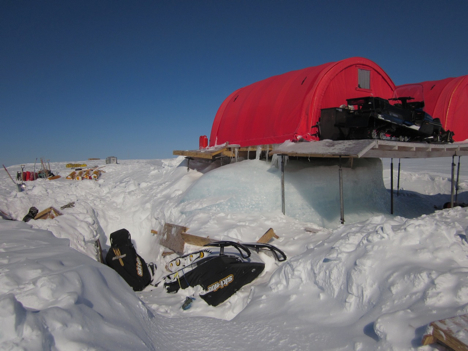
Swiss Camp sits near the equilibrium line of the ice sheet. This is a line on the ice sheet where the annual snowfall during the cold months is balanced by the amount of melting during the warm months. This means that although Swiss Camp is buried every winter by snowfall, it melts out each summer. Over time, the equilibrium line has increased in elevation as climate has changed, and ice flow has carried the camp downstream. Now the annual melt is greater than the annual snowfall, leaving Swiss Camp perched up on stilts, and the camp must be lowered every few years. The last such change was in 2010, and the next will probably be in 2012.
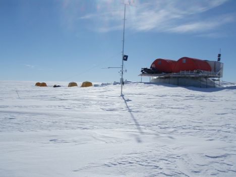
At the end of a long day of working outside, the red tents of Swiss Camp are always a welcome sight when they come in to view.
ROGUE: Real-time Observations of Greenland’s Under-ice Environment
The goal of the ROGUE project is to examine the nature and cause of short-term ice velocity changes near Swiss Camp, Greenland, by observing interactions between the ice sheet, the atmosphere and the bed.
May 17, 2011
When we arrived at each study site, we began the process of constructing a GPS station. The first step was probing the snow for crevasses before we start unloading heavy equipment from the sled. By mid-summer, this region will all be bare ice but now it is still covered by about a meter of winter snow. Despite the heavy weights of the snowmobile and sled, we were much safer sitting on them than walking around because of their large surface area in contact with the snow. We deliberately chose sites that were less likely to have large crevasses, but we did encounter small cracks at a few sites.
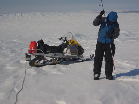
Once we were confident that we had a safe area in which to work, we unloaded the sled and prepared our tools. We thought carefully about what order we need tools and instruments, especially on windy days, because anything left out for too long is liable to be blown away or buried in drifting snow. On warm, sunny days anything exposed will be wet before long from blowing snow melting on contact with dark surfaces.
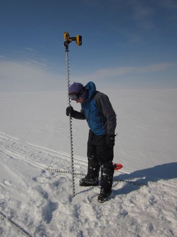
Because the ice surface on this part of the ice sheet melts about 2 meters (6 feet) each summer, we need to install long poles into the ice to keep instruments from melting out and falling over as the surface lowers. We used a cordless drill with an ice auger system to drill holes about 8 meters into the snow and ice. Once the holes were drilled, we couple pipes together to create poles long enough to survive two summers of surface lowering.
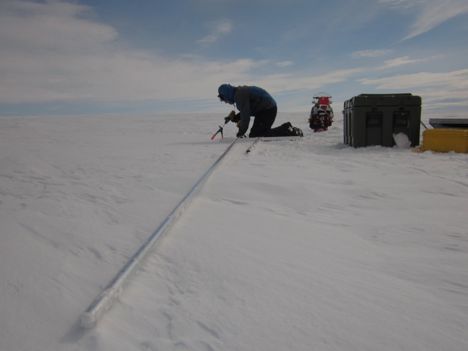
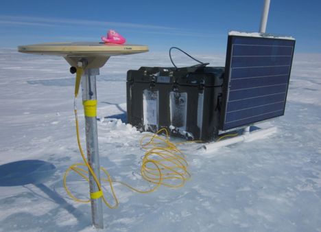
The crux of the operation was rotating the 8-meter (25 feet) poles into vertical position and down into the holes without damaging the poles or ourselves. Once in place, a GPS antenna is mounted atop one pole to measure the motion of a fixed point on the ice sheet. When we return in fall the antenna will be perched well over our heads. A second pole was outfitted with a solar panel on a PVC sleeve that will slide down the pole as the surface lowers.
The final part of the installation involved setting up a weatherproof box to house the batteries and GPS receiver and wiring everything together. The GPS receiver runs on power supplied by large 12V batteries that are charged by the solar panel. We designed the system so that the receiver will continue to collect data for a few weeks should the solar panel be buried in snow or destroyed in a large storm.

Once we made a final check to ensure that everything was connected properly and turned on (an important final step!) we closed and latched the big green box. The system will have to function on its own until we visit in fall. We said goodbye after loading up the sled, and pointed our caravan back towards Swiss Camp.
ROGUE: Real-time Observations of Greenland’s Under-ice Environment
The goal of the ROGUE project is to examine the nature and cause of short-term ice velocity changes near Swiss Camp, Greenland, by observing interactions between the ice sheet, the atmosphere and the bed.
May 16, 2011
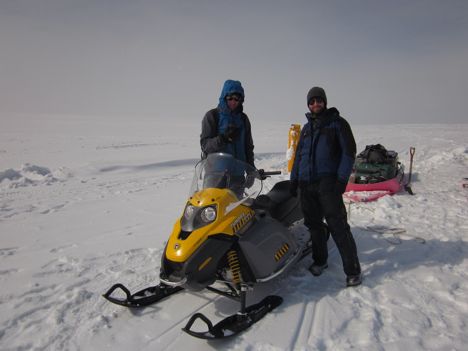
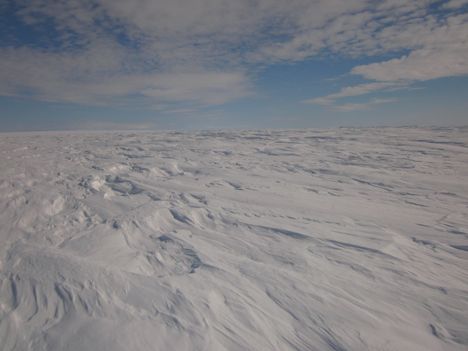
Each day we traveled to a new site in the area around Swiss Camp and set up a new GPS station on the ice sheet. We looked a bit like an Arctic version of the Beverly Hillbillies with Tom puttering the snowmobile out of camp pulling a big red sled piled up with boxes, bags, shovels, more boxes, pipes, solar panels, more pipes, and me precariously perched on top of it all. We crawled around at about 10 miles per hour to avoid rattling my teeth too much, especially when the wind has sculpted the blowing snow into crusty dunes called sastrugi. Our commute typically took about an hour which can be relaxing if the snow is soft and the weather is sunny and calm, or exhausting when it is windy and bumpy.
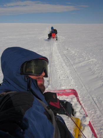
Because the ice sheet is pretty featureless, we traveled by GPS to locations that we had pre-determined but never visited. These x’s in the snow were chosen to provide information about both local and regional ice motion around our future drill sites. It’s a bit funny to travel to a specific spot on the ground that looks pretty much like every other spot from horizon to horizon. It’s also a bit funny to use a $100 handheld GPS to locate the site to install a high-precision GPS station, but you’ve got to use the right tool for the job. Handheld GPS navigation revolutionized travel across the flat white terrain of the ice sheet – without it, losing sight of camp from fog or traveling too far could be disastrous.
Even with GPS, traveling across the snow covered ice sheet can be disorienting under heavy cloud cover when the light is flat and the horizon disappears into a monotonous world of white in all directions. In those conditions, bumps in the snow are only apparent after you have driven over them too fast, and it’s really hard to tell how big anything is. One afternoon I was driving home in poor light, and about half way back I swore there was a little bug flying along side of the snowmobile. My initial (perhaps irrational) thought was that a fly had somehow been blown up onto the ice sheet and happened to be going the same way we were going. I was so convinced by what my eyes were telling me that I started to speed up to keep pace with the intrepid little guy who miraculously was cruising along at about 13 mph. After about a minute of this nonsense, my depth perception instantly snapped into place, and I realized that the fly was actually the GPS station we had set out the day before, about a half mile off in the distance. That night after dinner, Tom regaled us with stories of poor light in Antarctica that was so bad that you could hardly tell which way was up or if you were even moving!
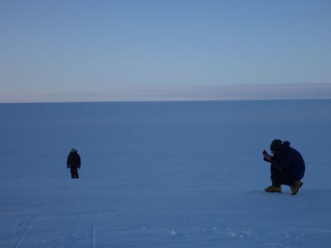
We were fortunate on this trip to generally have very good weather. On sunny days, the appearance of the subtle hills and valleys that cover this part of the ice sheet broke up the monotony, and the interplay of the low-angle afternoon sun on the snowdrifts created glittering sculptures of light and shadow that unfolded before us as we drove home.
ROGUE: Real-time Observations of Greenland’s Under-ice Environment
The goal of the ROGUE project is to examine the nature and cause of short-term ice velocity changes near Swiss Camp, Greenland, by observing interactions between the ice sheet, the atmosphere and the bed.
May 15, 2011
With a 50-50 chance of good weather, Matt and I headed out to Swiss Camp on Wednesday, May 4. We were lucky to get a break in the clouds and the wind that allowed the plane to land and drop us off safely with Koni and company. The weather continued to deteriorate over the rest of the day as the winds picked up and the snow started to blow.
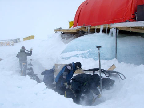
Everyone was hard at work when we arrived, cleaning up the debris from an impressively strong storm that moved through the area in February. According to preliminary data from the weather station at Swiss Camp, the wind speed exceeded 70 mph for nine straight hours. As you might imagine, this sort of wind was hard on weather stations, Swiss Camp, and anything sticking up out of the snow.
At Swiss Camp, part of the platform next to the kitchen tent had collapsed, causing 4 snowmobiles, 3 barrels of fuel, and about 10 propane tanks to drop down into the snow where the storm quickly buried them. By the time we arrived this week, everything that had had fallen was buried by at least 6 feet of snow and ice. We joined the shoveling brigade through the blowing snow on Wednesday, and succeeded in freeing one of the snowmobiles and most of the fuel.
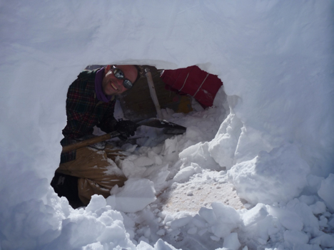
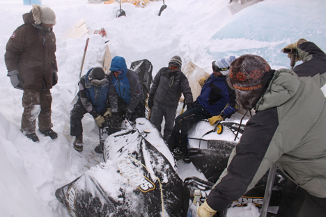
The wind died down by Thursday, and we freed the remaining snowmobiles by the end of the day. Everyone was pretty worn out, as you might imagine. The amazing part of it all was that Koni had all of the snowmobiles functional by the end of the day. We were left with an impressively large hole in the snow next to Swiss Camp, a lot of tired arms and wet clothes, and ready to start the work we came to do.
ROGUE: Real-time Observations of Greenland’s Under-ice Environment
The goal of the ROGUE project is to examine the nature and cause of short-term ice velocity changes near Swiss Camp, Greenland, by observing interactions between the ice sheet, the atmosphere and the bed.
