Most of the North American population probably wasn’t paying much attention, but the largest Atlantic storm since SANDY safely passed by the mainland well East of Bermuda in Mid-September. Edouard reached ‘Major Hurricane’ status as a category-3 storm on 9/16 and weakened over colder waters several days later. Below is a track for Edouard, compared to the three other hurricanes of the 2014 season.
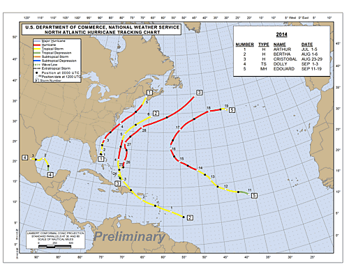
2014 season, courtesy of http://www.nhc.noaa.gov/data/tcr/index.php?season=2014&basin=atl
Edouard presented an excellent opportunity to assess several outstanding aerosol-related objectives for our group. First, the spatial distribution of particles throughout hurricane regions is largely unknown. Satellites can observe aerosols on the periphery of storms in clear regions, but the presence of clouds make these measurements impossible. Thus, in-situ observations are essential to see if particles can survive transport towards the eye of the storms. In general, we encountered much more clear air during storm transects at 10,000 ft altitude than I was expecting, and aerosol concentrations were highly variable from very clean (10-s of particles/cm3) to 1,000 particles/cm3. Future analysis will aim at better understanding this variability.
Another objective of our project is to observe and explain high concentrations of particles inside hurricane eyes. During Edouard, we consistently observed significantly enhanced particle number concentrations (up to 7,000 particles/cm3) and cloud condensation nuclei (CCN) in the clear, well-defined eye region. While these concentrations do not compare with polluted urban/continental regions, they may play a significant role for hurricane intensity by seeding the eyewall and potentially strengthening the storm. We hope to continue sampling storms like Edouard to understand where and under what environmental conditions these particles are formed.
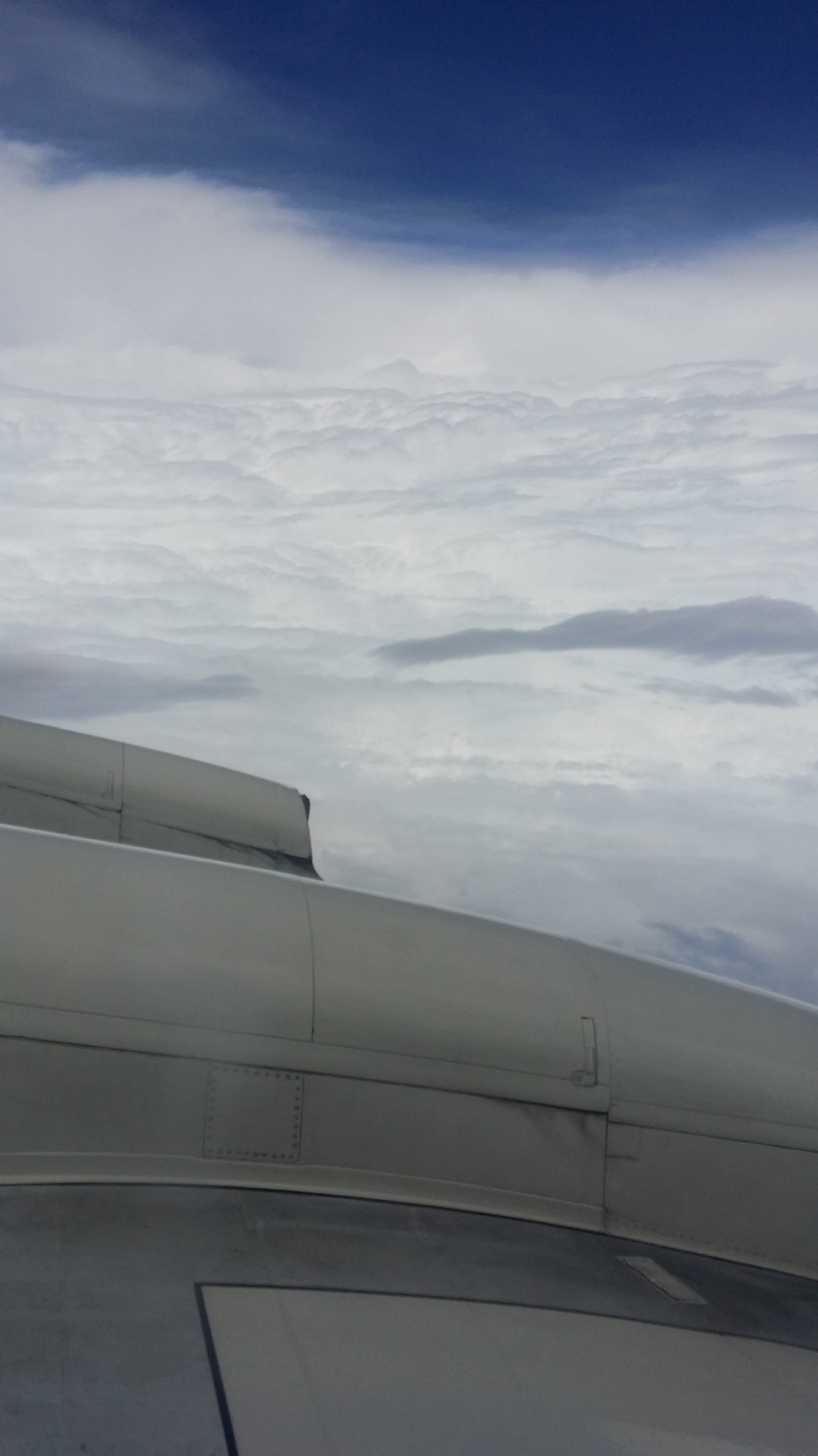
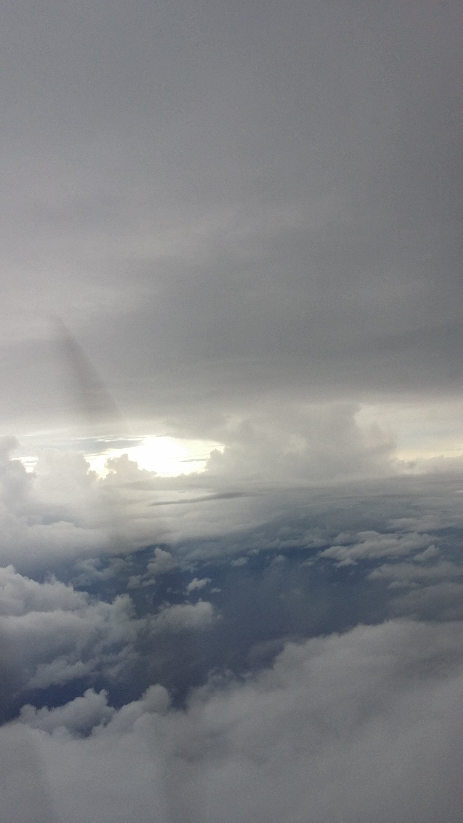
The unique conditions encountered inside the eye of a hurricane are pretty amazing, but also may directly lead to formation of the aerosols we sampled. For each of the 8 penetrations we made through the eye (on 3 flights), very few clouds were present resulting in sunlight penetrating all the way down to the fairly calm ocean water. Air in the eye is slowly subsiding from aloft and is clean and cool. New particle formation and growth typically requires these exact conditions; light to promote photochemical reactions, minimal surface area for gases to condense, colder temperatures, and enough time for growth to relevant sizes. Below are a few pictures from inside the eye.
Edouard Eyewall on 9/16

Calm ocean surface in Edouard Eye from 10,000 ft, 9/15
Other scientists on these flights were also taking advantage of this large well-defined eye to test newly developed unmanned aircraft, which can be used to fly in regions of the hurricane that are unsafe for manned aircraft. The link below contains a story and video about the NOAA ‘coyote’:
http://www.weather.com/news/science/edouard-noaa-drones-20140920
Next up for LARGE will be sampling from Fairbanks, AK for the ARCTIC FLUX campaign. While we don’t expect to see hurricanes, this region has interesting aerosol characteristics that offer more exciting scientific opportunities…
After a lengthy waiting period, we have successfully deployed our instrumentation to make aerosol measurements inside a tropical storm/hurricane.
As of our last post, instrumentation was mounted aboard the NOAA hurricane hunter aircraft but we were awaiting installation of an inlet. This is not a trivial task, as any structure mounted to the exterior of an airplane requires a fair amount of hardware fabrication and engineering review in order to ensure flight safety. After a doubler plate was manufactured (at the interface between the aircraft and the inlet), we were cleared to make measurements. Below is a picture of our inlet on the plane (directly forward of the american flag).
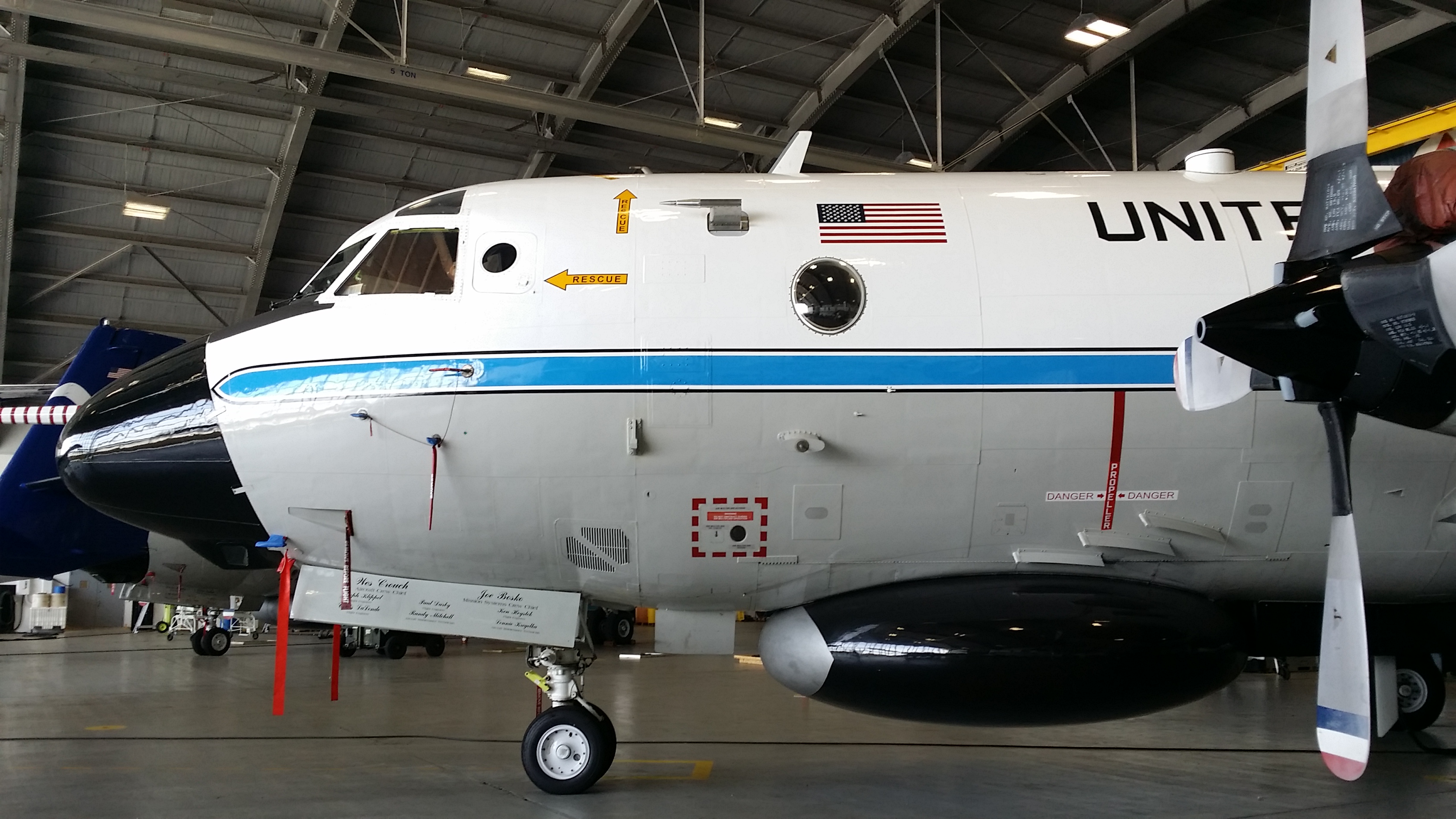
NOAA WP-3D Kermit, with aerosol inlet
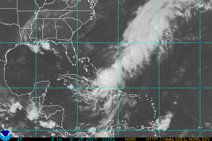
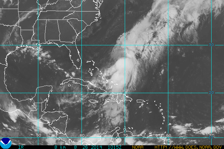
With the inlet installed, we were able to fly a brief test-flight near Tampa, FL, and three flights into CRISTOBAL last week. These flights were back-to-back-to-back (1 every 24-hours) with 2am takeoffs, sampling the storm at 3km altitude during its transition from depression to tropical storm (8/24), as a tropical storm (8/25), and as a weak category-1 hurricane (8/26). GOES-IR images below show the storm’s minimal organization as it slowly moved North from Hispaniola.
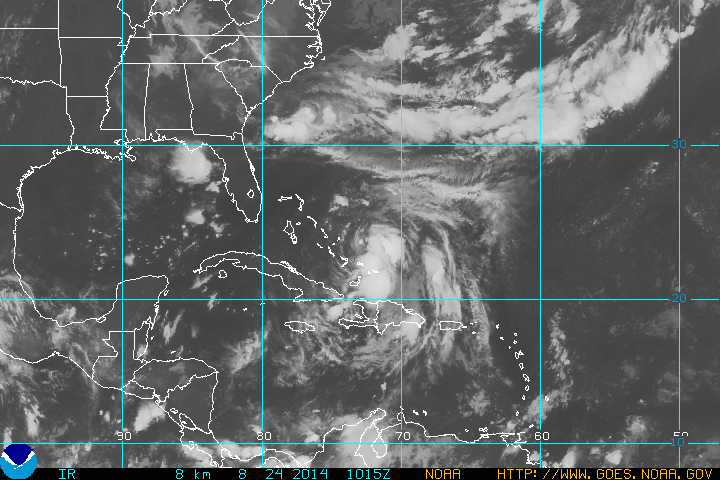
Tropical-Depression (3) – 8/24
Tropical Storm Cristobal – 8/25
Hurricane Cristobal – 8/26
Below are a few pictures from the flights. Since there was only moderate convection, turbulence on the aircraft generally wasn’t too uncomfortable. Our 2-am take-off time allowed a very pleasant sunrise about halfway through each flight. We could even see a rainbow in the storm vicinity, an unexpected sight while inside a hurricane!

In the NE quadrant of Hurricane Cristobal. Low level clouds with lots of cirrus outflow
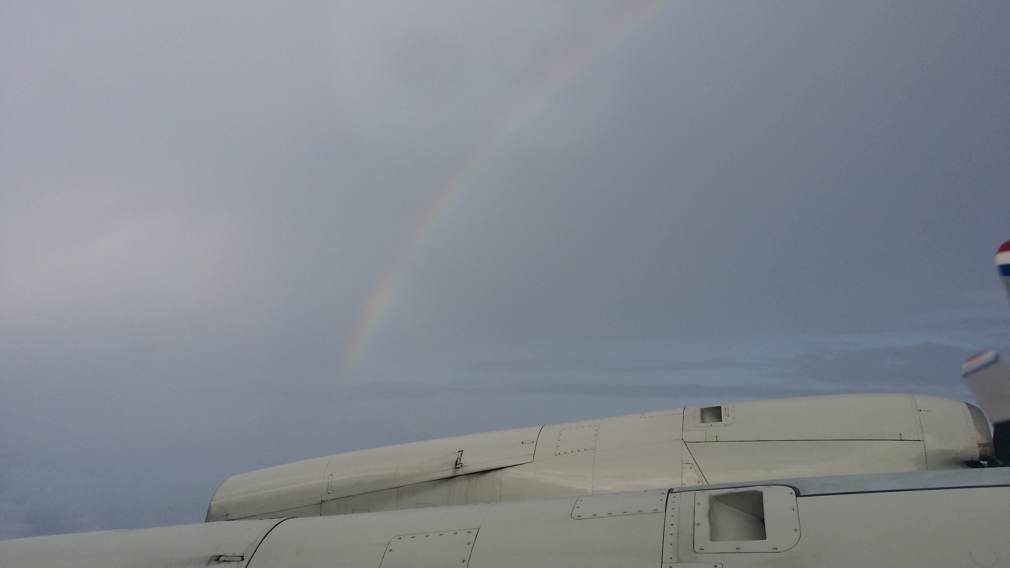
Rainbow during Hurricane Cristobal Flight
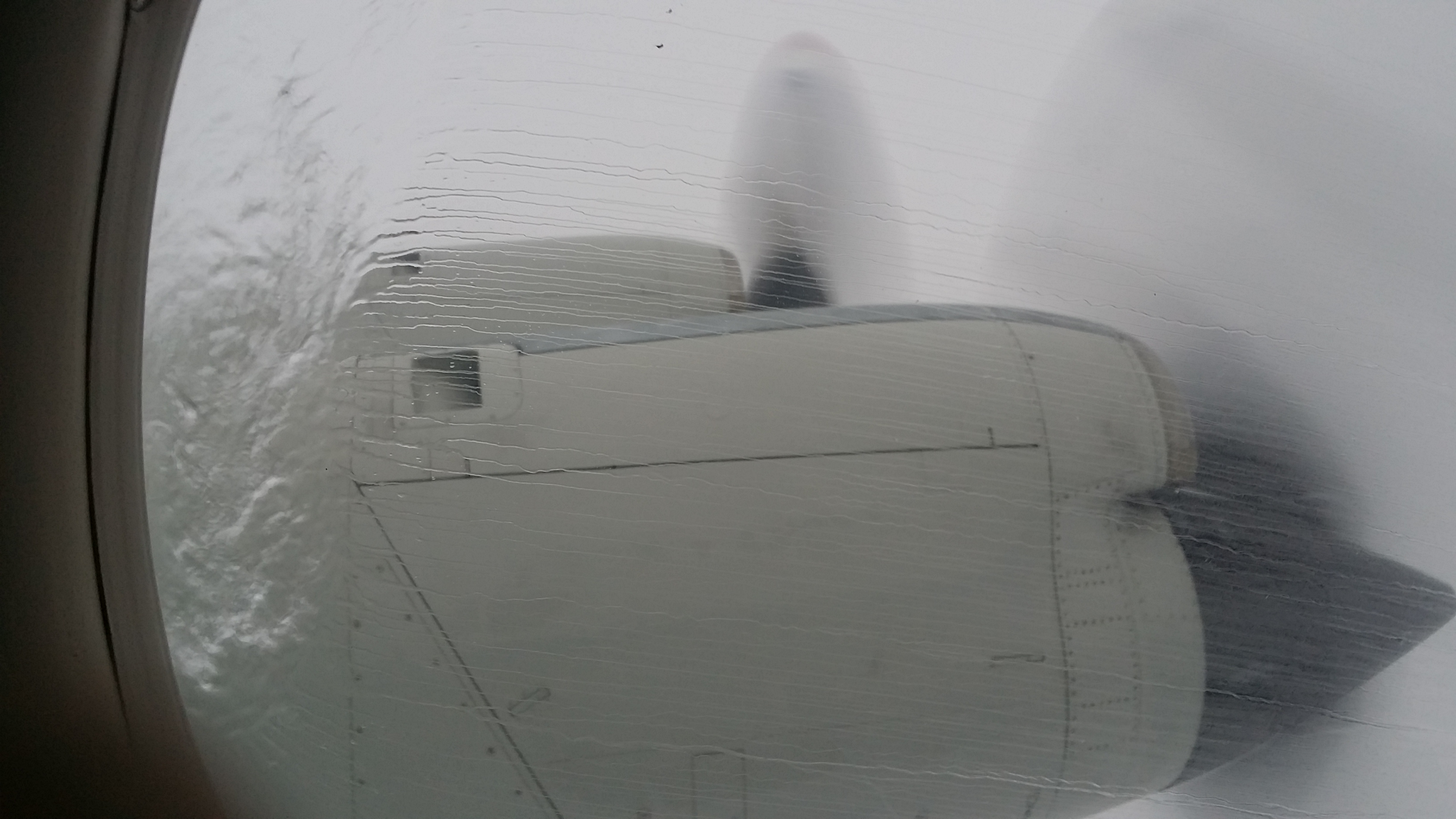
Typical view from the Hurricane Hunter aircraft, rain.
Sunrise flying into Tropical Storm Cristobal
If able to sample more organized storms, we hope to observe new particle formation inside the hurricane eye, a potential mechanism for intensifying the storm. Additionally, we aim to assess how hurricanes can redistribute biological particles that could act as efficient seeds for ice clouds at higher altitudes.
No storms are on the immediate horizon, but it is looking like a deployment to St. Croix is going to happen in the last half of September.
Thanks for reading. Luke
Welcome to the LARGE (Langley Aerosol Research Group Experiment) blog. We are a group of scientists at NASA Langley Research Center in Hampton, VA who study the chemical, optical, and microphysical properties of atmospheric aerosols and their effects on climate and air quality. We are involved in many exciting experiments with vastly different objectives and applications, but this blog will begin by focusing on a project this summer/fall to assess the distribution and impacts of aerosols on hurricanes.
This project is just starting but the hurricane season is already underway with the passage of Hurricane Arthur, which made landfall on the Outer Banks of North Carolina on July 4, 2014. Our work began the following week with installation of our instrumentation aboard the NOAA WP-3D aircraft known as “Kermit” (the other operational WP-3D aircraft is called “Miss Piggy”). Operating scientific instrumentation aboard airplanes requires a lot of planning and adherence to strict guidelines to ensure flight safety and collection of high-quality data. Since we make measurements in-situ (by bringing ambient air inside the aircraft cabin), our goal is to design a system that routes aerosols into the cabin and to our instruments without losing particles along the way. This involves a complex web of tubing, fittings, and cabling shown below.
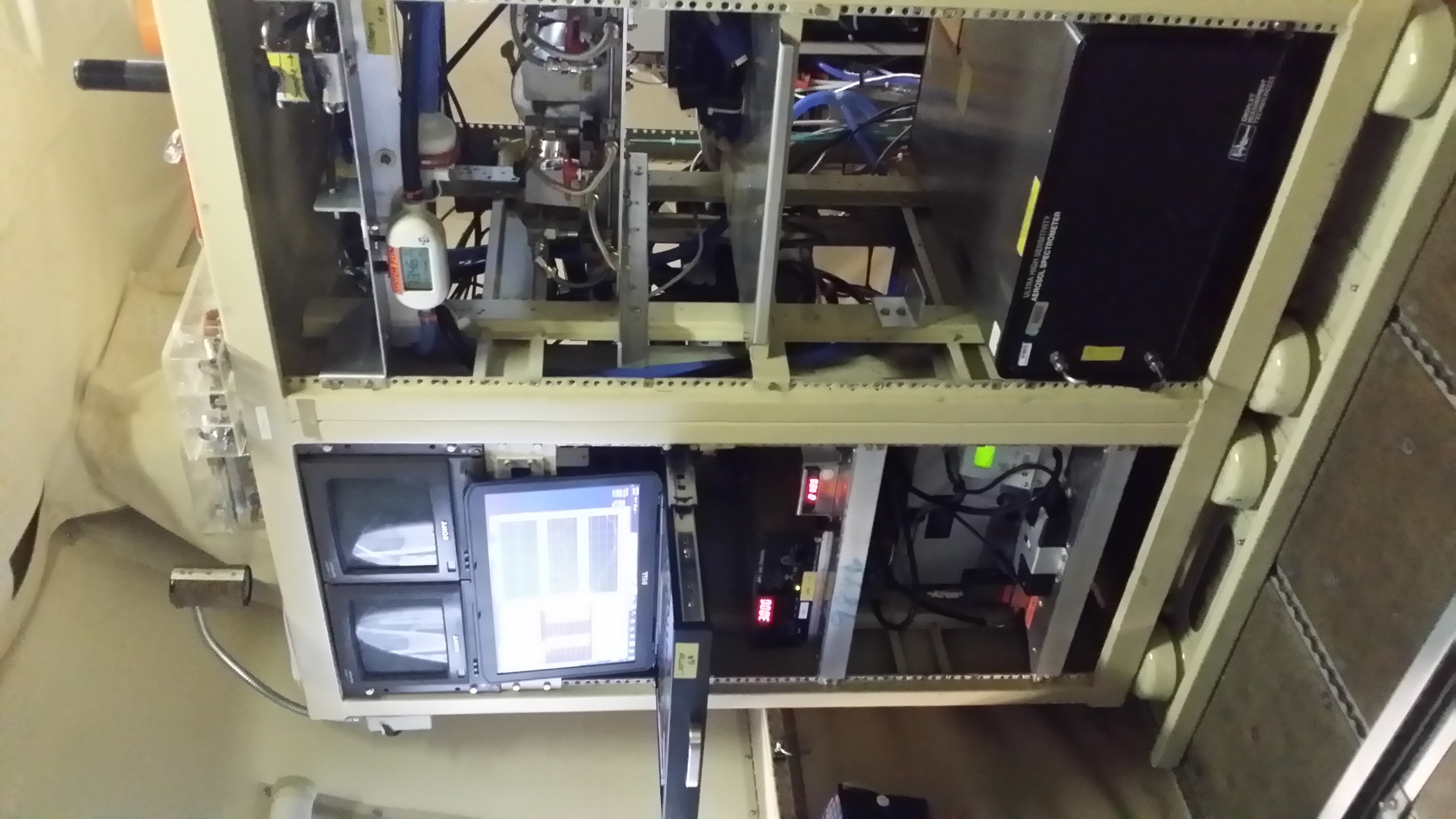
Front-view of the LARGE rack onboard the NOAA WP-3D aircraft.
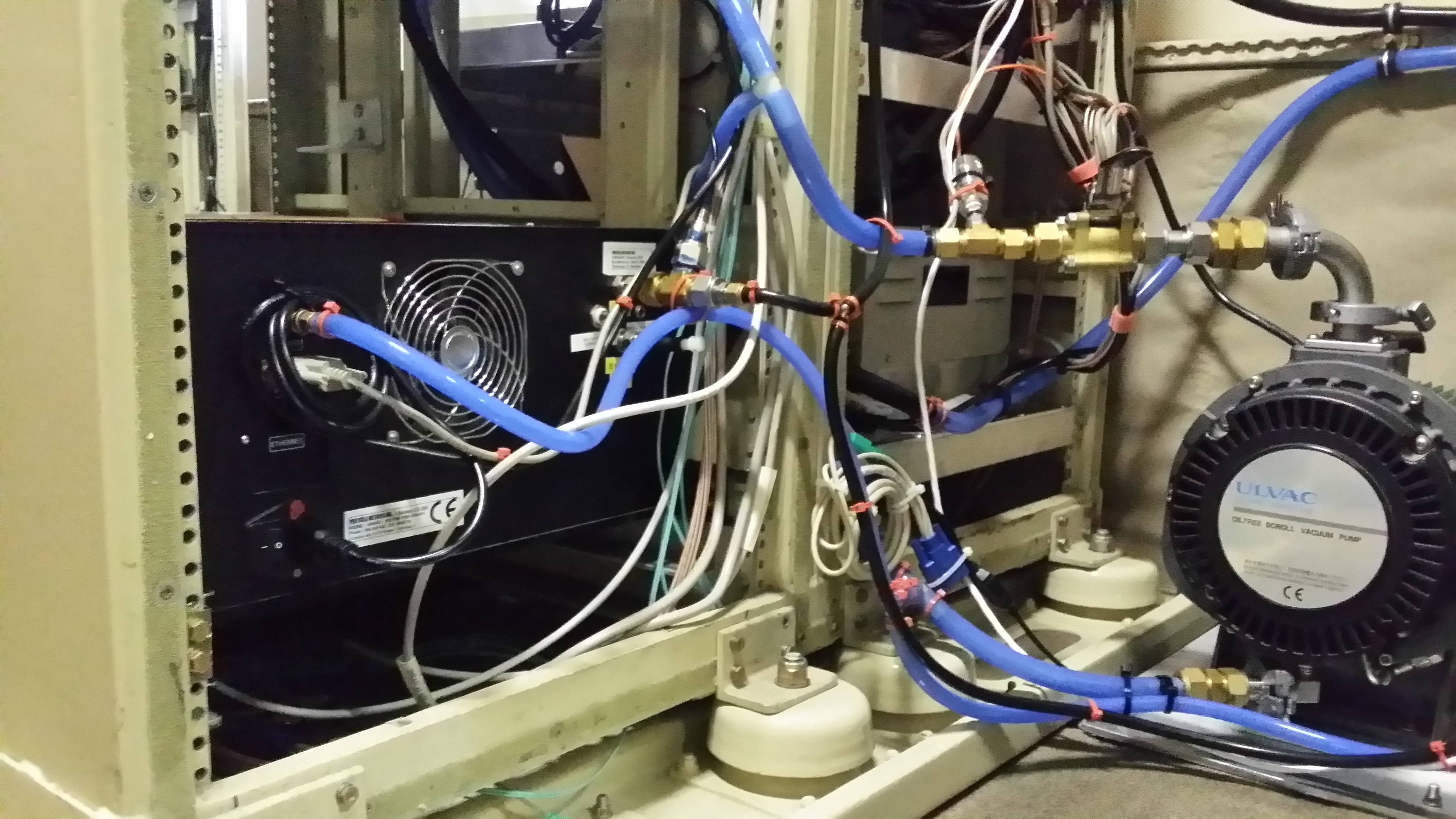
Back-view of LARGE plumbing.
We still have work to do to complete our instrument integration, especially to install an aerosol inlet on the aircraft. This will be completed soon and we will be poised to participate in the next hurricane flights! Check back later for more details about our instrumentation, science objectives, and pictures from inside the next Atlantic hurricane…
More information on our research can be found at the links below:
LARGE: http://science.larc.nasa.gov/large/
NOAA P-3 aircraft at the Aircraft Operations Center: http://www.aoc.noaa.gov/aircraft_lockheed.htm
