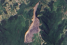
On June 5, 2009, a mountainside collapsed in the Chingqing region of southern China, burying dozens of people. The landslide remained visible in satellite imagery nearly two weeks later.
Published Jun 19, 2009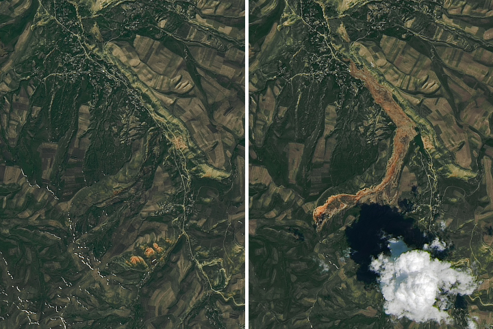
Debris spread more than 3 kilometers (2 miles) from the source to the toe of the landslide.
Published May 22, 2017
Acquired on April 20 and May 6, 2012, these images compare conditions before and after a landslide in Nepal. The slide likely led to deadly flooding.
Published May 24, 2012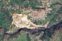
A pale tan scar in this natural-color image from March 14, 2010, marks the location of a landslide outside the southern Italian town of Maierato.
Published Mar 17, 2010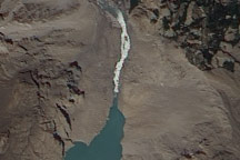
On July 2, 2010, a landslide-dammed lake in Pakistan appeared to have overtopped the dam, and water was streaming out through a man-made spillway.
Published Jul 2, 2010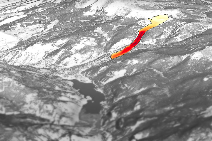
Through the study of an unusual, long-lasting slide, has developed a new technique to make prediction easier and more accurate.
Published Jun 5, 2020
A new NASA project improves landslide inventories with data from the public.
Published Jul 11, 2019
On January 4, 2009, a mountainside in northern Guatemala suddenly collapsed, sending thousands of tons of rock and debris downhill and burying a nearby road. The event occurred in the state of Alta Verapaz, some 200 kilometers (124 miles) north of Guatemala’s capital city.
Published Jan 15, 2009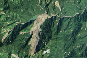
Heavy rainfall from tropical storm Komen triggered a large landslide in Myanmar (Burma).
Published Nov 8, 2015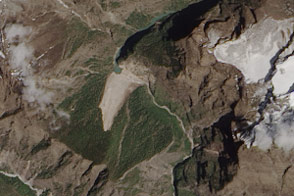
Debris from an earthquake-induced landslide has dammed a river in Nepal.
Published May 7, 2015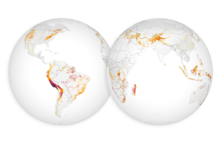
For the first time, scientists can examine rain–induced landslide threats anywhere around the world every 30 minutes.
Published Apr 18, 2018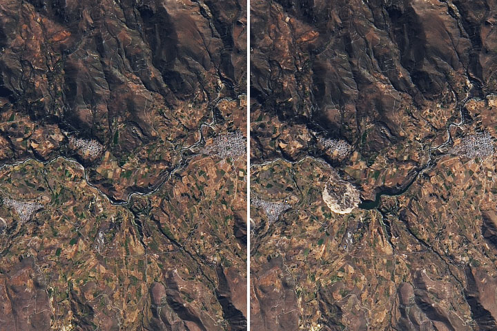
In Peru, a landslide damaged farmland and stopped the flow of an important local river.
Published Jul 3, 2020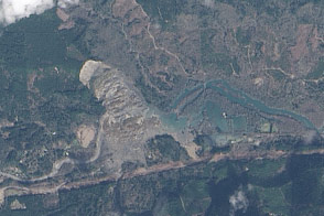
On March 22, 2014, a rainfall-triggered landslide near Oso, Washington, sent muddy debris spilling across the North Fork of the Stillaguamish River.
Published Mar 27, 2014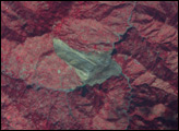
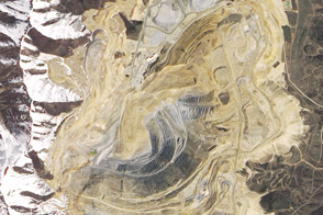
A massive landslide occurred at Utah’s Bingham Canyon Mine on April 10, 2013. It was the largest non-volcanic landslide on record in North America.
Published Jun 13, 2013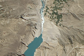
Acquired on August 3, 2011, this natural-color image shows the spillway relieving pressure on the lake created by a January 2010 landslide in the Hunza Valley of northern Pakistan.
Published Sep 4, 2011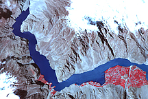
Acquired on May 2, 2010, this false-color image shows a growing landslide lake in the Hunza Valley of Northern Pakistan. A white outline shows the landslide lake’s extent in mid-March 2010.
Published May 11, 2010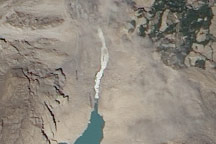
Acquired July 7, 2010, this photo-like image shows water from a landslide-dammed river flowing through a human-made spillway in northwestern Pakistan’s Hunza Valley.
Published Jul 8, 2010