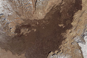
In western New Mexico, the landscape’s long volcanic history can be explored above and below the ground.
Published Feb 21, 2016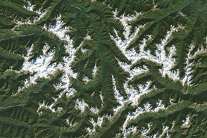
There are not many places in the world where you can move from the ocean to a rainforest to a glacier-covered mountain within 100 miles.
Published Feb 14, 2016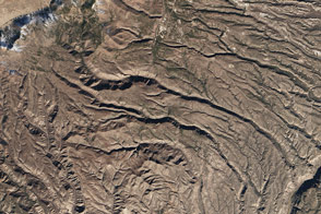
The rugged canyons slicing through plateaus in New Mexico’s Bandelier National Monument contain relics from human civilization that date back 11,000 years.
Published Feb 10, 2016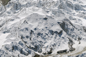
North America’s highest peak is slightly shorter than previously thought.
Published Sep 3, 2015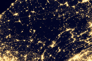
Areas recognized for their pristine dark skies are the perfect place to catch a glimpse of celestial phenomena.
Published Nov 15, 2014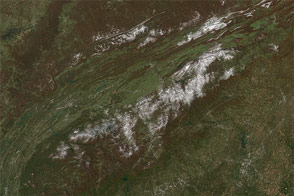
A potent weather system with origins in Manitoba moved south across the Great Lakes on Halloween and blew all the way to Florida, bringing snow and hard frost to regions that don't see either in some winters.
Published Nov 4, 2014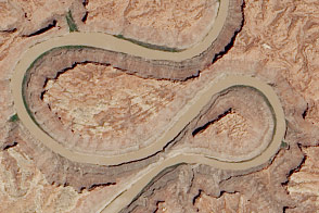
A double oxbow etched into the Colorado Plateau in Canyonlands National Park likely got its shape from an ancestral river.
Published Jun 18, 2014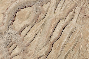
Sinking blocks of rock created this distinctive network of valleys.
Published Jun 6, 2014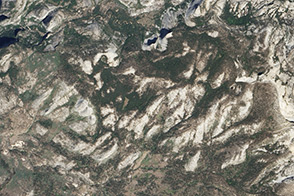
The landscapes of this national park are dominated by a tough, grainy rock that formed deep underground.
Published Apr 26, 2014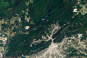
It takes thousands of years for rainwater to seep deep underground, warm up, and return to the surface before bathers can enjoy it in Arkansas.
Published Apr 23, 2014
Time transforms the ranges in the southern Appalachian Mountains through the course of a year.
Published Jan 14, 2014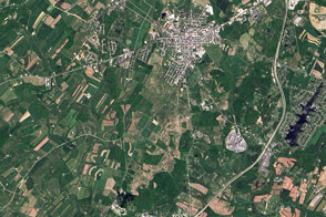
Modern remote sensing tools are helping to shed new light on the historic battle.
Published Jul 3, 2013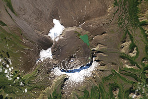
Acquired September 15, 2000, this natural-color image shows Aniakchak National Monument in Alaska, home to an old caldera, and even older fossils.
Published Oct 12, 2011
Americans celebrate the 75th anniversary of Shenandoah National Park, just 75 miles from Washington, DC, but worlds away in spirit.
Published Jun 25, 2011
Acquired April 2, 2002, this natural-color image shows Colorado National Monument and nearby agricultural and residential areas.
Published Mar 6, 2011
Acquired June 24, 2007, this natural-color image shows the eastern half of St. John Island in the U.S. Virgin Islands. The area pictured incorporates a national park and national monument.
Published Jan 20, 2011
Acquired on May 10, 2002, this natural-color image shows the varied landscapes of Big Bend National Park in southwestern Texas.
Published Jul 18, 2010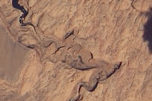
Acquired on May 23, 2010, this natural-color image shows the Colorado Plateau’s Rainbow Bridge, a natural sandstone arch, casting a slim shadow to the northwest.
Published May 30, 2010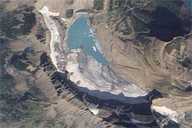
The retreat of Grinnell Glacier, in the heart of Glacier National Park, since 1950 is revealed in this image from August 21, 2003.
Published May 13, 2010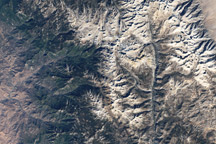
Acquired October 22, 2008, this true-color image of Sequoia National Park shows a network of varied ecosystem, including conifer forests, river valleys, alpine vegetation, and bare rocks.
Published Nov 15, 2009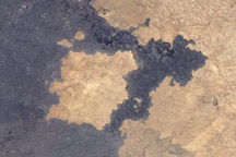
This "kipuka" in Craters of the Moon National Monument is an area of undisturbed grassland surrounded by a lava flow.
Published Oct 14, 2009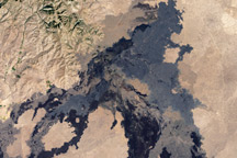
This lava field includes at least 60 flows ranging from 15,000 to 2,100 years old.
Published Oct 13, 2009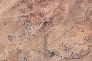
Acquired November 28, 2002, this true-color image shows an arid landscape in eastern Arizona. At the time of the earliest dinosaurs, it was a moist, tropical region near the equator.
Published Oct 4, 2009
Captured on June 27, 2009, this true-color image shows part of the White Sands National Monument in New Mexico, where brilliant white gypsum dunes slowly migrate toward the northeast.
Published Jul 12, 2009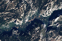
Naked summits alternate with forested lowlands in Yosemite Valley in this image acquired on August 18, 2001.
Published May 31, 2009
Kings Canyon and Sequoia National Parks contain a substantial portion of the Sierra Nevada and some 3,000 ponds and lakes.
Published Mar 22, 2009
State parks had already been established in the region when the U.S. Congress established northern California’s Redwood National Park in 1968.
Published Feb 22, 2009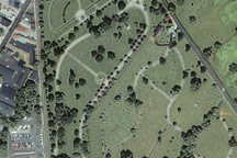
Soldiers’ National Cemetery, where U.S. President Abraham Lincoln delivered the “Gettysburg Address” in November 1863, appears in this Ikonos satellite image from June 25, 2003.
Published Feb 12, 2009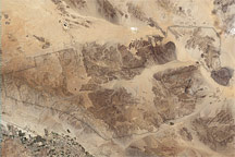
Three topographic and climatic zones converge in California’s Joshua Tree National Park, enriching the park’s biodiversity. The diverse terrain is shown in this Landsat image from May 28, 2003.
Published Jan 29, 2009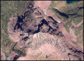
Geologically recent events sculpted the rocks of Glacier National Park into sharp mountain peaks and steep-walled valleys.
Published Aug 21, 2008