
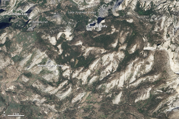
Congratulations to Earth Matters reader Mike G. for being the first to solve our April Puzzler! As Mike pointed out, this image shows granite outcrops in Yosemite National Park. Over on Facebook, Cooper Girard was the first to get the location; he also sagely noted that Yosemite’s landscape is the product of a granitic pluton being uplifted by tectonic processes and then sculpted by glacial ice. Read our April 26, 2014, Image of the Day for more details about the image, which was captured by the Landsat 8 satellite. After you’ve looked over the satellite image, check out this gallery of historical photography from U.S. Geological Survey geologist Francois Matthes showing many granite outcrops in the park. I’ve included a few of my favorite shots of Nevada Falls, Liberty Cap, Cascade Cliffs, and Mount Starr King below, but there are many more to see. At the very bottom of this post, you can also watch a nice video featuring geologists explaining how the granite formed.
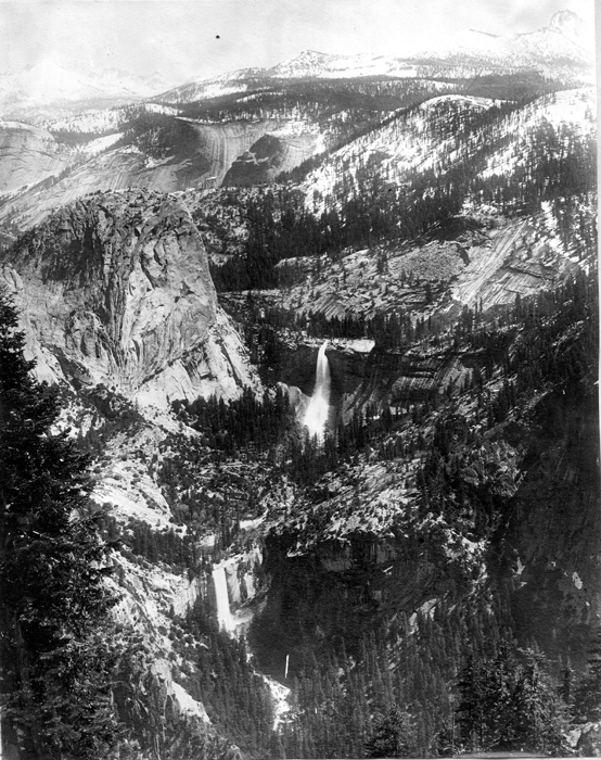
Yosemite National Park, California. Giant Stairway from Glacier Point. In the center is Nevada Fall, which leaps from the upper step, flanked by Liberty Cap. Below is Vernal Fall, which leaps from the lower step. On the far side of Little Yosemite Valley, which is behind Liberty Cap, are the water-streaked Cascade Cliffs, and beyond are the peaks of the High Sierra mantled with snow. At the left is Mount Florence. At the right is Mount Clark. Photo by A.C. Pillsbury, circa 1914. Plate 10, U.S. Geological Survey Professional paper 160.
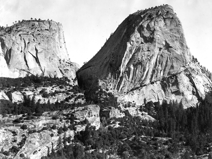
Yosemite National Park, California. Front of Liberty Cap and Mount Broderick. Their sheer, hackly fronts were subjected to the quarrying action of the Merced Glacier. The V-shaped cleft between them was gouged out along a narrow zone of shattered rock. Circa 1914. Plate 44-B, U.S. Geological Survey Professional paper 160.
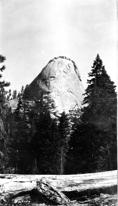
Yosemite National Park, California. End of an exfoliating spur on the west side of the Starr King group. This spur was not overtopped by the earlier ice. It owes its smoothly rounded form wholly to exfoliation. Circa 1913.
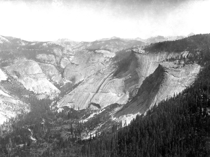
Yosemite National Park, California. Little Yosemite Valley. Through this broad antechamber the Merced River approaches the main valley. On the right are the Cascade Cliffs streaked by innumerable temporary cascades; on the left is Sugar Loaf (Bunnell Point). Circa 1914. Plate 4-A, U.S. Geological Survey Professional paper 160.
I believe what you posted mace a buch of sense.
But, what about this? what if you wer to write a killer
headline? I ain’t saying your information isn’t good, but what if you added something that makes people desire more?
I mean April Puzzler Answer: Yosemite