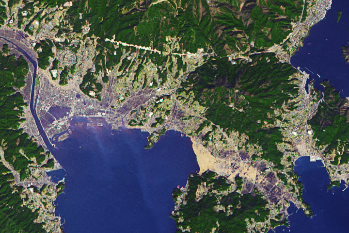
One of the hardest hit coastal cities in Japan is still working to recover.
Published Mar 11, 2021Image of the Day Land Water Human Presence Remote Sensing Earthquakes
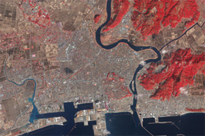
Acquired in March 2011 and February 2012, these images document the recession of flood waters after the Tohoku tsunami.
Published Mar 13, 2012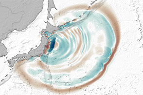
Even at great distances from their source, tsunami waves can grow by being focused and steered by underwater ridges.
Published Mar 12, 2012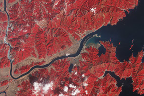
One year after the tsunami, the landscape near the mouth of the Kitakami river remains irrevocably altered.
Published Mar 11, 2012
Acquired 3 days after the Tohoku earthquake, this image shows the remains of a town that was nearly erased by the 2011 tsunami.
Published Mar 10, 2012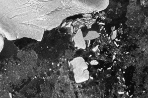
Scientists observed the calving of several large icebergs from the Sulzberger Ice Shelf in Antarctica as a result of the March 2011 tsunami half a world away in Japan.
Published Aug 9, 2011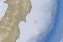
This map shows the location of a large aftershock off the coast of Japan on April 7, 2011.
Published Apr 7, 2011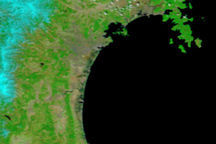
Taken on April 1, 2011, this image shows that floods linger in Japan’s tsunami-hit areas a full three weeks after the disaster occurred.
Published Apr 1, 2011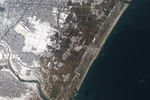
Acquired March 18, 2011, this natural-color image shows agricultural fields near Sendai, Japan, covered with either snow or flood water.
Published Mar 20, 2011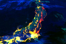
This color-coded composite image shows lights working or not after the earthquake and tsunami in Japan. The image compares observations from March 12, 2011, to data collected in 2010.
Published Mar 19, 2011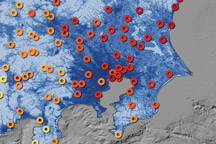
This map shows the ground motion and shaking intensity from the March 11, 2011, earthquake at dozens of locations across Japan.
Published Mar 19, 2011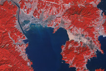
Acquired March 14, 2011, and March 1, 2007, these false-color images show the city of Rikuzentakata before and after a tsunami reshaped the local coastline.
Published Mar 18, 2011Image of the Day Land Water Floods Human Presence Earthquakes
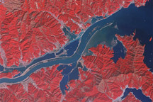
Acquired March 15, 2011, and January 16, 2011, these false-color images show part of the Kitaami River before and after the 8,9-magnitude earthquake and tsunami struck Japan in early March 2011.
Published Mar 16, 2011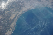
Taken March 14, 2011, this astronaut photograph shows the Japanese coast north, of the city of Sendai, in the wake of a devastating earthquake and tsunami.
Published Mar 15, 2011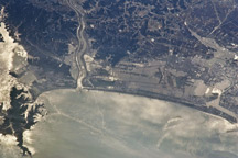
Taken March 13, 2011, this astronaut photograph shows the Japanese coast north of the city of Sendai, in the wake of a devastating earthquake and tsunami.
Published Mar 15, 2011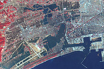
This false-color image acquired on March 14, 2011, shows widespread flooding in tsunami-hit Ishinomaki, Japan.
Published Mar 15, 2011
Taken on March 12, 2011, this stereoscopic image reveals the height of a plume of smoke rising from the Port of Sendai in the wake of the magnitude 8.9 earthquake and tsunami that hit Japan on March 11.
Published Mar 13, 2011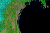
Skies over northeastern Japan were entirely cloud-free on March 13, 2011, providing a clear view of tsunami flooding along the coastline.
Published Mar 13, 2011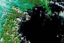
The Japanese coastline near Sendai is flooded in this false-color image, taken March 12, 2011, nearly a day after a earthquake-generated tsunami inundated the coast.
Published Mar 13, 2011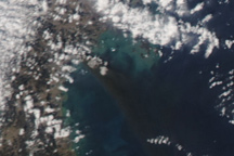
A heavy black plume of smoke streams southeast from Sendai, Japan, in this photo-like image from March 12, 2011. The smoke likely originated from a fire burning in an oil refinery in the wake of the massive earthquake that struck the city on March 11.
Published Mar 12, 2011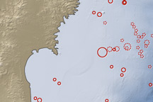
On March 11, 2011, a magnitude 8.9 earthquake struck off the east coast of Honshu, Japan, about 130 kilometers (80 miles) east of Sendai. If the initial estimate is confirmed, it will be the fifth largest earthquake in recorded history.
Published Mar 12, 2011