This map depicts rainfall for the Midwestern U.S. from April 19 to 25, 2011, when severe rains added to spring melt to bring dozens of rivers above flood stage.
Published Apr 27, 2011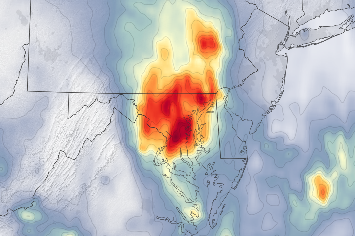
A dip in the jet stream pulled moist, tropical air from the Caribbean to the Eastern Seaboard and triggered several days of intense rains.
Published Jul 25, 2018Image of the Day Water Floods Severe Storms Human Presence Remote Sensing
A series of heavy rainstorms raised river levels to their second highest on record.
Published Sep 29, 2016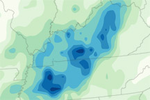
A map of rainfall totals between May 1 and May 3, 2010, shows a line of heavy rain following the path of severe thunderstorms across Tennessee and Kentucky.
Published May 5, 2010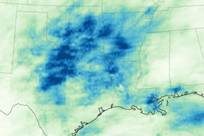
After years of drought, Texas, Oklahoma, and other states are now coping with persistent flooding rains.
Published May 22, 2015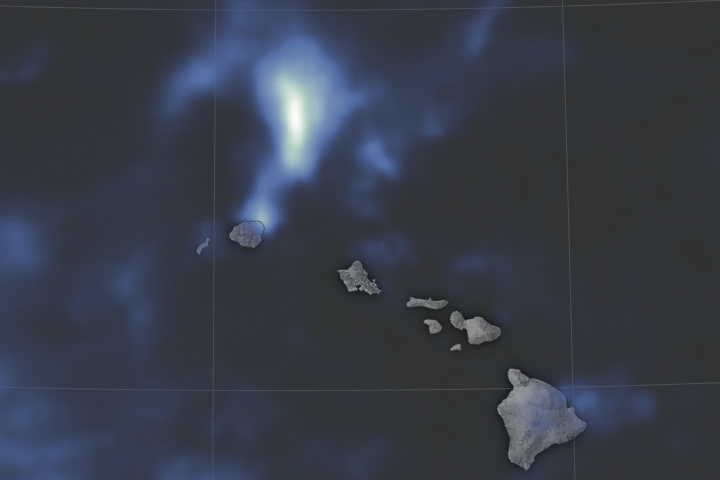
Torrential flooding on the northern shore of Kauai may have set a national record for the most rainfall ever in a 24-hour period.
Published May 2, 2018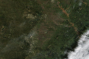
Muddy and swollen rivers are visible around Austin, Texas in the wake of flash floods.
Published Nov 1, 2013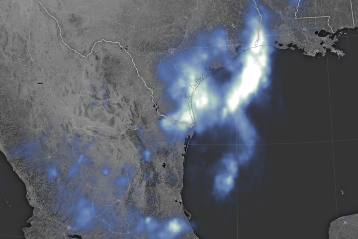
A tropical system dumps nearly a foot of water over many parts of southeastern Texas.
Published Jun 22, 2018Image of the Day Atmosphere Land Water Floods Human Presence Remote Sensing
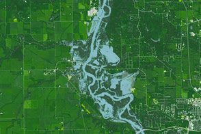
Parts of the Mississippi are swollen and spilling over its banks due to late December rains that are now flowing downstream.
Published Jan 5, 2016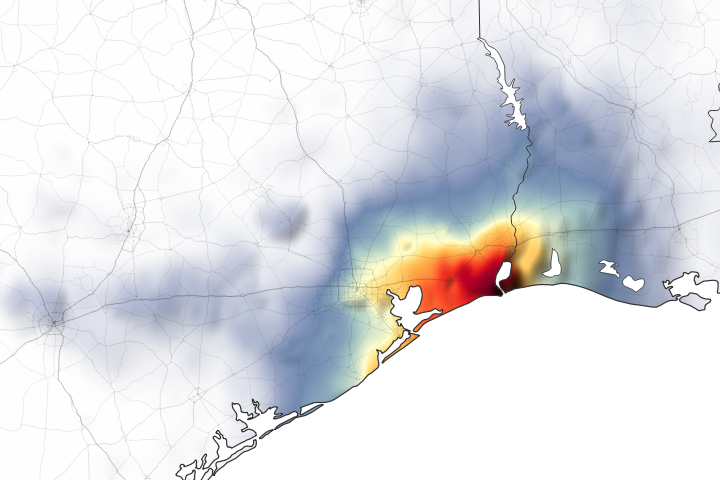
Parts of Houston and Beaumont are underwater after the remnants of Tropical Storm Imelda moved through the area.
Published Sep 20, 2019Image of the Day Land Water Floods Severe Storms Human Presence Remote Sensing
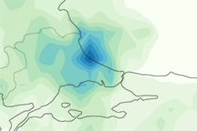
This image shows rainfall estimates for northwestern Turkey and the surrounding region from September 2 to September 9, 2009. The lightest amounts appear in pale green, and the heaviest amounts appear in blue.
Published Sep 11, 2009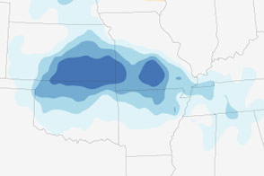
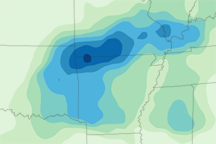
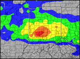
Heavy rain led to deadly flash floods in the Central United States in the first two weeks of August 2013.
Published Aug 18, 2013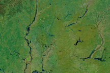
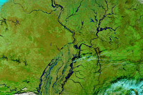
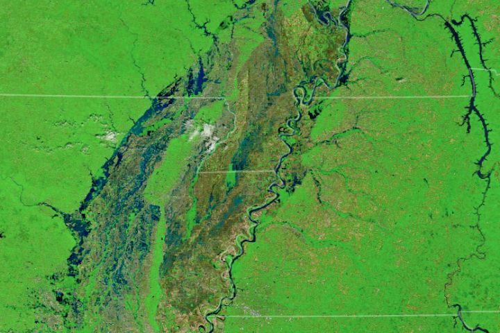
Swollen rivers and greening land in this image of southern Indiana on March 1, 2011, are signs that spring is approaching.
Published Mar 3, 2011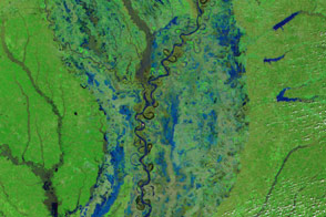
A slow-moving weather system brought a deluge to the U.S. South, flooding communities in multiple states.
Published Mar 16, 2016
Record rainfall in the Houston area led to severe flooding.
Published Apr 21, 2016
One of the hardest hit places was Mandra, a town west of Athens.
Published Nov 18, 2017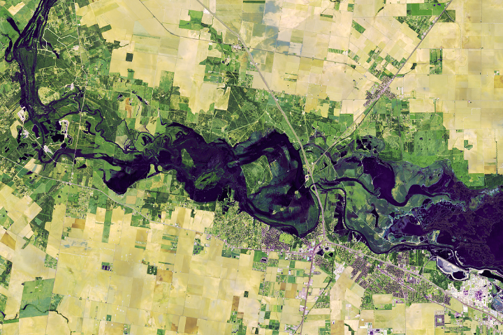
Storm after storm rolled through and dumped record rainfall in parts of Texas.
Published Nov 2, 2018Image of the Day Atmosphere Land Water Floods Human Presence
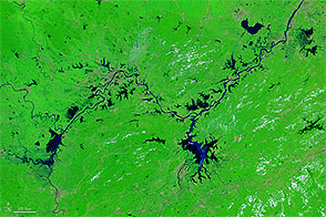
In summer 2016, flooding of historic proportions swamped the Yangtze River Basin.
Published Jul 30, 2016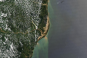
Floods spread across scores of kilometers in this image of the state of Espirito Santo from December 30, 2013.
Published Dec 31, 2013
June and July 2007 brought drenching rain and devastating floods to England. One of the hardest hit regions was Gloucestershire, in southwest England. The floods started in late June and continued throughout July.
Published Aug 3, 2007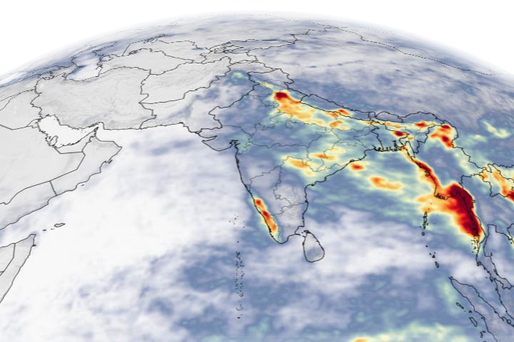
Abnormally heavy monsoon rains drenched southwestern India, leading to the worst flooding in Kerala since 1924.
Published Aug 21, 2018Image of the Day Atmosphere Land Floods Human Presence Remote Sensing
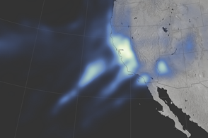
Parts of Northern California and the Sierra Nevada have not seen this much rain and snow since 2005.
Published Jan 12, 2017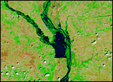
Several tributaries of the Mississippi River face record or near-record water levels.
Published May 3, 2017
Acquired July 7, 2011, and July 4, 2010, these false-color images compare conditions along the Souris River in North Dakota, where record flooding struck in June 2011.
Published Jul 7, 2011