
The recent megafire around Fort McMurray drew worldwide attention. Not only did this fire devastate a community, the fire also grew exceptionally large and started very early in the fire season. Northern forests are rapidly changing, and fire plays a crucial role in this transition.
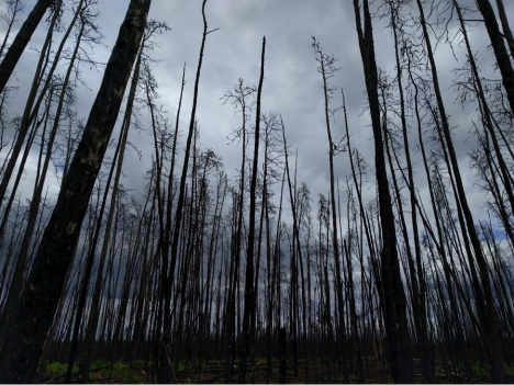
A recently burned forest in Saskatchewan, Canada. (Credit: Sander Veraverbeke)
Fires in the boreal forest emit large amounts of carbon dioxide, the most important greenhouse gas. Exactly how much they emit is a difficult question to answer. Over many decades these forest have piled up thick layers of downed needles and other organic material, resulting in thick carbon-rich soils. When a fire spreads through the forest, the carbon it emits comes mostly from these soil layers, and not so much from the actual live trees.
The real question is: how deep do these fires burn into the soils? There is a lot a variability depending on which forest type is burning and how hot it burns.
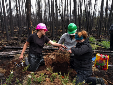
Some members of our team just excavated a deep organic soil. They will carefully measure this soil pie and cut out some samples for lab analysis. (Credit: Veraverbeke)
As part of the ABoVE field campaign, our field crew flew into Saskatoon, Saskatchewan on May 28th from Massachusetts, California, Ontario, and the Netherlands. We joined up with another field team from the University of Saskatchewan. After stocking up on supplies, we drove about four hours north to enter vast swaths of boreal forest.
Our goal in Saskatchewan is to quantify how much carbon fires emit in forest types that currently burn infrequently, but may become more sensitive to fire in the near future. For example, we are interested in reburns in forests that last burned only a couple of years ago, or burns in forests where people previously cut down trees. With all the changes that are underway it is important to understand how fires impact these forest types and how much carbon they emit.
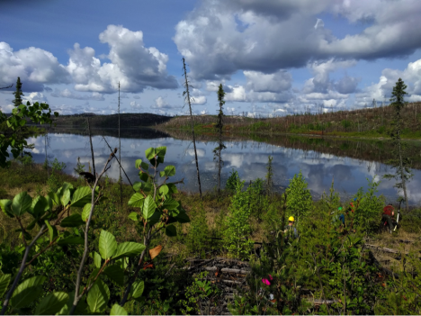
Our maneuvers in challenging terrain are rewarded by gorgeous vistas of landscapes that are untouched – except by fire. (Credit: Veraverbeke)
Since we arrived, we have been hitting up quite a few field plots. Getting to these field plots requires off-trail hiking in often-rough terrain, with soggy bogs and steep rocky hills. We have to scramble through piles of wood that fell down after the fire. Once we get to our desired site, we measure for several hours. We take samples of soils that will be analyzed in the lab and measure lots of trees (as many as several hundred). By doing so, we are able to assess the amount carbon of that was emitted by the fire.
We can link up our field measurements with data from NASA satellites to better characterize all fires within Canada and Alaska. During the day we get rewarded for our hard work with lunches-with-views, mosquitoes, and some thunderstorms that hopefully rain out somewhere far on the horizon…
Sander Veraverbeke is a project scientist at the University of California, Irvine, and an assistant professor in Remote Sensing at Vrije Universiteit in Amsterdam
Tags: ABoVE, Canada, carbon, Earth Expeditions, wildfire