NASA satellites and sensors constantly take the pulse of our planet, measuring how Earth changes by the day, season, year, and decade. Researchers and resource managers analyze those measurements and apply them on local and regional scales to better manage things like our food and water supplies, health, safety, land use, and ecosystems. NASA data is also used by other government agencies to help with responses to natural disasters and emergencies around the country and the world.
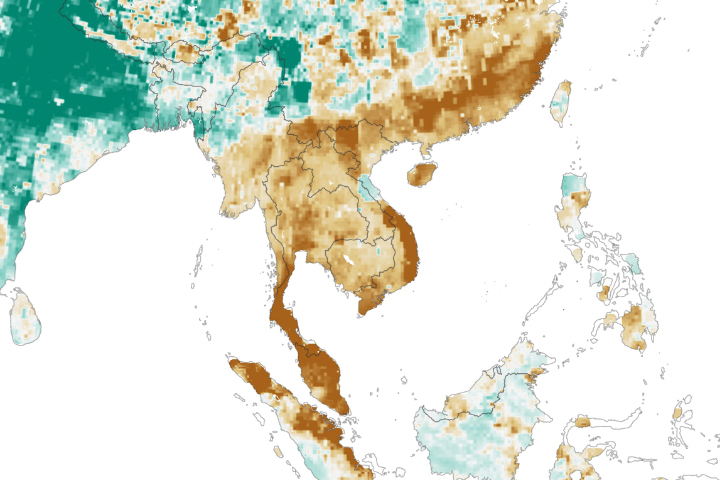
A severe drought in Thailand is affecting agriculture and drinking water in the region.
Published Feb 15, 2020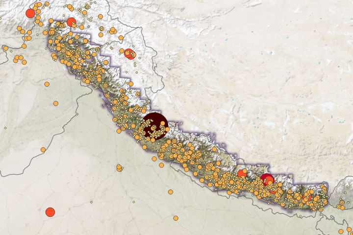
Warming temperatures will likely cause more intense rainfall, leading to increased landslide activity.
Published Feb 12, 2020Image of the Day Atmosphere Land Water Human Presence Snow and Ice Remote Sensing
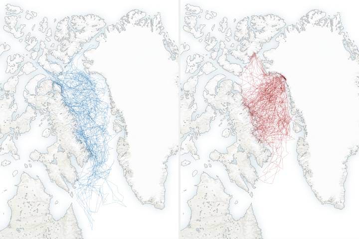
A new study shows that polar bears are spending less time on sea ice, leading them to fast longer, become thinner and have fewer cubs.
Published Feb 4, 2020
In the wake of a potent winter storm in late November in the U.S. Midwest, an unusual pattern turned up in satellite imagery.
Published Dec 6, 2019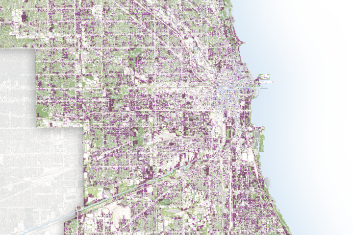
A new study shows that nocturnal animals are less active when the nights are too bright with electric lighting.
Published Oct 24, 2019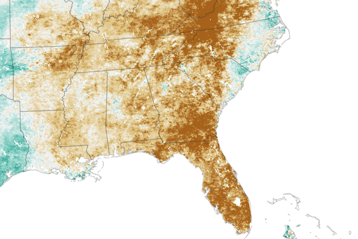
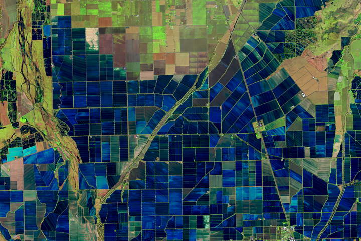
After a wet spring, a quick-onset drought has parched fields.
Published Oct 23, 2019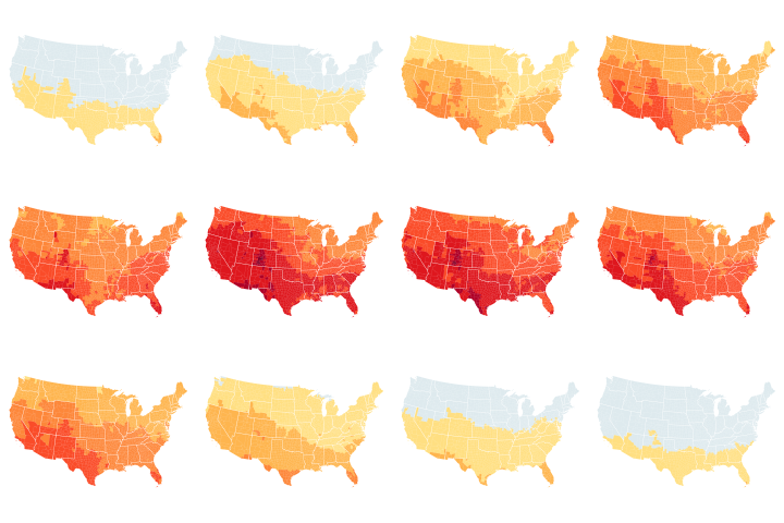
The Centers for Disease Control and Prevention is using NASA data to help the public better understand their UV exposure.
Published Aug 7, 2019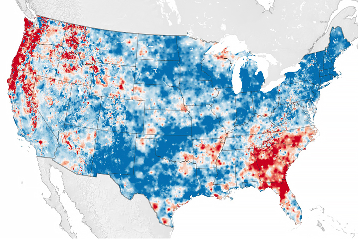
Scientists have developed a new way to measure water cycle intensity over time.
Published Jul 26, 2019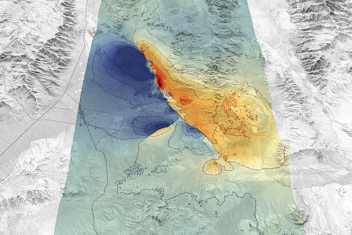
Remote sensing scientists are getting better at measuring such events and showing how they disrupt and move the land surface.
Published Jul 25, 2019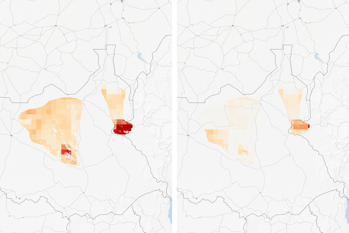
Researchers examined how human land use will affect species habitats around the world.
Published Jul 22, 2019
New study uses satellite and demographic data to show how the prolonged presence of green space is important for a healthy society.
Published Jul 17, 2019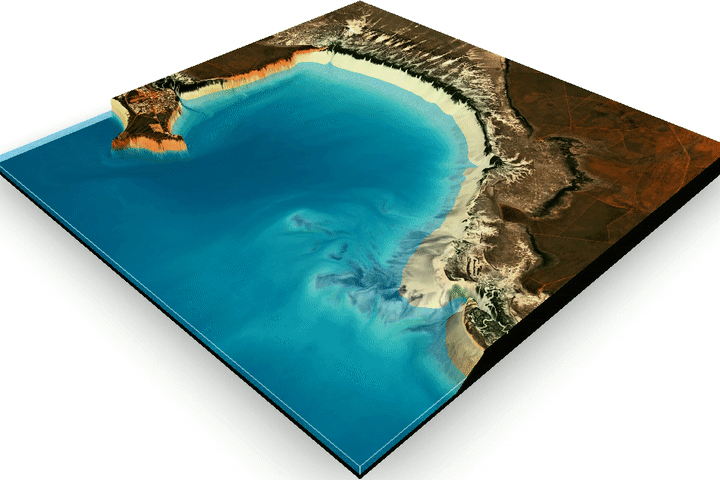
Harnessing 30 years of Landsat data, researchers have created the first three-dimensional model of Australia’s entire coastline.
Published Jul 2, 2019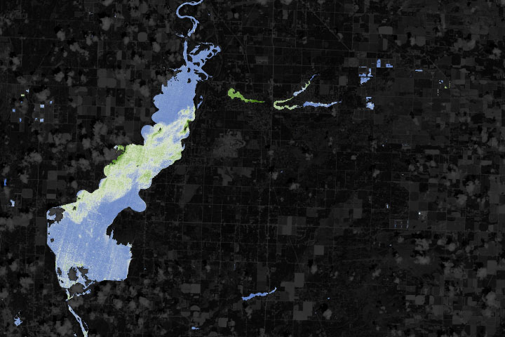
With limited resources to monitor often-unpredictable blooms, water managers are turning to new technologies to detect and keep track of hazards.
Published Jun 22, 2019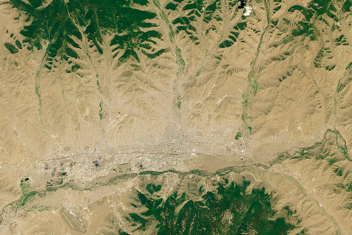
The Mongolian capital is spreading outward as migrants from the countryside fill neighborhoods on the fringes of the city.
Published Jun 4, 2019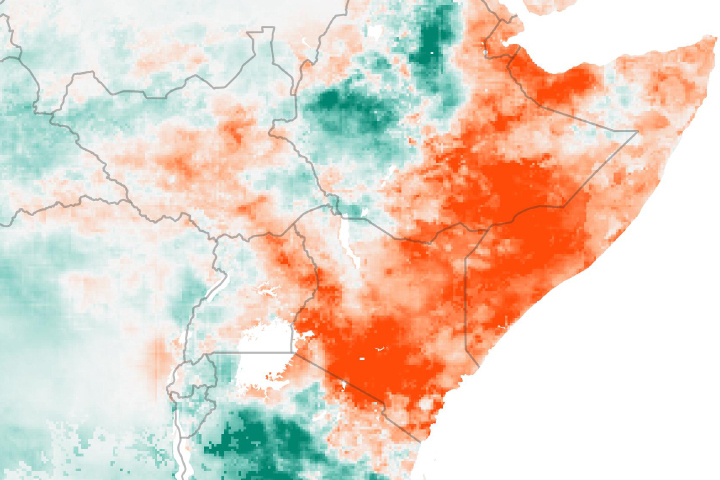
Drought is apparent across much of East Africa after seasonal rains failed to deliver much moisture to the region.
Published May 30, 2019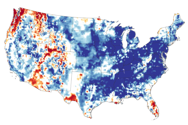
The continental United States recently finished its wettest twelve months in 124 years of modern recordkeeping.
Published May 24, 2019
The powerful storm, one of the worst to hit India since 1999, knocked out electricity across the state of Odisha.
Published May 8, 2019Image of the Day Severe Storms Human Presence Remote Sensing
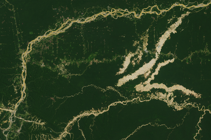
The Madre de Dios region has a rich concentration of endemic species, but their habitats are being threatened by human activity.
Published Apr 19, 2019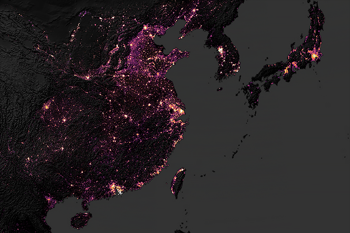
Large and wealthy cities have the biggest carbon footprints.
Published Apr 11, 2019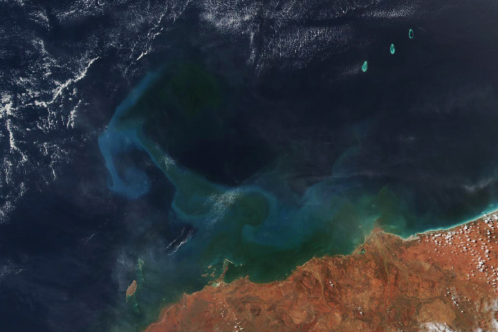
Tropical cyclone Veronica appears to have stirred up swirls of phytoplankton.
Published Apr 3, 2019
Researchers are using Facebook data to observe population movements during disasters.
Published Mar 29, 2019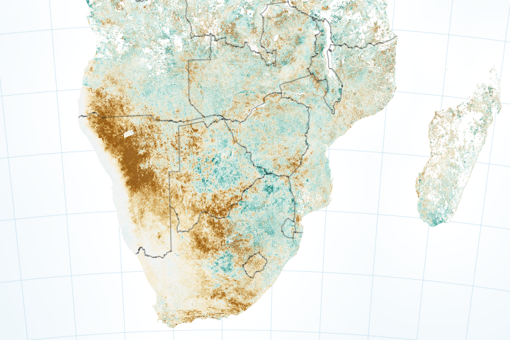
Dry conditions are bringing food insecurity to several countries.
Published Mar 20, 2019Image of the Day Land Life Water Drought Human Presence Remote Sensing
Flooded rice fields in the winter help farmers soften plant stubble for spring tilling. They also provide an oasis for migratory birds.
Published Mar 26, 2019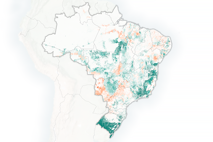
Brazilian researchers are using satellites to calculate how many cattle can be supported by the country's pasturelands.
Published Mar 12, 2019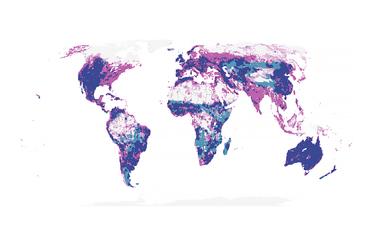
Fluctuations in rainfall are reducing the ability to sustain cattle on grazing lands.
Published Feb 22, 2019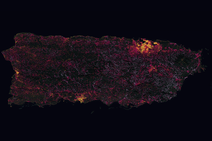
The hurricane took a disproportionate toll on power supplies in remote areas of Puerto Rico.
Published Dec 12, 2018Image of the Day Atmosphere Land Severe Storms Human Presence
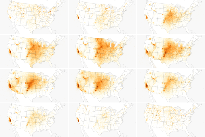
Farms and feedlots are a key source of the pollutant.
Published Dec 10, 2018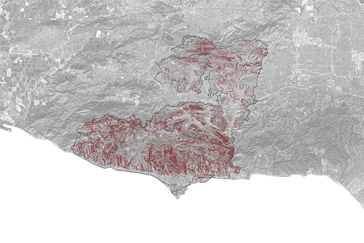
A NASA project is providing maps of satellite data to emergency response teams during the Woolsey Fire.
Published Nov 16, 2018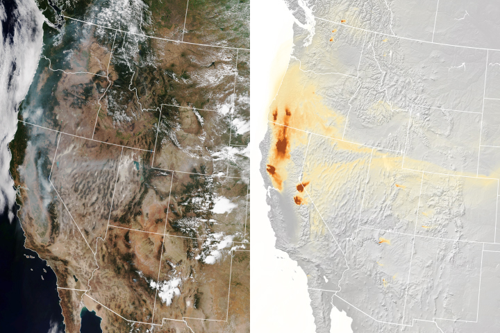
A new experimental model that relies on data from NOAA and NASA satellites has proven remarkably good at simulating the behavior of wildfire smoke.
Published Nov 6, 2018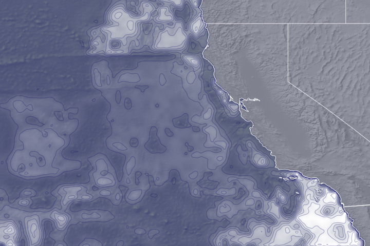
Environmental variables detected by satellites can help reduce collisions between ships and blue whales.
Published Nov 1, 2018