March 16, 2011
My alarm clock was set for 5:30 this morning to wake up, shower, get some breakfast and be at the hanger no later than 7 a.m. for an 8 a.m. take off. The weather was good for our target area north of the Canadian archipelago (islands), to survey the sea ice beneath the ENVISAT (LINK) satellite overpass that would take place later on in the afternoon. Part of the goal of IceBridge is to compare measurements taken on the P-3 to those measured by the satellites orbiting overhead. Since the satellite has much better spatial coverage then our airplane, if we can get good agreement between its data and the P-3 data, then we can trust that the satellite data is good. This will be tested on another level later in the week (hopefully) when we fly over the Navy Ice Camp, north of Alaska, where they will have instruments on the ground that we will then compare both our plane and satellite data again.
What type of instruments do we have on the NASA P-3? A Laser altimeter called ATM (Airborne Topographic Mapper), measures the distance between the plane and the sea ice surface, which gives us an elevation measurement. There are multiple radars, including one that measures snow thickness on the surface of the ice. A gravimeter is measuring Earth’s gravitational field, which in turn tells us about the bathymetry, or sea floor below. A magnetometer is measuring changes in the Earth’s magnetic field, again to give us an idea as to what the sea floor below looks like. We also have three digital cameras pointed downward below the plane taking constant pictures of our flight path.
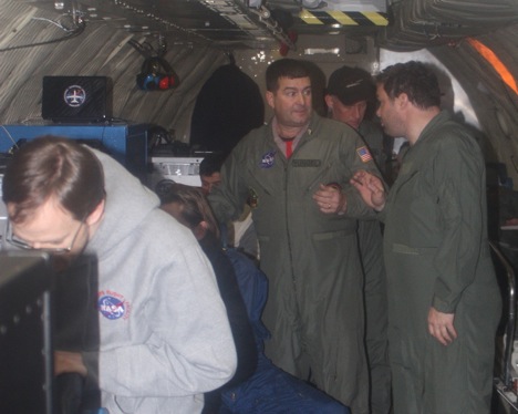
Ariborne Topographic Mapper (ATM) with Jim Yungel, ATM Program Manager (center) and Michael Studinger, project scientist for Operation IceBridge (right). Credit: LCDR Woods
It took about 90 minutes to get to our first collection waypoint. Weather plays an important role for the data collection because clear skies are needed for the instruments to take proper measurements. This morning’s weather briefing looked like our collection area was going to be relatively cloud free. After the transit, we dropped down to 1,500 feet and switched all the instruments into collect mode. The weather was perfect, and viewing the sea ice out the window was breathtaking. Lots of people think of the Arctic as just a flat expanse of white. This couldn’t be further from the truth. There are all sorts of cracks (leads) and mountains (ridges), similar to tectonic plates. The ice below is constantly moving via the winds and currents, and those forces acting on each piece of ice makes for a very dramatic seascape. There are areas of open water, though only for a few hours, because the surface temperatures below are well below freezing (approximately minus 20 degrees Celsius). You can see varying stages of sea ice formation, where there used to be open water, and the re-freezing process has already begun. It was rewarding to talk trough the different ice types with Midshipman Brugler, who took the Polar Science course last year, and get visual confirmation on concepts we discussed in the classroom.

The sunrise as seen from about 1,500 feet over the frozen Arctic Ocean. Credit: LCDR Woods)
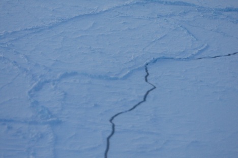
Cracks (leads) and ridges are visible in the sea ice. Credit: LCDR Woods
After approximately 2 hours of data collection at 1,500 feet, we turned the P-3 around and climbed to 17,000 feet. We collected data on the exact same track as our outbound leg, testing the instruments between low-level and high-level collection. The sea ice took on a much different perspective at this higher altitude. We could see individual features before such as actual blocks of ice piled up on each other at a ridge, but now we saw a much larger area, with decreased details. The ice still does not look flat, but more like a jagged jigsaw puzzle, with intermittent breaks in the ice. Both legs were equally exciting and I am looking forward to being back in the air again tomorrow … weather permitting!
March 14, 2011
Today was busy day; a cargo shipment arrived with some instruments for the ground stations at 1430, and the P-3 arrived from Wallops Island, Va., at 1535. The air temperatures were about 20 below zero, with wind chills around minus 30 degrees Celsius. I was able to get right outside the hanger, and actually shot some video and photos of the P-3 landing, from atop the taxi way stair truck. It was a bit hazy, with some blowing snow, so visibility was not the best, but I was able to snap some decent shots which would prove helpful later without knowing it at the time.
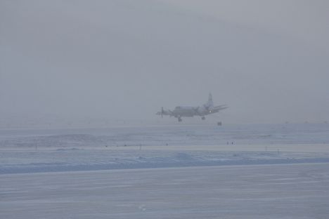
After transiting from Wallops Island, Va., the P-3 lands in Thule, Greenland. Credit: LCDR John Woods
The P-3 seemed to land very nicely from my vantage point across the runway, and it proceeded to taxi around towards the hanger. When it was about a hundred yards away we noticed that there was something wrong with the front tire. It had blown out during the landing/taxi. Later the pilots would use my photos of the plane landing to verify that the wheel had proper alignment during final approach. Unfortunately, due to the repairs, we will not be able to fly our first mission until Wednesday, March 16, however, the instrument teams will be able to utilize this time to finalize ground station set ups and calibrations. Hopeful for a sea ice flight on Wednesday!!
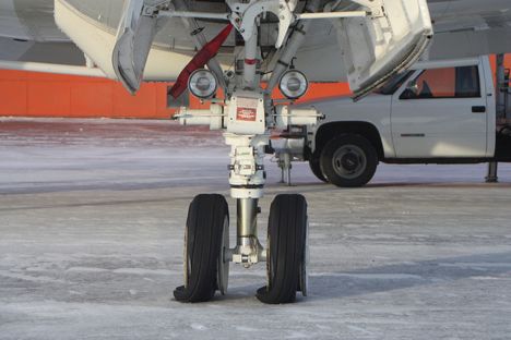
The P-3’s front tires blew out upon landing/taxi in Thule, Greenland. Credit: LCDR John Woods
March 11, 2011
Eric Brugler is First Class Midshipmen who is an honors Oceanography major at the United States Naval Academy. He is interested in the polar regions of Earth because he believes they play a very important role to the Earth’s climate system.
My research is focused primarily on sea ice and using airborne measurements to infer sea ice thickness over an area of the Arctic. If only the person sitting in the window seat knew that, maybe he would have understood why I kept leaning over him to get a look out the window.
Stepping off the plane was a shock in itself, all the moisture in my nose immediately froze! The highlight of my first day was definitely getting my “Arctic gear;” so now when I walk to the chow hall, at least I won’t be shivering the whole way. In all seriousness, the gear they issue to us upon arrival is really a lifesaver; the temperatures get to 50 below zero on some days. Having this gear will make the stay much more comfortable.
Our first flight in the P-3B aircraft, NASA’s scientific data collecting plane, won’t happen before Tuesday [March 15], so everyone is anxiously awaiting to finally get airborne and look at areas in the Arctic that are changing quite rapidly. Understanding the change happening in the Arctic is very important because the poles serve as harbingers for the Earth’s climate system. Basically this means that the poles give insight into what changes will happen around the world before any other place on earth. Being able to come to the Arctic and study this first hand is quite humbling since I am only a senior in college. However, I think that having firsthand experience will enhance my future studies as I continue to delve further into polar science.
March 12, 2o11
Saturday morning at Thule AFB is pretty slow paced. MIDN Brugler and I went to the gym around 0730, and we were the only ones there, except for a few Air Force guys. We had a lazy but productive morning (laundry, some research, email) in preparation for our sled ride trek in the afternoon coordinated by the base Activities center. The group was supposed to take us to the ice cap, however, the access road was closed, so we searched for an alternate site. We hitched a ride with some Greenland contractors (Danish citizens who work at Thule for years at a time), and we actually ended up going over to Dundas Village again. This time it was a much easier voyage via car, rather than walking across the sea ice. Also, the sun was shining bright, so the icebergs in the bay were even more spectacular!
While waiting for the start of the Operation IceBridge mission, Woods and Brugler tried sledding in Greenland. Credit: John Woods
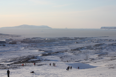
We finally ended up finding a spot to go sledding, and it had a great overlook of the entire base, harbor, and Detachment 1 site. The airstrip is enormous, and we had a perfect vantage point from where we were sledding. Thule operates a modern airfield with a 10,000-foot runway and more than 3,000 U.S. and international flights per year. Looking off in one direction you could see the harbor where each summer a Maritime Sealift Command docks with a fuel re-supply. The base is home to the northernmost deepwater port in the world. Off to the south we could see Detachment 1, where the US Air Force’s 23rd Space Wing’s global network of sensors providing missile warning, space surveillance and space control to North American Aerospace Defense Command and Air Force Space Command. It was a great panoramic vantage point in beautiful weather (only minus 5 degrees today with a minus 20 degree wind chill!)
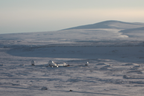
Detachment 1 can be seen from the panoramic vantage point of Dundas Village. Credit: John Woods
Everyone had fun sledding and snowboarding down the side of the hill. The snow was very dry and not very deep. The surface was a bit inconsistent and varied between ice, snow, and rocks. It reminded me of my early years learning to ski in New Jersey. Following the sled trip we went back to the community center and traded stories of how fun it was hiking back up the hill after a very fast sled ride down, no chair lifts here in northwest Greenland. It was another fun-filled day with once-in-a-lifetime experiences!
We’re still waiting for the P-3 to show up, after which we can start collecting some sea ice data! One more day of “Thule Trippin” tomorrow, then we get down to business on Monday when the plane and rest of the NASA and instrument teams arrive.
March 11, 2011
**We woke up to some horrible news about the Earthquake and subsequent Tsunami that struck Japan, and then threatened the Hawaiian Island and West Coast of the U.S. I taught the Intro to Oceanography course at USNA, and 2 of the core objectives are introducing the student’s to earthquakes and tsunamis. I hope that all those I taught were able to follow what was going on with a better understanding of the physical scientific processes that were taking place. The video and destruction were frightening to watch and my prayers are with the Japanese people to give them strength during these difficult times.**
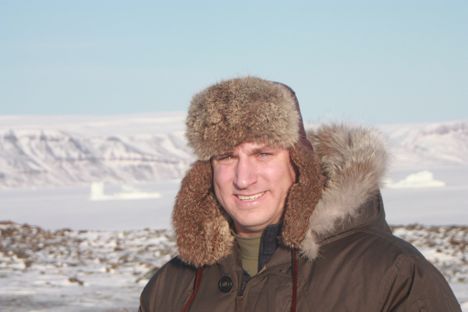
LCDR John Woods participates in the Arctic 2011 campaign of NASA’s Operation IceBridge mission in Thule, Greenland. Image is courtesy of John Woods.
Since the P-3 will not arrive until Monday we took the opportunity to take in some of the sights around base. Thule Air Base is the U.S. Armed Forces’ northernmost installation, located 750 miles north of the Arctic Circle. We were issued Arctic Gear the day before, which consists of a VERY warm down parka, and other essential clothing that you need to survive the minus 5 degree Fahrenheit air temperatures and even colder wind chills. Unfortunately the base was in a weather warning when we woke up which meant no off base travel was authorized. However, after lunch the weather warning was lifted. Before you are allowed to travel off base you must visit a building to check out a radio, and fill out a trip plan with your personal info, and planned return time. There was quite the character in there. He was a Emergency Management worker from Denmark telling us about recent polar bear sightings and the possibility of finding some Inuit Seal hunters in nearby Dundas Village. He was joking (we think) about which of us could run faster, stating that whoever was slowest should be a distraction to the hungry polar bear, and the faster runner should survive!
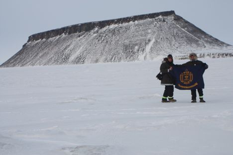
LCDR John Woods and MIDN Eric Brugler stand in front of Mt. Dundas in Thule, Greenland. Credit: John Woods
We took a taxi (more about them later) to edge of Northstar Bay and began our trek across the sea ice towards Dundas Village. The village looked only a mile or so away, however, all features seem closer than they really are here due to extraordinary clear atmosphere, it is quite the optical illusion. We got varying reports from folks how long it would take us to walk across the ice, from 1-2 hours. So off we went.
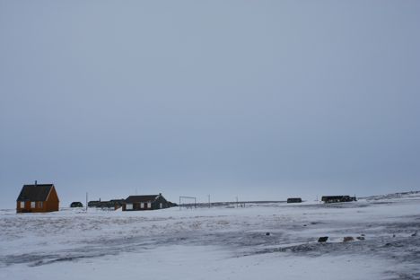
The clear Arctic atmosphere makes Dundas Village in Thule, Greenland, appear just a short distance away. Credit: John Woods
The wind was only about 10 or 15 knots, but right in our faces, which made any exposed skin very uncomfortable. We had our facemasks pulled up covering every last portion as we followed recent dog sled tracks towards the hunting village. When we arrived (approximately 45 minutes) it was eerily quiet, as we hadn’t noticed any motion during our walk across the frozen bay. There were no signs of recent activity, minus LOTS of sled dog droppings, and a polar bear paw, with its fur and claws ripped from it. We found it strangely odd that just this one paw was left behind with no other signs of anything, so we took a few photos, and put it back where we found it.

LCDR John Woods and MIDN Eric Brugler find a polar bear paw during their Arctic excursion. Credit: John Woods
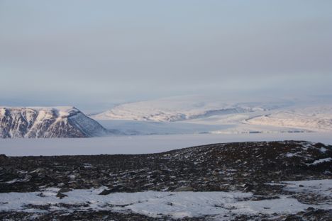
We explored the dozen or so huts, and decided to climb the small incline past the village to see what was on the other side. What a site! Another frozen body of water was in front of us, but this time three large Icebergs were within walking distance. We decided to hike out to the nearest one and got some good photos climbing to the top. At this point we were outside for about two and half hours, and we graciously took the offer of a Danish couple, who was out for a sightseeing drive, for a ride back to base. They were very pleasant, and shared all sorts of neat information about what it is like to live in Greenland. He was a firefighter and EMT, and has been here for over three years and she has been here just over a year and was a physical therapist on base. They brought us up towards the BMEWS (Ballistic Missile Early Warning System more on this in a later post), and to some great vantage points over looking the Wolstenholme fjord. This is the only place in the world where four glaciers combine into one fjord, it was an amazing view!
Woods and Brugler hike by a fjord in Thule, Greenland. Credit: John Woods
On the way back to base, we stopped in one of the many Survival huts, to take a look around. These are all over the roads off base, and on base in case of a sudden storm that can create impassable white out conditions. It was an exciting day, filled with adventures that you just cannot experience in many other places on Earth!
