
One of my scientific objectives while on MOSAiC is to make measurements that will help validate sea ice data collected by NASA’s ICESat-2 satellite. Using a helicopter, a laser, precise GPS coordinates, and some chocolate, we were able to do just that.
On the Morning of March 22, I looked into the upcoming ICESat-2 orbits and noticed that the satellite would be passing almost directly overhead of Polarstern the following day, a little over 24 hours from that moment. This presented a unique opportunity: If we could fly a helicopter (mounted with a laser scanner) directly underneath the ICESat-2 orbit at the exact time that the satellite was passing over, we would effectively have two independent sources of the same measurement – sea ice elevation detected by a laser – taken at the same time over the same sea ice. This method has been done previously during NASA’s Operation IceBridge campaigns, and has proven incredibly useful for validating the ICESat-2 data.
I checked with Robert Ricker, a remote sensing scientist with AWI and the operator of the helicopter-based airborne laser scanner (ALS), to see if this would be possible. He was excited to give it a shot…provided the flying conditions were favorable.
When we awoke on March 23, the weather was perfect. There was just one snag: The Captain of Polarstern wanted to ground all helicopter flights so that the ship’s crane could be used to move cargo on board. We quickly jumped in and explained the importance of our flight and just how time-sensitive it is. After a bit of convincing, he agreed to let our flight be the only one of the day.
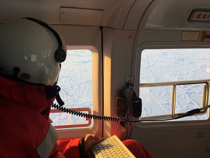
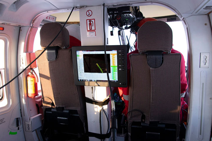
A little after 12:30 p.m., we took off in the helicopter. Robert was manning the ALS and my eyes were fixed on the GPS, making sure that we stayed on the orbit track. Since ICESat-2 has six beams, we planned to fly beneath the middle two beams, which are spaced 90 meters apart. The footprint of the ALS is about 300 meters wide, so we aimed to capture both of the middle ICESat-2 beams within the ALS footprint. It sounds easy in theory, with about 100 meters of buffer room on either side. In reality, it was like walking a tightrope. Any slight gust of wind would cause the helicopter to drift off track, prompting Robert or I to inform the pilots to veer slightly back along the orbit. We did our best to stay in line, and after around 45 minutes of flying on the orbit track ICESat-2 passed directly overhead!
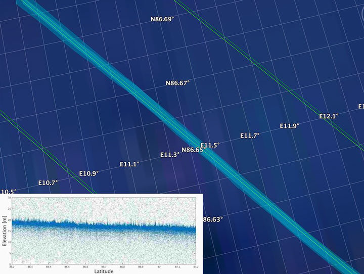
Overall, we flew around 75 nautical miles away from Polarstern along the ICESat-2 orbit before turning around and heading back to the ship the way we came. Of course, we shared a celebratory chocolate bar with the helicopter pilots on the way home. By performing this underflight, we collected valuable data that will not only be used to help validate the ICESat-2 sea ice algorithms, but also will help to scale up the measurements taken on MOSAiC to the larger Arctic sea ice cover.
Wonderful. Thanks for sharing this. I can’t get enough of this adventure, vicarious though it has to be.
Very fascinating experiment.