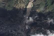
Acquired September 7, 2010, this natural-color image shows the Zhouqu landslide remaining visible on the landscape weeks after its occurrence.
Published Sep 13, 2010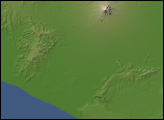
Debris spread more than 3 kilometers (2 miles) from the source to the toe of the landslide.
Published May 22, 2017
Sobering satellite views reveal massive damage on the Indonesian island of Sulawesi.
Published Oct 3, 2018Image of the Day Land Water Human Presence Remote Sensing Earthquakes
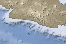
This image shows bathymetry in shades of blue and topography in shades of brown in the area where an earthquake struck off the shore of western Java on September 2, 2009.
Published Sep 4, 2009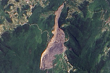
On June 5, 2009, a mountainside collapsed in the Chingqing region of southern China, burying dozens of people. The landslide remained visible in satellite imagery nearly two weeks later.
Published Jun 19, 2009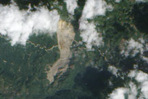
On January 4, 2009, a mountainside in northern Guatemala suddenly collapsed, sending thousands of tons of rock and debris downhill and burying a nearby road. The event occurred in the state of Alta Verapaz, some 200 kilometers (124 miles) north of Guatemala’s capital city.
Published Jan 15, 2009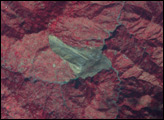
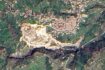
A pale tan scar in this natural-color image from March 14, 2010, marks the location of a landslide outside the southern Italian town of Maierato.
Published Mar 17, 2010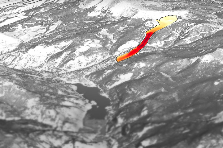
Through the study of an unusual, long-lasting slide, has developed a new technique to make prediction easier and more accurate.
Published Jun 5, 2020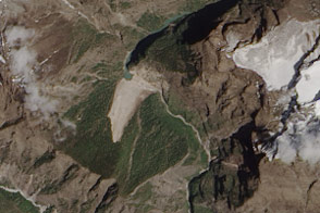
Debris from an earthquake-induced landslide has dammed a river in Nepal.
Published May 7, 2015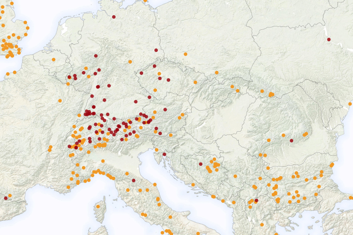
A new NASA project improves landslide inventories with data from the public.
Published Jul 11, 2019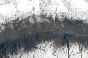
The powerful earthquake in Nepal triggered a destructive landslide that completely buried a village.
Published May 5, 2015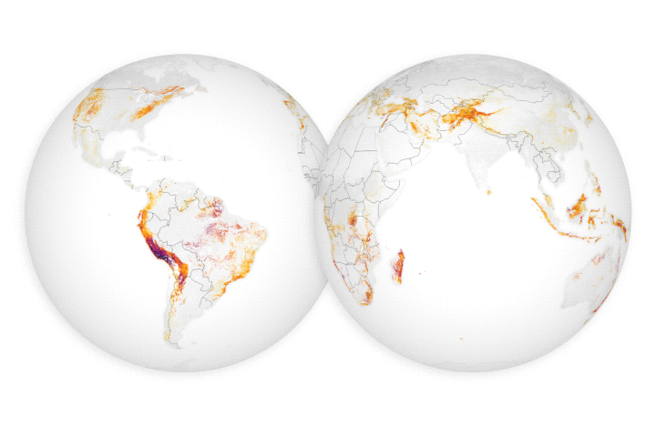
For the first time, scientists can examine rain–induced landslide threats anywhere around the world every 30 minutes.
Published Apr 18, 2018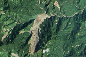
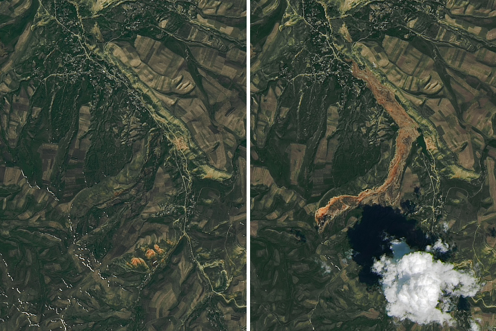
Heavy rainfall from tropical storm Komen triggered a large landslide in Myanmar (Burma).
Published Nov 8, 2015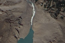
On July 2, 2010, a landslide-dammed lake in Pakistan appeared to have overtopped the dam, and water was streaming out through a man-made spillway.
Published Jul 2, 2010alert message
