
Persistent rains and saturated soils across the watershed swelled the river to its banks and occasionally onto floodplains.
Published Feb 4, 2020
Parts of the Mississippi are swollen and spilling over its banks due to late December rains that are now flowing downstream.
Published Jan 5, 2016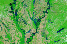
Acquired May 8, 2011, April 29, 2011, and May 3, 2010, these false-color images show water levels along the Mississippi River between Memphis and Vicksburg.
Published May 9, 2011
These false-color images compare conditions along the Mississippi and Yazoo Rivers around Vicksburg in June 2011, during heavy flooding, and three years earlier.
Published Jun 14, 2011
Acquired June 1, 2011, and May 28, 2010, these false-color images compare conditions along the Lower Mississippi River.
Published Jun 1, 2011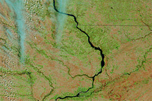
Acquired April 12, 2011, and March 2, 2011, these false-color images show retreating snows and rising rivers in the U.S. Midwest.
Published Apr 14, 2011
Acquired March 1 and 20, 2011, these false-color images show rising waters on the Mississippi River and some of its tributaries.
Published Mar 21, 2011
Acquired May 5, 2011, and May 5, 2010, these false-color images compared flood conditions in 2011 to calmer conditions one year earlier.
Published May 7, 2011
Heavy rains have caused major flooding in areas along the river, and forecasters say there's more to come.
Published Feb 27, 2019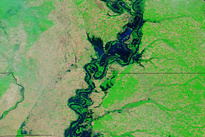
Acquired May 20, 2011, and April 14, 2011, these false-color images show water levels along the Mississippi River.
Published May 23, 2011
Persistent heavy rains in the first two months of 2020 have swelled rivers from Missouri to the Gulf of Mexico.
Published Feb 29, 2020Image of the Day Land Water Floods Severe Storms Human Presence Remote Sensing

Acquired April 29, 2011, and April 29, 2010, these false-color images demonstrate worse springtime flooding conditions in 2011.
Published May 1, 2011
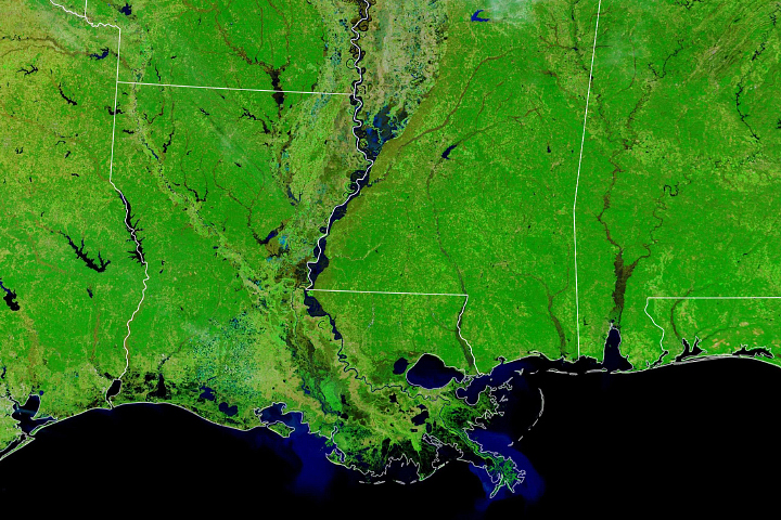
Acquired June 8, 2011, and June 9, 2010, these false-color images compare conditions along the Mississippi and Atchafalaya Rivers in Louisiana.
Published Jun 9, 2011alert message
