Persistent rains and saturated soils across the watershed swelled the river to its banks and occasionally onto floodplains.
Published Feb 4, 2020
Acquired June 1, 2011, and May 28, 2010, these false-color images compare conditions along the Lower Mississippi River.
Published Jun 1, 2011
Parts of the Mississippi are swollen and spilling over its banks due to late December rains that are now flowing downstream.
Published Jan 5, 2016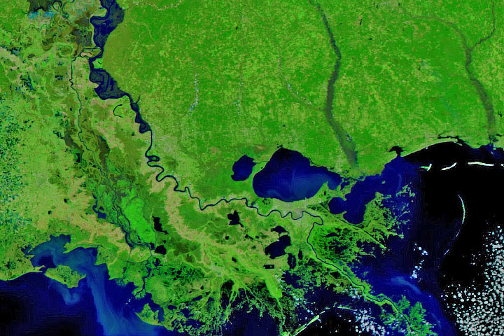
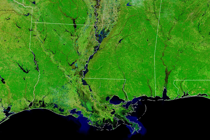
Persistent heavy rains in the first two months of 2020 have swelled rivers from Missouri to the Gulf of Mexico.
Published Feb 29, 2020Image of the Day Land Water Floods Severe Storms Human Presence Remote Sensing
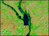
Lake Pontchartrain, immediately north of New Orleans, occupies the upper part of this astronaut photograph from April 29, 2008, with the winding course of the muddy Mississippi River snaking across the bottom of the view (flow is eastward, from left to right). The city of New Orleans is sandwiched between the lake and the river.
Published May 12, 2008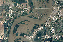
Acquired May 10, 2011, and April 21, 2010, these natural-color images show flooded and normal conditions along the Mississippi River in Memphis, Tennessee.
Published May 11, 2011
These false-color images compare conditions along the Mississippi and Yazoo Rivers around Vicksburg in June 2011, during heavy flooding, and three years earlier.
Published Jun 14, 2011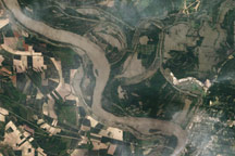
Acquired May 18, 2011, this natural-color image shows flooding along the Mississippi and Yazoo Rivers near Vicksburg, Mississippi.
Published May 19, 2011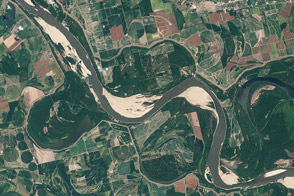
Coming off of the extreme floods of 2011, the river was approaching historic lows in the summer of 2012 near Memphis and along much of its lower reaches.
Published Aug 21, 2012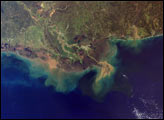
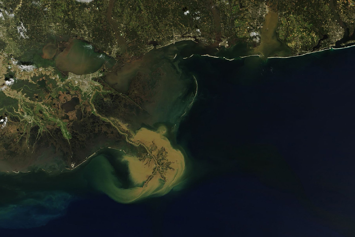
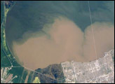
A pulse of flood water from the central United States spilled into the Gulf of Mexico.
Published Mar 9, 2018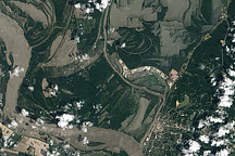
The Mississippi River is rising around Vicksburg, Mississippi, in this image taken on May 10, 2011.
Published May 11, 2011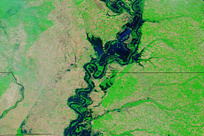
Acquired May 20, 2011, and April 14, 2011, these false-color images show water levels along the Mississippi River.
Published May 23, 2011