By Lora Koenig
It’s Thursday, December 1, and I am, yet again, sitting in our office, waiting. As the saying goes, “hurry up and wait”: This rings true in Antarctica. Last week, we were waiting for our radars to arrive on a plane from Christchurch. Usually there are about three flights a week from Christchurch to McMurdo, but an entire week of flights was canceled due to bad weather here. And finally, a plane arrived on Monday, November 28, bringing fresh fruit, new people and, most importantly, our radars.
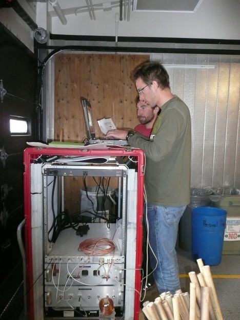
Ludo and Clem quickly set up the two radars, ran a few tests to make sure they were working and repacked them for shipping to Byrd Camp. Normally we would take a few days to do this but, since we were delayed, we all worked hard and completed the tasks in a few hours. We repacked the equipment very carefully to prevent damage, and put it into the cargo system. (See Michelle’s blog post to learn more about the cargo system). Our intracontinential cargo needed to be in the system 48 hours in advance, and we were hoping to fly to Byrd on December 1 (that is, today).
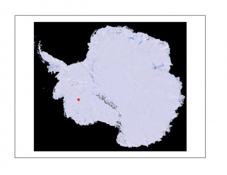
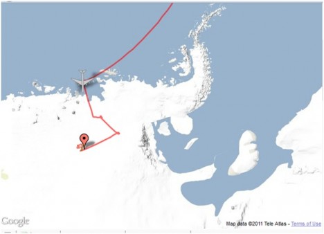
Just as a reminder here is the location we are trying to get to.
So our estimated departure date has come and gone, and here we are still in McMurdo. This is not a big surprise; delays are common in such a harsh environment. We are now scheduled to go to Byrd on Monday December 5. All of our work in McMurdo is done, so we will use the delay to rest a bit before the hard work of the traverse begins.
Why are we delayed? First, as I mentioned, McMurdo had a week of bad weather and no planes could land or take off. And once the weather in McMurdo cleared, it was Byrd’s turn to have bad weather, so planes could not land there. On top of that, there is a lot of science going on at Byrd this season, including another traverse lead by a NASA colleague, Bob Bindschadler, headed to Pine Island Glacier. (Check out this video on the Pine Island project, or visit their website.) Because there are so many teams flying to Byrd, we have to wait for five flights to get in before we are assigned a plane load for our science gear, fuel, snowmobiles and ice core boxes. Our team has a full LC-130 plane load of gear that needs to make it to Byrd.
Yesterday, they were finally able to get some flights into Byrd. Our flight number is T012; flight T010 will take off for Byrd this evening, then T011 has to fly and then it’s us. We are watching the monitors in McMurdo that show the flight status, just like at the airports, hoping that flights get in. We cheer when a flight returns and groan when a flight is canceled due to weather.
There is one more issue that is causing delays. This week they are moving the runways at McMurdo. In the early season, when it is still cold, the planes land very close to McMurdo on the sea ice at a place called Icey Runway. As temperatures warm, sea ice thins and the runway is moved farther inland to Williams Field, where the ice is thicker. This weekend is when they move airports, so there are no flights scheduled for Friday or Saturday (normally, there would be flights Monday through Saturday). So we will have another weekend in McMurdo, and when it’s time to fly to Byrd we’ll do it from William’s Field, about a 45-minute drive from McMurdo.
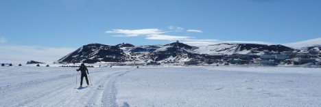
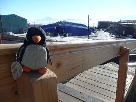
While we were waiting, I finally took some pictures of Percy the Penguin. Percy was given to me by a friend; it came from a geocache site in Seattle, WA and has now made it to Antarctica. Percy is actually the only penguin we have seen here. So far, the only wildlife we have encountered are skuas, large seagull-like birds, and Weddell seals that lounge on the sea ice just outside of McMurdo and Scott base. Through there are no seals in the picture of Michelle skiing, she is on an ice shelf below which the seals could be swimming. When the seals find a hole in the ice they come up onto the sea ice or ice shelf and lounge in the sun.
By Lora Koenig
Yesterday was an exciting day in the office. While I was downloading satellite data, answering e-mails and tying up loose ends before leaving for Antarctica, I was also closely following the NASA Airborne Sciences Flight Tracker and the flight path of the NASA DC-8 aircraft. The DC-8 is currently flying over Antarctica as part of the Operation IceBridge mission and yesterday it overflew the 2010 SEAT traverse line and ice core drilling sites. (For more detailed info on Operation IceBridge, check out the mission’s website).
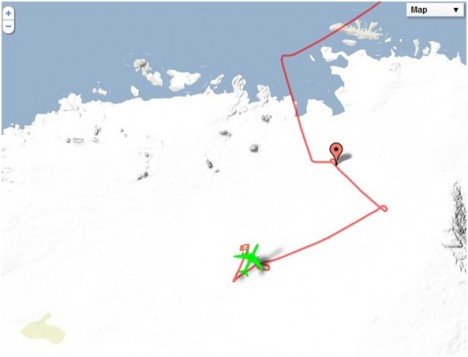
I spent part of the day yesterday watching my screen as the flight tracker showed a little green aircraft moving over our 2010 route. Here is the aircraft approaching our line at about 1:40 PM Eastern time. (The tracker was not updating the plane image at this time, but the aircraft was at the end of the red line.)
Here it is halfway through. (Note that the plane does a 270-degree turn to line up on our traverse line to make sure it is leveled as it crosses our 2010 ice core sites. This ensures the best quality of radar data.)
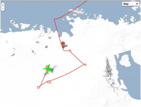
And here is the plane at about 2:35 PM EST, finishing the portion of its flight that retraced our traverse and four ice core locations:
I watched on my screen as the IceBridge plane covered in just less than an hour the same ground that took us 12 days to cover last year.
OK, so I guess you are asking yourself: Why do we go out in the field, in sub-freezing weather, to drive around on snowmobiles for 12 days to do what a plane can do in an hour? Because you can not drill an ice core from an airplane. The airplane carries radars, which provide great spatial coverage of radar data, but we need to calibrate the radar data with the annual cycles we get from ice cores. (See last week’s blog post on how we determine annual cycles in the lab). So, yesterday, IceBridge collected great radar data that will compare to the data from our ice core sites, as well as to data from the WAIS divide ice core and the ice cores collected by a group led by Dr. Ian Joughin at University of Washington.
The IceBridge DC-8 aircraft flies with radars that are nearly identical to the ones we use on the ground. They are named Snow Radar and Ku-band Radar and are built by the Center for Remote Sensing of Ice Sheets, CReSIS. We will use the airborne radar data gathered yesterday to investigate any differences between what the radars are measuring from the air and on the ground.
In a week, we board our flights to Antarctica. After watching the IceBridge plane flying in West Antarctica yesterday, I am even more excited to get my boots on the ice.
