

Greetings from New Zealand!
Soon, we’ll report back from even further south. We’re headed to the heart of the Antarctic ice sheet, to collect measurements on the ground for the ICESat-2 mission.
While NSF calls us the 88S project, sometimes you need that extra precision. We’re NASA. (Logo design by Adriana Manrique/NASA)
ICESat-2 is a NASA satellite, scheduled for launch in 2018, that will measure the height of ice sheets, glaciers, and sea ice in unprecedented detail. Designed and built at NASA’s Goddard Space Flight Center, it will carry a laser instrument called the Advanced Topographic Laser Altimetry System (ATLAS). ATLAS will send out small pulses of laser light, and precisely time how long the light takes to travel from the instrument, down to the earth, and back. These measurements, along with the position of ICESat-2 in its orbit, and the direction ATLAS was pointing, allow us to determine the height of Earth’s surface wherever ICESat-2 goes.
But how do we know those measurements from space are correct? We take a sample of measurements on the ground, which we can check against data gathered by the satellite. Which leads us to Antarctica.
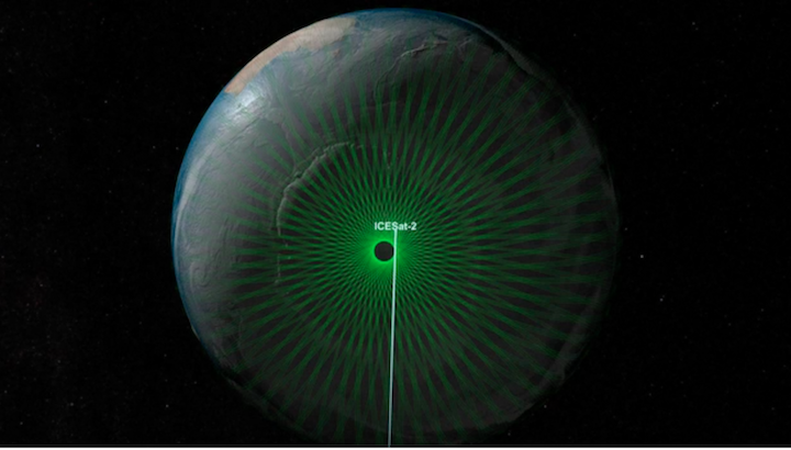
The green lines trace the path where data will be collected by the ICESat-2 mission. The tracks come closest to the poles at 88 degrees north and south, forming a dense network of crossing tracks. (NASA’s Scientific Visualization Studio)
Due to the particular orbit of ICESat-2, all the tracks for the satellite converge right around a latitude of 88 degrees south. Our plan is to travel to 88S and collect measurements of the ice sheet elevation around part of the circle at that latitude. We will compare our measurements with those from ICESat-2 shortly after launch to evaluate the performance of the satellite.
Kelly and I left the US last week after months of preparation, and are now en route! The first stop on our journey is Christchurch, New Zealand, where we recalibrate our internal clocks, collect the last of our cold-weather gear, and smell the roses before heading farther south. We are traveling along with science investigators and support staff working through the Antarctic Program of the US National Science Foundation. Christchurch has been the launching point for US (and New Zealand) field work in the Antarctic for decades, and we are grateful for the support of the NSF and our colleagues here in New Zealand. It is a huge advantage to follow in the footsteps of the thousands of other Antarctic program members who have gone before us.
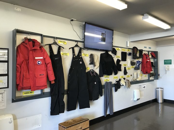
An array of hats, jackets, and gloves are available at the Clothing Distribution Center in Christchurch NZ to keep us warm while we’re down “on the ice.”
As you might imagine, it’ll be cold where we are headed, and having the right clothing is critical. Today, we visited the Clothing Distribution Center to borrow gloves, hats, parkas, and other items to keep us warm and safe. Tomorrow morning, bright and early, we’ll return to the CDC, get kitted up, and head south for McMurdo Station, the U.S. hub of operations in Antarctica.
Fingers crossed, and we’ll report next from Antarctica!
-Tom Neumann and Kelly Brunt
By Alek Petty
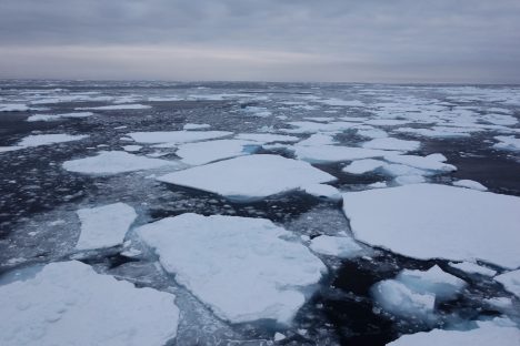
A mix of old and new sea ice floating through the northern Beaufort Sea during one of the last days of the cruise that we observed sea ice.
After 65 Rosette casts, 59 XCTD probes, 61 Bongo tows (nets that collect zooplankton samples), 212 surface water profiles, 40 ocean drifters released, three buoys deployed, one buoy recovered, three deep sea moorings collected and redeployed, eight ice cores collected, and 27 scientists deployed and partially recovered, our expedition around the Beaufort Gyre is finally over! The cruise was a huge success, with virtually all instruments operating successfully. The only downer was the lack of sea ice and our inability to get out onto the ice after Ice Station 1. The lack of ice wasn’t actually a problem for most of the scientists onboard, as they were more focused on measuring the state of the ocean, with the lack of sea ice providing interesting, albeit worrying, context for their measurements compared to previous years.
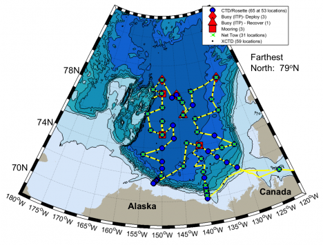
Final Joint Ocean Ice Study 2016 cruise map (Sept. 22-Oct. 18, 2016)”. Courtesy of Chief Scientist Sarah Zimmermann.
As I said back in my first blog entry, one of the key objectives of the expedition was to produce an up-to-date assessment of the freshwater content of the Beaufort Gyre. Based on a preliminary analysis of the data collected on this cruise, my colleagues reckon the total freshwater content of the Gyre could be at a record high. A chemical analysis of the ocean surface suggests that sea ice melt contributed around 20 percent of the fresh water mixed up within the surface waters, compared to around 80 percent from Canadian and Russian rivers flowing into the Arctic. The sea ice contribution was thought to be neutral a few decades ago, but the ice is now melting more than it’s growing, as we clearly witnessed, causing an imbalance. The wind circulation is also important in driving the ocean circulation that sucks in fresher surface waters into the Gyre (see an earlier blog of mine for more details).
Why does this all matter? Well, some scientists posited that the Beaufort Gyre oscillates between periods of spinning up and sucking in freshwater, and spinning down and releasing fresh water. A kind of breathing, if you like. The Gyre has been spinning up and sucking in fresh water for a few decades now (2008 saw a big increase) and we keep waiting, with similarly bated breath, for this trend to reverse. If the Gyre does reverse (breathe out), the Arctic Ocean will likely dump a load of fresh water into the Atlantic Ocean (as we think it did in the 1970s), which could cause some big impacts on weather patterns across the Northern Hemisphere. We’re not expecting a scene out of The Day After Tomorrow, but we’re not entirely sure what could happen either.
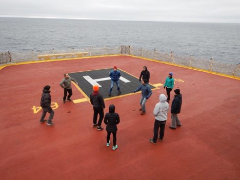
Hacky sack on the helideck. You can spot me by the bright orange hat.
It will take scientists a while to pour through all the data collected on this cruise and place this year’s findings into context. We spent our last few days compiling reports to summarize and document the data collected (in between games of hacky sack on the helideck). I’ve taken a look at some atmospheric data since I got back, and it appears the Beaufort Sea region was experiencing really warm, maybe even record warm, air temperatures throughout October. The data collected this year could therefore offer us a glimpse of what might be a new normal for the Beaufort Gyre and other regions across the Arctic Ocean.
I wasn’t able to cover all the science that happened on the ship during this blog series, but I hope you got a flavor for some of our primary scientific activities and have a better understanding of why it is we keep coming back to profile the Beaufort Gyre. I’m not sure if I will be out again next year, but I’ll be sure to let you know if I do. Thanks for reading, and do get in touch if you have any questions!
The Joint Ocean Ice Study is a collaboration between the Department of Fisheries and Oceans Canada (DFO) researchers with colleagues in the USA from Woods Hole Oceanographic Institution (WHOI). The scientists from WHOI lead the Beaufort Gyre Exploration Project, which maintains the Beaufort Gyre Observing System as part of the Arctic Observing Network. In addition to WHOI and DFO, the 2016 participants (those on board plus those on shore) come from three Japanese, five American, and six Canadian universities and research laboratories. Annual sampling of set oceanographic stations and mooring re-deployments since 2003 aboard the CCGS Louis S St-Laurent have built a time-series of physical and chemical properties of seawater, phytoplankton, zooplankton, and ice observations reaching from shelf waters to 79N across the Beaufort Sea. More information can be found on the Fisheries and Oceans Canada website.
By Walt Meier
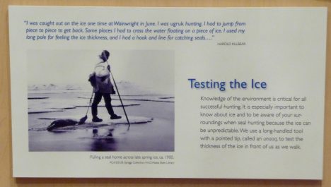
A sign at the the Inupiat Heritage Center in Barrow, AK.
Jun. 1, 2016 — We started our last day of the camp with a morning visit to the Inupiat Heritage Center to learn more about the indigenous local culture. Many of the Inupiat in Barrow still live their traditional subsistence lifestyle – hunting, trapping, and fishing for food. They do however take advantage of modern technology to make their way of life a bit easier and safer. For example, now machines have replaced dogsleds and rifles have replaced harpoons. But for some things, the old ways did not need to be modernized: the sealskin umiaq kayaks are lighter (easier to carry across the ice) and more navigable in the narrow leads of open water common to the area than anything manufactured today. And the fur-lined coats, pants, and boots are lighter, warmer, and repel moisture better than any modern outdoor gear.
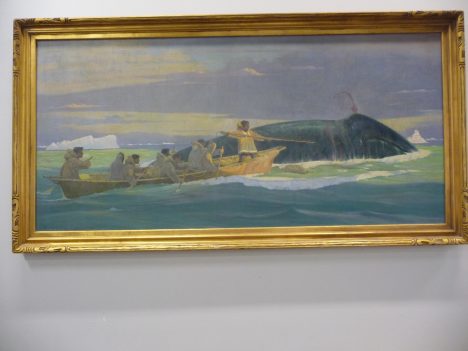
A painting of whale hunting at the Inupiat Heritage Center.
The Inupiat way of life is governed by the seasons. There is a season for whale hunting, for seal hunting, for polar bear hunting. The dark, cold winter season is a time to stay indoors and sew new clothes or repair old clothes. Festivals mark the seasons where the community comes together to celebrate and reinforce the bonds between families.
After visiting the heritage center, we headed back to our base for a final meal. Several times during the week, our field leader, Don Perovich, said that the key for a successful field expedition is “to eat as much as you can as often as you can.” And we were certainly well fed throughout, with plentiful sandwiches, instant soups, chips and crackers, and all-important chocolate for our typical mid-day meals. But our final meal in Barrow was a step above, thanks to Elizabeth Hunke at Los Alamos National Laboratory. She proved herself not only a top-notch sea ice modeler but also a great chef, putting together a delicious meal of spaghetti, garlic bread, and salad.
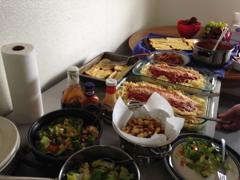
Last meal in Barrow.
Then it was time for our final sessions, presenting the data we collected and discussing our Grand Challenge efforts. Unfortunately, the data collection the previous day did not go as smoothly as we had hoped. We couldn’t collect albedo measurements because the instrument didn’t work yesterday. But this type of things is not at all unusual in field work. As Don said: “In Arctic field research, it’s important to make a plan; it’s also important to not become too enamored of that plan” because something inevitably will go awry and you have be prepared to adapt.
So we couldn’t directly compare one of the key surface features between the two sites. However, we had other data we could look at. The new site to the north was 10-20 centimeters (4-8 inches) thicker than the original southern site. So there was less melt there and the ice was likely to last longer there. And while we lacked some data, we had models we could use. Many people think of modeling simply as predicting the future – and indeed models are used for that purpose (e.g., weather forecasts), but models, particularly climate ones, are also used to investigate processes and learn how climate responds to different parameters. Though we didn’t have albedo data, we could adjust albedo in the model and see how that affected how the modeled sea ice evolves in the future.
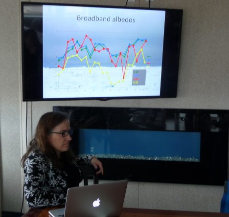
Grand Challenge results.
Several folks worked late into the previous night to process data and run the sea ice model. We obtained climatological weather data, input the data into the model and run it for the first two weeks in June. The results showed that the melt was strongly affected by the albedo of the surface and the amount of incoming sunlight, and that there will likely be substantial differences between the two sites. In a sense this isn’t terribly surprising, but to see such variation over such a small distance (the two sites were separated by only a couple miles) and within such short time periods (two weeks) is sobering. Large-scale complex models and satellite data cannot (yet) resolve such variability. There is still much research to do, and those of us at the camp have come away a greater appreciation for the challenge.
We finished up by discussing future plans. The goal of this camp wasn’t simply to get everyone together for one week, but to start new collaborations between modelers, satellite folks, and field researchers. We discussed several ideas to build upon the start we’ve made, keep momentum going, and convey what we learned to the broader sea ice research community. With that, it was time to head to the airport and begin our long journeys home.
Another tradition Don has is to bring a lollipop to each field expedition. When the expedition is done, he pulls it out as a reward for a job well done. At the beginning of our camp, he gave each of us a lollipop. It was up to us to decide when we were done. Some pulled theirs out after we wrapped up the meeting; some enjoyed theirs at the airport. I waited until the plane left the ground.
And so my adventure on the ice has come to an end. I can’t say I’m an expert in the field or ever will be. But it has been a rewarding week for me. I’ve gained a lot of knowledge about what it takes to do field work. I’ve gained an even greater appreciation of the value of field observations, as well as modeling studies. Hopefully I was able to give participants a greater understanding of satellite data. And finally, now when someone asks me if I’ve been on the sea ice, I can say “Indeed I have!” I still have the taste of the lollipop in my mouth to prove it.

Until the next time, Walt.
By Walt Meier
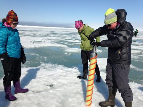
The Red Team drilling an ice core of sea ice.
May 30, 2016 — This morning we did another modeling exercise, led by Jen Kay of the University of Colorado. A question a sea ice scientist inevitably gets asked is “so, when is the Arctic Ocean going to become ice free?” I can understand the interest, but answering it is quite difficult. One reason of course is that the sea ice models are not perfect – we don’t know exactly how the sea ice will respond to warming temperatures in the future. But the main reason is that the climate naturally varies from year to year and over many years, just due to randomness in the climate system. Jen and others have found that the natural variation in sea ice is quite large. The implication is that even under warming temperatures, variations in the climate system may result in many years where the extent doesn’t decrease and may even increase for several years.
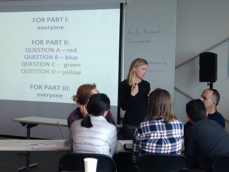
The Red Team in the classroom.
This means that we can’t extrapolate from current trends to estimate the year ice-free conditions occur because the current trends may well be interrupted by natural variations. It also means that even if we have several years where the extent doesn’t drop, it doesn’t mean the warming isn’t having an effect – it just means the warming effect is overwhelmed, temporarily, by a natural cooling effect. It’s like driving a car down a mountain – eventually you’ll get to the bottom, but on the way there may be many flat spots or even sections of the road that go uphill.
In the afternoon, our group did the sea ice properties activity. This involved drilling a core through the ice and analyzing it. Sea ice is not simply frozen water – it is frozen salt water. Although most of the salt escapes during the freezing process, some salt gets trapped in the ice in briny pockets of very high salinity water. Over time, these pockets begin to drain (especially during the summer melt), leaving little channels within the ice. In the core, we noticed the brine already starting to drain after we lifted it out of the hole. These brine pockets are important in determining how the ice melts and interacts with the ocean.
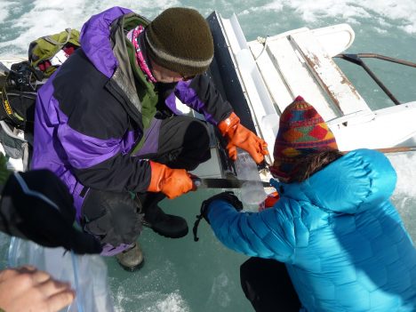
Slicing a sea ice core.
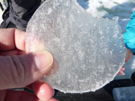
A section of a sea ice core.
We also measured the salinity and temperature in the water near the base of the core. The water was near freezing throughout, as expected. But the salinity was quite low just beneath the bottom of the ice. Normally, the ocean salinity should be around 30 ppt (parts per thousand), but below the ice, the salinity was only about 2 ppt. This is because the fresh surface melt water was draining through the ice. Several centimeters lower, we saw the salinity increase rapidly to near 30 ppt.
Today was Memorial Day, so it’s worth noting that Barrow has a long history of being involved in defense activities. We are staying and working at the Naval Arctic Research Laboratory, which as the name implies was a military research station. We can also see nearby the DEW (Distant Early Warning) Line station, which was an early warning defense system to detect ballistic missiles that could’ve been launched by the Soviets. The soldiers that served in the DEW Line stations were literally on the front lines of the Cold War. So it seems appropriate to be here in Barrow on the day honoring those that have served and made the ultimate sacrifice for their country.
By Walt Meier
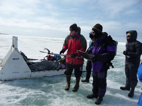
May 29, 2016 — This morning, we had our second modeling exercise, led by Ian Eisenman of the University of California, San Diego, where we investigated whether sea ice loss is irreversible – i.e., is there a tipping point for sea ice, a point of no return? In the simple models, like the one we used yesterday, once the sea ice disappears under warming temperatures, the ice does not come back even if temperatures cool back down to where they started. This means the loss is irreversible. However, the ice loss is reversible in more sophistical models such as those used for most future climate projections. So are the simple models missing something essential, or do the more sophisticated models get it wrong?
We examined an in-between Goldilocks model –not too simple, not too complicated– and found that the simpler models do miss important processes, such as the fact that heat diffuses into larger regions. This spreads out and slows down the ice-albedo feedback so that if the temperatures cool, the sea ice will come back.
In the afternoon, my group did an optics exercise out on the ice. This primarily involved measuring albedo of the ice. Albedo is basically the proportion of sunshine that gets reflected by the surface. At its simplest, it can be thought of as the whiteness of the surface. A perfectly white surface reflects all of the sun’s energy and has an albedo of 1 and a perfectly black surface will absorb all of the sun’s energy and has an albedo of 0. Albedo is key for sea ice because the ice has a much higher albedo than the ocean. So as temperature rises, the ice decreases, the albedo drops and more energy is absorbed. This added energy warms things further and you get what is called the sea ice albedo feedback, which amplifies the effects of warming temperatures. But the ice doesn’t need to disappear to have the sea ice albedo feedback. Changes on the ice surface – such as melting and ponding – also reduce the albedo.
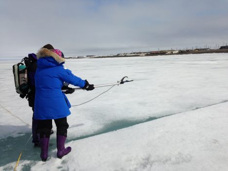
Measuring sea ice albedo.
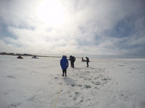
Our goal for the day was to measure albedo along a 100-meter (328-feet) line across the ice. It was our first day here with substantial sunlight; we had blue skies interspersed with clouds. Unfortunately, this was a bad day for albedo: to get good measurements, consistent light is desired. So the intermittent clouds make things difficult. Don told us that normally, if he were in the field in such conditions, he would skip the albedo measurements and drill some thickness holes instead. But we went out and gave it our best effort.
In the evening, we had a visit from two native Inupiat whale hunters, Billy and Joe. They told us how hunting bowhead whales is a fundamental part of their culture. The hunters go out onto the ice to the edge of fast ice (ice attached to the coast) and wait for the whale to surface. When they catch a whale, they bring it up onto the ice and share it with the rest of the community. Sharing is part of the fabric of their society – though the hunters make the kills, they are supported by the entire community. At the end of the whale-hunting season in June, there is a big celebration throughout the town with food, music, and dancing.
Because they use the ice to hunt, the Inupiat have intimate knowledge of the ice cover. They have shared this knowledge with scientists; this provides a valuable complement to our scientific data because they see things that satellites, models, and even scientific field observations don’t. For example, they can sense the softness of the ice, indicating a weaker ice cover. They also provide a long record from their personal observations and oral histories passed down over generations. The hunters mentioned how the fast ice used to extend at least 4 miles from shore, but now it only about half that distance. The ice moves out earlier as well, which affects their seal hunting. Also, there used to be a lot of multiyear ice in the area, but now it is rare.
The Inupiat work with the scientists to better understand the changes in the sea ice and their changes on the community. The scientists also help Inupiat by providing data and scientific guidance. With the changing ice conditions, going out on the ice has become more dangerous for the Inupiat – ice floes can break off without warning, stranding hunters. They now can use the Barrow sea ice radar to see how the ice is moving to get a sense of when and where it is safe to go out onto the ice. It was really interesting to hear the perspective from the local community, an essential source of knowledge that provides a view of sea ice that we scientists don’t get in the field, in our models, or in our satellite data.