
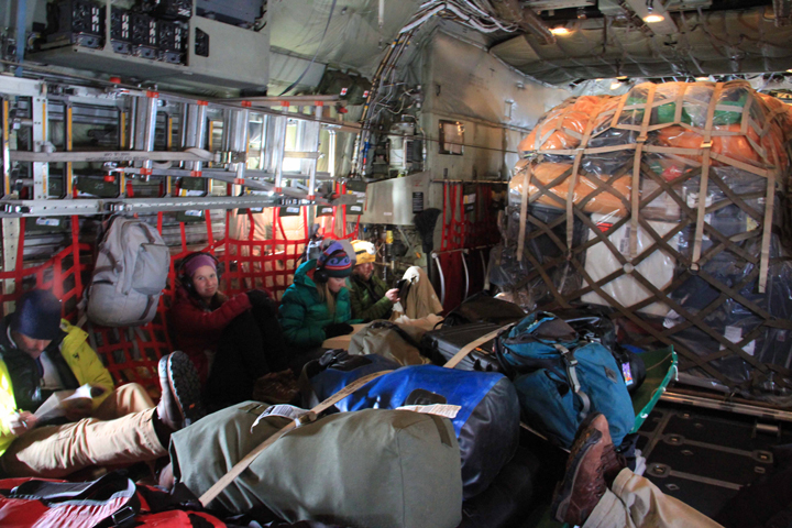
Our gear and the C-130. We were dropped off with our gear in Kulusuk by the C-130.
Hurry up and wait may the best way to describe our schedule lately. You never know exactly when a plane or helicopter will be ready to take you into the field or when the weather will be good. All you can control is when you have your gear ready to go.
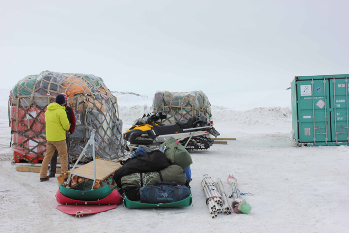
The C-130 dropped us off in Kulusuk, Greenland on Sunday (3/29/15) with over 13,000 pounds of science gear, snowmobiles, food and people. All the gear was loaded on 3 big pallets and fork lifted outside the airport next to a shipping container. Joe immediately started breaking down the pallets so we could start organizing the gear for the field. Monday brought a storm so we had to wait until Tuesday to sort our gear into the approximate Helicopter loads. We will be using a Bell 212 Helo to get into the field using 10 flights over 5 weeks to get the gear in and out.
Sorting the gear was difficult this year. We will be conducting five different science projects to better determine the amount of water retained in the ice in this portion of SE Greenland (you will hear about each separately in the blogs to come). We have to make sure all the gear for each helo load includes everything we need for each particular science project. For instance, we had to make sure the generator for the drill came in with the drill, not with the radar equipment; that the tool kit for the hydro gear was loaded with the hydro gear; and that the emergency and camp gear flew in on the first helo flight, and so on.
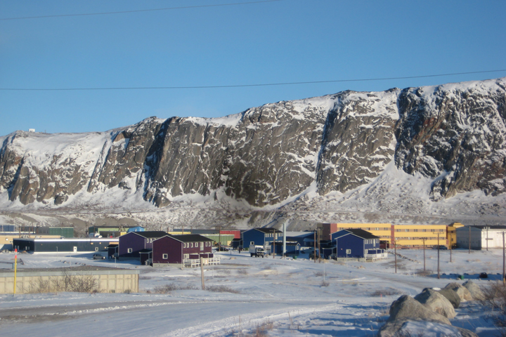
As we were moving our boxes around Lynn was diligently taking notes on which boxes were in each load and how much they weighed. Just after our morning team meeting on Wednesday (4/1/15) we put all our boxes in to a spreadsheet to calculate the total weigh for each load. I will backtrack slightly here to tell you a little about Kulusuk, Greenland. It is a beautiful town with mountain peaks rising above it and a beautiful fjord. It is a destination for the very adventurous skier and tourist. It has about 350 residences and one small grocery store. In short, this is not the place you can pick up a spare part, for say, a highly specialized ice core drill or water sampling equipment. So it is very common that we overpack. Send in a few extra spares for the “just in case” scenario and multiple rolls of duct tape.
This year we packed a few extra spares. We were overweight!!! The rest of Wednesday morning was spent on the computer moving boxes around and cutting out what we could to get our gear weight down. In the afternoon we started shifting gear around, and making the changes we had to make.
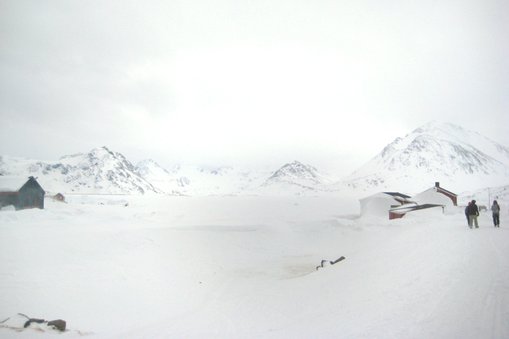
View from Kulusuk over the sea ice. The low visibility has delayed flights.
This all occurred at an accelerated rate because we were told by Air Greenland that they could move our flights to our field site earlier, to Thursday (4/2/15). We worked fast and hard to get ready to go. Wednesday night we were tired but ready! Thursday morning brought another storm so instead of heading to the field we got some much needed rest. It is now early Friday (4/3/15) morning, with OK weather. We will have breakfast and wait at the hotel for a 9 am call from the helo pilot to see if we are on the schedule for today. Hopefully we will launch for the field toady with two flights. The first will take Josh, Clem and I along with the camp gear. The second will bring Kip and Olivia and the hydrology. Fingers crossed or getting to our field site and starting the actual science soon. Fingers crossed for getting to our final destination today.

Amazing view from the plane of an iceberg.
After one day of delay due to extenuating circumstances in Kangerlussaq, we got the “OK” to fly across the ice sheet to Southeast Greenland. We gathered all of our gear from the Kangerlussaq International Science Support (KISS) center and headed off on a 1.5 hour flight on the C130 to the town of Kulusuk. Once we arrived, the 13,000 pounds of cargo was unloaded along with all of our personal bags. The cargo included over 1000 pounds of food, scientific field gear, camping gear, and two brand new “Ski-Doo” snowmobiles. Just as quickly as we landed and unloaded, the Air National Guard’s C130 was off for its next mission.
C130 Flight to Kulusuk. From left to right: Joe, Lynn, Olivia, and Josh.
13,000 pounds of cargo and gear unloaded from the C130.
We headed to Hotel Kulusuk for a quick lunch and group meeting to plan tasks for the day. The main goal was to unpack and take inventory of all of the cargo. Our group made a quick return to the Kulusuk airport, walking on top of the snowpack because the roads are treacherous. The roads have about a 10 foot wall of snow on either side making visibility for vehicles and plows very difficult. We worked the rest of the afternoon breaking down cargo pallets and taking inventory of everything. All gear has been checked off the list and received. A storage container was provided for cargo that could not be left out so priority gear was placed inside. The sun began to go down so we headed back to the hotel for dinner and another group meeting to plan for the next day’s events – grouping gear based on what helicopter flight it will be taken into the field and repackaging cargo to decrease the volume as much as possible.
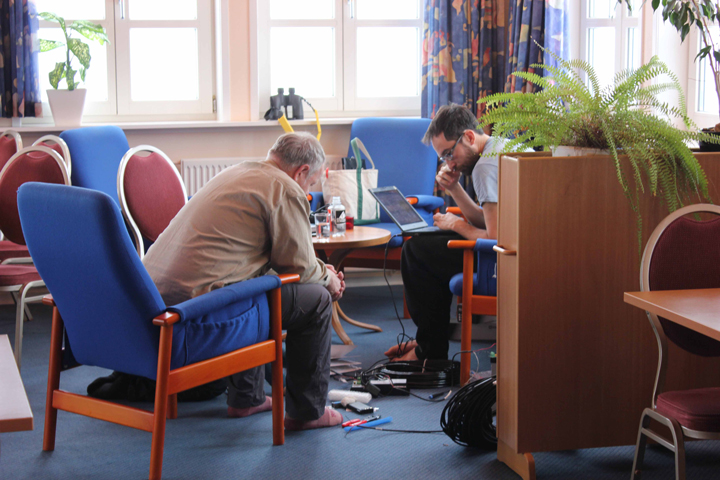
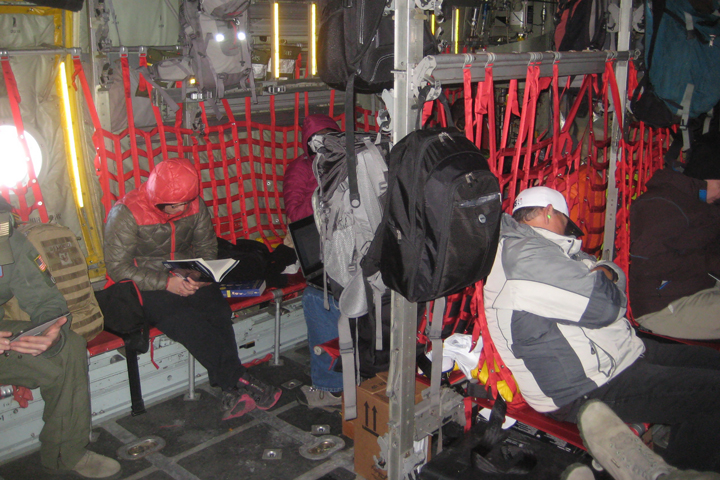
Kip and Clem working indoors during the bad weather on Monday.
This morning, Monday, we woke up bright and early to 30 knot winds with a forecast of 50 knot gusts later in the day. This created whiteout conditions for most of the day, making it very difficult and dangerous to get work done outside. The airport was closed and cancelled all incoming flights, we were very thankful that we got to fly in yesterday. Although conditions are poor, it creates a great analog for the field and we got a chance to try out all of our gear – parkas, snow boots, coveralls, ski goggles, gloves, and baklavas! Lora, Kip, Olivia, and I practiced using the GPS units by wandering around outside near the hotel. Josh, Joe (our Greenland Logistics Coordinator for Polar Field Services), and Olivia ventured out to get a key to the airport so we have access whenever we need. Most of the day was spent inside programming.
Tomorrow’s forecast looks very sunny and great for working outside. Can’t wait to get out in the field!
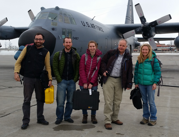
The team getting on our C-130 flight to Greenland. From left to right: Clem, Josh, Lynn, Kip and Olivia.
We made it to Greenland! On Thursday, Kip and I flew from Salt Lake City, Lora flew from Denver, Clement flew from Seattle, Lynn flew from DC, Josh flew from Madison, and we all met up in Clifton Park, NY. Only one bag was lost and later found, and one flight canceled. Although we have all been working together to prepare for this work, I hadn’t met most of the team face to face. I finally got to put faces to the voices I had come to know from weekly teleconferences over the past six months. I was also lucky enough to have some family who lives outside Albany come visit and bring me a care package of goodies.
Lora reading on a cold flight over to Greenland.
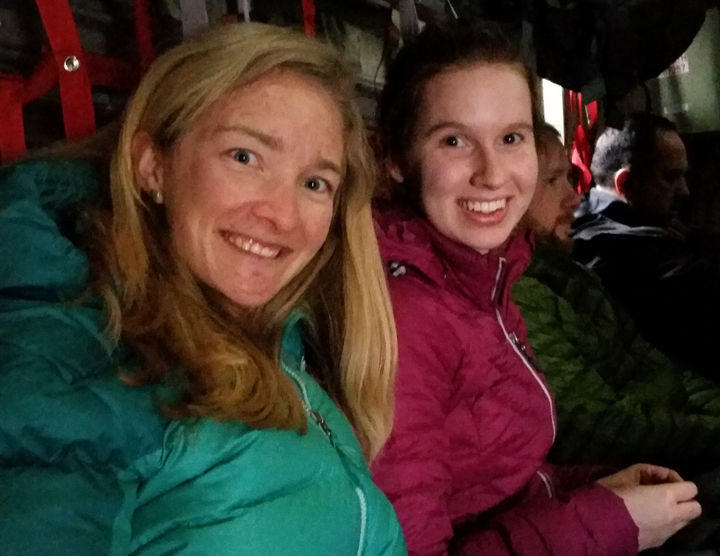
Olivia and Lynn excited to go to Greenland for the first time.
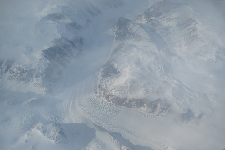
One of our first views as we flew into Greenland.
Friday was a long day. The Air National Guard picked us up from our hotel at 5 a.m. for our flight aboard a C-130 to Kangerlussuaq. We piled into the belly of the plane, sitting on webbing seats and peering out tiny windows as the North American continent slowly transitioned from forested land to tundra to open ocean to sea ice and finally to the glacially carved fjords and ice covered mountains of Greenland. As we approached our destination, the flight crew even let us go up into the cockpit. They had an impressive view!
A view of the town of Kangerlussuaq.
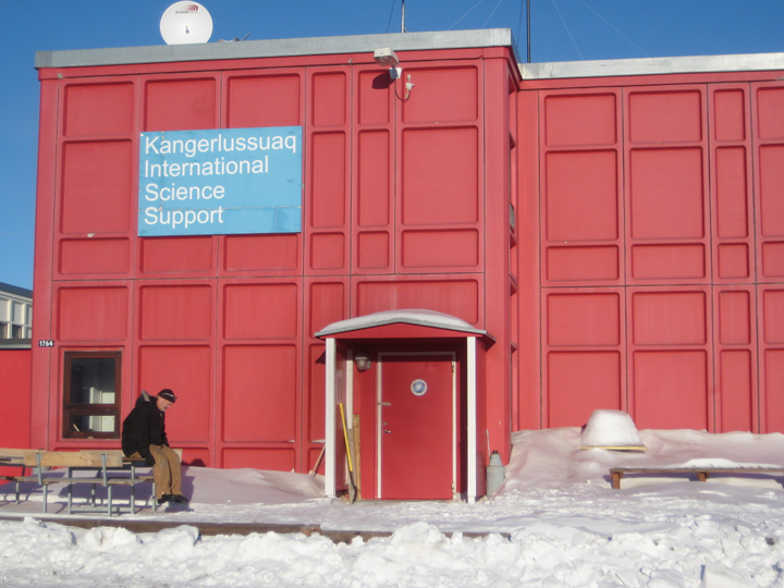
The Kangerlussuaq International Science Support building. Our home for the next few days.
Upon arrival, we were taken to the Kangerlussuaq International Science Support (KISS) base, where we stayed last night. After settling into our rooms we went through training on snowmobiles and how all of our communication devices work. Much of our field work will involve snowmobiles. We have personal locator beacons in case of an emergency and all kinds of radios to talk with helicopter pilots and each other, as well as several satellite phones. We also got to see all 80 boxes of science equipment that had been loaded onto pallets for us. We have so much equipment because we are conducting a variety of different kinds of studies this year (hydrology, ice coring, seismic, radar, and magnetic resonance) and each study requires a lot of different equipment.
Today, Saturday, we prepared for our last airplane flight to Kulusuk. The flight was scheduled for 10:15 so we happily got to sleep in a bit and catch up on some much needed sleep. For breakfast we headed to the cafeteria in the airport and made a quick stop at the grocery store to pick up some perishable food to bring into the field with us. Our flight was delayed a bit so we went to lunch at the Pizza-Thai–Grill restaurant in town.
Unfortunately we just found out that our flight been pushed back to tomorrow, so for now, we get to catch up on some work and spend a little time exploring the town.
Hello and welcome to the third installment of the Greenland Aquifer Team blog. We are back at it again this year to study the water hidden below the surface of the Greenland Ice Sheet. For background, if you have a lot of reading time, you can check out all of the blog posts (including those from previous years) here, or for a quick synopses check out the press release on our 2014 science papers resulting from our work here.
This season should be an exciting one. The National Science Foundation (NSF) and NASA are funding us to do a lot more work this season to better understand how much water is being stored in the Greenland Ice Sheet and what that ultimately means for all of you reading this. Note: If you are reading this while on spring break from a nice chair on the beach you should pay attention because over the next few decades the melt from Greenland will raise global sea levels. The only remaining questions are how much and how fast? Our team will play a small roll in answering these science questions by drilling, pounding, radiating, and penetrating into the aquifer in southeast Greenland.
Over the next five to six weeks, this blog will cover not only our science but also our adventures conducting science in one of the harshest regions on Earth. This year will be BIGGER. More measurements, more people, more time in the field, and more blogs. (More blogs assuming the satellite phone data link works. After all, this is field work so we never know.) Everyone on our team will contribute to the blogs so I will introduce them here quickly and you will hear more about each of them and their work in the weeks to come. Enjoy the blogs! We take off for Greenland on March 27, so look for our next installment about our trip from New York to Kangerlussuaq, Greenland, soon.
Greenland Aquifer Team 2015
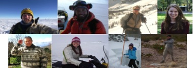
Top row left to right: Josh Goetz, Lead driller from the Ice Drilling Design and Operations group at the University of Wisconsin-Madison; Clément Miège, Post-doctoral student, radar lead, and Greenland Aquifer team veteran from the University of Utah; Kip Solomon, Professor and ground water hydrology lead from the University of Utah; and Lynn Montgomery, Undergraduate student and seismic team member from the University of Maryland.
Bottom row left to right: Anatoly Legtchenko, Director of research and electromagnetic resonance lead from the Laboratoire d’étude des Transferts en Hydrologie et Environnement (Laboratory of Hydrology and Environment); Lora Koenig, Research scientist, ice core lead and Greenland Aquifer team veteran from the National Snow and Ice Data Center at the University of Colorado; Olivia Miller, Graduate student and ground water hydrology team from the University of Utah; and Nick Schmerr, Assistant professor and seismic lead from the University of Maryland.
For more than 65 hours this month, NASA’s high-altitude ER-2 aircraft flew from Fairbanks over melting sea ice, glaciers, forests, permafrost, lakes, volcanoes and more. It zigged and zagged over the Beaufort Sea, and soared straight over the Bagley Ice Field.
The goal: to use a laser altimeter called MABEL to take elevation measurements over specific points and paths of land, sea and ice. To hit these marks, scientists and pilots painstakingly designed and refined flight routes. And then they adjusted those routes again to capture cloud-free views – a tricky proposition in a giant state with mountains creating complex weather systems.
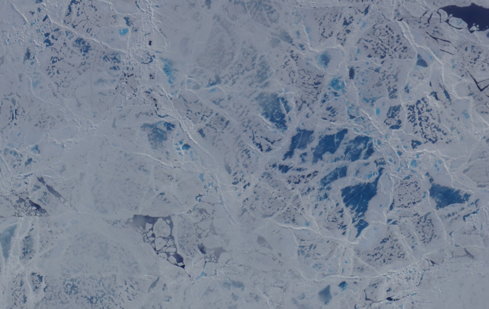
A camera on the MABEL instrument captured pictures of cracked sea ice, dotted with melt ponds, during a flight to the North Pole. (Credit: NASA)
“We have targets to the north, targets to the south, and mountain ranges blocking both,” said Kelly Brunt, a research scientist at NASA’s Goddard Space Flight Center who was MABEL’s science flight planner.
Scientists studying forests, glaciers, water and more are using MABEL data to develop software programs for the upcoming ICESat-2 satellite mission, and sent Brunt lists of what they would like to be included in the Alaska campaign.
“We get everybody’s input, and start to put it on a map,” she said. She drafts routes with targets in similar weather patterns, so that if one is clear the others are likely to be as well. However, often targets are removed from a route, based on the weather assessment from the morning of the flight. During the deployment, routes are also constructed to target specific sites that were missed during previous flights for either weather or aircraft reasons. Lots of the work goes into straightening the flight line, Brunt said, since when the aircraft banks at 65,000 feet, the laser instruments swivel off their ground track and the scientists can lose miles worth of measurements.

The MABEL campaign’s July 24 flight route covered glaciers, ice fields, forests, the Gulf of Alaska and more. (Credit: NASA)
One flight to measure sea ice was pretty direct – it took the pilot straight to the North Pole over one longitude line, circled around and came back on another. A second route involved a zig-zag pattern over the Arctic. But both routes were designed to capture a range of summer ice conditions, including melt ponds, large stretches of open water, and small openings in the sea ice, known as leads.
Flights over Alaska itself were often mapped to pass over glaciers, lakes, ocean moorings or even tide gauges that others have measured before, to compare with the data MABEL collected. Students from the Juneau Icefield Research Program (JIRP) assisted MABEL researchers by providing ground-based GPS validation for a mission that flew over the upper Taku Glacier, close to a JIRP camp. And the MABEL team collaborated with NASA Goddard scientists flying a different instrument, called Goddard’s LiDAR, Hyperspectral and Thermal (G-LiHT) Airborne Imager – the two campaigns flew some of the same paths over interior Alaskan forests.
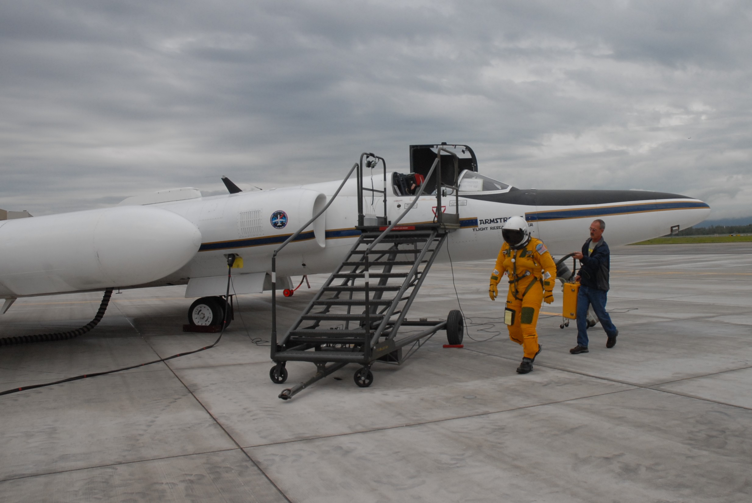
NASA ER-2 pilot Denis Steele, in a pressurized flight suit, before a July 16 flight over Alaska’s glaciers. (Credit: Kate Ramsayer/NASA)
From Fairbanks, Brunt worked with the campaign’s two pilots, Tim Williams and Denis Steele, to ensure the routes would work with the ER-2’s capabilities; and with weather forecasters to determine where to best focus efforts the following day.
In all, the campaign flew 7 flights out of Fairbanks. And today, the ER-2 – with MABEL aboard – flies back to California, collecting even more data about the elevation of the landscape along the way.
