By Ryan Walker
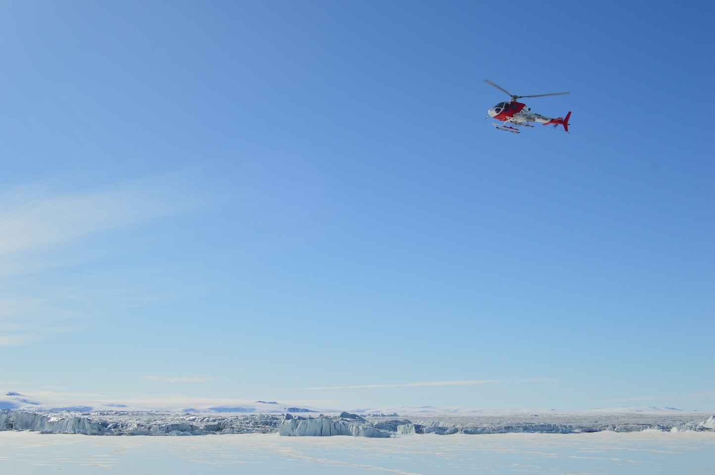
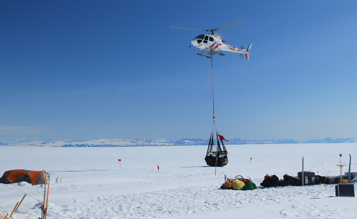
On our first full day at Jang Bogo, we weren’t expecting very much to happen. The majority of our equipment wouldn’t be arriving for another three days, so we thought we would settle in and learn about the basic amenities of the station — food, showers, laundry, wifi, espresso machine. (I’m not joking, there really is an espresso machine. You can learn all sorts of unexpected skills living in Antarctica.) But then the day turned out to be sunny and clear, perfect for flying, and one of our collaborators, Dr. Hyeon Jae Yoo, came and told us that he had reserved a helicopter for that afternoon to scout out our field sites.
Choosing field sites can be rather tricky. We had spent quite a while looking at satellite images and computer model output in order to estimate where the processes we wanted to study would likely be strongest. For GPS measurements of ocean tides causing ice motion, we wanted to be more in the middle of the ice shelf, away from the islands and rocky outcrops that pin its margins in place. For tilt meter measurements of ice shelf flexure, we would need to be near the landward edge of the shelf — most of an ice shelf floats freely up and down on the tides, and the bending happens in a narrow strip (maybe a few kilometers wide) between the floating ice and the ice resting on the land. Field site selection is then a balance between finding the ideal place to collect data and finding places where you actually can collect data. Crevasses (large cracks in the ice), very uneven ground, and ponds formed by melting of the ice surface can all prevent setting up instruments. In the end, it’s essential to get an in person look at your sites, preferably before you’ve dragged all your equipment there.
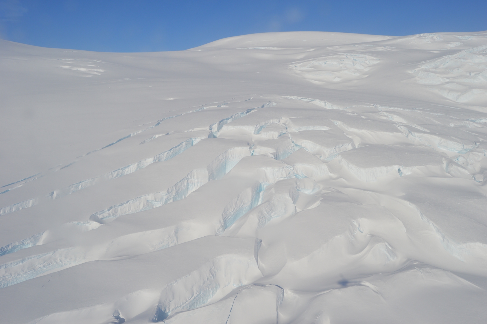
Large crevasses in the ice.
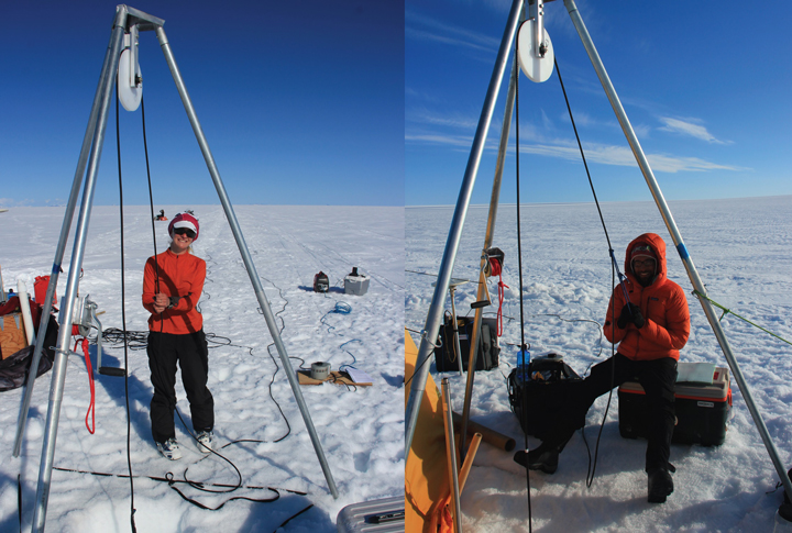
This was my first helicopter flight, and since it was my birthday (what a celebration!) Hyeon Jae and Christine insisted I should sit up front. Taking off is sort of like riding in a glass elevator. Flying in a helicopter is very different from flying in an airplane. Being able to go low and slow (or hover) gives great views. We were able to circle our GPS sites at about 10 feet off the ground, and touch down briefly (with the rotors going) at our tilt meter sites to test the firmness of the snow. Our GPS sites are all on blue ice, with no snow cover, and look favorable for installing the instruments. We’ll just have to shift a few of them a short distance so they’re on ridges rather than hollows — although the ice is pretty flat, this matters when the ice surface starts to melt later in the summer and the water flows downhill. Our tilt meter sites are on a snow-covered area, so we will have to dig down to ice (or at least very firm snow) to get a solid base so we can install the instruments level. This is really important because the ice only bends a little, so the tilt meters measure angles less than half a degree. (That’s a little less than 1 foot up per 100 feet across.)
Overall, we were very happy with the results of this flight. Our field areas look good, and we got truly spectacular views of the ice shelf and the rocky hills surrounding it. I shot video with a NASA-provided GoPro, and it came out great, even though all I had to do was point the camera at the windscreen and try to hold it still. The files are too large to post from Antarctica, but the best scenes should be part of the final video that Goddard will produce when we’re back home. Thanks to our pilot, Dominic of Helicopters New Zealand, for a smooth and safe flight.
By Christine Dow

Christine Dow and Ryan Walker, setting foot in Antarctica.
We made it to Antarctica in one piece! After a delightful 3 am start, we boarded the Safair plane that was to take us to the Antarctic along with Korean, Italian and French scientists. What followed was a somewhat chilly, noisy, cramped 7-hour flight. However, the views out our tiny window as we approached and then flew over Antarctica made it all worthwhile. We landed on a sea ice runway in front of the Italian Zucchelli station, with an impressively long run in, and then stepped out into bright sunshine and a “refreshing” breeze. The Antarctic! What a spectacular place. We were surrounded by mountains and ice and sea ice as far as you can see. Ryan traveled the 7 kilometers to Jang Bogo in a “Piston Bully” tractor, but I was lucky enough to get driven over in a specially adapted Kia SUV with heated seats. What luxury! On the way over, we drove past some basking Weddell seals and seal pups enjoying the sunshine.
Jang Bogo from the outside looks like a space ship and the inside does not dispel this imagery. It was only built in the last couple of years and has all the mod cons. There’s a greenhouse, hospital area, small gym with climbing wall, espresso machine, wi-fi throughout, and even humidifiers in each room. An intercom announces meals with cheery music (including breakfast at 6:50 am, which is a slightly disconcerting way to wake up if you’re not expecting it). The best thing by far is the view from the window. I can see an impressive iceberg, some more seals and the terminus of Campbell glacier. Flags from the countries representing the people staying at the base are flying outside including Korea, Japan, New Zealand, the US and the UK.
We were only able to bring one GPS and one tiltmeter with us because of weight restrictions on the plane. The rest of our equipment will arrive next week. In the mean time, we are going to have to examine the planned field sites so we are expecting a helicopter flight soon. More on it later!
By Ryan Walker
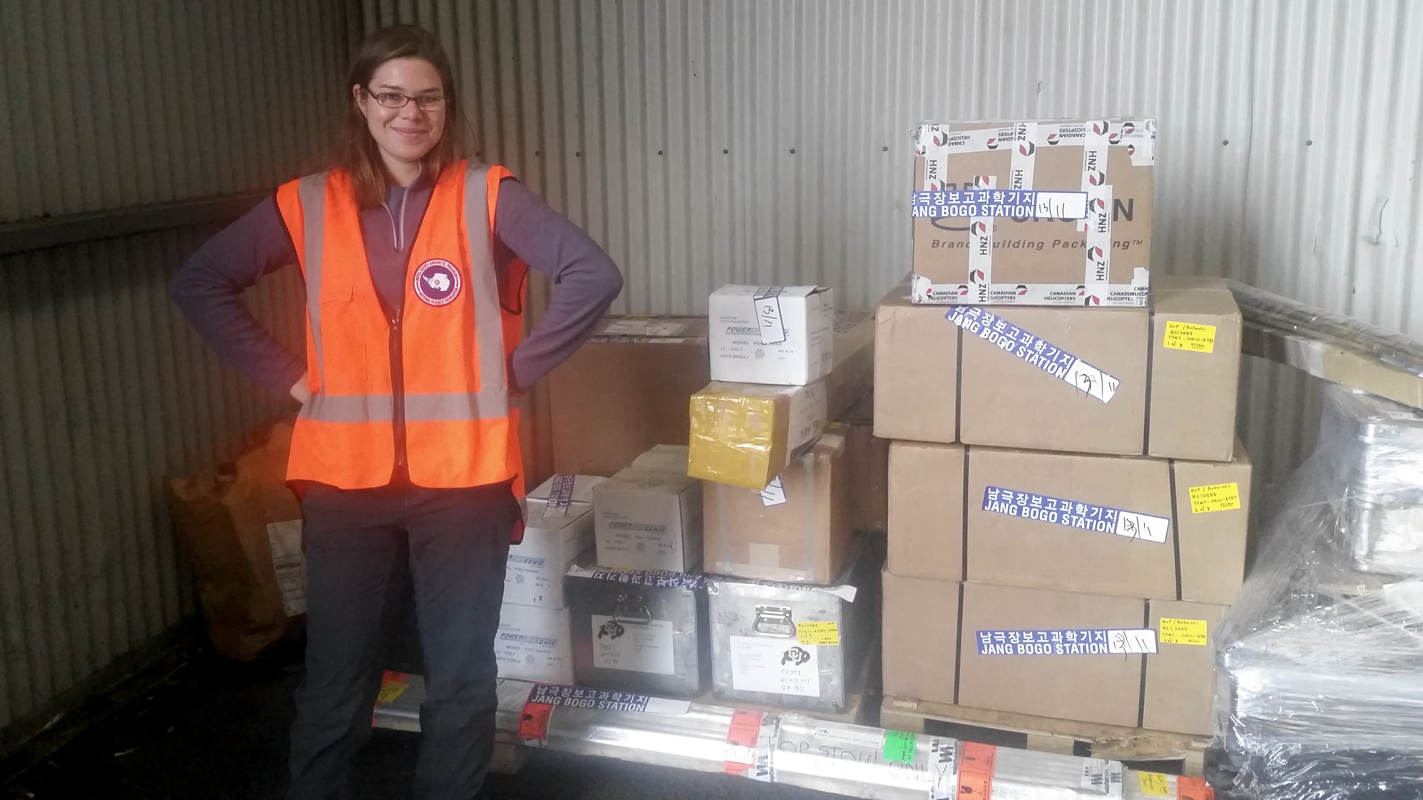
Christine stands near to our instruments and equipment, ready to be shipped to Antarctica.
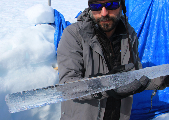
We arrived safely in Christchurch, New Zealand. On Wednesday morning we went over to the International Antarctic Centre to check up on our instruments and equipment. We have five GPS receivers for measuring horizontal ice motion, and two tilt meters for measuring the angle of the ice shelf as it flexes with ocean tides. (We borrowed these instruments from Sridhar Anandakrishnan of Penn State, and will collaborate with him to analyze the data.) Each GPS or tilt meter fits in a plastic case about the size of a carry on suitcase. However, for powering the instruments, we also need solar panels and car batteries (which weigh over 30 pounds each). There are also tools (such as an ice drill — thanks to Bob Hawley of Dartmouth) and over 125 feet of metal pipes that we will use to mount the solar panels and satellite antennas for the GPS. All together, it’s close to 600 pounds of equipment — some shipped from Goddard, and some ordered in New Zealand — so it was a huge relief to see everything in good shape and in the right place.
We found that the batteries had a slightly different type of terminal than we had expected. In order to make a firm connection between the batteries and instruments, which is critical because the stations will be deployed for roughly three months, we had to find specific size bolts and nuts and other wiring components. We spent the rest of the morning visiting a hardware store (twice), an automotive store, and a computer store before successfully finding the parts we needed. Not terribly exciting, but necessary, and handling this sort of issue is a big reason why we arrived in Christchurch a few days before our flight. We did manage to have some fun in the afternoon by visiting the Canterbury Museum, which has historical, cultural, and scientific exhibits and is adjacent to a large and beautiful botanical garden.
Tomorrow afternoon, we’ll be back at the International Antarctic Centre to meet up with the Italian Antarctic program for about an hour’s worth of basic preflight safety training. (Because their stations are nearby, the Korean and Italian programs share flights.) We’ll find out tomorrow exactly what time our flight leaves, but we already know it will be quite early in the morning. It’s a roughly 6 hour flight down to the ice runway at Italy’s Stazione Mario Zucchelli, and we’ll need to wear full Antarctic clothing the whole time. (Fortunately, it’s been fairly cool in Christchurch — highs in the 50’s F — so this shouldn’t be all that uncomfortable.) We haven’t heard yet how we will travel to Jang Bogo Station — it could be by ground vehicles or by helicopter — but we expect this to provide us with our first good photo opportunities before we settle down to work.
By Christine Dow and Ryan Walker
Editor’s note: Ryan Walker and Christine Dow are two researchers at NASA’s Goddard Space Flight Center who will be spending more a month in Antarctica to study the response of the Nansen Ice Shelf to ocean tides, while blogging from the field.
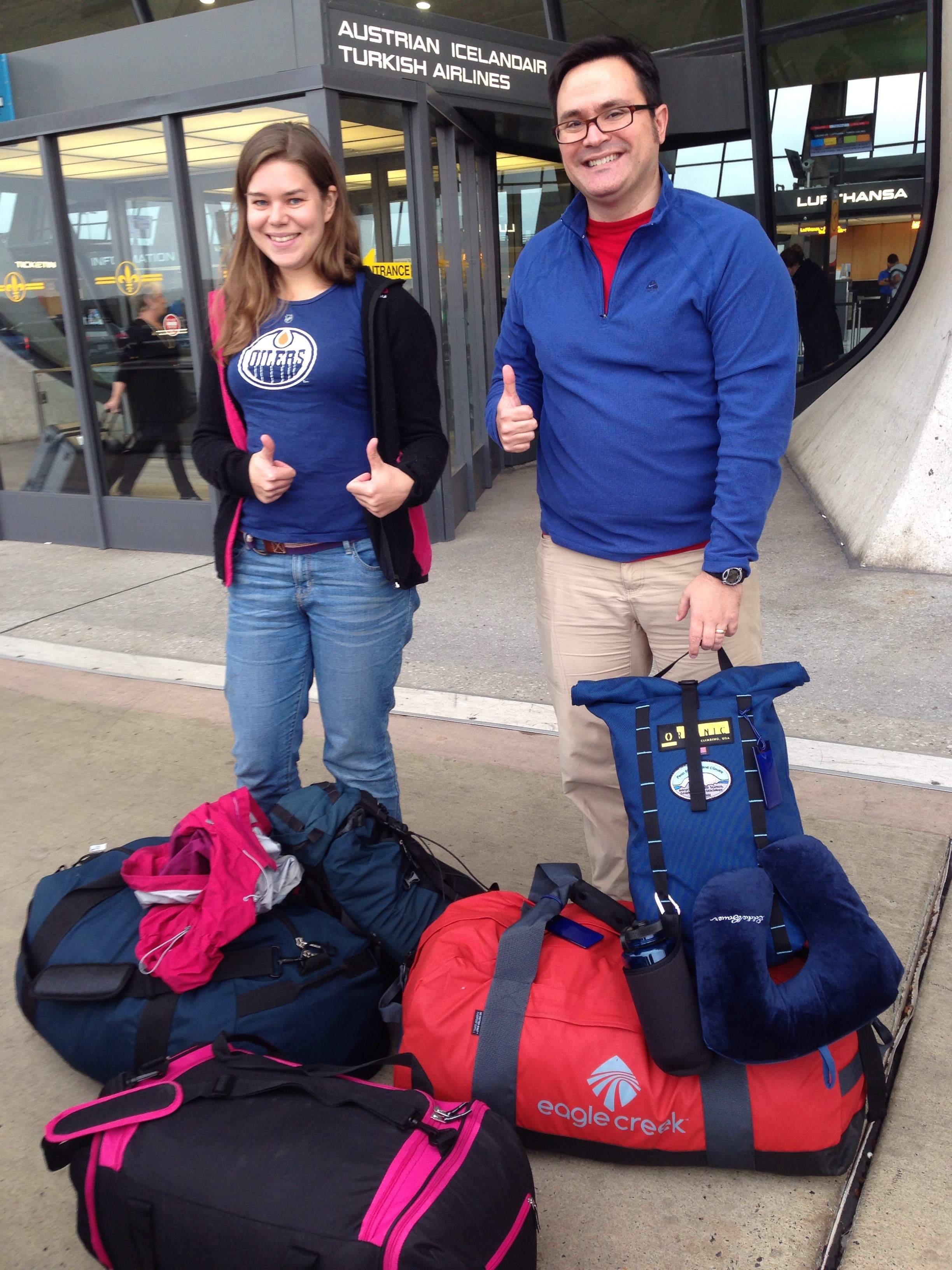
Christine Dow and Ryan Walker, on the day of their departure for Antarctica.
Christine: Hi! My name is Christine Dow. I’m a postdoctoral fellow and my main area of research is using numerical computer models to examine water flow pathways develop underneath the Antarctic ice sheets. I am particularly interested in what controls the growth and drainage of large lakes that form underneath the ice. Despite being chained to my desk most of the time, I love to go into the field. Not that it’s very easy to directly observe water flow underneath the ice sheets, but I find going to visit glaciers always reinforces the large scales of processes that are reduced to a few lines of code on my computer. I have previously lived and worked on glaciers in the Canadian Rockies; Devon Island in the Canadian High Arctic; and on the Greenland ice sheet. However, this will be my first trip to the Antarctic, and has been top of my bucket list for a very long time.
Ryan: And this is Ryan Walker. I’ve been with the Cryospheric Sciences Laboratory at NASA’s Goddard Space Flight Center and the University of Maryland since 2012, following five years at Penn State University. I’m a glaciologist now, but most of my background is in mathematics and I’m primarily an ice sheet modeler. This will be my second trip to the Antarctic — I was on a research cruise studying sea ice with the Australian Antarctic Division when I was in grad school — but this will be my first time on the continent. This trip resulted from the Korea Polar Research Institute inviting me to their symposium in 2014. Although they were mostly looking for my advice as a modeler, our discussions eventually led to an offer to collaborate in the field, for which I’m very grateful. I’m looking forward to getting a close-up view of what I’ve been modeling for years.
Christine: We’re almost off. It’s the culmination of more than six months of preparation involving not just a little bit of stress and appearance of more gray hairs. Ryan and myself will be heading to the South Korean Jang Bogo station in Terra Nova Bay for a month to measure flexure of ice tongues due to ocean tides. We will be installing five GPS stations that will record uplift of the ice and two tilt sensors that will record very subtle changes in ice uplift and motion. The GPS will be placed on regions of the ice that are technically floating on the ocean water, whereas the tilt meter will be placed just about the grounding line where the ice is on land. We have very carefully planned exactly where these will go but, I’m sure, as with all fieldwork we will have to be somewhat flexible with our aims. There are logistics to think of, like weather for helicopter flying, including wind (which we’ve heard is quite brutal in that region) and crevasses in the ice which a) we don’t want to fall down and, b) we don’t want the equipment to fall down. For this reason, we have back-up plans and back-up plans for the back-up plans. However, in the end I think going with the flow is probably the best idea.
In terms of organization, the most important/stressful part so far has been our shipping deadline at the end of September. Holes were drilled, plywood was hacksawed and sanded, metal conduit was sawed and of course lots of packing and repacking. All of this equipment is (hopefully) awaiting our arrival in New Zealand before travelling down with us on a plane to the land of ice and snow. All that is left to do is make sure we have enough socks, etc. and to make sure we catch the multiple flights. The route is going to be Washington Dulles to San Francisco to Sydney (with a lovely 8 hours to entertain ourselves between flights) and then finally to Christchurch. We leave Saturday evening (Nov. 7) and arrive Monday evening (Nov. 9)! Good thing that we have a couple of days to acclimatize before we catch the flight down to the Antarctic. We will be in touch from the southern hemisphere!
Hi there,
For this last blog post of the season, we summarize our work with numbers and photos to give you an idea of our field camp and the life/work on the ice sheet.
This summer fieldwork can be summarized as:
Weather and camping:
Science:
And that is about it for the 2015 fieldwork! Our team will spend fall working on the data at their labs, and we will be back into the field next year in the spring (May/June).
We hope you are enjoying the blog posts and we would like to thank you all very much for following this work! See you all next year!
Best wishes,
Clem
Sling load containing the snowmobile is lowered by the helicopter.

Anatoly, Lynn and Nick taking a picture break in the cook tent.
Olivia and I taking turns operating the thermal drill.
Nick showing a beautiful clear ice layer found below the firn aquifer.

Anatoly posing next to the iWS from the University of Utrecht before and after backfilling the 2-feet deep snow pit.
The complex path of water infiltrating in the SE Greenland firn.
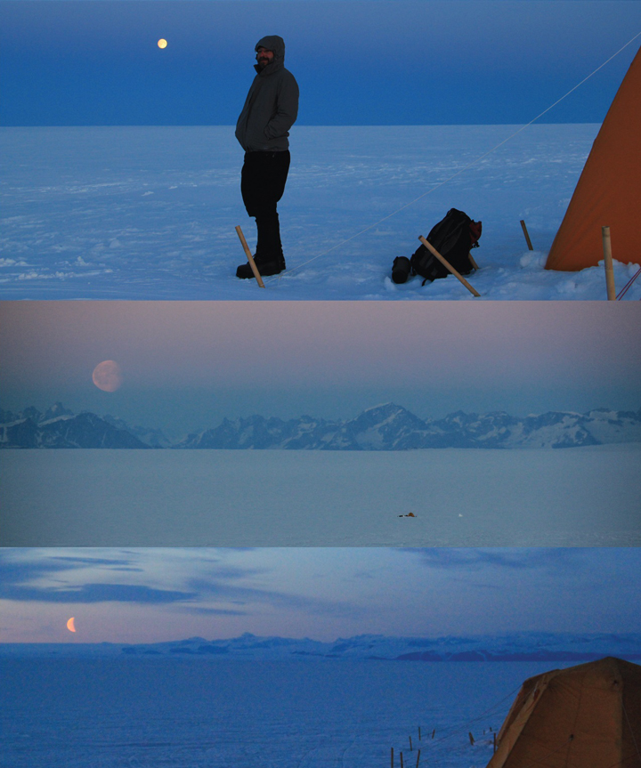
During the 18 days of fieldwork we got the chance to witness great moonrise.
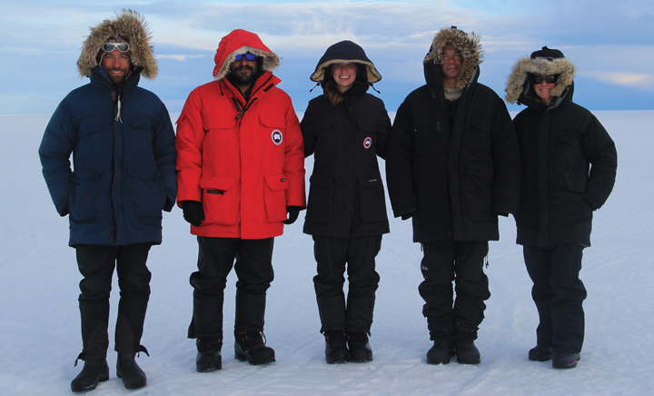
Field team! From left to right: Clem, Nick, Lynn, Anatoly and Olivia.
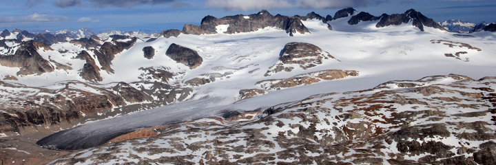
A nice glacier with a dark tongue that we saw on the East side of the Sermilik Fjord.
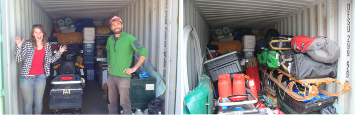
Left: Lynn and I posing at the front of the container after putting the snowmobile inside. Right: gear in the container, ready to over winter.
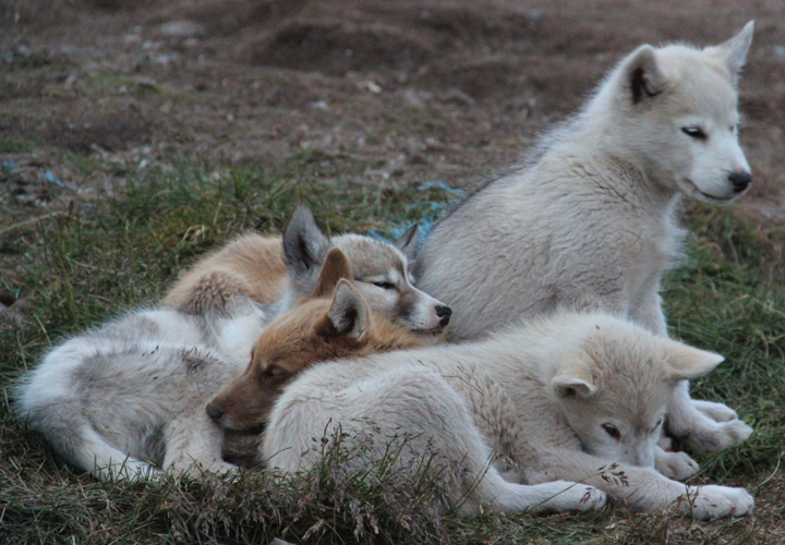
Greenlandic puppies napping peacefully at the village of Kulusuk.
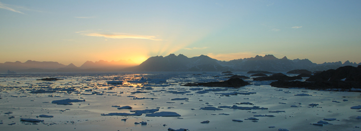
Last sunset in Kulusuk, Greenland before heading back to the U.S.
