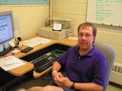
By Walt Meier
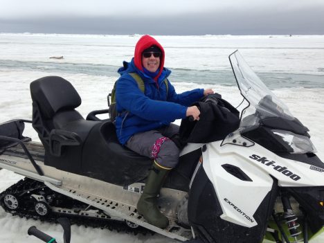
Walt Meier on a snowmobile.
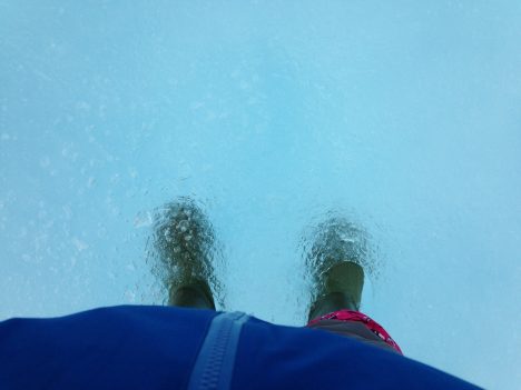
May 27, afternoon – After our morning orientation and introduction sessions, I headed out onto the ice for the first time. We were split into four teams; each team will rotate through a different activity every day with each activity being led by one or two experts that will serve as our guide. I was assigned to the Red Team. Our activity for the day was sea ice morphology, or studying the forms of sea ice, and it was led by Chris Polashenski at the U.S. Army Cold Regions Research and Engineering Lab and Andy Mahoney at the University of Alaska, Fairbanks. All the other activities were being conducted within a short walk of the beach, but in order to see different types of ice, we needed to roam farther. This meant using snowmobile. After getting comfortable on the machines, we headed out. Our first stop was on a first-year ice floe, or is ice that has grown since the previous summer. This type of ice is generally thinner than multi-year ice (ice that has survived at least one summer melt season) and its thickness is largely controlled by the air temperature during the winter (though how much snow falls is important too). Colder temperatures mean more ice growth and thicker ice at the end of winter. We measured the thickness by drilling a hole through the ice using an auger. Then we dropped down a measuring tape. The tape has a folding metal bar at the end that catches the ice at the bottom of the hole; the tape is pulled taut and the thickness is read off the tape.
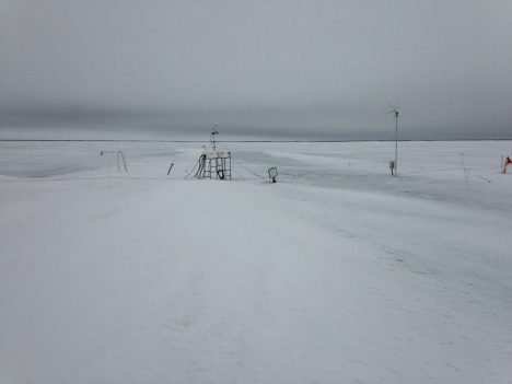
An ice mass balance station in Barrow, AK.
According to Chris and Andy, first-year ice in the area normally should be about 1.5 meters (5 feet) thick. We measured only 0.75 m. That means it’s been a very warm winter around here. But that is nothing new; in recent years, warm winters have become the norm as indicated by thickness measurements. For the past several years, Andy has been installing a sea ice mass balance station on the ice, automatically taking thickness readings every 15 minutes through the winter. The data is available online here.
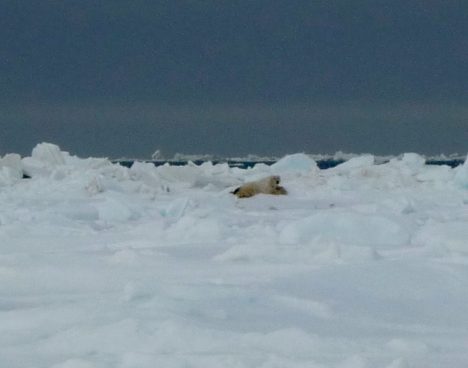
A polar bear in the distance.
Next we head further north, past Point Barrow, the northernmost land in the U.S., toward the fast ice edge. On the way, we spotted two polar bears in the distance. Polar bears are not an uncommon sight. They usually hang out near the ice edge hunting seals, though they sometimes wander into town, which can be a problem. At this time of year they are attracted by the whale carcasses that the native populations pull onto the ice as part of their traditional whale hunts. The bears were distant and barely visible, but it was quite exciting to see a bear. Polar bears can be dangerous and during all of our activities on the ice, we will have a polar bear spotter –a trained local resident carrying a shotgun – with us at all times.
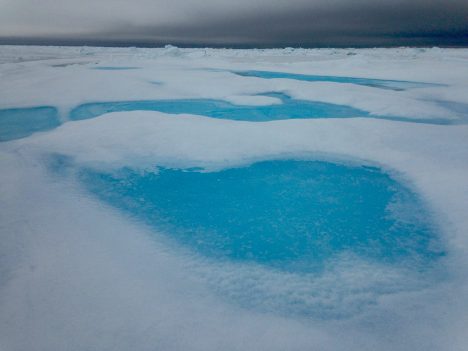
We left the polar bears to their business and rode further out to a multi-year ice floe that was more than 5 meters (16.4 feet) thick. We attempted to measure the thickness, but we didn’t break through the bottom of the ice at our auger’s (boring tool) maximum 5-meter length. To my untrained eye, the multiyear ice didn’t really look much different than first year. But with careful viewing, one could see an elevation change compared to the first-year ice. It wasn’t a lot, but a just little more elevation on the surface that floats above the ocean translates into much thicker ice because roughly 90 percent of the ice thickness lies beneath the surface of the waters. So a 5-meter thick floe of sea ice rises only about 50 cm (20 inches) above the waterline. The most distinguishing characteristic, at least at this time of year, are the brilliant blue melt ponds that form on the surface. As the snow melts, the melt water will accumulate in depressions in the ice, pooling into ponds. The crystal clear water on top of the pure multi-year ice produces a distinctive turquoise color reminiscent of the water around a tropical island. Melt ponds are very important because they absorb much more solar energy than the surrounding ice, which accelerates the melting process. But to be honest, when seeing a pond in person, the first thought one has is how pretty they are.
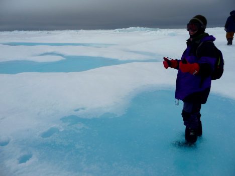
Walt, standing on a melt pond.
Just a few meters away, back on first-year ice, was another melt pond. But this had a much darker color due to the thinner and flatter ice. The water was also somewhat salty because first-year ice still retains some salt. The salt gets flushed out of the multiyear ice, so the blue ponds on the multiyear ice are fresh water suitable for drinking. We tried some and it was quite refreshing – ice cold!
Next, we headed over to a large piece of ridged ice. Ice ridges form due to ice floes being piled into each other due to winds or waves. The fast ice does not move, but the drifting ice beyond does and when the winds blow toward the land, the drifting ice collides with the fast ice, forming mountains of ice. The one we investigated was around 5 meters (16.4 feet) high. This means the ice could extend 50 meters (164 feet) deep below the surface. However, the water is fairly shallow off the coast and in reality, the ridge was likely grounded to the sea floor. These grounded ridges actually stabilize the fast ice by acting like big support columns, holding the fast ice in place. This explains why the coastal ice remains in place long after the drifting ice has retreated.
The morphology activity was quite humbling to us satellite data scientists and modelers. We work at scales of 5 to 50 kilometers (3 to 31 mi) – i.e., we’re observing or modeling sea ice in 5-50 km aggregates. Here over just a few kilometers we saw a tremendously varied icescape. Even over just a few meters, we saw multiyear ice, first-year ice with melt ponds on each. How can interpret our satellite data to account for such variability and how can we simulate it the models?
With the ridged ice, we completed our tour of the various forms of ice found in the Barrow area at this time of year. We hopped on our snow machines for the ride home. In front of us the sun broke through the clouds, behind us the polar bears roamed, and all around us, a lovely landscape of ice.
By Walt Meier
I have arrived in Barrow, Alaska. It was an interesting flight up from Anchorage: the plane had seats only in the back half of the plane because the front half is used for cargo. That is because there are no roads into Barrow, so supplies need to be brought in by plane or, during the short summers, by barge. After a stopover in Prudhoe Bay, we arrived to gloomy skies, which are quite typical for this time of year. Temperatures are right around freezing. We are staying at the NARL, which originally was the Naval Arctic Research Laboratory. Various research groups and other activities –even a college– now share this facility.
The accommodations are spare, but comfortable. Most people are staying in Quonset huts (prefabricated huts made of galvanized steel), but I’m with four others in “The House”, which is more like, well, a house. We have a living room, kitchen, full bath, and four bedrooms. Because we have a kitchen, we are the base for meals where the whole group meets up to eat breakfast and lunch. Last night we all gathered for a light meal after arriving and, with 24 people, it got pretty crowded. But it was nice to catch up with old friends and meet new colleagues. Already the collaborations have begun as we informally discussed each other’s research.
The whole campus is on a narrow spit of land north of town sticking out into the Beaufort Sea. I can see the sea ice from the house. So you might say we’re staying at a beachfront resort! With the ice right out the window, it was tempting to take a walk out there last night. However, we were told to not go out on the ice until we get a safety orientation. The ice off the coast is landfast ice – ice that is attached to the coast, so it doesn’t drift with the winds. However, it can still shift with the tides, as evidenced by piles of ice ridged formed as ice got pushed together. So one doesn’t want to just run out on the ice without being familiar with the hazards. Oh, and there are also potentially polar bears roaming around – another very good reason not to go roaming off by oneself.
Our view of sea ice from The House.
Now we’re heading off to our orientation session and introductory discussions where we’ll start learning about modeling, satellite data, and field observations. This afternoon we’ll take our first trip out onto the ice. When the week is over, each of us will have broadened our expertise beyond each of our core research areas and hopefully we may find new areas of research to collaborate on and advance our understanding of sea ice.
By Walt Meier
Whenever I tell people that I’m a polar scientist or that I study sea ice, inevitably one of the first questions I’m asked is, “so, have you been to the ice?” I’ve always had to answer no. I’m a remote sensing scientist who works with satellite data. Other than a few aircraft flights over the ice several years ago, I’ve spent my career in front of a computer analyzing satellite images. When I’ve needed field data, e.g., to validate satellite measurements, I could always obtain it from colleagues. So there has never been any need for me to go out on the ice. And to be honest, spending days or weeks in the field, as many researchers do, does not have particular appeal to me – I like the comforts of my heated office! Nonetheless, I’ve always wanted to get out at least once in my career and see the ice close up, feel it crunching under my feet, hear it creak and groan as it strains under the winds and currents.
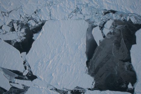
An image of sea ice in northwest Greenland, captured by NASA’s Operation IceBridge.
Now I am getting that chance, thanks to a National Science Foundation funded Summer Sea Ice Camp workshop. I and a couple dozen fellow scientists are heading to Barrow, Alaska – the northernmost point in the United States at 71 degrees N latitude – to partake in a unique project. The goal of this project isn’t specifically to collect data (though I hope that some of the data we collect will be useful), but rather to foster communication between remote sensing scientists like myself, sea ice modelers, and field researchers.
While there is a lot of collaboration in the sea ice community in terms of sharing data and results, scientists tend be silo-ed within their own area of expertise when it comes their actual work. Modelers focus on model development, validation, and results. Remote sensing folks like myself analyze satellite data. And field researchers collect and analyze in situ observations. Partly this is simply due to time – just focusing on one area keeps one plenty busy. But it is also partly due to a lack of communication. For example, I know a bit about modeling, but I don’t really understand the details of how a sea ice model is put together, how it can and should be used. Similarly, while modelers often use remote sensing data to compare with their model results, they don’t often understand the capabilities and limitations of satellite data. This can lead to under use or misuse of the data. And neither modelers nor remote sensing scientists may have much understanding of how to best take advantage of in situ data.
The goal of this workshop is to bring the three groups together for a week to talk and work with each other to better understand each of the three specialty areas and how perhaps the three groups can better work with each other to advance our understanding of sea ice. So now I’m on my way to Barrow, Alaska, looking forward to helping others understand satellite data, as well as running sea ice models and feeling that crunch of ice and snow under my feet as I collect data from on top of the Arctic Ocean. More in my next blog post from Barrow!
For more than 65 hours this month, NASA’s high-altitude ER-2 aircraft flew from Fairbanks over melting sea ice, glaciers, forests, permafrost, lakes, volcanoes and more. It zigged and zagged over the Beaufort Sea, and soared straight over the Bagley Ice Field.
The goal: to use a laser altimeter called MABEL to take elevation measurements over specific points and paths of land, sea and ice. To hit these marks, scientists and pilots painstakingly designed and refined flight routes. And then they adjusted those routes again to capture cloud-free views – a tricky proposition in a giant state with mountains creating complex weather systems.
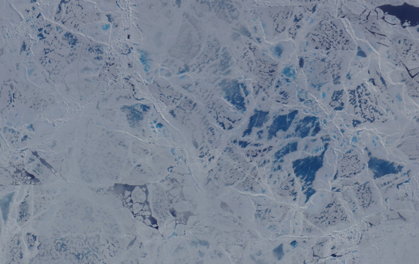
A camera on the MABEL instrument captured pictures of cracked sea ice, dotted with melt ponds, during a flight to the North Pole. (Credit: NASA)
“We have targets to the north, targets to the south, and mountain ranges blocking both,” said Kelly Brunt, a research scientist at NASA’s Goddard Space Flight Center who was MABEL’s science flight planner.
Scientists studying forests, glaciers, water and more are using MABEL data to develop software programs for the upcoming ICESat-2 satellite mission, and sent Brunt lists of what they would like to be included in the Alaska campaign.
“We get everybody’s input, and start to put it on a map,” she said. She drafts routes with targets in similar weather patterns, so that if one is clear the others are likely to be as well. However, often targets are removed from a route, based on the weather assessment from the morning of the flight. During the deployment, routes are also constructed to target specific sites that were missed during previous flights for either weather or aircraft reasons. Lots of the work goes into straightening the flight line, Brunt said, since when the aircraft banks at 65,000 feet, the laser instruments swivel off their ground track and the scientists can lose miles worth of measurements.

The MABEL campaign’s July 24 flight route covered glaciers, ice fields, forests, the Gulf of Alaska and more. (Credit: NASA)
One flight to measure sea ice was pretty direct – it took the pilot straight to the North Pole over one longitude line, circled around and came back on another. A second route involved a zig-zag pattern over the Arctic. But both routes were designed to capture a range of summer ice conditions, including melt ponds, large stretches of open water, and small openings in the sea ice, known as leads.
Flights over Alaska itself were often mapped to pass over glaciers, lakes, ocean moorings or even tide gauges that others have measured before, to compare with the data MABEL collected. Students from the Juneau Icefield Research Program (JIRP) assisted MABEL researchers by providing ground-based GPS validation for a mission that flew over the upper Taku Glacier, close to a JIRP camp. And the MABEL team collaborated with NASA Goddard scientists flying a different instrument, called Goddard’s LiDAR, Hyperspectral and Thermal (G-LiHT) Airborne Imager – the two campaigns flew some of the same paths over interior Alaskan forests.
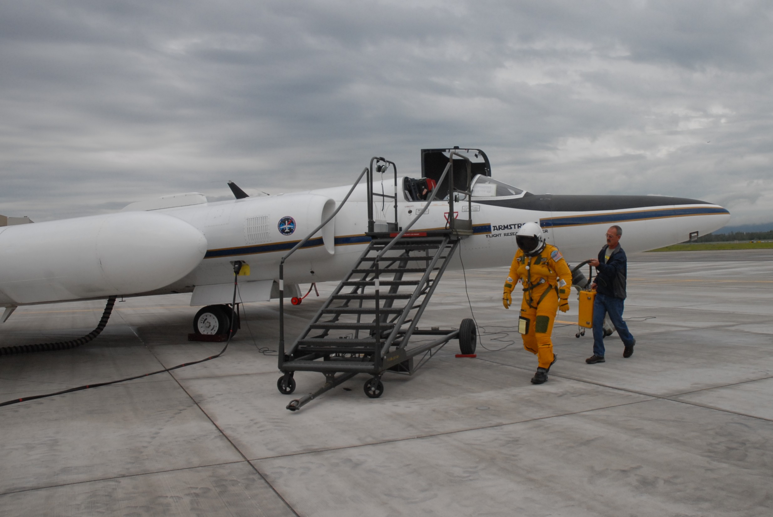
NASA ER-2 pilot Denis Steele, in a pressurized flight suit, before a July 16 flight over Alaska’s glaciers. (Credit: Kate Ramsayer/NASA)
From Fairbanks, Brunt worked with the campaign’s two pilots, Tim Williams and Denis Steele, to ensure the routes would work with the ER-2’s capabilities; and with weather forecasters to determine where to best focus efforts the following day.
In all, the campaign flew 7 flights out of Fairbanks. And today, the ER-2 – with MABEL aboard – flies back to California, collecting even more data about the elevation of the landscape along the way.
As the ER-2 pilot got ready for his first flight out of Fairbanks, I wondered what it’s like piloting the aircraft, all by himself, 65,000 feet up.

Denis Steele sets up a video camera in the cockpit of the ER-2, 65,000 feet over Alaskan mountains and glaciers. (Credit: Denis Steele/NASA)
The NASA ER-2 pilots for this campaign, Tim Williams and Denis Steele, are flying the MABEL instrument to study the glaciers and ice sheets. Before they fly, they have to get suited up. It’s quite a process. Because the altitude is so high, they need to wear pressure suits. I talked with expert NASA engineer technicians Raul Cortes and Ryan Ragsdale, who are veterans in testing equipment and prepping pilots before a flight to ensure safety.
The involved process starts the day before a flight, when Cortes and Ragsdale prepare the pressure suit. They check the pressure and make sure there are no leaks in the gloves, body suit, and helmet. They put the whole system together and inflate it, like a giant balloon character, to test that the suit will properly pressurize.
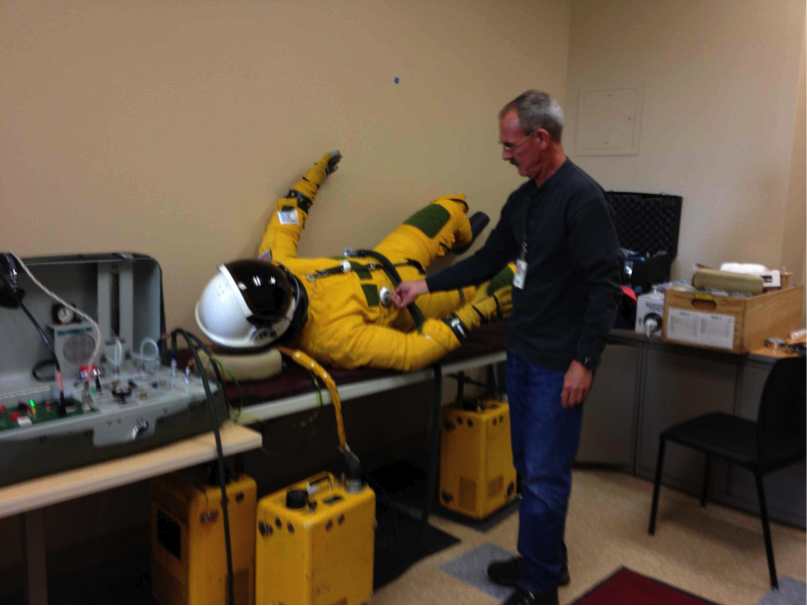
Engineer Technician Ryan Ragsdale of NASA Dryden inflates the pressure suit the day before to make sure there are no leaks. (No, there is not a real person in there!). (Credit: Valerie Casasanto/NASA)
When a pilot puts on the suit, it’s bulky and stiff, so it’s difficult to work in. And it’s difficult to eat in. During the long flights, pilots eat and drink out of a straw.
The food is the consistency of pudding, and the straw feeds through a small hole in the helmet of their pressure suit. I asked what was on the menu for one flight. They have a choice that includes beef stroganoff, pears, caffeinated chocolate pudding (which happens to be Cortes’ and ER-2 crew member Luis Rios’ favorite). I was curious about this chocolate pudding, but given a free sample of the “pears” — which tasted like part baby food, part applesauce, with a pear afternote.
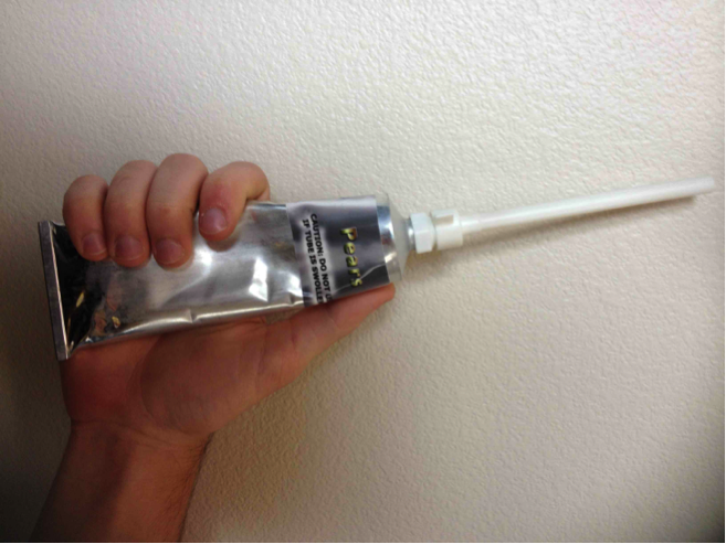
Pears in a tube. (Credit: Valerie Casasanto/NASA)
The caffeinated chocolate pudding used to be Williams’ favorite until he switched to the caffeinated apple pie. Mmmm, wonder if there are crusts in there too. When Steele first started flying, he ate the tube food. But sometimes it would get messy. One time a pilot was heating up a “sloppy joe” tube and it accidentally squirted out all over the cockpit. Now Steele just drinks water. You can easily dehydrate up there since you are breathing pure oxygen.
I thought it must be pretty confining in that suit with not much room to move, so talked with the Steele and Williams to see what the space is like for their 8-hour journey. The cockpit seemed to be about the size of half of a bob sled. Or, according to Steele, “if you throw a blanket over your head and body and lift your arms out a little, it’s that area between you and the blanket.” Just a little bit of room to move around, and a bit of leg room (unless a pilot is really tall). However, it doesn’t feel claustrophobic, Williams said, because they have good visibility.
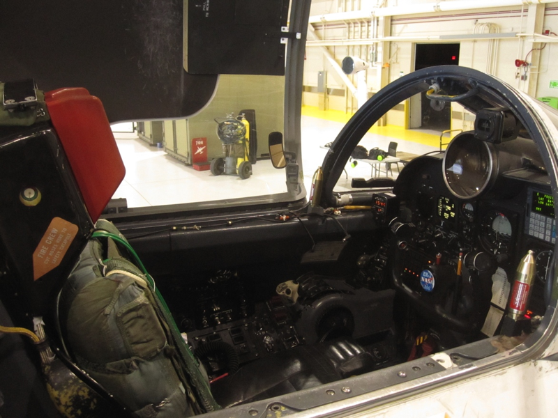
The ER-2’s cockpit, with little room for movement. Credit: Valerie Casasanto/NASA
When they’re up in the stratosphere, pilots keep a close watch on the plane’s instruments, Steele said. “You are always thinking – watching the instruments, doing science, mental math, calculations, thinking about what you would do in an emergency situation.”
They even do puzzles. On one flight last week Williams did Sudoku to keep entertained. You can also plug in to play music, although there are stories of colleagues playing tricks on the pilots, and programing in Disney music prior to flight.
Long flights at high altitudes do have effects, Steele said, and pilots need to be careful and not exercise too much after they land.
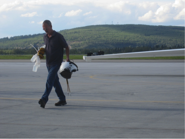
Ryan Ragsdale carries empty water bottles and pilot’s helmet back to hangar after a long day’s flight. (Credit: Valerie Casasanto/NASA)
“Being at 60,000 ft. does drain you, especially if you are working hard,” he said. “The time you are working hardest is when you take off and land. The pilot does a lot of movements to keep the plane stable at low altitudes. It wears you out. But you get used to it, it’s like driving a car!”
