Eni Njoku
Today was planned as the first full day of science flights and soil moisture sampling. The morning Go/No-Go telecon confirmed our “Go” decision of yesterday evening, so the ground sampling crews were given the signal to head for the fields (an hour or more drive from Winnipeg) and the PALS folk headed for the airport.
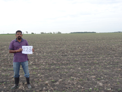
Narendra Das on the soybean field #123. We should see a big difference in a few weeks!
For more information and to read a news release, visit SMAP Blogs from the Field.
Eni Njoku
Today was a test day, to go through the PALS/Twin Otter flight operations, and for the ground teams to get familiar with the soil and vegetation sampling equipment and the field site locations.
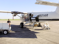
Richard (pilot) and Andreas getting the Twin Otter and PALS instrumentation ready.
Test Flight
We were at the airport by 8 am. The plane was outside being prepared by Richard and Dave (pilots). Andreas worked on the antenna external calibration target while Seth and Ian checked out the PALS electronics.
After the pre-flight briefing, take-off occurred as planned at about 10 am. The plane climbed and headed northwest towards Lake Manitoba for high and low altitude calibrations over water, and then turned southward to test maneuvers and data collection over a few of the designated field site flight lines. At 11:30 am the plane landed back at Winnipeg and we went through the debrief. Andreas checked the data back at the hotel (downloaded onto a thumb drive).
To read more, please visit SMAP Blogs from the Field.
Eni Njoku
Arrived yesterday evening (Monday June 4) and settled into the Hilton Suites, Winnipeg near the airport. The Twin Otter had arrived a couple of days earlier from Grand Junction, Colorado via Wyoming and is hangared at Winnipeg airport.
Training (First Day)
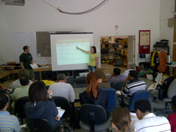
Heather and Grant explain high points in the ROC.
Early Tuesday morning we headed for the Agriculture and Agri-Food Canada (AAFC) Regional Operations Center (ROC), Winnipeg located on the other side of town near the University of Manitoba campus. This is to be the training center and gathering place for SMAPVEX12 field operations. Heather McNairn (AAFC) the lead site organizer on the Canadian side, Mike Cosh (USDA) and Grant Wiseman (AAFC) were there to meet everyone, and after welcomes and a brief round of introductions including a summary of SMAP status from Eni and Peggy the training began.
For more, please visit SMAP Blogs from the Field
Friday April 27 the PALS instrument was packed up by Barron and Seth and shipped by truck to Grand Junction, Colorado to be installed on the Twin Otter aircraft assigned to the SMAPVEX12 campaign. This is the first leg of the PALS journey to Winnipeg, the site of the field campaign.
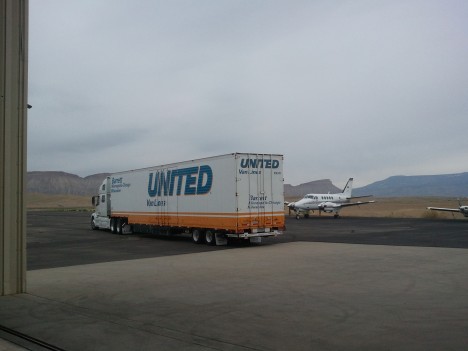
Moving van arrived at the Twin Otter facility
Monday April 30 Seth and William Chun arrived in Grand Junction to meet the moving van and direct unloading. The Twin Otter aircraft N821AR was waiting with tundra tires and larger brakes installed. The PALS racks were placed in the aircraft and cabling and verification began. Seth met our pilot, Richard Webb.
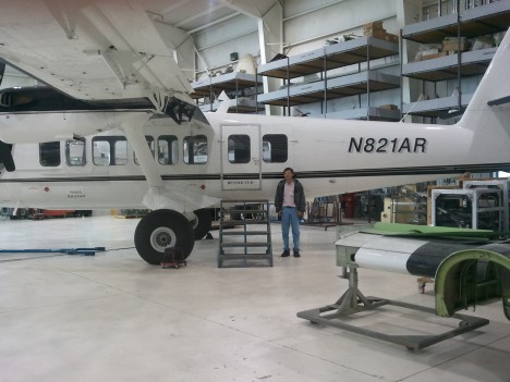
Twitter Otter Aircraft
May 16-18 Instrument checkout and flight readiness reviews complete. Test flights underway with PALS on board. Aircraft take-offs, landings, practice maneuvers. Flight to Lake Powell.
For the full blog, visit SMAP Blogs from the Field
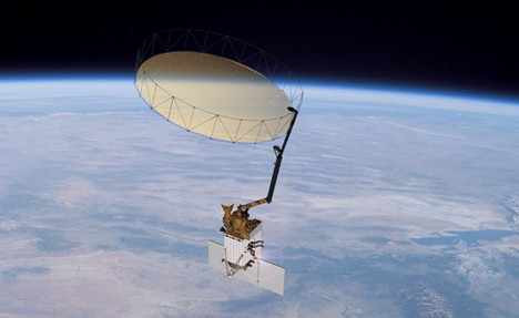
SMAPVEX12 stands for the 2012 Soil Moisture Active Passive (SMAP) Validation Experiment.
SMAP is a NASA Earth science satellite mission that uses microwave radar and radiometer instruments to measure soil moisture from space. The radar and radiometer share a six-meter mesh reflector antenna that rotates at approximately 14 revolutions per minute. The instrument system is mounted on a dedicated spacecraft that will be launched into space in October 2014 if all goes well, and will orbit the Earth approximately every 90 minutes at a height of 685 km above the Earth’s surface. The instruments will measure the microwave radiation emitted and scattered from the land surface, and will transmit the measured data down to Earth where the data will be converted into global maps of soil moisture. The maps will also show whether the moisture in the soil is liquid or frozen at any given time.