
A Powerful Landscape
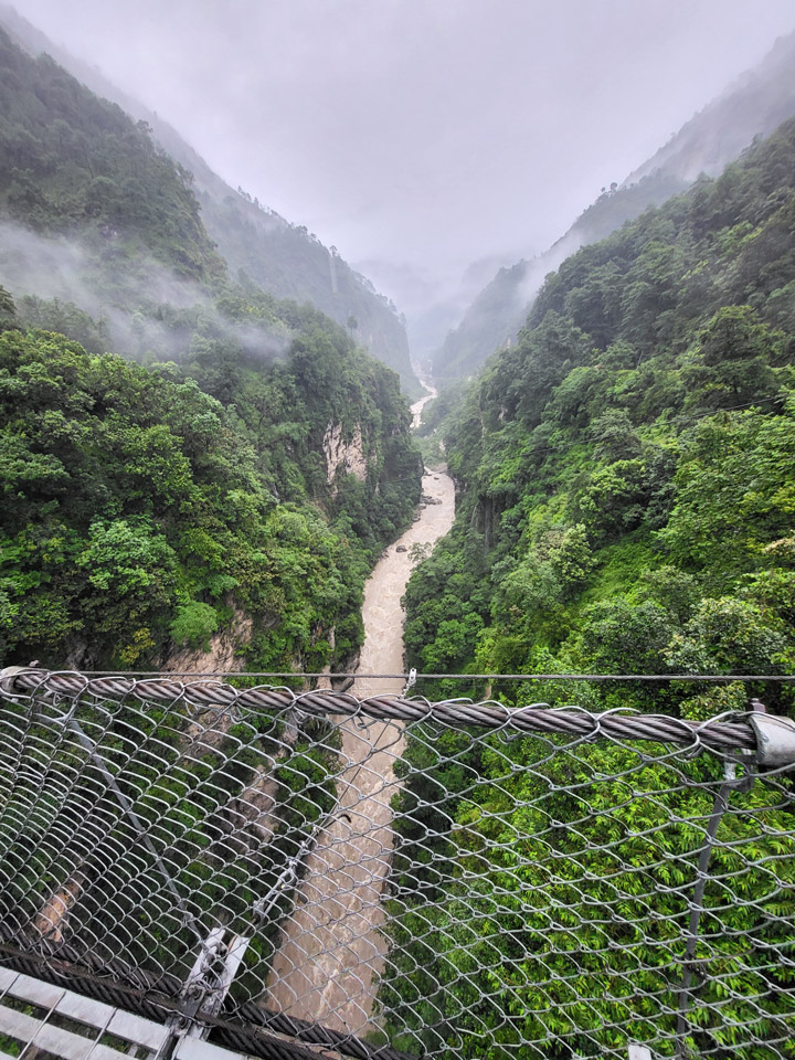
Umbrella in one hand, I gripped the metal cable of the suspension bridge as I looked down into the boiling Bhotekosi River coursing below me through a steep, verdant canyon. Due to the steep slopes, fragile geology, and frequent rainfall, Nepal is especially subject to natural disasters including landslides and flooding.
I found myself in this powerful landscape because I work for SERVIR, a joint NASA and USAID program that works with leading regional organizations to help countries worldwide use Earth observations and geospatial technologies to address environmental challenges. I joined a group of scientists and disaster risk reduction practitioners on a trip to view major landslide sites and better understand what satellite data can tell us about the landscape. Driving up from Kathmandu, we passed by small villages, hydropower plants, bulging retaining walls holding back hillsides, and the aftermath of past destructive landslides.
As an applied remote sensing scientist, I seek to understand the physical processes driving these hazards, how satellite data can capture these processes, and how the information from satellite data can complement the existing systems used for planning, early warning, and disaster response. While satellite data has the distinct advantage of consistently receiving data over large regions of the world, it is only a single perspective.
Visiting the field, talking to experts, and consulting with end users is critical to designing a product that is effective at reducing loss of lives and infrastructure due to natural hazards.
Cascading Hazards in Nepal
Cascading hazards (or ‘multi-hazards’) are events where one hazard triggers or increases vulnerability of a second hazard, such as a landslide that blocks a river and creates a flood. They pose a challenge to disaster managers since they can evolve quickly and the outcome can be difficult to predict. Nepal’s predominantly rural population is increasingly at risk as climate change drives extreme and erratic precipitation events that trigger cascading hazards.
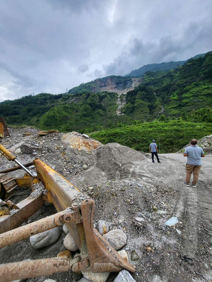
During our drive, we stopped to look at the site of the Jure landslide on the right bank of the Sunkoshi River. In 2014, the Jure landslide broke free from the steep valley walls, plummeting thousands of meters to the valley floor, blocking the river, and destroying over 100 homes and lives. The natural dam quickly caused water to back up, posing a serious flood risk to upstream towns and damaging hydropower infrastructure. The Nepal Army and Police force acted quickly to dynamite a section of the dam to release some of the water downstream, but even after this quick action the threat of catastrophic flood remained. Fortunately, a month later when the dam breached, no major damage was caused by the flood waters. In addition to loss of lives and homes, damage to the road interrupted necessary services, disrupted the primary trade route with China, and impacted the tourism trade.
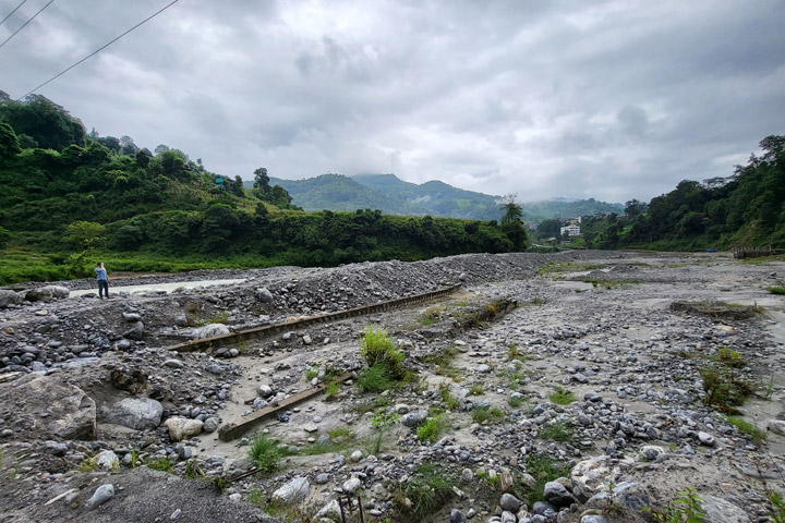
In addition to precipitation events, several factors increase the chance of cascading hazards in this region: glacial lakes, snowmelt, permafrost degradation, glacial deposits, high relief, and fragile topography. The Melamchi flood disaster that occurred June 15th of 2021 was triggered by heavy rainfall at higher elevations and snowmelt. This increased amount of drainage caused a glacial lake to breach. The consequent erosion of glacial deposits and natural dams downstream resulted in severe flooding that carried debris the size of boulders and triggered further landslides and riverbank erosion.
The communities here are familiar with the risk of natural hazards. They know that there is a higher risk of landslides when it rains. The current mechanisms for warning are primarily word of mouth, phone calls, text messages, and social media posts. Despite these warnings, many lives are lost during these disasters. There is still a need for an integrated multi-hazard early warning system.
The Satellite Perspective
Satellite data can be used to consistently monitor large areas for potential hazards, such as slopes at risk for landslides. Factors such as precipitation, soil moisture, slope, aspect, and even slow-motion movement can be measured via satellite and contribute to landslide hazard mapping.
NASA’s High Mountain Asia Team (HiMAT) is a group of scientists focusing on bringing the satellite perspective to these hazards. Thomas Stanley and Pukar Amatya from UMBC/NASA worked together with Sudan Bikash Maharjan from International Center for Integrated Mountain Development (ICIMOD) to develop a prototype landslide mapping and hazard awareness tool for the Karnali River Basin in Nepal. Collaborating with the National Disaster Risk Reduction and Management Authority (NDRRMA) and other government agencies, they are working to integrate the landslide hazard awareness tool into the planning and early warning process. In addition, a SERVIR applied science team is looking at how satellite radar systems can be used to monitor slowly moving slopes in the region.
The hazard awareness tool is known as Landslide Hazard Awareness for Karnali (LHASKarnali). It is a pilot project to adapt the global Landslide Hazard Assessment for Situational Awareness (LHASA) model for use in High Mountain Asia starting with the Karnali River Basin of Nepal. LHASA was previously regionalized for a SERVIR Applied Science Team project in the Lower Mekong region. It provides a one-day forecast of the hazard level for rainfall-triggered landslides by using precipitation forecasts. The LHASKarnali tool integrates forecasted precipitation from the High-Impact Weather Assessment Toolkit (HiWAT), which is managed by ICIMOD.
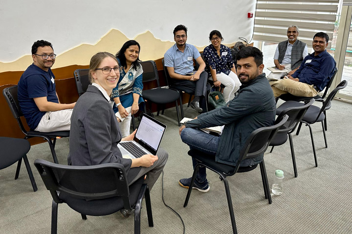
At a workshop prior to our field visit, we sought the insights of national stakeholders and academic experts, including the Department of Mines and Geology and the Department of Hydrology and Meteorology. Drawing from their experience assessing slope stability for high-risk communities, they felt that soil depth and soil moisture were among the most important factors controlling the occurrence of rain-triggered landslides. While satellite data can accurately provide data on slope, aspect, and rainfall, soil moisture is not well captured due to the steep slopes and high vegetation cover in Nepal. Although prior rainfall was used in LHASKarnali as a proxy for soil moisture, how this translates to soil moisture is unknown. These conversations helped end users think through the value of the tool and how their expertise could be used to enhance the end-product going forward.
The limitations of a 4-kilometer resolution product also stood out to participants. Response agencies like Practical Action emphasized the need to be able to identify vulnerable populations at a household or village level. Even smaller landslides can be highly destructive and more targeted warnings are important when evacuations and other high effort actions are required. Going forward, a partnership between the scientists and universities will contribute to an effort to increase the resolution of the landslide hazard forecast.
Looking Ahead
During my time in Nepal, I traversed steep river canyons, which showed me the challenge of capturing and interpreting the steep slopes and narrow rivers in satellite imagery. Talking with disaster management agencies like Practical Action and NDRRMA, I learned about the need for a joint system for multi-hazard assessment to understand the cumulative effects of landslides, floods, and other factors like the erosion of natural dams. Getting the opportunity to speak with communities and get feedback about satellite observations, such as concerns over the representation of soil moisture, help us get closer to achieving warning systems for these complex hazards.
With increasing extreme events due to climate change, being able to plan and react to these hazards is critical for resilience. It will take collective expertise and tools to tackle this complex challenge.