
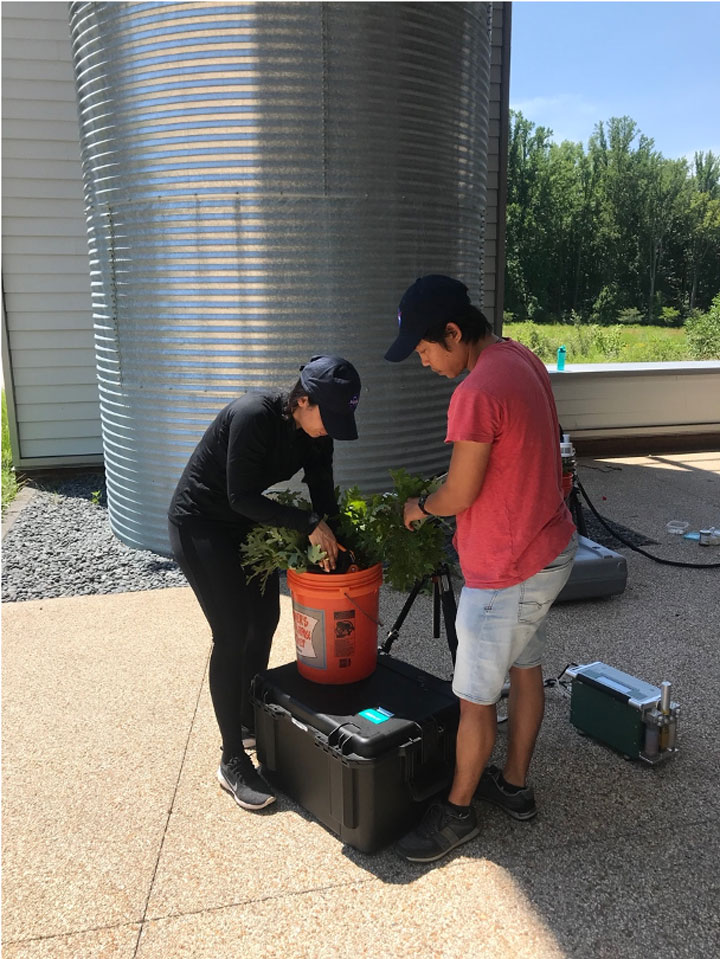
On a warm July morning an Unmanned Aerial Vehicle (UAV) quadcopter rises up through a gap in the tall, dense deciduous forest canopy at the Smithsonian Environmental Research Center (SERC) in Edgewater, Maryland. Hanging down from the quadcopter is a pole with a black robot claw at the end (video, above). Under the control of students Emmy Braun and Charlie Southwick of West Virginia University, the quadcopter flies above the forest canopy to a specific tree where it carefully drops down and grabs a branch with the claw. The claw cuts off a branch sample from the tree top and carries it down to the ground, where the researchers await, ready to take it to the lab for measurements (Figures 2 and 3).
Our project, “Quantifying leaf-to-landscape predictors of tropical forest drought vulnerability through ISS observation-model integration,” led by Dr. Loren Albert of WVU aims to use measurements from these branch samples to better understand how to use data from the International Space Station (ISS) to detect the effects of climate variability on tropical forests.
We regularly see astronauts floating around in the ISS, working on experiments inside or doing space walks outside the station, but what does the ISS have to do with tropical forests? The ISS has become an important platform for state-of-the-art Earth observing instruments. Among the instruments on ISS there are four that can describe key characteristics of forests. These instruments include the Global Ecosystem Dynamics Investigation (GEDI) which uses lasers to determine the height and structure of forests; the DLR Earth Sensing Imaging Spectrometer (DESIS) that breaks up the light reflected from plants into hundreds of narrow color bands that can be used to describe the biochemistry of leaves; the Orbiting Carbon Observatory-3 (OCO-3) that measures the amount of carbon dioxide in the atmosphere and also can describe the light emitted by plants as part of photosynthesis which can be related to plant productivity; and the ECOsystem Spaceborne Thermal Radiometer Experiment on Space Station (ECOSTRESS) which measures the temperature of plant canopies and can detect the occurrence of water stress in plants. Together, this suite of instruments has the potential to significantly improve our understanding of how plants function and respond to stress.
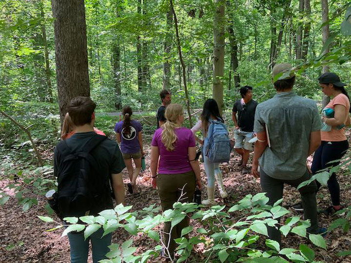
The goal of the SERC campaign was for team members from WVU, the University of Maryland Baltimore County, NASA Goddard Space Flight Center, and the Smithsonian Institution to work together to develop and refine protocols for data collection for future campaigns in tropical forest sites. SERC is home to one of the Forest Global Earth Observatory (ForestGEO) sites. ForestGEO is a global network of sites that monitor tree growth and death, biodiversity, and function for a wide range of forest types. The ForestGEO site at SERC is a deciduous forest dominated by tulip poplars that are over 100 feet tall and over 100 years old, where every stem larger than 1 centimeter in diameter is identified and mapped (Figures 4 and 5). After working at SERC the team will take what we’ve learned and move on to the ForestGEO site in Panama on Barro Colorado island for a field campaign in the fall of 2022.
A persistent challenge in trying to study trees in tall forests is getting access to sunlit canopy leaves—the leaves observable by remote sensing instruments viewing the trees from above. This is where the robot claw on the quadcopter comes in. Leaves from the samples returned by the quadcopter for the major tree species were measured to determine their photosynthetic light response, their chlorophyll content, spectral reflectance, and chlorophyll fluorescence (Figures 2 and 6). These data will be used to parameterize the SCOPE vegetation biophysical and radiative transfer model to connect with remotely sensed data from ISS instruments.
