
After the Tomsk campaign, we traveled to Yakutsk for the next leg of the campaign that came with new scientific objectives. Our team now included three members from Vrije Universiteit Amsterdam, two members from Woods Hole Research Center and one collaborator from the Institute of Biological Problems of the Cryolithic Zone from the Russian Academy of Sciences. Our destination was a burn scar from last year’s fire season near the small village of Yert, approximately 200 km West of Yakutsk and surrounded by larch forests, sometimes mixed with pine forests, growing on permafrost terrain. Approximately 20% of the boreal biome are dominated by deciduous larch forests, yet we do not really know how wildfires influence carbon stocks of these ecosystems. We aimed to fill parts of these knowledge and data gaps by collecting ground measurements to quantify the amount of carbon released during these fire events. This is also a formidable opportunity to see on site what these forests look like before studying it at larger scales from satellite data.
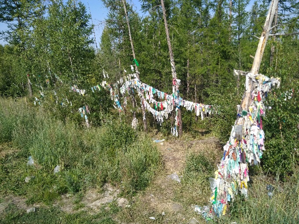
Our first task was to reach our camping site located within the burn scar of approximately 900 km2. On our way to the field site our local collaborator and driver showed us how the forests are honored in Yakutian culture. We made several stops along the road to worship the Bayanay spirit, the spirit of hunting, taiga, and its animals and birds, by leaving several presents on trees. Our local collaborators told us that these offers would bring good luck to our field campaign. Thus, of course we were very generous.
We had been told that locals from Yert were quite excited that an international team would visit their village. Indeed, when our team arrived at the village after a five-hour drive from Yakutsk we were kindly welcomed by the chief of the village with a cup of kumiz, local drink of fermented horse milk, and several local dishes. While having tea we talked more about the scientific goals of our campaign, and the local surroundings. They were also intrigued about the fact that our ‘Dutch’ team consisted of team members of French, German, Belgian, American and Russian nationalities. When we selected this little village as our access point to access the burn scar several months ago several thousand kilometres from here, in Amsterdam, using road maps and satellite images, we had no idea that this local community would be so welcoming and honored by our visit.
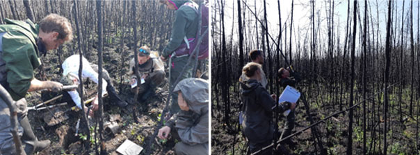
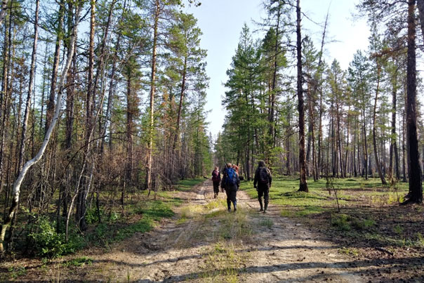
The first five days we sampled burned plots with gradients in fire severity, soil characteristics and vegetation composition. In each plot, we performed a wide range of measurement including soil sampling for carbon analysis, aboveground biomass and combustion estimates, active layer thickness measurements, tree cores for stand age estimates and post-fire tree seedling counts. Getting into these plots in such a remote area was quite challenging as we had to hike in dense bushes or waterlogged grasslands carrying all the equipment and freshly collected samples, and some days were unfortunately rainy. With these wet and cold conditions, the camp fire became an important place after the working days to dry clothes, but also to keep positive minds sharing tea and snacks together. It was worth facing these tough conditions as we made some interesting and unexpected observations. For example, we did not expect to find relatively young, approximately 50 to 60 years old stands, that were very dense and burned with high severity.
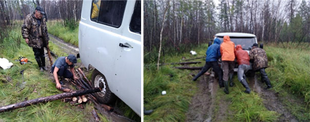
Waking up with rain showers in the morning of the fifth day of the campaign, we decided in a hurry to return to the village one day earlier than originally planned. More than working under rainy conditions, we were worried about the road that could become too muddy, even for our sturdy all-terrain van. We got indeed stuck multiple times on the muddy road back to the village, but thanks to a collective ‘pushing’ effort of the team and particularly to the amazing skills of our driver and ‘hero’ Dima, we safely made it out through 15 kilometres to the village after four hours on a muddy forest road. And this was supposed to be our rest day!
The work in the second week around this burn scar aimed at finding and sampling unburned sites along a forest road. These unburned plots were selected as ‘best’ matches of our burned plots by having similar forest compositions and landscape positions. The measurements in these ’control’ plots will allow us to estimate pre-fire carbon stocks, and thus act as a reference for comparison with our burned sites. While the comfort of staying in the village and sampling along the road may sound easier than our earlier camping experience, we ran into several unexpected mishaps. Our van suddenly broke down on a seemingly ‘easy’ part of forest road, and one team member had to recover from a muscle strain for two days. We quickly learned making a plan B… or even plan C. Luckily, we could rely on our local collaborator and driver, which were of a tremendous help throughout the campaign in addition to taking care of most of the logistics. They were very helpful in sharing knowledge on the ecosystems, but also cooked delicious meals. The jury is still out whether Dima’s soup or Roman’s pasta was the best meal.
We collected data in 24 sites which will enable us to better understand carbon emissions from fires in these larch ecosystems. This dataset will be completed with similar measurements that we will make in another burn scar on the opposite side of the Lena river North of Yakutsk in the upcoming ten days.
This field campaign is part of the ‘Fires pushing trees North’ project funded by the Netherlands Organisation for Scientific Research (NWO) and affiliated with NASA ABoVE.
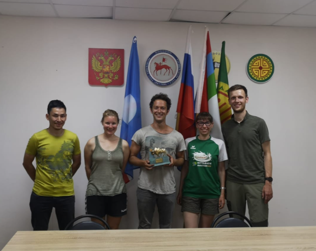
This blog post was written by Clement Delcourt, PhD student at Vrije Universiteit Amsterdam, researching carbon emissions from boreal fires.
Tags: ABoVE, FireExpeditionSiberia2019, FiresPushingTreesNorth, NASA, NOW, vuamsterdam