SWESARR flew two more flights before coming home. The second-ever SWESARR flight was on December 3, 2018, and the third flight was on December 4. The weather conditions on December 3 did not allow the aircraft to fly over Colorado’s Grand Mesa, so we used that flight opportunity to update the instrument parameters and nail down the settings before a flight to the mesa.
On December 3, we also changed the flight crew a little bit. Quenton Bonds, Rafael Rincon and Chase Kielbasa flew on the aircraft collecting data around the airport. The main difference between these flights and the first flight was that the roll compensation sensitivity was reduced by 20 percent to compensate for the aircraft roll without being sensitive to the aircraft vibration. Also it snowed between Sunday and Monday, making the imagery a bit more scenic and relevant to SWESARR.
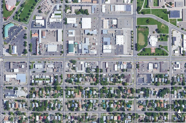
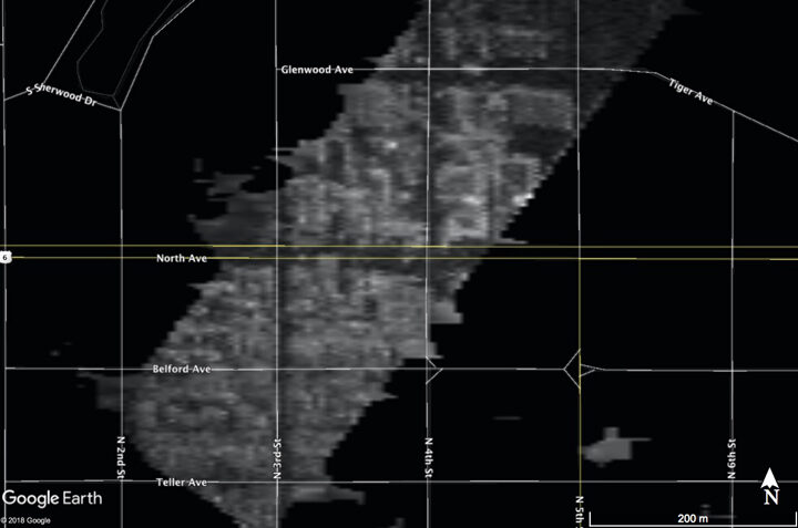
Using the data from December 3, Tobias Bollian was able to generate first geocoded and first-cut motion compensated images from SWESARR. Without the precise GPS clocks the accuracy of the motion compensation and geocoding are not ideal, but they confirm that the instrument parameters are reasonably well defined. For these images, the resolution is kept at 2.5 meters, even though the instrument’s native resolution can support about 1-meter resolution.
The next day, the weather was good and team was ready for a flight over the Grand Mesa. SWESARR team member Ludo Brucker, and SnowEx team member Chris Hiemstra were also on the ground to support SWESARR flights over the Mesa. Flight lines were coordinated in advance so that ground and air teams could collect data over the same areas.
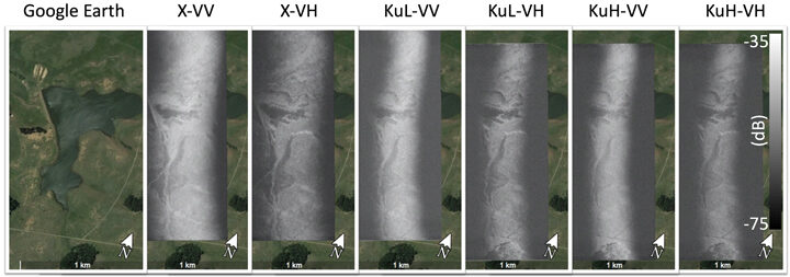
Preliminary images over Grand Mesa around the intersection of Forest Service (FS) 100 Rd and FS 44 5/10 Rd show a partially frozen lake in these radar images from December 4, 2018. The areas where liquid water remains appear dark, while most of the lake has a much brighter backscatter. Because a single antenna is used for three different frequencies, the illuminated swath changes from about 600 meters to about 300 meters from X to KuHbands from an altitude of 1500 meters above the ground level.