Here we are, already on Day 6 of AT32, our november cruise on the North Atlantic, and we will reach our first station tomorrow.
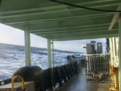
Today the weather is rough, as can be seen in this picture
but during the first few days, we were blessed with unusually warm weather and forgiving seas. This was a bonus since those days were mostly spent securing our incubators to the aft deck, and resolving the challenge of achieving specific light levels for each one of them. We change the light inside the incubators by wrapping the incubators with different thicknesses and layers of screen mesh. Stapler, tape, and bungees in hand, we “sewed” special “tube tops” that we slipped onto and tied to the tanks. Wind and waves tried to discourage our efforts but we persisted and got better and faster with every try. You can see pictures of our work with the incubators on a blog maintained by our onboard journalist Nicole. The blog can be found here.
The reason for this exercise is that onboard incubations make it difficult to replicate the ocean vertical dimension over which plankton are mixed and thus exposed to a continuously changing light environment. Setting up different light levels, in which replicate bottles containing plankton will be incubated, is essential in assessing the effect of a chosen light level on the phytoplankton growth and grazing mortality rates we will be measuring during incubations.
No sooner was the incubator challenge resolved than another one presented itself when we first tried our filtration system. Once again, problem solving and team work got the problem fixed. Everyone’s willingness to give a hand when it’s needed is perhaps what I enjoy most when working on a ship. This is how we form bonds and gradually become a big family of scientists, with ties that often last long after our time spent together on the ship.
During our transit we have been collecting water from the flow-through system, which continuously passes surface sea water through a variety of instruments that collect data such as sea surface temperature and salinity. We’ve been analyzing the collected samples using an automated image particle analyzer known as the FlowCAM, which combines a microscope and camera, and generates images of plankton particles contained in seawater. Here are some pretty photogenic organisms:
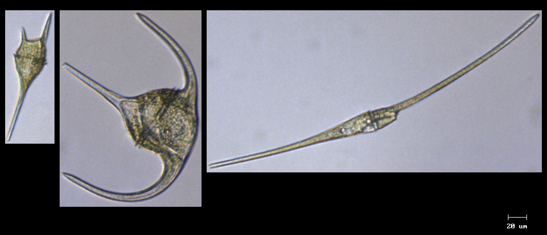
Here is a trio of different species of Ceratium, a genus of dinoflagellate.
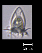
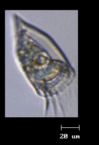
Below is a series of ciliates, named after the hair-like cilia they use to swim and engulf prey. Below are 2 images of tintinnid ciliates. You can see the organisms in their “shell” also called a lorica, and ingested phytoplankton cell inside. Below them is a group of ciliates that do not have a lorica.
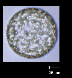
Overall phytoplankton are not very abundant. We have seen very few diatoms, the large phytoplankton cells that usually dominate when biomass accumulates into a bloom. Yesterday we saw these perfectly spherical colonies of Phaeocystis
Tomorrow we will start our experiments with plankton. In preparation for them we have lowered the temperature in the main lab of the ship where we will be setting them up in bottles for our incubations. Plankton organisms are quite fragile and sensitive to changes in temperature so we don’t want to shock them by bringing them into an over-heated lab. There is a trade-off however: Brrr!!!! We’ve switched from wearing our t-shirts to wearing our winter coats, and dancing to our music to keep us warm!!

It’s been a very busy week as OLYMPEX gears up for full operations. The last ground site was installed yesterday and the full network is collecting data. We have learned a lot from these sites alone and have already sampled some intense storm systems laden with rain. The four radars are installed, or being installed, with two of them already making measurements of the three dimensional structure of approaching storms. Two aircraft have arrived and will be ready to fly later this week. The third is performing test flights and will be ready to fly missions next week. All these preparations are just in time – the forecast is for a major, very wet 2-day storm system to impact the Olympic Peninsula at the end of the week with rainfall totals potentially as much as 200 – 250 mm (8 – 10 inches) of rain. Yikes – be careful what you ask for!
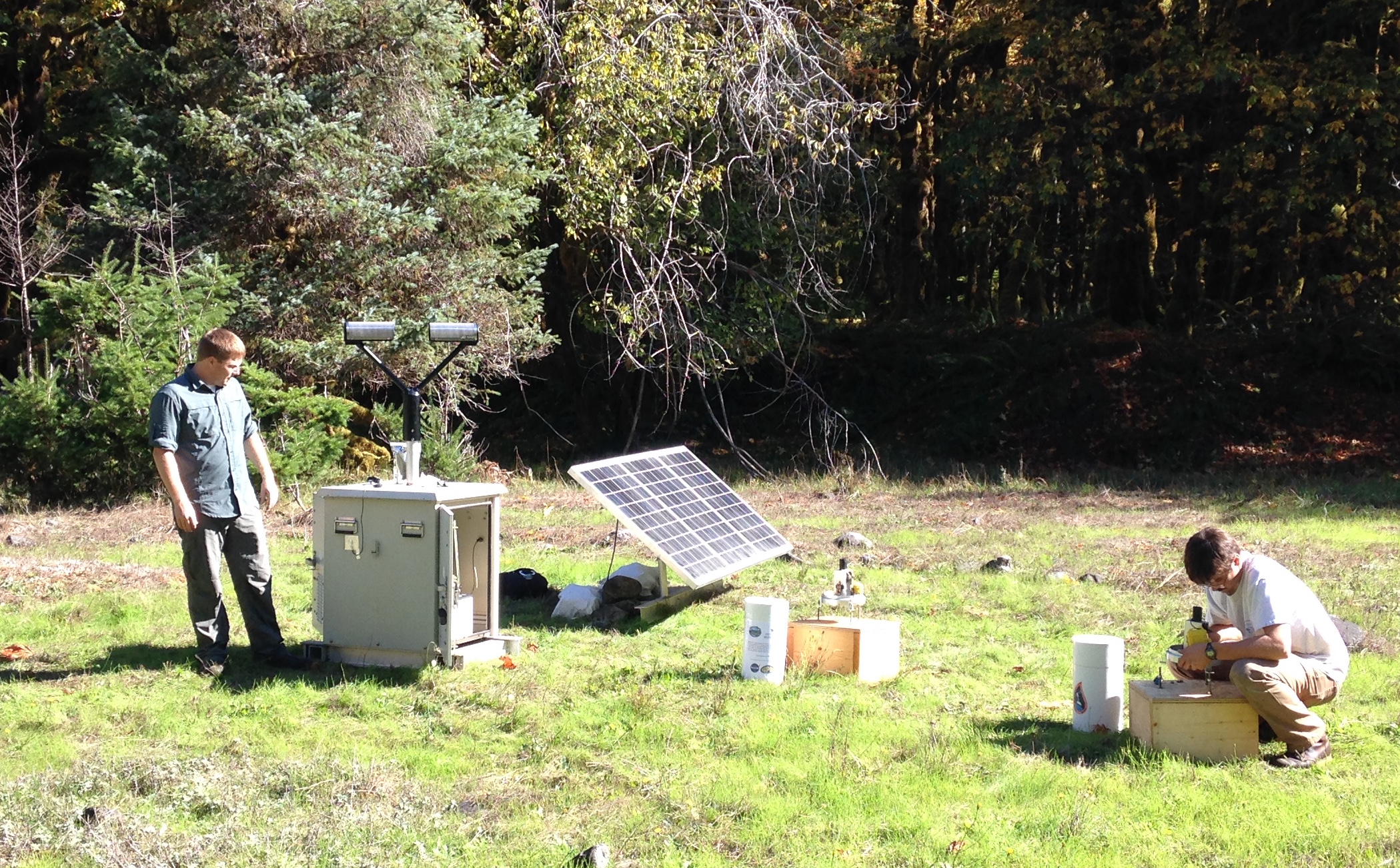
Matt Wingo (NASA) and CJ Urnes (Olympic National Park) install rain gauges and a Parsivel disdrometer (an instrument that measures sizes of falling precipitation) in the Olympic Mountains. (Photo by Joe Zagrodnik)
The photo above of one of our ground sites was taken in early October when it was still nice and sunny. Those were the days!

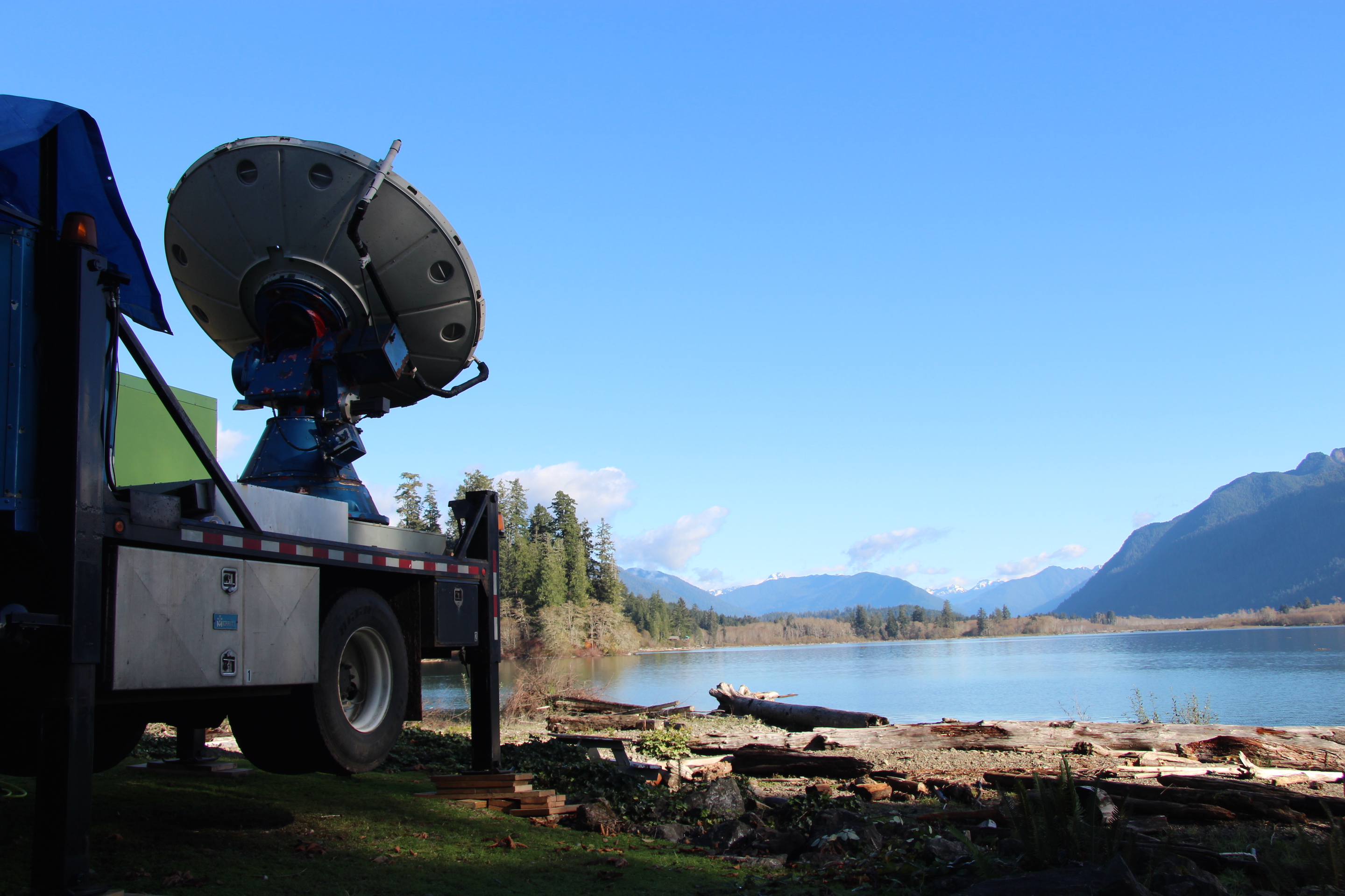
The S-band weather radar called NPOL and the Ku- Ka-band radar stand ready to sample storms. Photo by Dr. Angela Rowe
In the above picture, these two radars (NPOL, obvious in the middle, and the Ku- Ka-band radar called D3R, to right) are situated so they have a clear view to the ocean to sample oncoming storms and a clear view to the Olympic Mountains to sample the storms as they interact with the terrain.
The Doppler On Wheels situated to view precipitation systems as they approach the mountains. Photo by Joe Zagrodnik
The Doppler On Wheels (DOW) shown above has already been collecting fascinating data. We’ve found evidence that even minor terrain features can alter the cloud and precipitation structure above it producing small pockets of slightly enhanced precipitation.
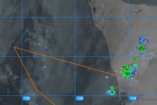
The DC-8 made its transit flight to McChord Airforce Base today (shown above in the screenshot made realtime during the flight) and they managed to fly over some light precipitation over the Olympic Peninsula. Precipitation won’t be light later this week, if the rain forecast verifies. We’ll be ready for it!
By Christine Dow and Ryan Walker
Editor’s note: Ryan Walker and Christine Dow are two researchers at NASA’s Goddard Space Flight Center who will be spending more a month in Antarctica to study the response of the Nansen Ice Shelf to ocean tides, while blogging from the field.
Christine Dow and Ryan Walker, on the day of their departure for Antarctica.
Christine: Hi! My name is Christine Dow. I’m a postdoctoral fellow and my main area of research is using numerical computer models to examine water flow pathways develop underneath the Antarctic ice sheets. I am particularly interested in what controls the growth and drainage of large lakes that form underneath the ice. Despite being chained to my desk most of the time, I love to go into the field. Not that it’s very easy to directly observe water flow underneath the ice sheets, but I find going to visit glaciers always reinforces the large scales of processes that are reduced to a few lines of code on my computer. I have previously lived and worked on glaciers in the Canadian Rockies; Devon Island in the Canadian High Arctic; and on the Greenland ice sheet. However, this will be my first trip to the Antarctic, and has been top of my bucket list for a very long time.
Ryan: And this is Ryan Walker. I’ve been with the Cryospheric Sciences Laboratory at NASA’s Goddard Space Flight Center and the University of Maryland since 2012, following five years at Penn State University. I’m a glaciologist now, but most of my background is in mathematics and I’m primarily an ice sheet modeler. This will be my second trip to the Antarctic — I was on a research cruise studying sea ice with the Australian Antarctic Division when I was in grad school — but this will be my first time on the continent. This trip resulted from the Korea Polar Research Institute inviting me to their symposium in 2014. Although they were mostly looking for my advice as a modeler, our discussions eventually led to an offer to collaborate in the field, for which I’m very grateful. I’m looking forward to getting a close-up view of what I’ve been modeling for years.
Christine: We’re almost off. It’s the culmination of more than six months of preparation involving not just a little bit of stress and appearance of more gray hairs. Ryan and myself will be heading to the South Korean Jang Bogo station in Terra Nova Bay for a month to measure flexure of ice tongues due to ocean tides. We will be installing five GPS stations that will record uplift of the ice and two tilt sensors that will record very subtle changes in ice uplift and motion. The GPS will be placed on regions of the ice that are technically floating on the ocean water, whereas the tilt meter will be placed just about the grounding line where the ice is on land. We have very carefully planned exactly where these will go but, I’m sure, as with all fieldwork we will have to be somewhat flexible with our aims. There are logistics to think of, like weather for helicopter flying, including wind (which we’ve heard is quite brutal in that region) and crevasses in the ice which a) we don’t want to fall down and, b) we don’t want the equipment to fall down. For this reason, we have back-up plans and back-up plans for the back-up plans. However, in the end I think going with the flow is probably the best idea.
In terms of organization, the most important/stressful part so far has been our shipping deadline at the end of September. Holes were drilled, plywood was hacksawed and sanded, metal conduit was sawed and of course lots of packing and repacking. All of this equipment is (hopefully) awaiting our arrival in New Zealand before travelling down with us on a plane to the land of ice and snow. All that is left to do is make sure we have enough socks, etc. and to make sure we catch the multiple flights. The route is going to be Washington Dulles to San Francisco to Sydney (with a lovely 8 hours to entertain ourselves between flights) and then finally to Christchurch. We leave Saturday evening (Nov. 7) and arrive Monday evening (Nov. 9)! Good thing that we have a couple of days to acclimatize before we catch the flight down to the Antarctic. We will be in touch from the southern hemisphere!
Plankton are microscopic yet they play a big role in the cycle of elements fundamental to life on earth. The NAAMES project is a testimony to their importance in our ability to predict how the oceans may mediate the Earth’s future climate.
I’ll be joining the cruise to measure rates of phytoplankton growth and mortality, the latter induced by a community of largely unicellular organisms best known as microzooplankton. These include <200 µm ciliates and flagellates, which in the past 50 years or so have been discovered to be quite fond of the microscopic plants that grow in the sea, or phytoplankton. The NAAMES project is particularly interested in the role microscopic grazers play in the yearly cycle of phytoplankton biomass. One idea we are exploring is whether winter creates conditions favorable for phytoplankton growth to outpace the rate at which grazers can eat them, setting things up for the explosion of phytoplankton biomass that occurs every spring in the North Atlantic.
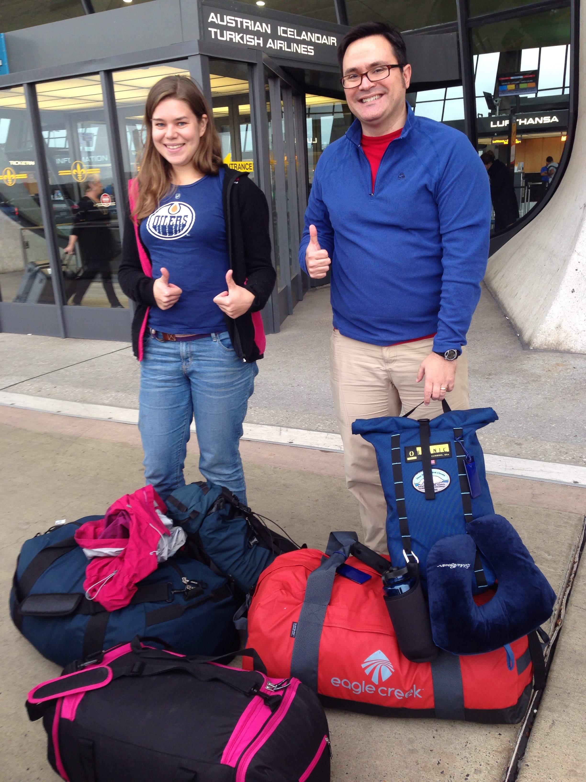
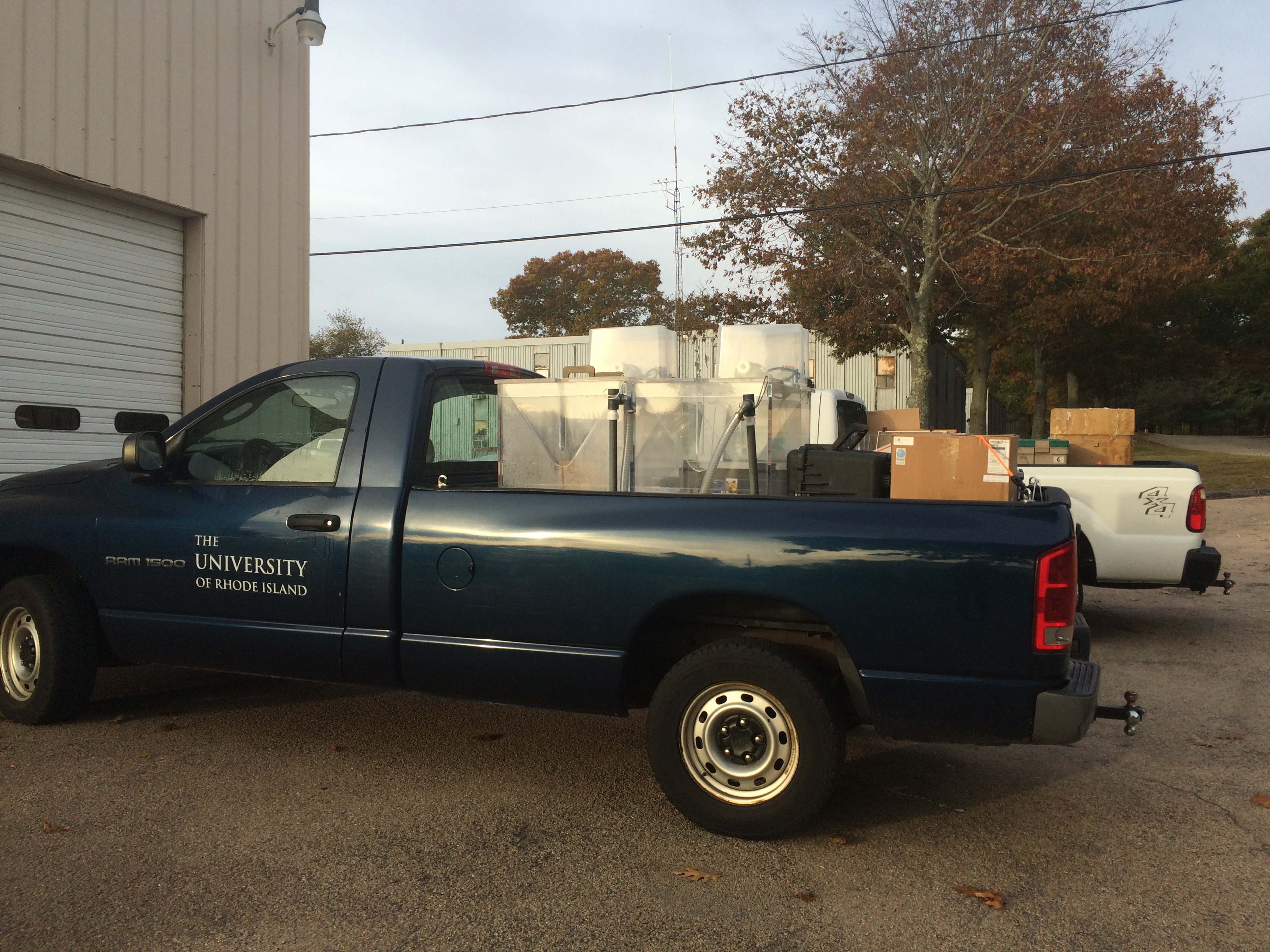
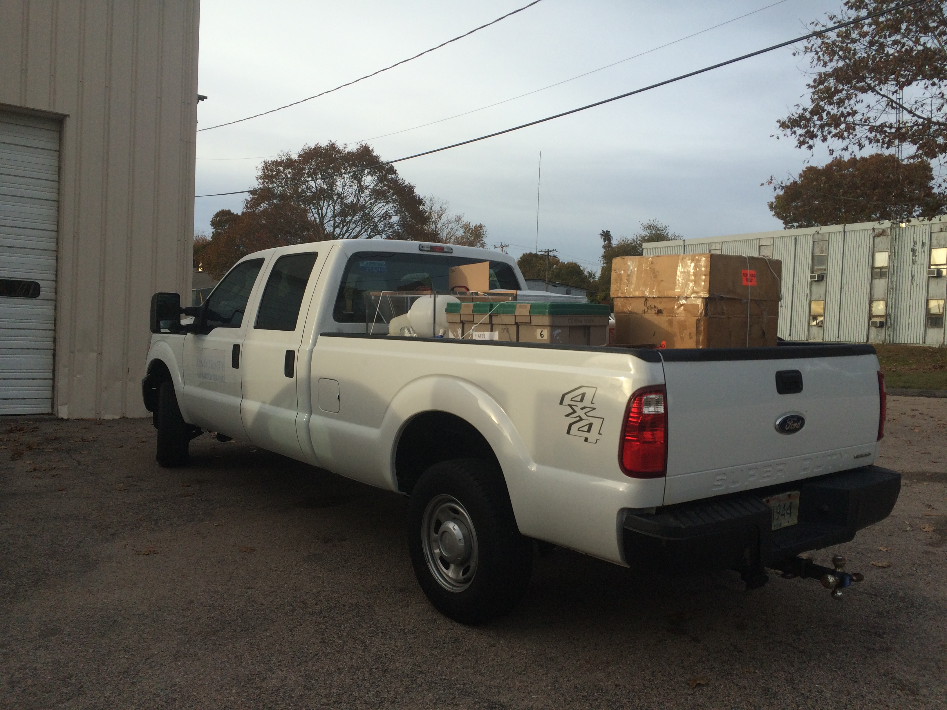
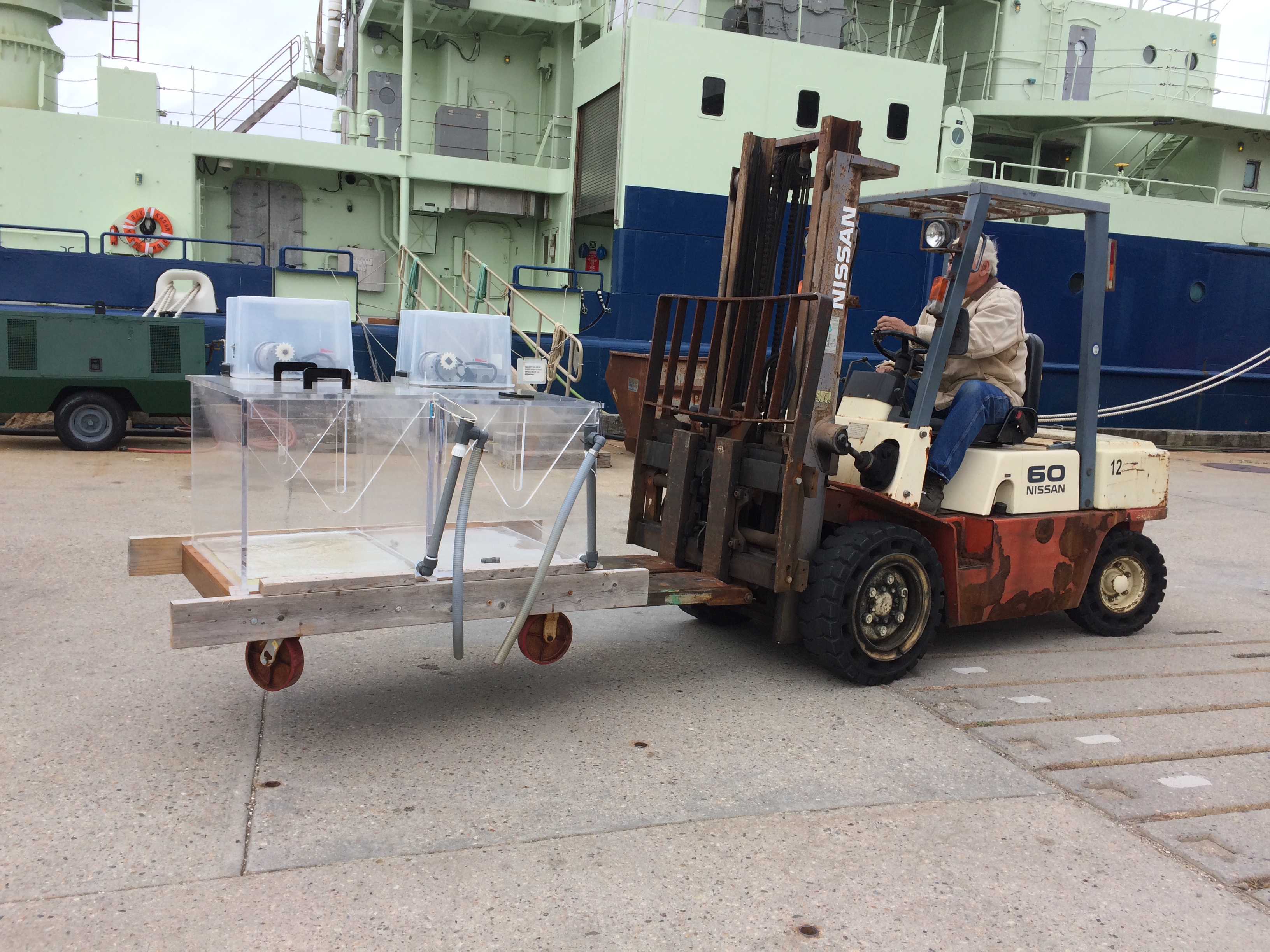
The work we’ll be conducting on the ship to make such measurements requires our lab to bring a battery of equipment. We are fortunate that Woods Hole, where the ship will depart from, is only 1-1/2 hour away from our campus at the URI Graduate School of Oceanography, and last week we loaded the 2 trucks pictured here and brought all our “stuff” to the dock.
Essential to our work will be daily incubation experiments in specially crafted incubators like the ones shown in the picture below. And bottles, lots of bottles!!!
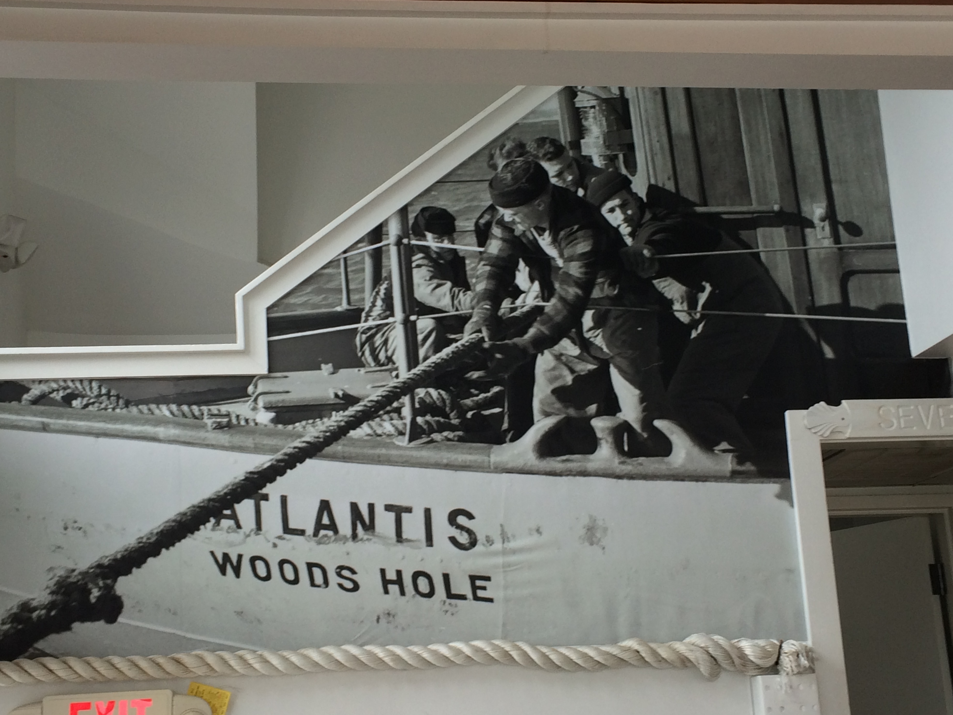
Once we were done unloading, we enjoyed a delicious lunch at the Quick Holes Taqueria. I’m glad the R/V Atlantis we’ll be boarding soon does not quite resemble this earlier version of the Atlantis, a picture of which hangs in the restaurant!
Although we’ve been planning this first research cruise for several months now, it’s last week at the dock that I really started getting excited about going to sea! Tomorrow members from our lab will meet me in Falmouth to move the equipment aboard. Can’t wait to get started!!
![]()
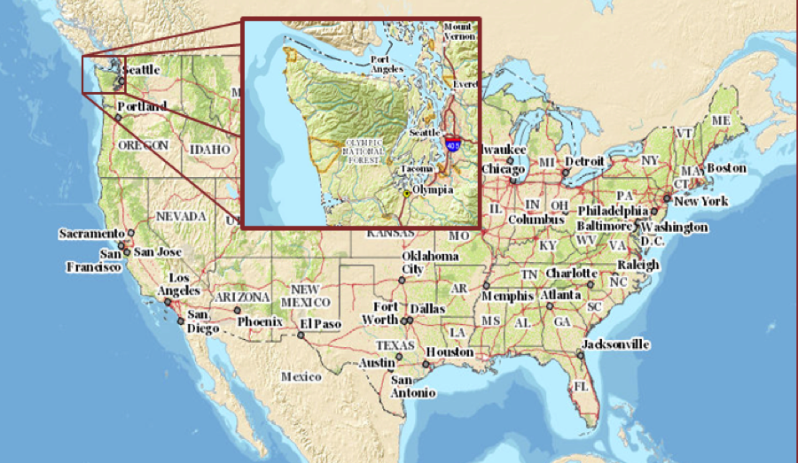
I live in Seattle, part of the Pacific Northwest in the NW corner of the continental United States. We have the reputation of being a very rainy place, but it’s nothing compared to the Olympic Peninsula, just to my immediate west. Starting next week, we begin the Olympic Mountain Experiment, or OLYMPEX. It is a NASA-led field campaign, which will take place from November 2015 through February 2016. The goal of the campaign is to collect detailed atmospheric measurements that will be used to evaluate how well rain-observing satellites measure rainfall and snowfall from space. In particular, OLYMPEX will be assessing satellite measurements made by the Global Precipitation Measurement (GPM) mission Core Observatory, a joint mission by NASA and the Japan Aerospace Exploration Agency (JAXA), which launched in 2014.
The Olympic Peninsula is an ideal location to conduct a ground validation field campaign. The Peninsula is home of a temperate rain forest, with old growth trees covered in lichen and moss. Its active winter storm season consists of wet weather systems traveling from the Pacific Ocean, over the coastal region and into the Olympic Mountains. The peninsula reliably receives annual precipitation amounts ranging from over 100 inches (2500 mm) on the coast to about 180 inches (4500 mm) in the forested mountainous interior.
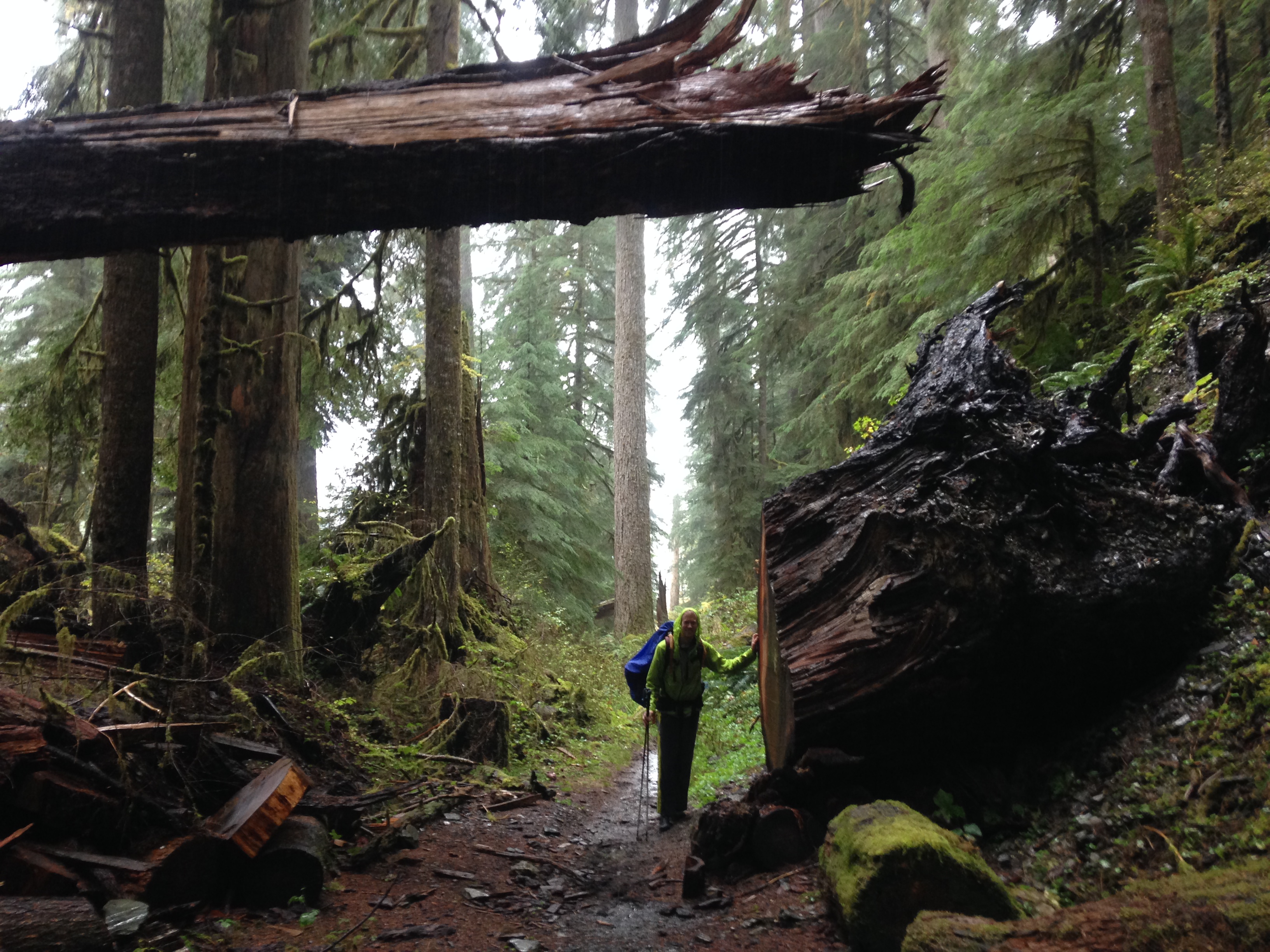
This is Joe Zagrodnik, graduate student at University of Washington, on his way up to install instruments at one of our ground site. That’s some tree.
I am a Senior Research Scientist and Senior Lecture in the Atmospheric Sciences department of University of Washington and Project Manager and one of the lead scientists of OLYMPEX. Together with colleagues here at UW, other universities, Environment Canada and, of course, NASA, we have set up ground instruments including rain gauges, advanced weather radars, and balloon launching sites to monitor incoming storms. Simultaneously, we will collect data from three aircraft flying through and above rain clouds, as well as from the GPM Core Observatory and other rain-observing partner satellites when they pass overhead.
Much of our ground network is in place and collecting data. We are currently experiencing a very wet storm system and the NASA ground instruments measured 24-hr rain amounts ranging from 35 mm (1.3″) on the coast to over 170 mm (6.7″) at a station at 540m elevation. This station is actually not at a terribly high elevation. Mt. Olympus is much higher at almost 2400 m, but 540m of elevation is enough to really affect the storms systems when the air is forced up and over the terrain enhancing the rain producing processes.
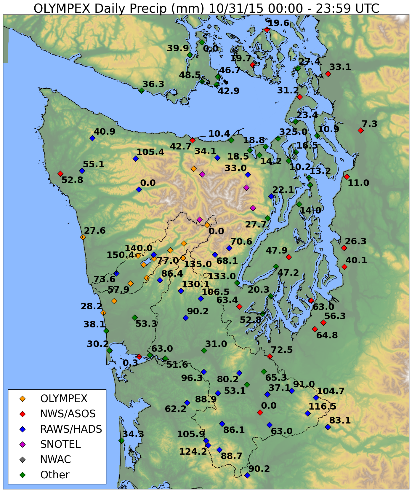
This is a map of 24-hr precipitation totals in mm as measured at a variety observing stations, including some installed for the OLYMPEX field project.
As the field campaign ramps up over the next couple of weeks, we will keep everyone posted about the progress of the project, the storms we are sampling and the experiences we’re having as we try to keep up with onslaught of storm systems from the Pacific Ocean.
