
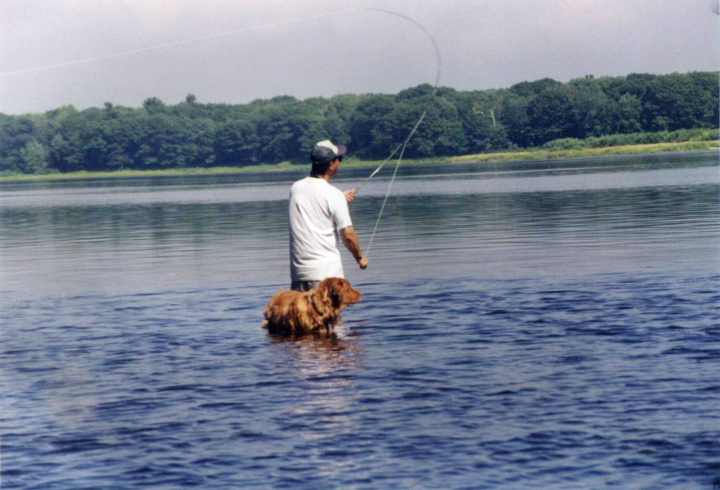
To many, Maine evokes images of rugged coastlines, bold light houses and bright red, buttered lobster. The draw of the water is so strong that the Maine Office of Tourism’s website currently sports all coastal photographs. Their sole image of the woods is only a backdrop to white water rafting. Despite the beauty of the summer coastlines, the heart of Maine lies in her interior, in the woods. Even after decades of logging and development, 90% of Maine is still forested. The state nickname is The Pine Tree State and the flag proudly displays a large, green pine tree in its center.
Coastlines may call to tourists, but it is the forested interior that fascinates ecosystem scientists interested in remote sensing, such as the NASA-led team, who have traveled from throughout the United States and Canada in order to work in Maine from August 18 through 29, 2009. This team, led by Dr. Jon Ranson, Goddard DESDynI Lidar Project Scientist, NASA Goddard Space Flight Center, Greenbelt, Maryland is focused on making accurate measurements of forest vegetation in order to validate remote sensing data recently collected from lidar and radar. The data will be used to improve algorithms for the remote sensors for NASA’s DESDynI mission, which is due to launch in 2017.
The Mission
DESDynI stands for “Deformation, Ecosystem Structure and Dynamics of Ice”. It will combine two sensors placed on satellites that will provide observations for solid-Earth (surface deformation), ecosystems (terrestrial biomass structure) and climate (ice dynamics). The sensors will be an InSAR (L-band Interferometric Synthetic Aperture Radar) system with multiple polarization and a multiple beam lidar. The radar will estimate forest height within meters of accuracy and polarimetry allows estimation of three dimension forest structure. The lidar system provides accurate measurements between canopy top and bottom elevations, vertical distribution and the size distribution of the forest. Lidar is the most direct estimate of vertical structure of the forest, but it measures the Earth only in small samples. Radar is less precise, but measures large areas. DESDynI will combine the capacity of the radar to measure wide ranging areas with the greater precision and directness of lidar, which will also calibrate and validate the InSAR data. It will be the best of both remote-sensing worlds combined to help scientists better understand our Earth.
The Site
The forests in central Maine are especially well suited for development of remote sensing algorithms and validation of data for several reasons. First, the terrain is reasonably flat. Remote sensing instruments are sensitive to terrain as well as vegetation, so more uniform terrain allows scientists to isolate the changes in data due to the vegetation change. These forests are biodiverse, with a wide range of species types. In addition, the biomass of the forests are quite variable, with some sparse stands and some thick stands of trees. This diversity allows the scientists to see how their instruments respond to variation in species and biomass. “This is what lured us up here to begin with, both for this trip and also way back in the late 1980’s, when we were just starting,” says Dr. Ranson, “These forests are an excellent place to get a basic understanding of remote sensing for forest studies.” The steep Siberian mountains are a great place to use remote sensing for wild forests, but it’s Maine where the researchers can come to fine-tune and study their own instruments.
This year the team has chosen two forests in which to conduct measurements: the Howland Research Forest and the Penobscot Experimental Forest.
The Howland Research Forest comprises about 558 acres of lowland evergreen forest just west of Howland, Maine. It has great ecological value because it is one of the few areas that escaped the mechanical logging practices that are common in Maine. In 1986, the forest owner, International Paper, designated this land as a research forest. Since that time, it has been one of the more intensively studied forests in the state. NASA began visiting Howland in 1989 and so has an excellent data set of the forest changes over time. In 2007, the forest was purchased by the Northeast Wilderness Trust, forever setting it aside for scientific research.
The Penobscot Experimental Forest was set aside in the 1950s as a research forest. In 1994 the industrial owners donated the 3,800 acres to the University of Maine, stipulating, in part, that it be used “to demonstrate how the timber needs of society are met from a working forest.” This is a managed forest, not wilderness. There are areas which have been thinned, so the biomass is reduced, yet the trees in the area are as tall as more natural stands. These areas are ideal for testing and developing the three-dimensional accuracy of remote sensing instruments. Less sensitive instruments could measure canopy height and canopy density, but not penetrate the canopy, leading to error in biomass calculation. More sensitive instruments will penetrate the forest canopy to better estimate the actual density of the forest stand, thus leading to more accurate estimates of biomass.
One part of many
It is this type of accurate biomass measurement that is so important to the DESDynI mission, and the reason this team has journeyed to Maine this summer. NASA has flown both lidar and radar over this area from aircraft this summer, as well as over sites in New Hampshire and Quebec. The scientists are now carefully making accurate ground truth measurements here, as are other teams in the other areas, in order to verify and better understand the data collected by the instruments. The scientists will then study the data in order to create better algorithms to improve the DESDynI instruments. This field campaign is one part of many which will, ultimately, enhance our understanding of the entire Earth.
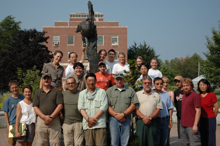
There is much to learn and experience in Maine. The team is made of up about 26 scientists, students and support staff, who come from all over the United States and Canada. Each has a story to tell. These woods are a treasure – diverse and moody, full of life and rich in history. What will be discovered here?
For the next two weeks, Dr. Jon Ranson will call from the field each day to report his findings, his experiences and to share the stories from the North Woods. Working from home base in Maryland, Dr. Joanne Howl will post the report into our blog in near real time, sometimes commenting with background information. As a team, we invite you to come along with us to explore the North Woods, Maine 2009.