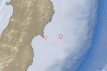
This map shows the location of a large aftershock off the coast of Japan on April 7, 2011.
Published Apr 7, 2011
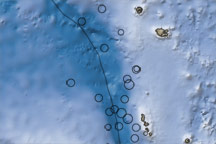
This map shows the region surrounding the earthquakes that occurred near Vanuatu on October 7 and 8, 2009. Ocean water appears in shades of blue, and land areas appear in shades of brown. Circles mark earthquake locations, and a black line marks the tectonic plate boundary.
Published Oct 9, 2009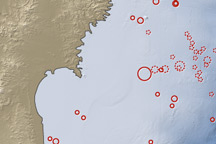
On March 11, 2011, a magnitude 8.9 earthquake struck off the east coast of Honshu, Japan, about 130 kilometers (80 miles) east of Sendai. If the initial estimate is confirmed, it will be the fifth largest earthquake in recorded history.
Published Mar 12, 2011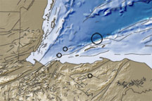
This image shows the topography and bathymetry of the region surrounding the earthquakes that occurred on May 28-29, 2009. Red circles indicate quake locations, and fine black lines indicate fault lines.
Published May 30, 2009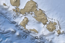
The contrast in ocean depths between the Australia Plate and the Pacific Plate near the Solomon islands reveals the subduction of the former beneath its northeastern neighbor. This subduction was responsible for the 7.2-magnitude quake on January 4, 2010.
Published Jan 5, 2010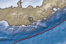
This color-coded map shows the topography, bathymetry, fault lines, and earthquake locations related to earthquakes in New Britain on July 18–19, 2010.
Published Jul 20, 2010