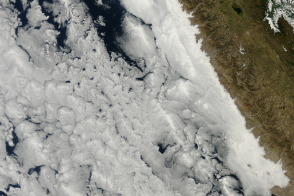
Low, moist ocean clouds outline South American country’s coastal desert.
Published May 31, 2014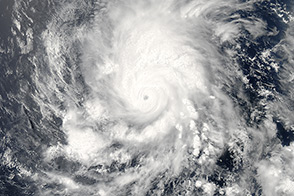
The first hurricane of the 2014 season churned over the Pacific Ocean southwest of Mexico in late May.
Published May 28, 2014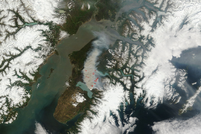
The Funny River Fire burned at least 182,000 acres of southern Alaska forest by May 27.
Published May 27, 2014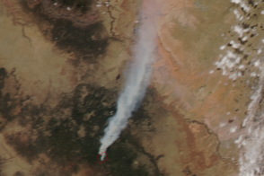
The Slide fire ignited in Oak Creek Canyon south of Flagstaff, Arizona, late in the afternoon of May 20, 2014.
Published May 22, 2014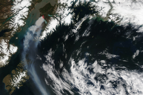
Burning on Alaska’s Kenai Peninsula south of Anchorage, the Funny River fire produced dense smoke that affected air quality throughout the region.
Published May 21, 2014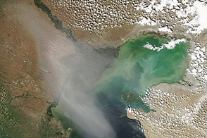
On May 18, 2014, the Aqua satellite captured this image of dust blowing over southeastern Russia.
Published May 21, 2014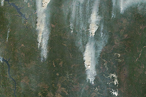
Fires in Russia in May 2014 fueled pyrocumulus clouds that pumped smoke high into the atmosphere.
Published May 21, 2014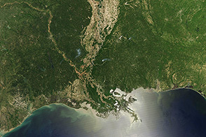
Though it was once the largest forested wetland in North America, only a few forests remain. The rest have been converted into farmland.
Published May 18, 2014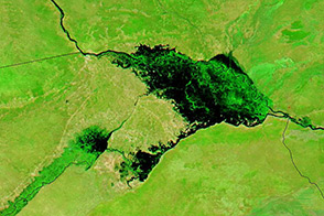
Seasonal rain sends the Zambezi River spilling into broad floodplains in eastern Namibia every year.
Published May 15, 2014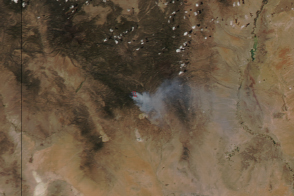
The wildfire was first spotted in the mountains of southwestern New Mexico on May 11, 2014.
Published May 13, 2014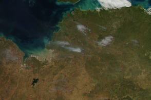
The beginning of the dry season also brings the beginning of the burning season to fire-prone savannas and grasslands.
Published May 10, 2014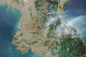
In April 2014, the Aqua satellite observed dozens of fires burning in mountainous parts of the country.
Published May 2, 2014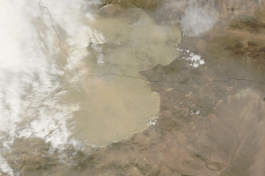
A large weather front kicked up dust across much of northwestern China.
Published Apr 25, 2014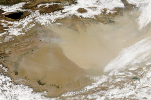
Widespread dust hung over the Taklimakan Desert on April 23.
Published Apr 23, 2014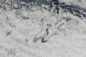
Cloud shapes reveal the fluid-like nature of the atmosphere.
Published Apr 20, 2014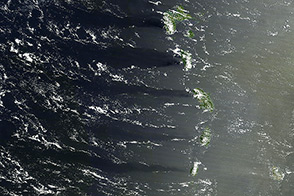
The combination of sunlight, islands, and wind painted this scene on the surface of the Caribbean Sea.
Published Apr 19, 2014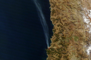
Thousands of wooden homes burned when strong winds blew a forest fire into the Chilean port city on April 12 and 13, 2014.
Published Apr 15, 2014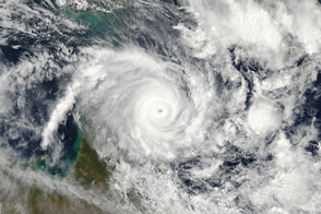
At the time of this image, the potent storm was headed for landfall in Queensland.
Published Apr 12, 2014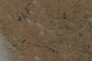
Prairies can’t exist without fire, so burning is essential to preserving the last remaining tallgrass prairie in North America.
Published Apr 9, 2014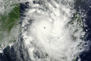
Tropical Cyclone Hellen approached the African island of Madagascar as a powerful Category 4 storm, but weakened just before coming ashore.
Published Apr 6, 2014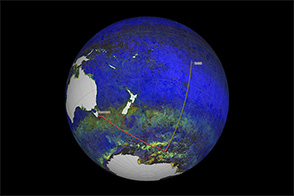
Scientists from NASA are cruising on a research vessel from Tasmania to Tahiti by way of the Southern Ocean. Their objective: gather detailed measurements of Pacific sea water that will be used to validate satellite measurements
Published Apr 5, 2014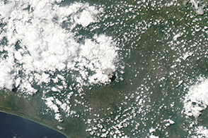
Indonesia’s Mount Merapi exhibited a short-lived increase in activity on March 27, 2014.
Published Mar 31, 2014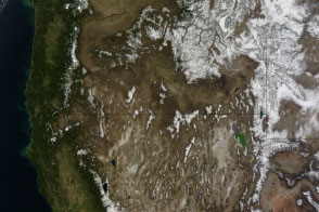
While Californians wondered what happened to the snow, those in Wyoming and Montana wondered when the snow would stop falling.
Published Mar 30, 2014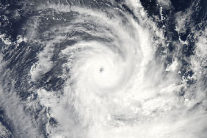
Tropical Cyclone Gillian became the equivalent of a Category 5 hurricane on March 23, 2014.
Published Mar 26, 2014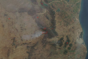
Several fires burned in the forested corridor of national parks and wildlife preserves in India’s Andhra Pradesh state.
Published Mar 24, 2014
For the second time in a week, a large dust storm swept across the Southern Plains.
Published Mar 21, 2014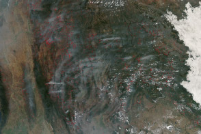
Hundreds of fires veiled northern Indochina in smoke as the traditional land-use burning season neared its peak.
Published Mar 19, 2014
Clouds often obscure land features in satellite images, but viewing conditions were perfect when Aqua captured this shot.
Published Mar 12, 2014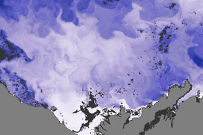
Satellites and scientists capture the Mackenzie River in the act of warming the ocean and breaking up ice in the Beaufort Sea.
Published Mar 6, 2014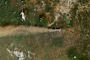
A volcano near Guatemala City erupted violently in March 2014.
Published Mar 5, 2014