You might think Earth-observing satellites like the recently launched Suomi NPP, Landsat 8, and Global Precipitation Measurement (GPM) have clear and precise vision right off the launch pad. The reality is more complicated. Satellite sensors start collecting data soon after launch, but it takes time—and work on the ground—to ensure that those observations are accurate and meaningful.
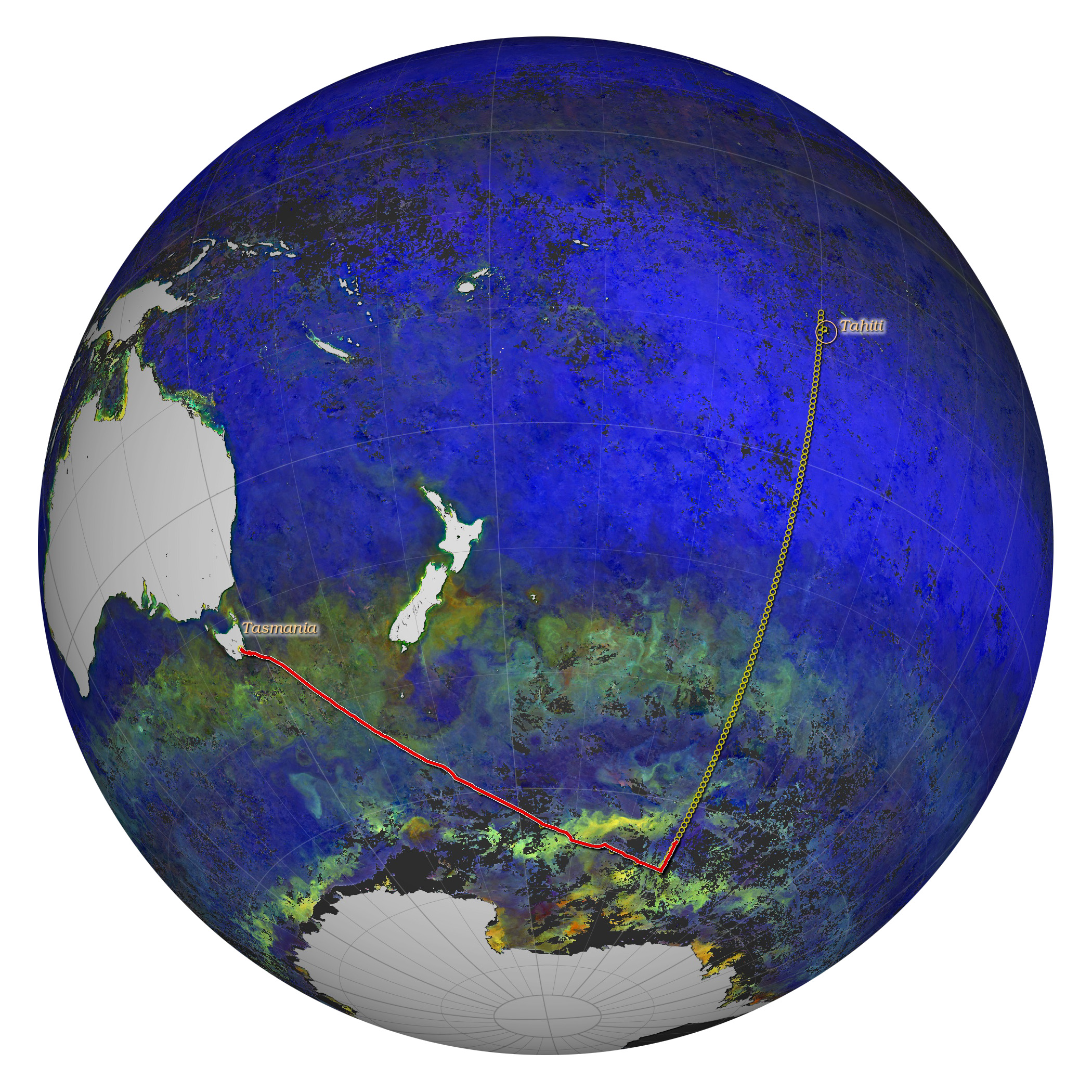
One of the best ways to do this is to send scientists into the field. In the case of a team of oceanographers from NASA’s Goddard Space Flight Center, “the field” is the South Pacific and Southern Ocean, where they are making detailed observations of the water at the same time that satellites pass overhead. The researchers are now in the midst of a 45-day journey southeast from Hobart, Tasmania, to the waters off Antarctica, and then northeast to Papeete, Tahiti. They are onboard the National Science Foundation ship Nathaniel B. Palmer, a 308-foot icebreaker that can accommodate 37 scientists and 22 crew members.
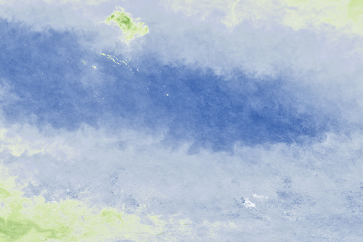
The map above shows the progress of the ship as of April 3, 2014. The distance already covered is shown in red, while the planned route is shown with a series of yellow circles. The background image is a composite showing light reflectance off the ocean surface between February 10 and March 13, 2014, as measured by the Moderate Resolution Imaging Spectroradiometer (MODIS) on the Aqua satellite. Areas with more particles suspended in the water are represented with orange, yellow, and green. Blue areas have fewer particles.
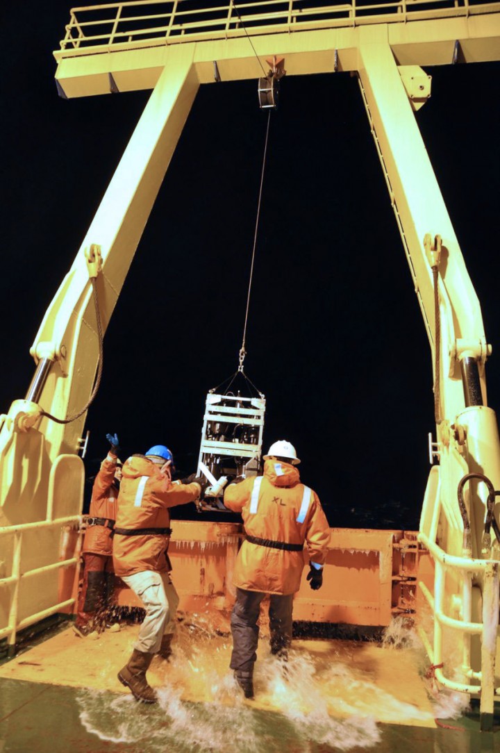
Each circle represents a location where the team plans to lower a sensor package into the water to collect data on temperature, salinity, depth, and how much light the particles in the water absorb and scatter. When weather permits, the team will also deploy a radiometer, which measures light entering and exiting the water column. The video below shows scientists lowering a sensor package on March 30, 2014.
By comparing measurements collected from the Palmer with visual and spectral measurements collected by satellites, researchers will validate whether the observations from space match what is really happening at the surface. Data collected on the ship will be fed into the SeaWiFS Bio-optical Archive and Storage System (SeaBASS), a database the includes hundreds of thousands of measurements taken from ships on more than a thousand field campaigns. Among other things, SeaBASS is being used to validate chlorophyll measurements made by the Visible Infrared Imaging Radiometer Suite (VIIRS) on Suomi NPP, a satellite that launched in 2011. The data also will help scientists develop algorithms for future ocean color missions.
The Palmer set sail from Tasmania on March 20, 2014, and should arrive in Tahiti on May 5. Check the team’s blog for written updates, photos, and video throughout the cruise.
Map by Norman Kuring using MODIS data from the Aqua satellite. Caption by Adam Voiland, with information from Aimee Neeley, Joaquin Chaves, Scott Freman, and Mike Novak of the Ocean Ecology Laboratory Field Support Group at Goddard Space Flight Center.


