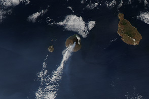
The volcano in Cabo Verde erupted for the first time in 19 years and sent lava through several villages along its slopes.
Published Dec 2, 2014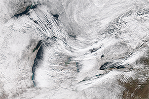
Some towns east of Lake Erie received several feet of snow as cold air passing over the lake sopped up moisture and then dropped it over land.
Published Nov 20, 2014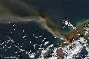
Alaska’s Pavlof volcano was erupting when the Aqua satellite passed over on November 14, 2014.
Published Nov 17, 2014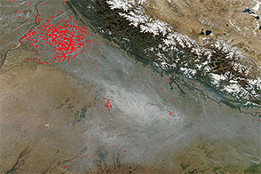
The skies over northern India are some of the haziest—but also most variable—in the world.
Published Nov 14, 2014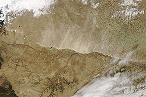
As a cold front swept south through the United States in November 2014, it kicked up this dust storm in eastern Colorado.
Published Nov 13, 2014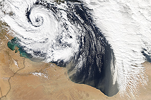
In November 2014, a storm off the coast of Libya helped blow Saharan dust over the Mediterranean Sea.
Published Nov 11, 2014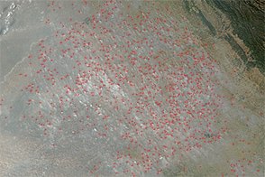
In late-October and November, farmers in northern India burn off crop debris, a practice known as stubble burning.
Published Nov 5, 2014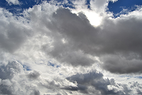
With just a few clicks of a camera and a mouse, you can contribute to research that will help atmospheric scientists better understand how clouds affect climate.
Published Nov 5, 2014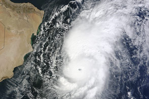
The storm became the third strongest on record for the Arabian Sea, but it was ripped apart by wind shear before reaching land.
Published Nov 2, 2014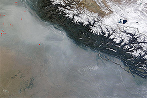
Thick haze hung over northern India in the latter part of October 2014.
Published Oct 30, 2014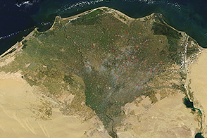
In fall 2014, the MODIS sensor detected several small fires in the Nile River Delta.
Published Oct 20, 2014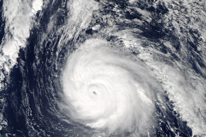
The most potent hurricane of the 2014 Atlantic season was poised to pass directly over the British island territory.
Published Oct 18, 2014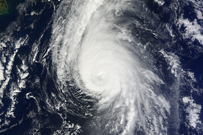
The fierce storm was just hours from passing over Bermuda when a NASA satellite captured this view.
Published Oct 17, 2014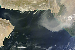
The Terra satellite captured this view of dust over the Arabian Sea in October 2014.
Published Oct 15, 2014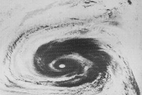
Fifty years ago, NASA launched the first of seven satellites that revolutionized how we study weather, the atmosphere, and other Earth systems.
Published Oct 12, 2014Image of the Day Atmosphere Water Severe Storms Remote Sensing
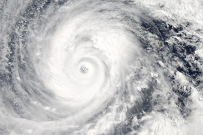
The second massive storm of October 2014 barrels down on Japan.
Published Oct 10, 2014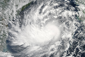
In early October 2014, the storm crossed the Andaman Islands and the Bay of Bengal before possible landfall in India.
Published Oct 9, 2014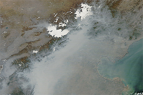
Pollution far exceeding World Health Organization standards blanketed the North China Plain in October 2014.
Published Oct 9, 2014
A grass fire burning in Australia’s Northern Territory charred an area as large as Massachusetts in October 2014.
Published Oct 9, 2014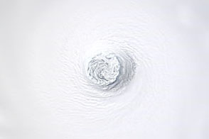
The storm became the fourth this year to reach category 5 strength.
Published Oct 8, 2014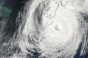
The storm made landfall on October 6 and brought substantial rainfall.
Published Oct 6, 2014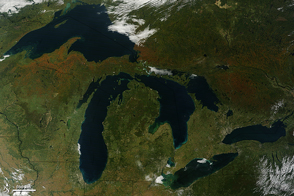
A process that occurs on a micro scale in trees shows up on a macro scale in satellite imagery.
Published Sep 30, 2014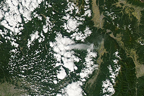
In September 2014, an unexpected eruption proved deadly for dozens of hikers on Japan’s Mount Ontake.
Published Sep 29, 2014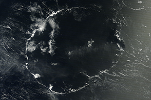
An open-celled cloud over the Pacific Ocean had a shape reminiscent of a certain circular letter of the alphabet.
Published Sep 27, 2014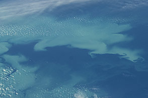
Changing conditions in the waters near Alaska promotes late summer phytoplankton growth.
Published Sep 19, 2014
The fast-moving King fire burned in Eldorado National Forest in September 2014.
Published Sep 18, 2014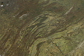
An underground mass of volcanic rock may have caused the Appalachian Mountains to bend in Pennsylvania.
Published Sep 18, 2014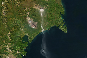
Ash from Zhupanovsky blew south over the Pacific Ocean in September 2014.
Published Sep 15, 2014
Torrential rain caused widespread flooding in Pakistan in September 2014.
Published Sep 13, 2014
In addition to posing scientific challenges and opportunities, sunglint makes for some spectacular satellite images.
Published Sep 11, 2014