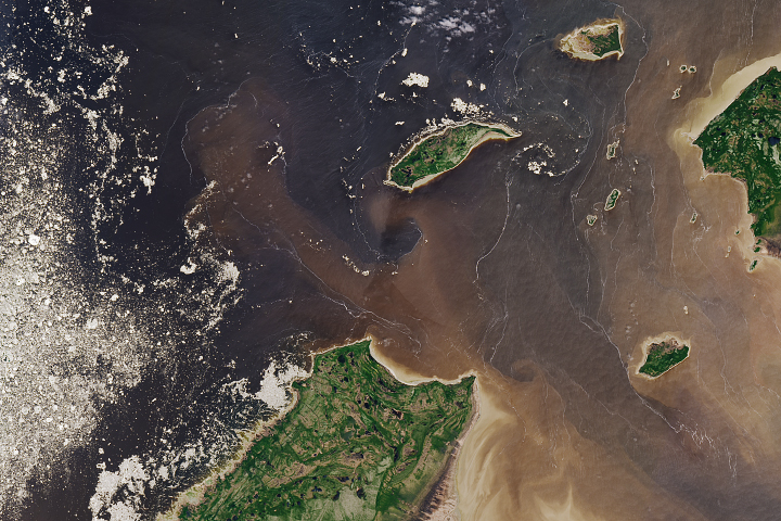
Wild patterns on the water's surface are evidence of the fluid dynamics that occur when fresh river water meets sea water.
Published Aug 20, 2018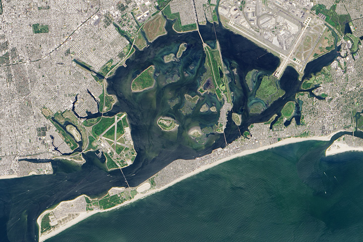
Despite the bay’s calm waters, constant reminders of the city break through.
Published Oct 5, 2017

Once an important port during World War II, the bay is comprised of a complex delta system that makes it a very scenic and popular tourist destination in Australia.
Published May 30, 2020
Where Glacier Bay National Park reaches the Gulf of Alaska, the climate is mild and prone to significant rainfall. Glacier Bay itself, however, tends to be snowy and cold.
Published Sep 11, 2016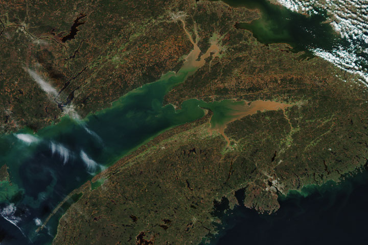
High tides in the funnel-shaped bay are anything but a bore when they collide with river water flowing in the opposite direction.
Published Oct 28, 2019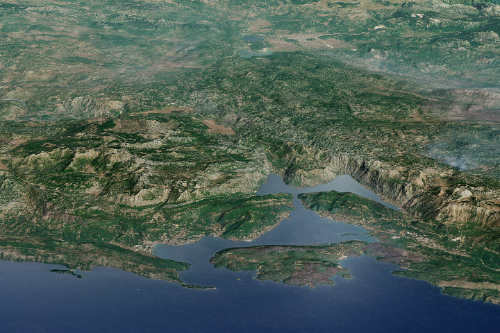
The stunning scenery in this bay in Montenegro has made it a popular destination for cruises ships.
Published Sep 17, 2017
Few people live around the Ulbanskiy Bay. Whales, however, are plentiful.
Published Apr 9, 2017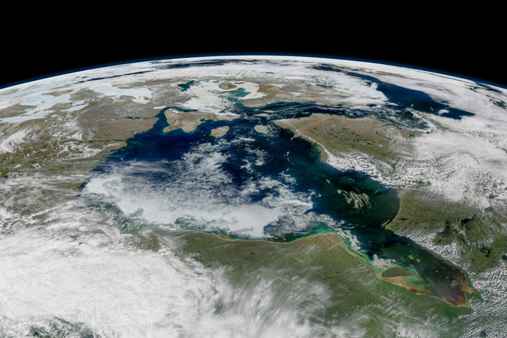
When the ice on Hudson Bay breaks up and melts away, polar bears head to shore for a few months. This year they stayed out a little longer.
Published Jul 28, 2017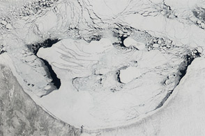
Ice in Hudson Bay starts melting each April, and melts away completely each July. Images from early April and early June 2012 document the ice retreat.
Published Jun 17, 2012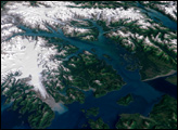
The first recorded charting of the area was done in 1794 by George Vancouver, in which he showed the bay being a small indentation in the Icy Strait with a gigantic glacier stretching off to the horizon.
Published Dec 7, 2003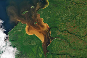
Dissolved organic matter from forests and wetlands stained the water dark brown near Rupert Bay. A similar process darkens tea.
Published Oct 1, 2016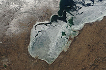
Lakeshore residents of Linwood, Michigan, were invaded by mountains of ice on the evening of March 8, 2009, as winds drove ice ashore from Saginaw Bay in Lake Huron. These images show the break-up of ice on the bay.
Published Mar 11, 2009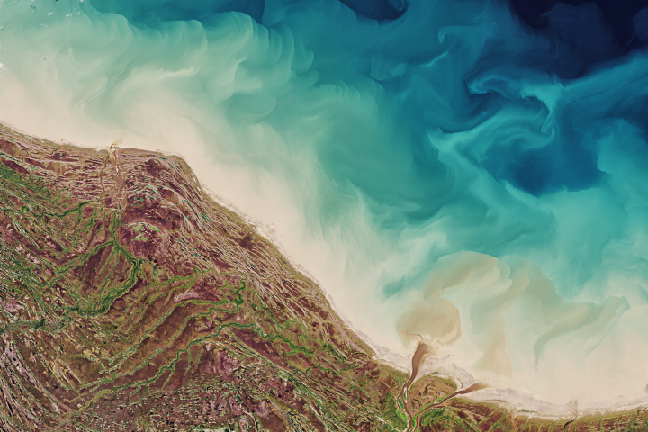
Raised beaches around the bay in Canada’s Ontario Province show how the landscape responded after the last ice age.
Published Oct 19, 2020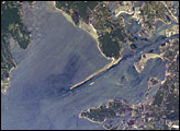
The modern Buzzards Bay is approximately 45 kilometers long by 12 kilometers wide and is a popular destination for fishing, boating, and tourism. The Cape Cod Canal allows for passage between Buzzards Bay and Cape Cod Bay to the northeast; the wakes of numerous pleasure craft appear along the length of the Canal.
Published Aug 29, 2005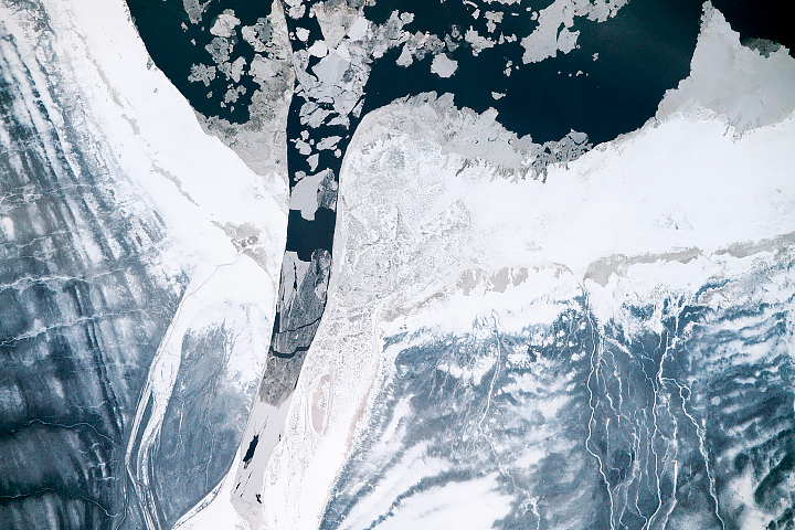
Taken near the northernmost extent of the space station’s orbit, this photograph shows ice growth in the midst of freezing season near James Bay.
Published Jan 31, 2019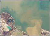
Muddy brown water fills Sandusky Bay, just south of Lake Erie in this astronaut photograph. The small city of Sandusky occupies the southeastern shore of the bay. The most striking aspect of this image is the flow of the brown water in and out of the mouth of the bay. Slight movement of lake surface water, driven mainly by wind, causes a small ebb and flow of bay water. Sediment-charged water is derived from agricultural fields along the Sandusky River upstream. Mud plumes in Lake Erie originate from prior pulses of muddy water from the bay. When this image was taken, some clear, lake water (blue-green strip) appeared to be flowing into the bay.
Published Feb 20, 2006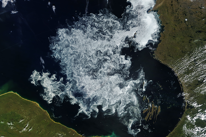
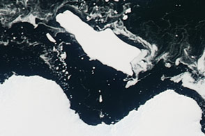
Sea ice can linger on Hudson Bay into the summer, but it is usually gone by mid-August.
Published Jul 30, 2018Image of the Day Water Unique Imagery Snow and Ice Sea and Lake Ice
Sea ice in an East Antarctic bay broke up, providing access to Cape Denison for the first time in six years.
Published Mar 4, 2016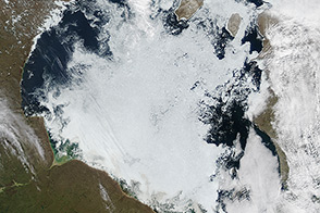
The timing of ice breakup on Hudson Bay occurs earlier now than it did decades ago.
Published Jul 6, 2014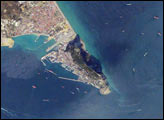
Gibraltar Bay, located near the southernmost tip of the Iberian Peninsula, is the central feature of this astronaut photograph. The famous Rock of Gibraltar that forms the northeastern border of the bay is formed of Jurassic-era seafloor sediments that solidified into limestone, a rock formed mostly of the mineral calcite, which is found in the shells of sea creatures. The limestone was subsequently lifted above the ocean surface when the African and Eurasian tectonic plates collided. The cities of La Linea and Algeciras bordering the bay, together with petroleum-processing facilities along the northern shoreline, are part of Spain, whereas the city of Gibraltar itself (to the west of and including the Rock) is under the jurisdiction of the United Kingdom.
Published Jan 8, 2007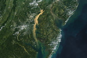
Ships, airplanes, and satellites all play a role in monitoring Chesapeake water quality, algae blooms, and dead zones.
Published Nov 2, 2016
A drop of water that falls in central New York takes a long ride to the sea. It flows past some extraordinary natural features that help tell the story of how the Chesapeake Bay came to be.
Published Jul 22, 2016
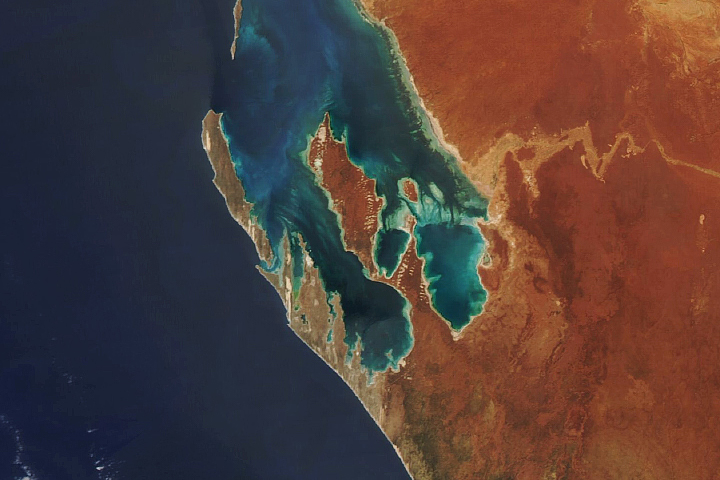
Australia’s Shark Bay contains the largest beds of seagrasses in the world, as well as some of the oldest lifeforms on Earth.
Published Oct 10, 2020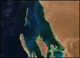
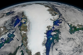
The green color associated with phytoplankton around Greenland is not uniformly distributed, nor are the patterns random.
Published Oct 4, 2016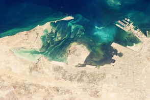
The historical oasis on the coast of the Arabian Gulf is now an oil industry oasis.
Published Jun 3, 2013alert message
